Back to Pembrokeshire
2nd January 2013When I first visited Pembrokeshire on the first weekend in June 2006, I had no idea that it would take more than six years to get back there again. Then, I only had been a month blogging and the terseness of the description of my weekend down there reflects this. Nowadays, my description of the ups and downs encountered between Newgale and St. David’s would merit more than a little mention, though perusing the photos from that sunny summer weekend do keep my memories of how steep the drops and rises were very much alive. Similarly, the article that inspired me to go on that first trip still hasn’t faded from my mind’s eye either and I might just go looking through past issues of TGO to revisit it again.
Though I only had a long weekend, I got in more than just one stretch of Pembrokeshire’s coastline and its national trail. Sunday saw me take in a circular walk around Marloes with even more rugged cliffs to be savoured. Monday may have been when I went home again, but that didn’t preclude a little nibble of what lay around Newport, both the coastline and the Mynydd Preseli hills. It was but a short stop while on route to Ceredigion but it was memorable nonetheless.
My route home saw me continue to Aberystwyth by bus before going by rail the rest of the way. That had me playing with going to see more of Pembrokeshire by reversing the route to make more again of another possible weekend stay that never came to pass. It might have been the way that I’d have gone last August but it never entered my mind. Time’s passage and my looking for a quick getaway might have had something to do with it.
Like the last time, Haverfordwest became my base and I played with different walking options with practicalities like public transport and weather governing which would be my eventual choice. Only for clouds approaching from that direction according to the weather forecast, I might have taken in the south coast between Manorbier and Bosherston. If there had been time to spend at the former’s castle and the latter’s lily ponds, it would have been a double bonus but they’ll need to await another visit. The Preseli Hills were another option but I came to the conclusion that they were an escapade too far for what was a flying visit. That left the west and north-west with my looking at options around St. David’s with there being a summer shuttle bus in operation. My eyes even started to follow the coastline up as far as Strumble Head even though the distance from St. David’s is no short undertaking.

While all the above threw up appealing options, I decided to trim my cloth to my measure to settle on a hike from Strumble Head to Fishguard and it rewarded me copiously too. Of course, it helped that Sunday morning came sunny after a Saturday with plenty of wet moments. Though its situation is imperfect, Haverfordwest’s castle ruins still caught my eye and became a target for photographic capture before breakfast and prior to my departure for Fishguard. To my mind, the photo above could have been taken in May or June such is the green colour of the surrounding foliage. Maybe the wetness of the year we got meant that the onset of autumn became delayed.
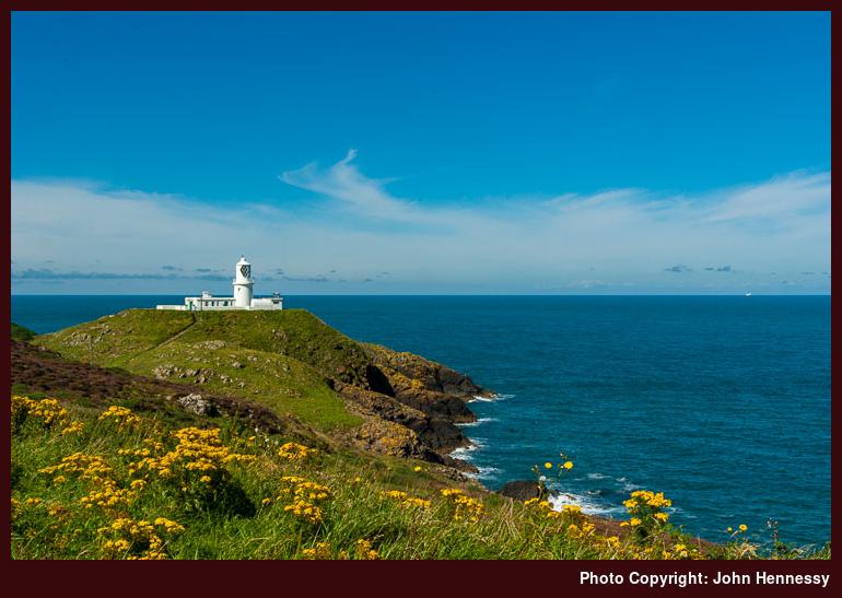
After a little wait, a busy Strumble Shuttle bus conveyed me and others to Strumble Head while others may have gone the whole way to St. David’s, a journey of around two hours along narrow country lanes. This would make good use of a day with suspect weather, but it was that of the glorious variety that I was lucky enough to have. There may have been a white cloud approaching in the distant, but its leisurely approach meant that it was no spoilsport while I was around Strumble Head, though it did end the sunny spell early in the afternoon.
Strumble Head’s lighthouse is on an island called Ynys Meicel and there is a footbridge across to it. However, this was locked so no one could ramble about the spot. Even so, I dropped down to the bridge for a look and took in the sight of the narrow channel that it crossed while a dog started barking; apparently, he took exception to the walking poles attached to my rucksack or so his owner said. Leaving that ostensibly odd situation after me, I decided to make my way south along Carreg Onnen Bay before starting in earnest for Fishguard.
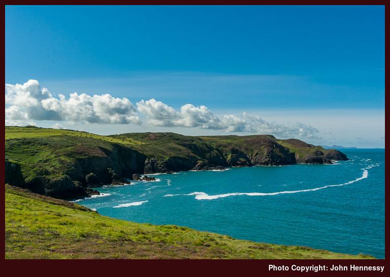
As I looked to the south, I fancied that I could discern Carn Llidi near St. David’s in the distance. There still is nothing that would convince me otherwise unless another visit were to see me proven wrong. As I went south along the joint rote of the Pembrokeshire Coastal Path and the Welsh Coast Path, I lost sight of the more distance view, but there was more than enough to keep me busy in the sunshine. The path was narrow enough and others had the same idea as me, some going slower than others. Going south opens up views of the islands of Carreg Onnen and Ynys Onnen along with keeping that of Ynys Meicel. Those of the coastline by which I was passing were attractive too with their sea-eroded wild ruggedness and there was no trepidation intruding on the proceedings as I did so.
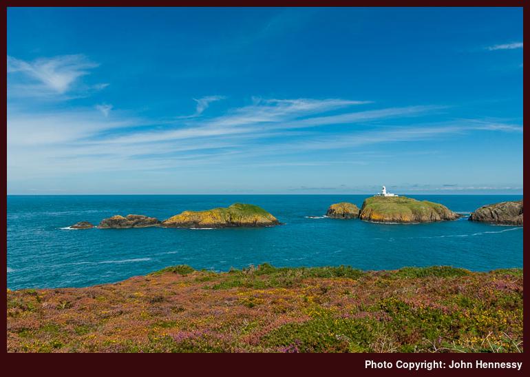
Because I was planning to go in the other direction, I eventually had to find a southern turning point despite how glorious it felt. A piece of higher ground in access land near Carn Melyn did the job for me. It allowed one last panoramic view of what lay around before I retraced my steps. By the time that I reached Strumble Head’s car park again, there had been a change that couldn’t be missed. The approaching bank of white cloud had come much closer and was encroaching on the sun’s space too.
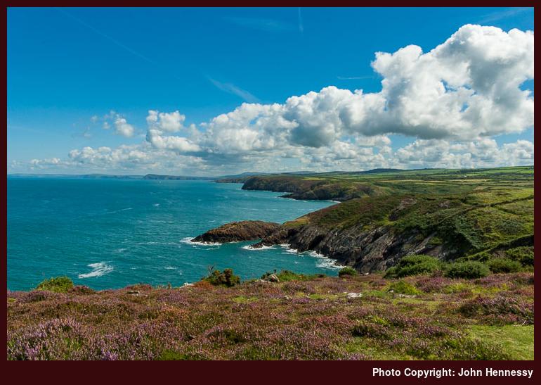
Before there was any more in the way of change, I set to shortening the distance to Fishguard. Given how expansive the eastward views were from there, I stopped for a bit of lunch near Carreg Gybi. Hurrying on ahead of the cloud might seem tempting to me now as I write this but it had no bearing after what I had got from the day by then. As I was stopped, the sights of the likes of Dinas Head and Cemaes Head were within my line of sight, albeit in the far distance.
To reach those far-off places from my location would have taken several days of walking so I was happy to enjoy the views and leave it at that. After all, there was plenty of coastline to pass before I ended up in Fishguard again. Ups and downs lay ahead but they were nothing like what I met between Newgale and St. David’s. There were to be twists and turns too because of the indented coastline but I hadn’t cut myself short on time and was happy to ease myself along. Each inlet was a marker of progress and there were many, many of which with names. Watercourses and muddy stretches were passed too and the civilised world felt further than being a kilometre from a public road would suggest.
There were human intrusions aside from other walkers too. For instance, there was the house near Penryhn and the Carreg Goffa Monument commemorating the ill-fated French landing at Carregwastad Point; rough seas, drunkenness and a wily Welshwoman saw off that foreign invasion. The drop into Cwm Felin and the subsequent rise to sweep around Aber Felin may give clues as to why the landing happened there.
Beyond that site of that historical intrigue, the distance to my destination very clearly was receding. The access land of Ciliau Moor lay in surroundings that felt well isolated even if I were to pass barking dogs just afterwards; they were on the other side of a hedge, thankfully. As my southward turning was approached, I met up with a local man going in the opposite direction who told me about a miniature Giant’s Causeway around Anglas Bay that he found for the first time when he got a little lost while out on a then recent walk, though I never did confirm this for myself; my (southern) Irish accent had given me away as it always does.
Once past Crincoed Point, the breakwater of the Stena ferry harbour was growing in view. Earlier, I had seen the same ship coming and going from there so it would have been much busier than the quiet desolation that I found on my own passing. Before reaching that lower ground, the coastal path was to take me onto tarmac again for the first time since Strumble Head. It would be tempting to think that navigation from there would be a simple matter but, if anything, it was more complex than following the coastal path while away from conurbations. The intricacy was greater than what the map could show so it was up to signage to point out secluded pathways that dropped me from one road to another, taking me near a hotel at one point. Once over the footbridge across the railway, matters became simpler again. Passing the ferry terminal, I made for the tourist information centre to see what food might be served. However, I instead found my way to a useful public convenience and ended up at the local Tesco. My next stop was a seat in a nearby park to partake of an ice cream before going further.
The final stretch of my wandering made use of the coastal tarmacked walkway around Penyraber. It’s a pleasant place to be strolling even without the sun and seeing Fishguard’s older and more sheltered harbour full of pleasure-craft made me wonder what the sight would be like if clouds hadn’t filled the sky as it had. There was a bus to be caught for Haverfordwest and that was playing on my mind too so I didn’t dally. In fact, I timed things just right and had a little wait before it came. When en route, another matter of timing was brought to my attention: there was a rain shower around Wolf’s Castle and hills to its west, so my hiking had stopped before the rain to get a dry day’s walking. The next day came even wetter so thinking about the blue skies and sunshine was at odds with the soaking I got on the way to Haverfordwest’s train station. That won’t stop me pondering a return, though.
Travel Arrangements:
Return train journey from Macclesfield to Haverfordwest, changing at Stockport on each way. Return journey on bus service 412 between Haverfordwest and Fishguard. Single journey on Strumble Shuttle (bus service 404) as far as Strumble Head.
Why go elsewhere when there are good things nearby?
9th October 2012The past few weekends have seen me enjoy walks through local countryside. For instance Sunday saw me drop from the Cat and Fiddle Inn into the Goyt Valley before walking along its length as far as Whaley Bridge. Skies may have filled with cloud as I went and much mud may have been encountered but that reminder from last January while on another walk from the same starting point that landed me in Buxton at its end was set to prove its worth and I wouldn’t mind having another hike around there either.
The Saturday of the previous weekend came up sunny too and I used the afternoon for a walk from Bollington back to my house that took in the Saddle of Kerridge and Tegg’s Nose Country Park as I revisited parts that I should frequent more often than I do. In fact, that was a thought that occupied my thoughts as I took in my surroundings. With so much on my doorstep, I have been wondering why do I not get out there more often.
That may get corrected on the evidence of the Saturday before that again when I followed part of Macclesfield Canal while en route to Lyme Green Retail Park on a shopping errand. A short snippet like that neatly fits into a life with other things that need doing. Little outings often have their uses in getting out of doors to build up to bigger ones and that certainly has been happening over the last few weeks.
During that time, thoughts of wandering around Teesdale from Middleton-in-Teesdale has surfaced more than once only for working week fatigue to put paid to the scheme. The same thing has defeated a trip to Abergavenny to go up and down Sgyrryd Fawr. Another is playing more of a part now as well: local attractions. That’s quite a change given how delights that were further away once blinded me to what lay nearby.
For instance, Sunday offered choices that I struggled to decide between them. One possibility was a walk that took me from the Cat and Fiddle Inn, over Shutlingsloe and then onto home. It was one that would have been my choice but for the sight of cloud advancing from the south. Reprising the Gritstone Trail between Bollington and Disley was another and there’s walking along the Macclesfield Canal between Macclesfield and Congleton in mind too. Then sun shone and decision needed overcoming to get out the door. The Goyt Valley may have got my vote on the day but the others remain tempting though and would make ideal walks for shorter days too.
However, that isn’t to say that walks have been discounted because the list of trip reports that need writing include a range of destinations: Loch Ericht and Glen Tilt in Scotland, Cumbria’s Howgill Fells, the Gower in south Wales and Pembrokeshire in west Wales. Of these, I scarcely have made any mention of those August visits to Wales. The Gower saw me walk from Rhossili to Prot Eynon and its a hike that I can recommend. On a long deserved return to Pembrokeshire, I sampled part of the coastal path between Strumble Head and Fishguard. Cloud may have filled skies on both of these – is that becoming something of a feature for me, I wonder? – but the walking was good and that’s all that I ever ask.
So, I have some sharing to do and more ideas on places to be exploring and revisiting. The shortness of some of my designs should mean that the shorter days of winter should not be an excuse for hibernation. Getting in (at least) one longer walk every month has become my target and it seems to happening so far. It’s a habit that I wish to continue.
Pondering coastal walking possibilities
28th April 2010With a bank holiday weekend ahead of us, thoughts turn to making use of the extra time. In truth, the pondering started last week and my thinking ended up in Northumberland even if I didn’t. It’s been a while since my sole hike by the county’s coastline near the start of 2006 and, given that I had a largely cloudy day for my exertions, it would be worth going back to savour the sights. Then, I journeyed from Alnmouth to Craster and back again, so there are sights such as Dunstanburgh and Bamburgh castles awaiting my attention along with Lindisfarne. Public transport connections make a day trip tricky, but it might be high time that I spent a bit longer over there.
While on the subject of a few days around Northumberland, my brain wandered inland to Wooler where I began to consider using St. Cuthbert’s Way for heading west to Kirk Yetholm. Transport (on Sundays and bank holidays, that is; it’s reasonable on other days) and other practicalities set me to considering the following of the Borders Abbeys Way for getting to Kelso for onward travel. Another walking option in the area would be going east along St. Cuthbert’s Way towards the coast where travel connections are better of a Sunday.
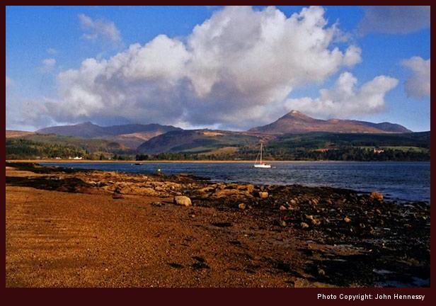
After that mental meander inland, it is time to return to the intended subject for this posting. That takes me to Arran, another part of the world where I haven’t been for a few years since I walked to the top of Goatfell on Easter Sunday in 2006. Then, I got mixed weather with hail near the summit, a patch of snow on the path on the way down and a deluge that beset me while making my way back to my lodgings for the night. The next day, I took a bus ride around the island with occasional showers never far away. There is a coastal path to complement the bumpy stuff in the north of the island and that is what brings the island into this discussion. A return is long-overdue and following part of the island’s coastline would make a good excuse to spend more time there again.
Turning south brings me to the Isle of Man and its coastal path. To date, the island has received just a single solitary flying visit, and I am tempted by the prospect of spending a bit more time seeing more of the place. It has its hills too, but you sometimes can get to know what lies inland while peering in from the coast. So far, it is largely uncharted terrain for me and that might be adding a certain frisson of novelty to the idea too.
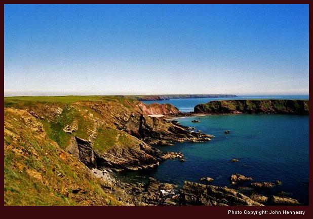
Staying on a southward trajectory takes me to another part of the world where I haven’t been for next to four years: Pembrokeshire. A lengthened weekend down there had me walking from Newgale to St. David’s on Saturday, around Marloes on Sunday and around Newport while on the way home on Monday. While there, I got lucky with the weather and the sunshine did plenty of justice to the indented coastline as it wowed me while I took in my ever-changing surroundings. Be warned that there are plenty of ups and downs with gentleness not being a strong point of the gradients. By the end of my walk on Saturday, it was time for a well-earned rest after the way that my leg muscles had been exercised along the Pembrokeshire Coastal Path. It may feel that I have taken in a lot, I only have nibbled at the national trail, so there’s much more to savour yet.
There is a reason why I am sticking with a few examples of coastal trails for now: there are loads and enacted legislation is to provide more access, so there must be a certain something to exploring coastline for more than me. Navigation generally is easy, and the scenery can be an intoxicating mix too. Some walk may walk right around Britain or another island, but I’ll content myself with pleasing sections like those mentioned above. Others such as the Fife Coastal Path, the Gower and the South West Coast Path are there should I ever decide on exploring very new horizons but pacing myself feels more sensible. Plenty of tempting options exist that are nearer to me and keeping closer to home mightn’t be such a bad plan.
In its own way, the forthcoming bank holiday weekend set all of this off. It looks like bringing a mixture of weather to us but don’t they all? Even so, I have concocted some sort of scheme to break me away from the day-to-day routine. As is my habit, I’ll leave it to work out how it will before saying more on here.
Pembrokeshire photos added
12th December 2006It may have been six months since I spent some time there, but a selection of the photos that I made while out walking in Pembrokeshire have finally made it onto the web. There is now a new album to go with the trip report that was shared on here already. It was a glorious weekend visit so I hope the photos reflect the majesty of what I managed to sample while down there.
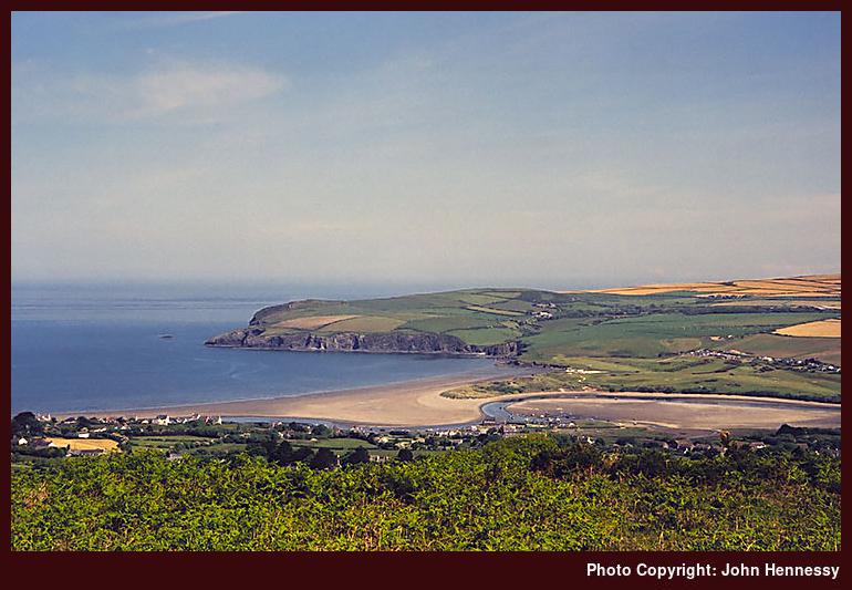
A first visit to Pembrokeshire
6th June 2006Here is an account of my trip to Pembrokeshire last weekend. An article in TGO and the gift of a fine weekend propelled a somewhat hastily arranged visit. The fact that I was in Ireland on what turned out to be a gardening holiday (yes, work rather than leisure) didn’t allow me any more time to pull myself together. As if that weren’t enough, a Friday afternoon meeting threatened to derail an already precarious plan.
Nevertheless, I did get there in the end. After work, I headed south-west on a journey that took me around by Birmingham. Bristol and Swansea. Defeating the conspiracy of a late First Great Western express to scupper the last leg of the journey, I got to Carmarthen almost as planned (even if I was 20 minutes late!); the provision by FGW of a taxi from Swansea helped towards that end.
The next morning, I got to my Pembrokeshire base of Haverfordwest. That might come as a surprise to some but it functioned as intended and I got to sample the Pembrokeshire Coast Path, which was my main reason for coming all this way. Public transport options allowed me to savour the delights around St. David’s, Marloes and Newport before I made my way back home on Monday. That gave me plenty of walking and sea air to enjoy, even if things got a little too hot at times. The up-and-down nature of the stretch between Newgale and St. David’s left me feeling a little “cream-crackered” but the walking around Marloes was a lot easier on the legs. Only having an hour or two meant that I only got a brief taste of the hill country around Newport, but a return is a definite possibility.
My journey home took me through Cardigan, Aberystwyth, Shrewsbury and Crewe, but this was more direct than the way that I came and could be the way I would go if I got the opportunity to return again. After all, there is much more to see. For instance, the Preseli hills are definitely worthy of exploration and I only sampled a fraction of the 186 mile (299 km) length of the Pembrokeshire Coast Path (though the heavily industrialised section around Pembroke and Milford Haven is an acquired taste).