When two walks became one
7th August 2012There are times when more gets fitted into a day than was expected and one of those came my way on a Saturday in May of this year. When a walk from Waterhouses to Hulme End didn’t fill the day, an extension was in order. That took me to Hartington via Beresford Dale, Wolfscote Dale and Biggin Dale and fitted easily within the bounds of the rest of the afternoon. Being able to enjoy a longer walk was a bonus with the sunshine that was there to be enjoyed, whenever clouds didn’t get in the way.
Waterhouses to Hulme End
Contrary to where my thinking had been, this essentially became a morning walk last May. It raises questions as to how I overestimated how long it would take me and I now think that tramping level tarmac tracks had something to do with my making good progress. As it happened, I am not so sure that I was expecting a metalled surface underfoot for all the way.
If the shortness of the trot had dawned on me last January, a tardy start after a busy tiring week at work would have had little impact on the day’s plans, other than a later start. The non-appearance of a bus from Macclesfield to Buxton dues to icy road conditions would have had no real effect either. Nevertheless, it might have been better not to confront the prospect of icy surfaces so readily. Without actually getting out that day, I have no idea how things looked but it now sounds that rushing could have been unwise then.
One aspect of the walk in May was that no rushing was needed. A certain hunger ensured that I caught the 09:10 bus from Macclesfield. It was destined for Ashbourne and was well busy too, a heartening observation for a rural bus service in these austere times. Then, two folk boarded it when I alighted from it in Waterhouses.
My disembarking point gave me a longer walk through the village than a little extra knowledge would have left to happen. In the sunshine, that was of no concern and I proceeded steadily. That the River Hamps wasn’t at all far away meant that I soon reached it and shadowed its course as I left the village. The next objective was the left turn that would get me away from the side of the A523 along which I was going.
The lack of signage when I did reach the turning near Brown End Farm reinforced the quiet vigilance that I had been exercising. This one of the few points in the day when inattention to map reading would have resulted in a spot of navigational floundering. Things would have been more obvious if I had sought out the site of the old railway station and started from there, but my approach worked and that’s all that was needed.
The stillness of the countryside by the Hamps struck me and there only were a few passing cyclists and walkers to disturb any sense of isolation. Another reason for the quiet was a geologic quirk that meant the Hamps made no use of its riverbed on the day that I passed the way. Being limestone country, the river disappears underground for much of its course unless the weather turns wet enough for it to emerge above ground. With the news media being full of stories about drought at the time, it was tempting to think that this might be a manifestation of what was causing water companies to issue hosepipe bans and other measures aimed at conserving dwindling stocks. Little did I realise that we were in the midst of the wettest April to July period since weather recording began. Now, we don’t hear such things and moans about having too much rain have replaced all the talk of water shortages, though it now seems that the weather has done a very good job of filling up reservoirs. With the U.K.’s dependence on surface water collection for our water supplies, maybe we need to better tolerate wet weather if we are to have any water at all.
The lack of water above ground prompts another question. Could our desire for being beside gently flowing rivers also explain the lack of folk around that part of the Hamps? Thinking about it now, it seems that other factors at play and I was following the route of a former narrow gauge railway that was set to link nowhere to nowhere. One of these backwaters was Waterhouses and it still is a quiet place today and the other was Hulme End and that’s not exactly bustling either. Folk might seek more scenic drama when they visit the countryside and I was thinking my pastoral surroundings a little tame as I passed through them. In fact, thoughts of making good a design on walking the Howgill Fells from Sedbergh momentarily were restored and I was wondering if I had been a little timid in my route choice. Since then, I have made good use of the Howgills idea and need to say more about that excursion.
It isn’t all farmland beside the Hamps, because the National Trust owns a number of woods along the way. It only took me an hour to get from Waterhouses to reach these and the sides of the valley had steepened by this point, partially putting paid to any yearnings for more visual drama. What also was unmissable was the lack of leaves on many trees that surrounded me. The evening before saw me spend some time around Tatton Park near Knutsford in Cheshire where there are plenty of leaves on trees, so this was a marked contrast. There must be slightly different climates between the two places.
Those National Trust woods had another use too on a track that needed little in the way of navigational intervention. They told me where I was and how I was going; names like Old Soles Wood and Soles Coppice proved to be good locators. Checking the map beside these told me that more might be made of the day than I had dared to expect. Beeston Tor Farm’s caravan park came as a surprise to me after all the quietness that I had encountered and the limestone outcrop of Beeston Tor was there to be seen on the approach to where the Hamps meets the Manifold too. This was more like the sort of sight that I had in mind and there were more like it to be seen throughout the rest of my walk.
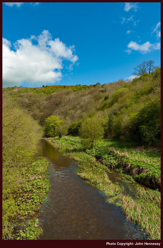
Unlike the Hamps, the Manifold was in good flow and there were more folk around it too, hence my earlier thoughts about humanity and flowing rivers. A mobile ice cream stall had set up for the day so there needed to be some custom. The caravan park, with a curious collection of older specimens, will have helped their cause along with any day visitors that came the way, though I staved away any sense of temptation. Accessibility helps too, since this was the next public road crossed by the former railway on its journey north since the A523 near Waterhouses. The abundance of hills made for narrow single track roads but we make our ways wherever we will.
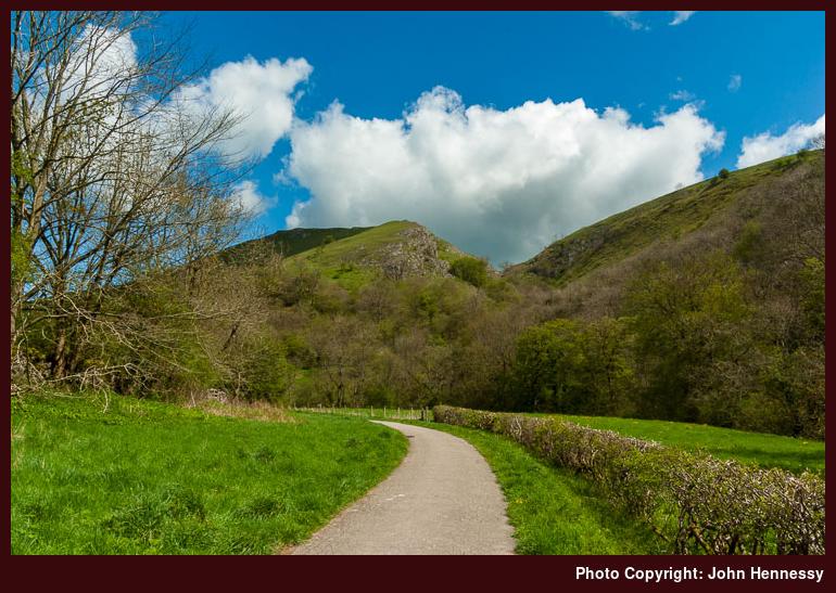
Soon enough, I was back on an off-road track again after admiring a road bridge over the River Manifold. Having to share the delights of the surroundings with more folk now was no downer and I continued to make good headway. The level nature of the track played its part and it could be a good option for anyone wanting to get back to walking again after a lay-off. Maybe that’s what attracts those who don’t get out so often. Those seemed to more numerous after I returned again to a public road after Ladyside Wood. On the approach to that road, someone bid me good morning and asked if it still was that time of day. There were ten minutes to go to noon, so a laugh was shared and enjoyed before we parted.
The next off-road section of the Manifold Way was beyond Ecton Bridge and the old railway tunnel required passage too if I wanted to stick with the route of the Manifold Way. Many signs for the Hamps Way and the Manifold Trail were to be seen along the course of my walk without any depiction on my OS map. Further investigation since then revealed that I needed a new one and it is sitting in front me as I write these words. The trails could have uses for future walks.
In fact, the Manifold Trail could have a use since it avoids the tunnel. As I went through it, others came that way with loud motorcycles and there was such a din that I stopped next to a wall until they had gone. The motorcyclists may have enjoyed the racket, and there are those who do, but it is not a taste that I plan to acquire. Being able to hear the peaceful sounds of the countryside is more my thing and there was plenty of restorative quietness between that tunnel experience and the end of the Manifold Way in Hulme End.
Hulme End to Hartington
After a break at Hulme End, a stretch of road walking conveyed me to Beresford Dale. The day was growing hotter as I plied more tarmac, all the while noting that caravan and camping sites are not scarce in this part of the world. It after passing the last of these for the day that I began my descent into Beresford Dale. As I did so, signs highlighting a public footpath diversion were to be seen and the cause was that the bridge that I was planning to cross had lost its railings at one side. In the event, I chanced going over it in spite of all the safety tape and did so without mishap or tumble. Sometimes, you have to use your own judgement.
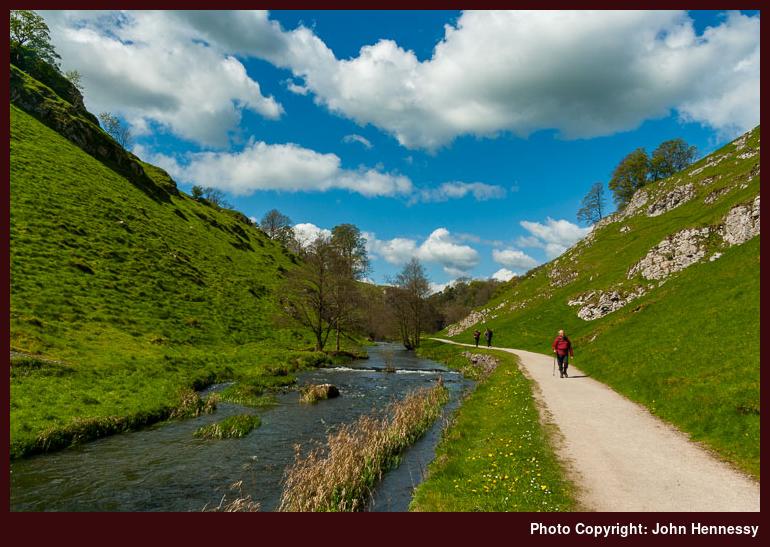
Once across the River Dove, crossing a field got me onto National Trust land and into Wolfscote Dale. The sun was in hiding when I entered the dale but it soon emerged to light up the wonder that lines this stretch of the River Dove. For one thing, the whiteness of limestone outcrops contrasted wonderfully with the green vegetation that surrounded them. Adding in a gently flowing river like the Dove was enough to make it all feel like a little piece of heaven that happened to fall to Earth. There was a need to share, but isn’t there always?
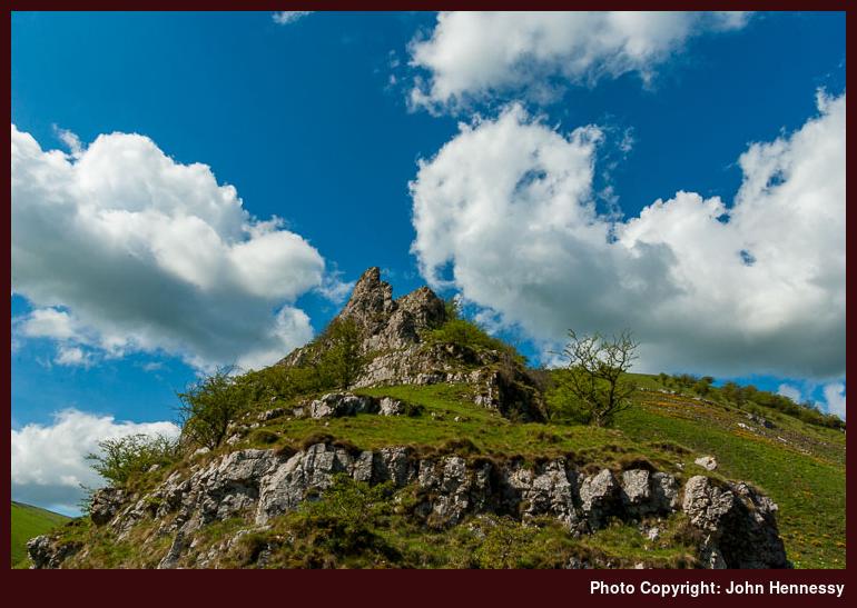
At the junction where Wolfscote Dale meets Biggin Dale, I popped uphill a little to find another resting place and ate more of my sandwiches there, a sort of outdoors afternoon tea after a fashion. During that time, the nearby surroundings emptied of folk to leave the place practically to myself. The prospect of continuing south towards Thorpe and Ashbourne really tempted, so alluring did the dale look. However, the use of two route ideas on the same day was enough so that brainwave was left for another time. It’s best not to be greedy.
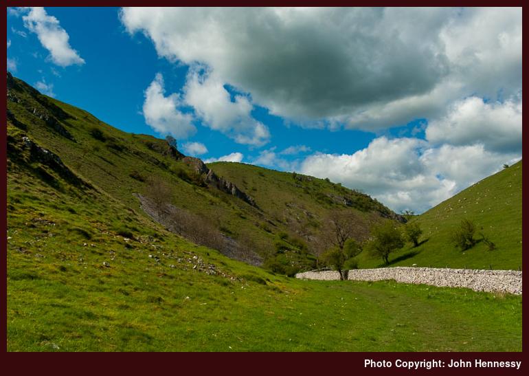
Once down off the slopes again, I turned to enter Biggin Dale and followed the walls while I was admiring the luscious green valley sides in bright sunshine. At the northern end of the dale, navigational choices were needed and I chose to go for Dale End instead of either Biggin or Reynards Lane. Once I had allowed cars and tractors to get by each other on the small road, I left it for the much quieter Highfield Lane to get to Hartington. Being above the dales at this point reminded me how much I felt I was missing while following the Tissington Trail from Pomeroy to Ashbourne in 2010. Appearances are that it’s so much easier to make interesting photos when you’re in a dale than when you’re above it in this part of the world.
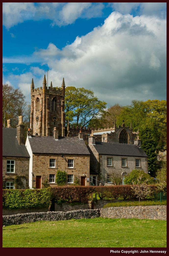
The lane was left for a public footpath that took me to the road into Hartington a little further along than the lane would. While dropping into my destination, I spotted a function going on at the YHA hostel, something that surprised me given it was May. Small wonder then that booking a YHA is an acquired art when things like that are done with their properties. A pleasing view towards Hartington’s church replaced those thoughts and I turned into the heart of the place to find a bus stop in plenty of time before the next bus to Buxton would appear.
More Ideas
The outing may have used two walking ideas but it yielded many more. Even the homeward bus journey had its part to play in that it showed me what is to be found around Longnor and Crowdicote. There’s much more to savour in White Peak country yet so I should not be bereft of excuses for escapades when I fancy straying not far from home.
Travel Arrangements:
Bus services as follows: 108 from Macclesfield to Waterhouses, 442 from Hartington to Buxton, 58 from Buxton to Macclesfield.
Please be aware that comment moderation is enabled and may delay the appearance of your contribution.