Sampling Kintyre with Arran and Cowal in View
14th July 2010The Met Office weather forecast for my few days in Arran and Argyll displayed an ever improving trend with Saturday being among the best of the lot. Of course, weather trends can change and there wasn’t as much sun as predicted. However, that has its advantages because clouds shield you from the heat of the midday sun and that makes for more friendly conditions for walking. At times when I felt the full force of a strong sun, I was grateful for those times when under a cloudy shield.
That last Saturday in June got a cloudy start and it stayed like that for much of the day. Over time, breaks did appear in the cloudy cover that allowed the sun through until it took over around Tarbet, where my walk was set to end. The starting point for the hike was Claonaig, so a ferry crossing was to get there from Lochranza, on the ferry that I saw the previous evening in fact.
Ironically for a part of modern-day Ayrshire, Arran is closer to Argyll and may have been considered part of that part of the world in previous times. That meant that the sailing on the small ferry only took around 30 minutes as opposed to around an hour for the bigger boat between Ardrossan and Brodick. Saying that, I can see the draw of civilisation result in a greater pull from the east that overwhelms any from the west. Well, the boat from Lochranza is a summer only affair while the Brodick one travels all year around.
Arran only grew a little smaller with the north-westward sea travel and it was unmissable from the shores of Kintyre as I started north along the Kintyre Way for Tarbert. The northernmost section of the long-distance trail was to be my lot for the day with helpful mileposts counting down the distance that I had left to travel. That decreasing numerical trend told its own story in that the Kintyre Way should be walked in a southbound direction rather than reversing it as I was doing.
First, I had to make up the road towards Skipness with a sleepy atmosphere in the air. Tempting seats were to be found in places by the road and I topped up on food while resting on one of them. Though the predominant colouration was more steel grey in nature, I still enjoyed any glimpses of Arran from across the sea. These were captivating vistas on a day with more sun, but they were still to blame for my going slower than usual. However, there was a long day ahead of me before I was to meet with a Scottish Citylink coach at Tarbert, so there was no need to rush.
At the quiet collection of houses that is Skipness, I left the tarmac to give my legs a blast of steep ascent up a gravel track. Unlike the day before, walking poles were with me to help, and the assistance was well needed with my carrying everything around with me. From this point forward, I was on the route of the Tarbert to Skipness Walk as well as that of the Kintyre Way.
To meet up with the banks of Skipness River, that hard-earned height gain was lost, not something that I found alluring after the earlier effort and in the knowledge that more ascent was ahead of me. Arran was lost from view with much forestry surrounding me, very much a feature of the route that I had chosen for myself.
Good progress was made and I began to go uphill again with the hills of Arran rising up over their lower counterparts on Kintyre. A longer lunch stop was made near Meall Donn, where I found a handy picnicking table at the end of the gravel track that I had been following. There was no real bother from midges either and the sun was finding a way through the clouds too, though the effect wasn’t as strong as that observation might suggest.
After the midday stop, it was along a well-defined path that I was following as it weaved around among the firebreaks in the forestry plantation. Though planted with trees, there was bog too with bridges placed over Allt Carn Chaluim to keep the wanderer on a raised bank throughout. Progress was slower than inspection of a map might suggest but I came to pass Loch na Machrach Mòire in its own good time anyway.
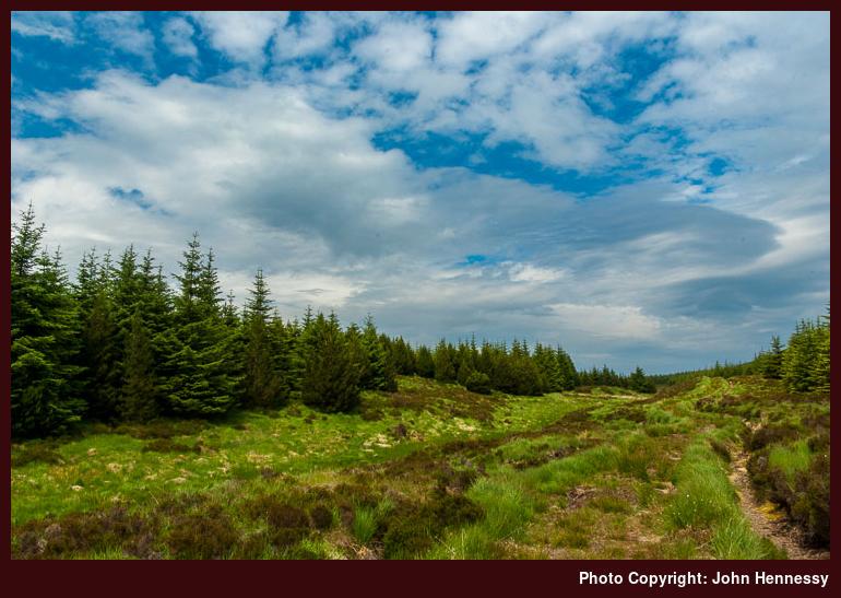
Once the loch was behind me, I left the forestry too to find myself among a boggy landscape replete with untidy rocky hummocks. Out of curiosity, I popped onto one of the nameless ones before returning to locate my belongings again before continuing along the path again to reach a piece of hill track brutality that was a recent addition to the landscape. For all the world, it looked as if a gravel track wide enough for two cars to pass each other had been gouged out of the hillside. Let’s hope that nature softens the unpleasant handiwork in its own good time but it too is easy to see why there is a campaign against such things in progress in Scotland. Not only are they ascetically disturbing but they also can confuse the unwary by making maps out of date at the scoop of a large mechanical digger. There has to be better ways of enabling timer harvesting and the Forestry Commission should know better.
Very soon, I was back among conifers gain and the sun was doing a better job of battling the clouds. That also meant that it started to feel hotter too as I began to come down from the none too heady heights that I had scaled. Any views of Arran were lost completely and it was those over Loch Fyne that replaced them. The Portavadie-Tarbet ferry was crossing beneath me as I made good any opportunities to look eastward to Cowal, a place on which I have designs of doing some exploration.
All the while, I was on the lookout for the path that would take me from the forestry track and drop me into Tarbert. It may have taken its time coming to me but it was a welcome sight when it came. The subsequent stop for rest and sustenance might appear like a kind of celebration, but my eyes were drawn by the brightening surroundings and the growing semblance of the development of a wonderful summer’s evening, much like the opening of a beautiful flower.
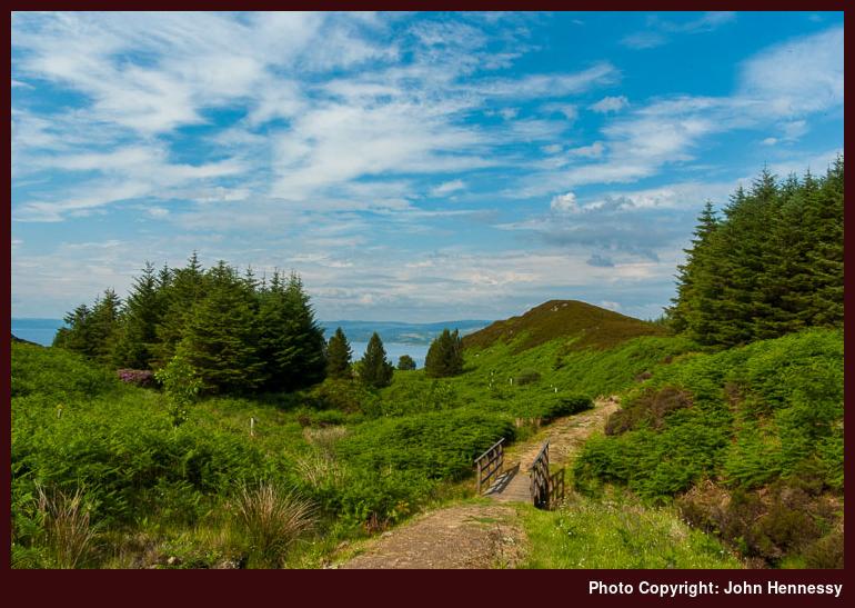
The way down was to be very steep and I didn’t envy those who I had seen coming up against me earlier on in the afternoon. As I neared Tarbert Castle, the gradients eased so that easier walking became my lot with a quick diversion to a view point. While thankful for less taxing slopes, I was questioning the attentiveness of the waymarking but I filled in any lapses in signing without a blunder.
The castle was unavailable for photography due to ongoing restoration work so I continued onto the shoreside road in what is quite a pretty place with nicely presented and colourfully painted buildings. After asking for directions in a shop where I bought some refreshments, I found the coach stop where my walk ended with plenty of time to spare.
Inveraray was my next port of call and I did some exploring before settling down for the night. Sunday was to turn rainy up there while other parts of the U.K. sweltered and England crashed out of the World Cup. If you had wanted to find a world away from that outcome, Scotland would have been more than forthcoming. There may have been occasional places where the sound of the vuvuzela could be heard, but there they were many more where peace, quiet and stillness reigned supreme, as I had discovered for myself.
Drier this time around
12th July 2010Last time I went to Arran, it was during an Easter weekend with a very mixed weather forecast. Despite that, I gained the satisfaction of getting to the top of the island’s highest hill, Goatfell, and a bus ride around the island. What I cannot deny was the existence of low clouds and heavy rain showers on that first visit over four years ago, but something could be made of the drier interludes anyway.
The weather that I met near the end of June couldn’t have been more different. So far, this year has turned out to be unusually dry in May and June though July looks as if it is getting an unsettled start. Things weren’t looking so settled as I travelled up to Arran on Thursday with a belt of rain bearing cloud dropping south over mainland Britain. While on the subject of weather, it might have been best to stay east if I had wanted sun but the allure of going west won out on this occasion. In any case, strong sunshine and heat tend to go together at this time of year, so gaining a cloudy respite is no bad thing either.
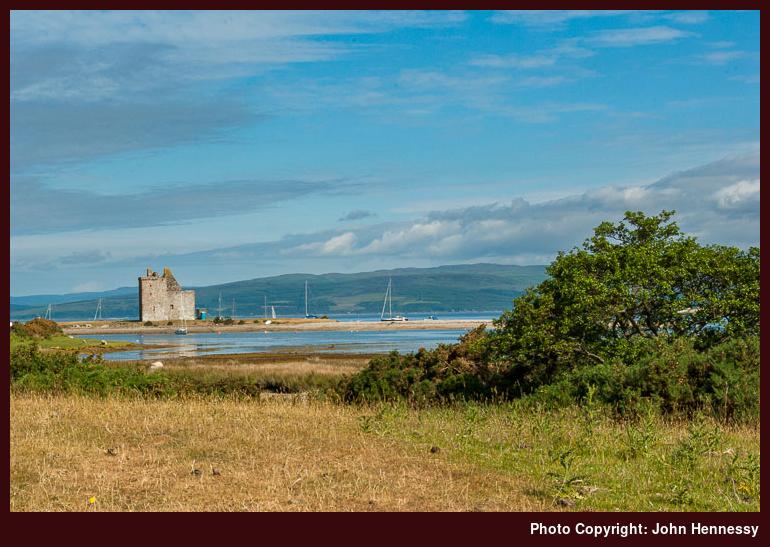
It was the clouds that were winning on Thursday though the sun was getting through in spots and at times. Any ambitions of bettering previous photos of Goatfell as seen over Brodick Bay would have to wait and it looked as if pleasing photos of Lochranza Castle were to prove elusive too. However, basing yourself anywhere gives you the time window within which sunny magic can happen and so it was with Lochranza. After an evening meal, the skies let the sun through to light up the surrounding landscape sufficiently for some photographic endeavour to ensue before I returned to my lodgings to take up my bed for the night.
Arising next morning revealed that the day had made a very promising start. After breakfast, I organised myself for a day’s walking, though conversation with another visitor may have meant my forgetting my walking poles. It would have been better to have had them with but I was well into my walk before I remembered my omission. A bit more presence of mind than usual was to be in order for any descents and having the whole day for a none too adventurous schedule was to help enormously. For once, I wasn’t trying to cram in too much.
Having been perusing Paddy Dillon’s Cicerone guide to walking on Arran, I had the bones of a plan too. Usually, these things can be very wide open for me, though that can have its uses when you find something of interest to explore that hadn’t come to mind until I am on an excursion. Those little surprises often add zest to a trip and one discovery on Harris comes to mind from a few years ago.
If it wasn’t for the recycling of hill names on Arran, my walk might have been easier to describe. For example, there are a few named Beinn Bhreac, but it is the naming of Beinn Tarsuinn that really complicates my description; there are three of them, all within sight of each other! First up is the really rocky that can be seen from the island’s east coast, and that wasn’t where my wandering took me and I had no inkling that there was a wooded top to the south of it too. No, I ended up bumbling about the triple-topped more rounded one out to the west of both of them with paths up Gleann Easan Biorach and down Glen Catacol taking me away from and back to civilisation, respectively.
My hike started out along the A841 with stops to look back at Lochranza in the growing heat. After the distillery, I picked up a path that was to allow me to escape from tarmac for much of the day. As I was to discover, quite a few folk use it to get to Loch na Davie before turning back again. In no way were the hillsides overrun but it did mean that I needed to share. Quite why one of the others needed to stay on his mobile phone for much of the way is beyond me. It goes against my main motivation for journeying through empty hill country: to leave all the paraphernalia and pressures of modern life behind me for a while to recharge my spirit.
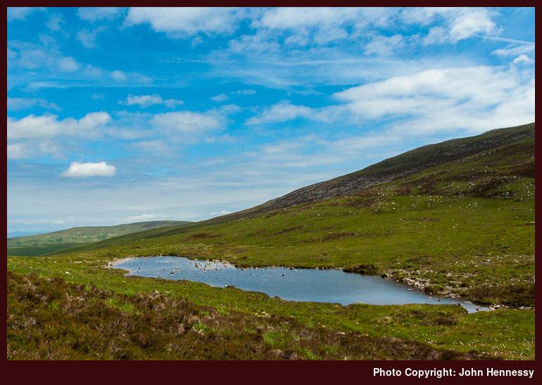
After a spot of leap-frogging and the passing of a few words, the others were to overtake me to continue on their way and I was left to enjoy the surroundings uninterrupted. The sky was taking on an ever milkier aspect but that cut down on the heat of the sun, a development that I had grown to appreciate. There was no need to rush so I had good luck all around me with Torr Nead an Eoin behind me and a spot of height to be gained before I came to pass Loch na Davie in its own good time. Those who earlier overtook me were now coming back against me with their objective reached. There was another man walking very much with a sense of purpose; he wanted to see if he could retrieve his spectacles after his being this way two days earlier. As I was sat near Loch na Davie partaking of some food and enjoying a little rest, he returned after a fruitless search but minded to speak to the police to see if anything was handed into them. After that, I was to have the place to myself.
What helped towards that episode of total immersion in the countryside was my leaving the path later on. Before that, I rounded Beinn Bhreac with Glen Iorsa and its ribbon of Iorsa Water opening out beneath me. Carn Mor and the nearby rocky Caisteal Abhail were at my back with the by now cloud-filled skies limiting the sunshine and any photographic action. However, the sun was by then in the wrong place for any successful photos of the rocky photogenic stuff; you need the sun to be in the west for that and it hadn’t got that far at that point in the day.
It was when I reached the saddle between Beinn Bhreac and Beinn Tarsuinn when I left the distinct path for some trackless passage towards the latter. My first destination was a 514-metre-high top before I headed for the 556-metre one before losing and regaining height to reach the 527-metre one. Quite whether one or all of these make up Beinn Tarsuinn isn’t so clear from the OS maps that I have seen but it was the shrieks of resident bird life that was taking up attention. Were they trying to ward off a blundering intruder or was something else happening? All that I’ll know is that it stopped once I reached the last hummock in the trio. Anyway, it was a reminder that it was countryside that was home to other creatures with a deer sighting cementing the impression.
From there, it was a matter of studying contours to find the least taxing descent into Glen Catacol. Taking in Loch Tanna might have made a tempting prospect but I wasn’t going to be so greedy. My legs were tiring too, so that may have been the deciding factor and there still was some height to lose as I passed the waterfalls of Abhainn Mor with yet another Beinn Bhreac above me. Very oddly, it seemed as if there was an attempt by dragonflies and other largish insects to stop me going forward; rightly or wrongly, it felt as if my legs were being mobbed. It’s not something that ever happened to me before so it might be an idea to get up to speed on insect behaviour. Otherwise, there were a few folk, not many though, coming up against me. Were they headed for Loch Tanna?
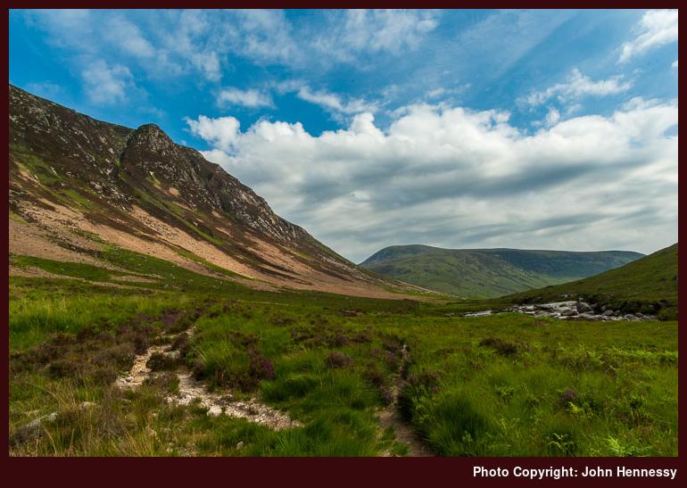
After making pains not to trip on any stones that littered the path, I reached those more level and kinder parts. The sun started to try getting through the cloud cover as I passed Gleann Diomhan and its National Nature Reserve. This would have been where I came down if I hadn’t deviated from the path to take up a more roaming course. Creag na h-Iolaire towered above me and I might have been convinced that my climbing was over for the day. In fact, there was a little more as I neared the road at Fairhaven. This may not have been much but it speared any sense of complacency.
Once back on tarmac, I had it in mind to check out the Catacol Bay Hotel for a spot of food. First, there was the continued battle between sun and cloud to keep me occupied as I looked back towards where I had walked. Meall nan Damh was rearing to the south of where I was and sending the road all around it. Out to the west was Kintyre where I would be the day after.
When I reached the aforementioned hotel, it looked a down at heel sort of place but it did food all day and that was to satisfy me. It was good to know that I wasn’t too early for service and folk were holding up the bar already. Suitably refuelled, I continued my journey back to Lochranza with the Claonaig ferry crossing to Arran for its last sailing of the day; it was to convey me to the mainland the following morning.
Unhurried strolling was to return me to Lochranza though it would not have been all on tarmac if I had been aware of such thing as a postman’s path between Catacol and my destination. More height gain would have been brought upon me, but my refuelling should have helped me deal with that. Apparently, there’s a need to watch out for a rocky edge too but I have managed loads of those so it wouldn’t have been a major issue. Once back at my accommodation again, I relaxed a while before settling down for the night, a tired but sated Irish lad.
It wasn’t sunny everywhere, not that it mattered
28th June 2010Depending on where you were, this past weekend might have felt every bit a scorcher. However, if you were stood around Rest and Be Thankful on Sunday morning, it was not scorching sun that you would have experienced but a soaking from a conveyor belt dragging showers of rain through the surrounding hills. Having experienced this a few times myself, I can attest to the amount of rain that can come down on you when the mood takes the weather. Yesterday though, I was travelling in a coach through it all after spending a few days reacquainting myself with the Isle of Arran and getting to know a piece of Kintyre.
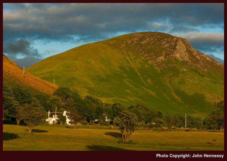
Having a few days of leave coming my way, my mind turned to returning to Arran more than four years after a first visit that took in the summit of Goatfell and a bus ride all around the island on a showery Easter weekend. The base this time was Lochranza rather than Brodick and the immersion into hill country deeper even if the heights were lower. The sun may have stayed hidden by cloud cover for much of the time, but that may have meant cooler temperatures more suitable for walking, so there can be no complaints.
After leaving Arran, there was time for a trot along part of the Kintyre Way between Claonaig and Tarbert. The views of Arran stayed with me much longer than I might have expected. It looked as if it were going to be a cloudy day’s hiking until that cloud began to break up to give me a blast of sweltering heat on the final approach to Tarbert with views over Loch Fyne towards Cowal to my right.
From Tarbert, I travelled to Inveraray for an overnight stopover prior to my coming south again the next day. The evening was perfect for lingering and, if you fancied the idea, al fresco dining on Inveraray’s shore line. A cheeky incursion into the surroundings of Inveraray castle came to pass too and without any sort of rancour from the residents in the castle either; mind you, I wasn’t making my presence that apparent. The sun may have been playing hard to get but it was the sort of evening that would keep you out of doors with its sense of quiet stillness.
Returning to the point on which I started this piece of mental rambling, the next morning was damper and that made departing not such a hard thing to do. Nevertheless, it always leaves open the idea of returning when better lighting is available, especially if you have photographic designs like me. As is my habit with these things, I’ll leave the wider musings on the landscape through which I traipsed for other postings. Even though I never was that far from Glasgow, everywhere I went had the feel of a quiet backwater, so there was plenty of time for uninterrupted reverie with the theatre of the skull unleashed. Though others may be dazzled by thoughts of sights further north, there is plenty around Arran and Kintyre for anyone seeking restive and restorative peace and calm. All in all, it did feel as if the frantic pace of everyday living was far, far away.
Travel Details:
Return train journey between Macclesfield and Glasgow, with a change at Manchester on the northbound leg and changes at Preston and Manchester on the southbound one. Rail connection to Ardrossan for a ferry crossing (CalMac) to Brodick with a ride on bus service 324 to Lochranza. Ferry crossing (CalMac again) from Lochranza to Claonaig; all ferry travel used a handy Arran hopscotch fare. Scottish Citylink service 926 between Tarbert and Inveraray and again between Inveraray and Glasgow.
Pondering coastal walking possibilities
28th April 2010With a bank holiday weekend ahead of us, thoughts turn to making use of the extra time. In truth, the pondering started last week and my thinking ended up in Northumberland even if I didn’t. It’s been a while since my sole hike by the county’s coastline near the start of 2006 and, given that I had a largely cloudy day for my exertions, it would be worth going back to savour the sights. Then, I journeyed from Alnmouth to Craster and back again, so there are sights such as Dunstanburgh and Bamburgh castles awaiting my attention along with Lindisfarne. Public transport connections make a day trip tricky, but it might be high time that I spent a bit longer over there.
While on the subject of a few days around Northumberland, my brain wandered inland to Wooler where I began to consider using St. Cuthbert’s Way for heading west to Kirk Yetholm. Transport (on Sundays and bank holidays, that is; it’s reasonable on other days) and other practicalities set me to considering the following of the Borders Abbeys Way for getting to Kelso for onward travel. Another walking option in the area would be going east along St. Cuthbert’s Way towards the coast where travel connections are better of a Sunday.
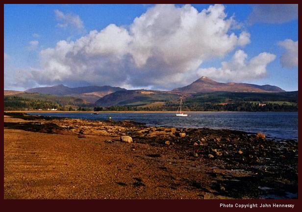
After that mental meander inland, it is time to return to the intended subject for this posting. That takes me to Arran, another part of the world where I haven’t been for a few years since I walked to the top of Goatfell on Easter Sunday in 2006. Then, I got mixed weather with hail near the summit, a patch of snow on the path on the way down and a deluge that beset me while making my way back to my lodgings for the night. The next day, I took a bus ride around the island with occasional showers never far away. There is a coastal path to complement the bumpy stuff in the north of the island and that is what brings the island into this discussion. A return is long-overdue and following part of the island’s coastline would make a good excuse to spend more time there again.
Turning south brings me to the Isle of Man and its coastal path. To date, the island has received just a single solitary flying visit, and I am tempted by the prospect of spending a bit more time seeing more of the place. It has its hills too, but you sometimes can get to know what lies inland while peering in from the coast. So far, it is largely uncharted terrain for me and that might be adding a certain frisson of novelty to the idea too.
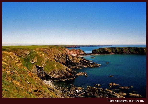
Staying on a southward trajectory takes me to another part of the world where I haven’t been for next to four years: Pembrokeshire. A lengthened weekend down there had me walking from Newgale to St. David’s on Saturday, around Marloes on Sunday and around Newport while on the way home on Monday. While there, I got lucky with the weather and the sunshine did plenty of justice to the indented coastline as it wowed me while I took in my ever-changing surroundings. Be warned that there are plenty of ups and downs with gentleness not being a strong point of the gradients. By the end of my walk on Saturday, it was time for a well-earned rest after the way that my leg muscles had been exercised along the Pembrokeshire Coastal Path. It may feel that I have taken in a lot, I only have nibbled at the national trail, so there’s much more to savour yet.
There is a reason why I am sticking with a few examples of coastal trails for now: there are loads and enacted legislation is to provide more access, so there must be a certain something to exploring coastline for more than me. Navigation generally is easy, and the scenery can be an intoxicating mix too. Some walk may walk right around Britain or another island, but I’ll content myself with pleasing sections like those mentioned above. Others such as the Fife Coastal Path, the Gower and the South West Coast Path are there should I ever decide on exploring very new horizons but pacing myself feels more sensible. Plenty of tempting options exist that are nearer to me and keeping closer to home mightn’t be such a bad plan.
In its own way, the forthcoming bank holiday weekend set all of this off. It looks like bringing a mixture of weather to us but don’t they all? Even so, I have concocted some sort of scheme to break me away from the day-to-day routine. As is my habit, I’ll leave it to work out how it will before saying more on here.
Some competition for attention
30th March 2010Last weekend should have seen me heading off somewhere for a day trip but nothing of the sort happened. Various excuses could be summoned and fatigue following a busy working week certainly would be among them. Then, there's the one that you cannot be away every weekend and that's true too. Still, it would have been nice to have made better use of the fine weather that visited us on Saturday and Sunday, especially with the weather for the forthcoming Easter weekend looking as if it will be as mixed as it is at the moment.
In the middle of all of this, there are a variety of interests competing for my attention. Sunday was taken up with a spot of messing about on a computer. In part, the cause was the resurgence of another interest of mine: cycling. With the bike's back tyre still needing attention to rid it of a (very) slow puncture, a damper should have been put on this but, no, it is threatening to send my brain off into places that are not compatible with adding contributions to what essentially is a hillwalking blog. It was that state of affairs that had me sent off exploring another piece of blogging software called Serendipity (yes, there's nothing wrong with WordPress but there's never any harm in having a look at the competition from time to time) in the name of crafting a cycling blog to complement this thing. While Serendipity itself works well, a few rays of reality fell on the idea and I am minded to consign it to the back burner for now. Saying that, a quick look on Google demonstrated that there might be a place for a cycling blog that revels in the countryside that gets explored. Of course, that also is what I do here so there may be room for including news of the occasional bicycle foray so long as it doesn't the focus of what you find on here.
With a website idea being left to come to maturity in its own good time, my mind again turns to the Easter weekend and any opportunities for restorative escapades. The weather has turned cold gain with blizzards visiting parts of Scotland and whiteness coating parts of Ireland. Here in Cheshire, it is cold rain that we have but that doesn't mean that I am ruling out the chances of an escapade between the showers that seem to be in the current forecast. It's just that I'll need to see how things look later in the weekend before making any plans. That's not to say that there aren't some ideas already in my head such as coastal hikes in Northumberland or Pembrokeshire, a short hop to Arran or, closer to home, a wander along the Peak District moors between Baslow and Hathersage. For any of those to happen, it's a matter of having at least some of the kind of weather that those such places visual justice. It will be a case of waiting, this time around.