Other things on my plate
1st June 2010My staying at home over the weekend has less to do with the weather not being all that inspiring. After all, it wasn’t that unpleasant either so an outing wouldn’t have gone amiss. However, there were other things needing doing whose details don’t belong on a blog such as this. Even so, I got to completing the sprucing up the Snowdonia album in the photo gallery for now. Where there was one album, there now are two: one for the area’s castles and another for its hill country. As with much of my poring over old photos, ideas come to mind for excursions. The Nantlle Ridge looks interesting and there’s poking around the Carneddau from Bethesda. Should the right weather make its appearance and other matters release me, they could come in handy. In the meantime, there are more photos from that weekend in Ireland to be sorted and the Kerry album is being given the once over in between everything else. Also, next Saturday is looking promising and my mind might be free to make use of it. Of course, weather predictions can change but, unless you keep an eye, windows of opportunity can be missed and mental soreness might be the result when the rain soaking seems neverending. For now though, there are stirrings of complaints about a drought but they may be emerging too soon…
Catching some sun in Munster
28th May 2010Last weekend, I crossed the Irish Sea for a more social visit to the south-west of the island where my parents live. While there was a spot of lawn-mowing, hedge-cutting and other bits and bobs to be done, there were chances for limited immersion in hill country too. Friday saw us heading to Gougane Barra in West Cork. The sun was playing hard to get until later in the day, but that didn’t spoil any enjoyment derived from poking around Coillte’s forest park in the Valley Desmond. There remains one trail that I would mind doing but it’s best never to exhaust the possibilities of anywhere. In any case, having had good weather for photography on a previous visit meant that it didn’t matter on this occasion.
If I had been dissatisfied, Saturday was going to rub it in with its cloudless skies and strong hot sunshine but I wasn’t to be bothered. The sun did change my colour as I attended to lawn edging and other tasks but it was nothing that a rub of after-sun soother couldn’t sort. It turned out that Sunday was going to offer more of the same, so hat-wearing and sunscreen were my defences against the attentions of strong sunshine. Letting down my guard wasn’t an option.
Though many were heading for the coast, we struck on for Killarney. With the heat that was to be felt, it wouldn’t have been the wisest to embark on a long hike without acclimatisation but it was not going to be that sort of day. In fact, the time was taken up with driving from spot to spot and strolling around them too. The locations included Looscaunagh (where the old disused pub is now for sale; who’s going to buy a derelict building in the middle of nowhere in these times?), Moll’s Gap, a stop to the west of Ladies’ View, a lunch stop by the Upper Lake and Muckross House and Gardens. Though coach parties were being conveyed, Moll’s Gap didn’t feel overrun and it was only as we came downhill again that more and more other folk were being encountered.
Though there was a suggestion of haze, no cloud occupied the sky. Not was that a complete change from the last time that I was around there, but giving the sun unobstructed access to the countryside had a dramatic visual effect. In fact, I really have to think back in time to pick out a visit to Iveragh that was blessed with such good weather. The last one must have been on a Sunday in September not long after the turn of the century, when we were celebrating a family occasion with a ride out from Ross Castle around Lough Leane on the Waterbus. Before that, my memory is taken to 1995 by photos that I took that long ago. A few years before that, there was a drive down the rough track into the Black Valley and on to through the Gap of Dunloe. Maybe I need to visit more often to even up the odds of getting optimum weather.
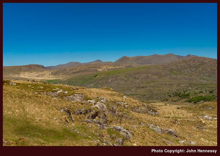
With my luck with the weather around Killarney, it might be that 2010’s visit will stick in the memory for being a photographic sweet shop. Only the chance of having an earlier start or a later finish would have made it even better. As it was, I had to contend with high sun and the risk of lens flare but I came away with something better than anything that I got before regardless. The viewpoints were by now familiar to me so I had ideas as to what to do with them and there was no fumbling in the ever strengthening sun. That’s not to say that I wasn’t open to anything that came my way and I now have quite a few photos to organise.
Apart from a longer out and back walk down the spit of land that separated Muckross Lake from Lough Leane. It was all short strolls for me, but that was no bad thing with temperatures hitting up to 25º C. That’s not to say that some weren’t embarking on longer journeys with a charity cycle in progress and a good of folk out on (hired?) bikes. Some of the latter were later found with their feet in the cooler waters of Muckross Lake, and who’d blame them? Others were loafing around in front of Muckross House as I caught it catching the sun for the first-ever time.
As good as the day was, I left with ideas for the future, with the main one being the prospect of a walk all around Muckross Lake. That would need more time than I had and figuring out something to occupy less patient souls while that is in train will be a must; I ended up most of half an hour late on returning from my walk and it sounded as if every minute was an eternity for someone, not good but I was at peace and I didn’t let it get to me. An ice cream stop in Barraduff put that behind us and I got to capture a view of the Paps between the more urban paraphernalia too.
The day after couldn’t have been more different with its foggy greyness, but things got ever brighter as I continued north to Dublin as I commenced my eastward return. It had taken over well by the time that my flight took off into the air. On the way over Wales, I spied the hills of Snowdonia and made out gashes like the Ogwen Valley and the Llanberis Pass. They were helping me to draw distinctions between the Carneddau, the Glyderau and Snowdon itself. In the midst of all this, I even tried looking for Moel Siabod but without enough certainty whether I had picked it out from the surrounding bumps though the Conwy Valley was unmistakable. Apart from recollections of Welsh hill outings, all this was reminding me that I am in the middle of giving the Snowdonia photo album in the photo gallery a makeover. That’s not finished yet and new photos of Kerry already are in mind as is doing something with the uncertainties of the bank holiday weekend that is upon us. All this is the sort of activity that has to take second place to the necessary tasks of everyday life but it never stops in its own way either.
Those Irish strolls may have been short but I was left feeling so at ease that I ended up thinking that I don’t go over there often enough. That’s an old problem but resolving it could be interesting if perusals of recent issues of Walking World Ireland are to have any effect.
A little something in monochrome
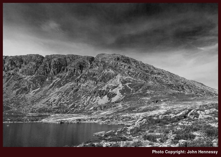
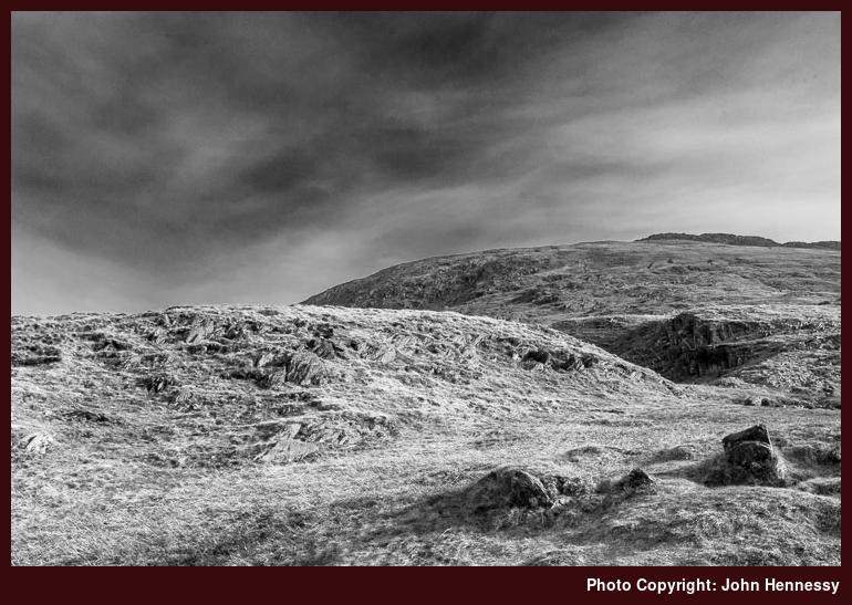
20th April 2010The hazy conditions that pervaded while I mounted Moel Siabod on the way from Dolwyddelan to Capel Curig didn’t make photography an easy pursuit. However, I still had well lit photos though the haziness made me wonder how they’d come out in black and white. Regular readers might remember the colour versions of these from a previous posting, but I thought that I’d share anyway. Maybe my approach to the world of monochrome should be more deliberate but, unless you try, you aren’t going to learn what works and what doesn’t. Then, you can imagine what results you might get. That might explain my trust in my ageing yet trusty Pentax K10D for image capturing duties: I have a good feel for what it does, and it helps when attempting to translate the scene that’s in front of me into a photo.
A developing pattern?
19th April 2010Unusually for me, my walking escapades seem to involve my reaching more summits than usually has been the case. In fact, finding some sort of hummock to ascend has formed part of my planning in the last few months. The most recent example of this was an out and back hike to Y Llethr from Dyffryn Ardudwy over the past weekend. That followed a yomp over Moel Siabod the previous weekend and there was an ascent of Diffwys in early February. Thus, three outings to Wales have come to pass so far this year and Terry Marsh's Great Mountain Days in Snowdonia (Cicerone) might inspire more yet.
Mark Richard's Great Mountain Days in the Lake District should be encouraging a few too but I only have January's spur of the moment crossing of Place Fell to record for 2010. Still, that now looks as if it was start of a pattern where reaching hilltops has been playing a large role in my hill country outings. Even when I went to Scotland, I ended up on a unnamed though snow blanketed foothill of Bynack More when I had intended to stay low (boggy ground stalled my initial scheme). As if to continue high level hiking, an Easter crossing of Baslow Edge, Curbar Edge and Froggatt Edge needs to be mentioned too. With all of this falling into place, it may be a matter of time before that first Munro gets ascended and there are a few candidates in the Cairngorms that have caught my eye but there's no rush on that one.
All of this action may look like peak bagging but that is an incidental upshot rather than the avowed aim of the exercise. If creating some list of hills climbed was the aim, I wouldn't be bobbing around the place in such an unplanned manner. Going up hills is for me a device for propelling me out of doors when the weather makes an offer. It used to be that exploring somewhere or a new angle to an old favourite did the job on its own but adding a hill top has been giving form to plans in place of finding a tempting path or track on a map. Quite where all this is leading me is another matter but I'll enjoy the countryside along the way and share that (and any decent photos that I make) with you afterwards. Now, I need to find time to say more about that flying visit to Y Llethr…
A weekend around Capel Curig
16th April 2010With fine weather around and a good forecast, I made sure that I sorted something for the past weekend without letting it to the vagaries of Friday night planning, an at times fragile activity that is vulnerable to tiredness after an intense working week. Much to my surprise, I managed to book a bed in the Capel Curig YHA after drawing a blank there and at other hostels in the vicinity on previous attempts. That placed a pivot on the map of Wales for my route planning. With that there, I pencilled in a planned walk from Dolwyddelan that was to take in the summit of Carnedd Moel Siabod. With a need to get away early on Sunday, I didn’t fancy my chances of getting in another hike, but I managed to fit in a yomp from Capel Curig to Betws-y-coed through woodland and over boggy terrain.
Saturday
After an early morning start from Macclesfield, I arrived in Dolwyddelan on a busy two carriage train with lively dogs across from me; the tail of one of them kept striking my newspaper and I didn’t envy their owners when it came to controlling them. All the way there, the skies had a very hazy look about them, and it was no different around Dolwyddelan. It was a hint that the day wasn’t going to be one for splendid photographic results, but I set to sorting myself out in the car park anyway. That act left any other interlopers that came off the train with me time to go on their merry way.
The start of my hike reprised a route that I followed around the same time last year. It started with a short hop along the road that took me over the Afon Lledr before crossing a field. Once over a not so busy A470, I pulled out my walking poles and set off uphill; they were set to stay in use all the way to Capel Curig.
Just because I wasn’t gaining so much height on the lane up from the A470 did nothing to reduce the gradient, but it still wasn’t as steep as I remembered it to be, and I was carrying a more laden rucksack on my back this time around! After that effort, a short stop was in order and I made out Dolwyddelan Castle in the near distance. Last year, I seem to have missed it for no reason that I can recall, so it was a matter set to rights.
With that initial steepness out of the way, the terrain became more level as I ambled along a forestry track. Moel Siabod, the prospect that jumped out of the Snowdonia member of Cicerone’s Great Mountain Days series, loomed above me as if to let me know what awaited me, yet I wasn’t to be deflected, even with the white streaks that were apparent. When I last passed the way, there were more folk about, but this occasion was much quieter; I was to meet no one until a few mountain bikers passed me as I approached the sign for Moel Siabod. Last year, I kept going for Capel Curig with mixed feelings, but Llyn Idwal was my ultimate destination that day, and I wasn’t to be disappointed with either progress or surroundings.
This time, I lugged my heavy pack to the top of Moel Siabod with no misgivings, marked Carnedd Moel Siabod on OS Explorer maps. The mention of maps brings me to the subject of my having two maps available in a trouser cargo pocket. One of the problems with Moel Siabod is that it sits astride OL17 and OL18 and not all the paths around the hill are depicted either. Given that Harvey’s Superwalker map of the area put the hummock in the middle and not at the edge, it came too, and a few more tracks are depicted on it too. However, it doesn’t show my route from Dolwyddelan to Llyn Foel very well, so an OS map was at hand too. When you get different stories, you need to hear them all to get a fuller picture.
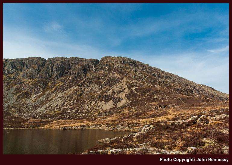
Before I could emerge into open country, I needed to pick my way though forestry, not my strongest point but the track was clear up to its end and the path that took over was more than navigable too. The day was hot and sweat was coming out of me as I ascended the slopes until I exited the forest into boggy and craggy terrain. I knew that I had to cross the stream to my right but took a somewhat roundabout route before doing so; there’s no need to do everything at once when some things can wait. It was from there that the gradient really sharpened, and I noticed two other walkers below me, the only ones that passed this way as I was making my ascent. They were far less laden, so I left them pass before continuing my sluggish course. Cataracts abounded, allowing opportunities for stopping and staring. Patience was needed too and it’s so easy to become frustrated with not reaching your objective as soon as you’d like. Overestimating how high you are is another slippage to which I have succumbed, so I took it easy and left the shore of Llyn Foel come to me in its own good time.
Once there, I had a choice of going left or right. The former may have been the shorter journey, but I needed a break from hopping over stones and boulders, even if that took me over boggier ground. That it was to do so meant careful footwork of a different kind was in order until the drier ground leading to the flank of Daear Ddu allowed a chance of a rest. It became clear that I was onto more frequented turf by now with folk passing by while I was stopped. You never could call it overrun, but remarks about a glorious day are always good to share.
Knowing that the ascent of Daear Ddu was ahead of me, I paced myself as I continued up as yet not unfriendly slopes. Though not marked on any map anyway a path could be made out, and I followed that while using the widening views as a means for tracking progress. Dolwyddelan Castle and the Crimea Pass could be picked out below me as I scuttled up the steep hillside. Eventually, I even was led to believe that a sliver of Llyn Trawsfynydd was visible over hilltops. Progress was slow and not just for me. Another pair of walkers lost patience and went for a more direct approach to the summit and guess who they met up there before them? A certain laden Irishman who wasn’t that far above them when they went their own way. My more circuitous course demonstrated that direct routes aren’t always that quick.
Though I needed to negotiate a boulder field and remnants of the past winter in the form of patches of snow, the fence that you see marked on an OS map came soon enough. While I was wondering if more clambering was ahead of me, another walker came and, after sharing a few words about the view, lobbed his Jack Russell terrier over that fence. Deciding to do the same, I followed while marvelling at all that I could pick out from the surrounding buckling of the landscape. Snowdon, Tryfan, Glyderau, Carneddau… The list grew on a day when haze meant that photographic capture was limited to record shots. Well, Snowdon is situated in a better place for morning photography from the Capel Curig side so it’s horses for courses. However, now I know what dome lay on the horizon when I looked east from the Miner’s track to Snowdon’s top a few years ago: Moel Siabod.
If it wasn’t for the fact that I hadn’t planned to stay the night, I might have been concerned by my arrival on Moel Siabod’s summit at around 16:00, but I fitted in both the views and one of the boulder-strewn humps that are marked as Moel Siabod by the OS before heading down. Having had enough clambering done for any day, I left the other one or two after me, at least for now. One advantage of staying high for that little bit longer was that a downhill was plain to see. It also was the one that I planned to take to get onto an old pony track that was to take me down again. Even with my being at the gentler side of the hill, that didn’t mean that I could go downhill willy-nilly. For one thing, the paths were stony and the gradients significant. Concentration remained of the essence.
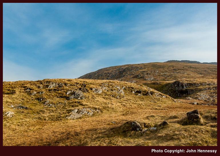
With accommodation sorted and a few hours of daylight remaining, tiring limbs were not being rushed, but I was down in less than three hours all the same. Llynnau Mymbyr lay beneath me as I made for Coed Bryn-engan, through which I needed to pass before I was out on the A5. Though there were better routes through the wood, I wasn’t going around in circles either, even after a long day on the hoof. Still, it wasn’t before time that I got to the hostel to be given a room with no one else in there before me, a situation that never greeted me before. That gave me time to organise myself before anyone else appeared on the scene, and it was a full house later on and a noisy one too. With all the tossing and turning above, I wondered at the wisdom of taking a lower bunk, but the night wasn’t all sleepless either. Before all this though, I had spent a very good hour sat on a rock next to Afon Llugwy as the light declined.
Sunday
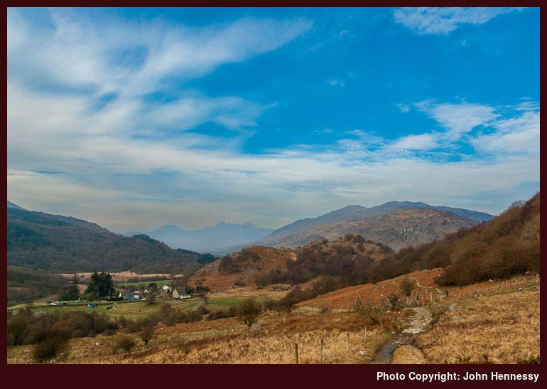
An early start after a decent breakfast had me heading towards Betws-y-Coed with an eye on the time. There was a footpath that circuited the hostel via a nearby campsite that gained me some height with occasional sun lighting up the likes of Moel Siabod and Snowdon among others. Eventually, the going got boggier and navigation needed attention if I wasn’t to end up going all the way to Llyn Crafnant and Trefriw in error. Looking at a map since then, revealed that would have covered the same distance and used a different bus at the other end, not the end of the world in other words. On the ground, it took time for my selected course to reveal that it was my intended one and not another. Sodden soft ground is not the best for navigational clarity and a later map showing a permissive path on a gate had me scratching my head for a moment. All that map perusal and careful stepping cost me time, and it took an hour to reach forestry again.
Once among trees, the pace quickened, and I dropped onto a path to cut down on the distance travelled, though a trip landed me out on my elbows at one stage. Apart from another muddying go with that from an earlier ill-placed footing, there was no damage done and I crossed Afron Abrach and took to another forestry track. This followed the edge of the plantation with Glyn Farm to my right. It also allowed good progress and I later stayed on forest tracks by choosing to cross a road to meet another. The roar of the Swallow Falls (a mistranslation of the Welsh for “Foaming Cataract”, apparently) come up from below me and I saw the nearby hotel too, a good sign that time was with me.
When I found another narrow road, I stuck with it for a little while until wonderment about the wisdom of staying on it all the way to Betws-y-Coed led me onto a rough path that shadowed Afon Llugwy. The promise of a softer surface must have swung it, though I don’t know if the ups and downs were all that kind. Having had enough, I returned to the road only to find public footpath signs and left it again. The way east from Miner’s Bridge grew ever flatter and drier. As I neared my destination, the numbers of people typical of a honeypot were milling about. Quite what they made of a muddied walker with two sticks and a well filled rucksack is another matter. They were no impediment as I sought out my bus stop with more than half an hour to spare. There may have been outdoors stores, but I resisted their allure and stuck with popping into a Spar for some sustenance and the National Park centre for leaflets and gifts. A weekend spent among wilder surroundings ended among more genteel ones. How dull would life be if it wasn’t full of such contrasts?
Travel arrangements:
Getting to Dolwyddelan was all by train with changes at Manchester and Llandudno Junction. The non-running of trains on the Conwy Valley line on Sundays meant travelling to Llandudno Junction from Betws-y-Coed on the X84 before continuing by train with changes at Chester and Manchester. The bus service accepts train tickets, so there was no extra cost beyond the price of a return train ticket to Dolwyddelan.