Calderdale revisited
6th March 2007For some reason, the West Yorkshire Metro calls the railway that passes through Calderdale the Caldervale Line; it’s enough to confuse the likes of me. However, the local authority is Calderdale MBC and so it is Calderdale to me then.
Anyway, let’s get away from the nomenclature and back to some walking. Last week, I was feeling a little burnt out so I took Friday off in an effort to recharge my batteries in the hills around Calderdale. Taking in another section of the Pennine Way was also on the agenda.
An early morning departure from Macclesfield got me as far as Manchester Piccadilly station, from where I used the Metrolink to get to Manchester Victoria station. From Victoria, I caught a train to Todmorden. The timings were a little finer than I would have liked, but the departure from Victoria was delayed by 10 minutes due to its needing some attention; for once, a train was late when I wanted it to be that way.
Once in Todmorden, the walking started in earnest, and in glorious sunshine too. The Calderdale Way and the Pennine Bridleway took me from the heart of Todmorden onto Lumbutts and Mankinholes before rounding Stoodley Pike to pick up the Pennine Way. At this point, my previous hike in the area took me south on my way to Littleborough. This time around, I headed north and descended to the A646 at Charlestown. The only problem with mid-walk descents is that ascents usually follow and the one from the A646 did take its toll on my legs as I continued on my northward trajectory. My amble continued with a spot of road crossing as I skirted Heptonstall on my way to and through Colden. There was a bit of down and up as I neared Colden but I did take the chance for a spot of lunch by the stream that caused it. A pub wasn’t far away either if I felt so inclined.
Beyond Colden, the Pennine Way regained its wild feel after its passage through what is a very much inhabited and post-industrial area. The section around Heptonstall Moor was one of the most enjoyable of the whole walk, the only fly in the ointment being the cloud that was bubbling up in the sky. Eventually, I neared the Gorple Lower Reservoir and followed the Pennine Way as it dropped into the gorge carved out by Graining Water until it clambered out onto the nearest minor road. From here, the Pennine Way continues east and it was at this point that I left it for the Pennine Bridleway, the trail that was to take me onto Worsthorne and Burnley.
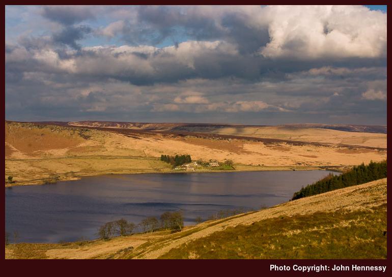
I continued up the road and took the track around the shores of Widdop Reservoir, stopping for another food break along the way. After being dull for an hour, the day began to cheer up as I left Widdop and it largely continued that way for the rest of my walk. On my journey, I continued past views of gritstone outcrops and Gorple Upper Reservoir. The final stretch to Worsthorne took me past Hurstwood Reservoir with views over Burnley on the descent. Once on tarmac, things began to feel like a slog and I broke my walk into Burnley town centre when I encountered the bus that returned me to Todmorden, a welcome sight. Once in Todmorden, I commenced my railway journey upon the arrival of the next service to Manchester, delayed due to technical problems in Leeds. After that, it was the reverse of my journey that morning.
Though tired after the long day, the walk was a good one and it has far from dimmed my appetite for future Pennine Way strolls. Immediate options are the section that starts near Littleborough and gets you near to Marsden, with other footpath options doing the connection honours. Continuing northward, perhaps onto Keighley or beyond on the next stretch, remains a very tempting possibility.

Please be aware that comment moderation is enabled and may delay the appearance of your contribution.