Autumnal and springtime encounters with both Parkhouse Hill and Chrome Hill
16th July 2019Sometimes, places get two visits before I get around to writing up any of them. A few of the trip reports that have made their way on here already have that characteristic so you get two for the price of one, as risky as that might be when it comes to quickly writing the accounts. As you will find here, it is a chance that I am taking yet again.
This one involves a comparison of different seasons after my finishing the winter, autumn and spring instalments of a seasonal tetralogy written by renowned Scottish nature writer Jim Crumley. The fourth has yet to be published, but the others contain a sense of how seasons can betray their caricatures to produce green winters and white springs, something that he notes in the snapshots he features in these writings. Our climate may be changing but I still get the sense that what we get is more like daily weather rather than a seasonal pattern.
It also needs to be said that seasons can be cultural as much meteorological or astronomical. That quite possibly is how I got taught about Celtic seasons at primary schools. These apparently have regular starts on the first day of each of February (St. Brigid’s Day, spring), May (Beltaine, summer), August (Lunasa, autumn) and November (Samhain, winter). Given meteorological vagaries, I am going to stick with this convention for this piece, so a February stroll is a representative of spring and it helps that the weather on that day was more like a day in April.
October 2017
First though, I return to October and that is given a name in the Irish language (Deireadh Fómhair) that means “end of autumn” so you should again hear the effect of what I described above. In the natural world, autumn is a season of change as much as spring can be and it brings stormy weather too after the supposed quietude of summer. However, the world of the human mind can be quite a different place.
The summer of 2017 became one of my most tumultuous and it brought me to commencing a much-needed career break. It was in the midst of ongoing renewal and recovery that I went to Sterndale Moor. It was a sunny day after the preceding passage of Storm Ophelia and there was a camera to try out on the day.
Earlier in the year, I acquired a second-hand Canon EOS 5D Mark II DSLR that I partnered with a lens I bought when I used photographic film. The lens began to show its age on that October day before it totally failed a few months later. It was replaced earlier this year after it was deemed irreparable due to unavailability of spare parts. Together with life’s other events, the expense of the purchase had caused me to delay the new acquisition.
A successful local outing near Macclesfield encouraged me to leave my usual camera after me to make more use of the Canon so it was with that I left the A515 to go to Earl Sterndale. In some ways, there was not so much that was photogenic as I crossed fields on the way towards a landscape that has been altered by quarrying of limestone. The presence of quarries explains why Buxton is excluded from the Peak District National Park.
A walk from Buxton to Castleton quite a few years ago took me through a quarry on the northern side of the former and brought home to me the violence of the assault on an otherwise bucolic landscape that such industry can undertake. Thankfully, my stroll in 2017 shielded me from much of the horrors of such labours and Earl Sterndale felt far removed from such things. As if the layout of the countryside can conspire to deceive, that pastoral setting was to accompany me for much of the way from there to Buxton.
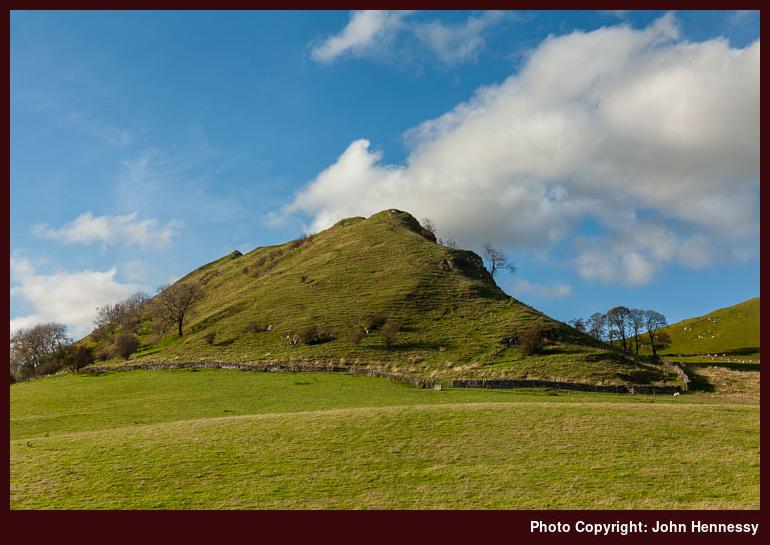
From Earl Sterndale, a public footpath led me through fields around Hitter Hill before dropping me onto the B5053 near Glutton Bridge after I had deliberated on the supposed line of the public footpath give that a farmhouse lying just beneath me. This was to be repeated later, but the next part of my route was easily clear. Deciding against any ascents, I passed Parkhouse Hill instead of ascending it. This was to be a time for getting to know the area better after passing by on several bus journeys and seeing photos in magazines. Any hill climbing could wait and there were photos to be made.
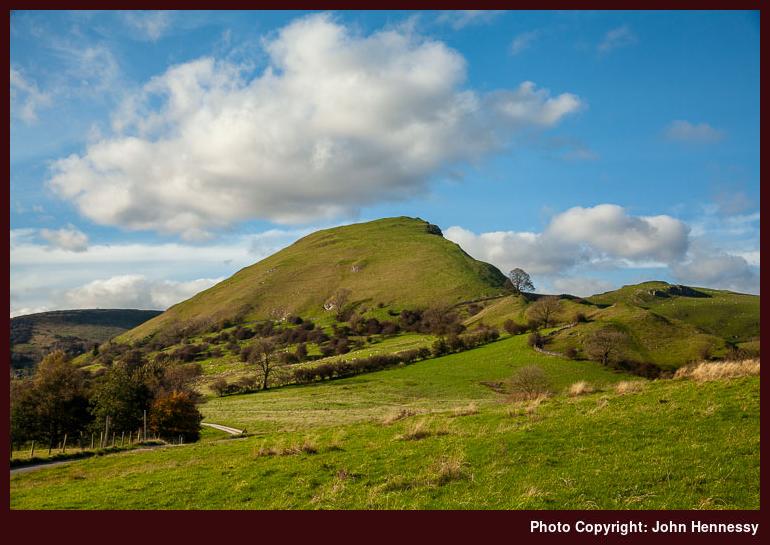
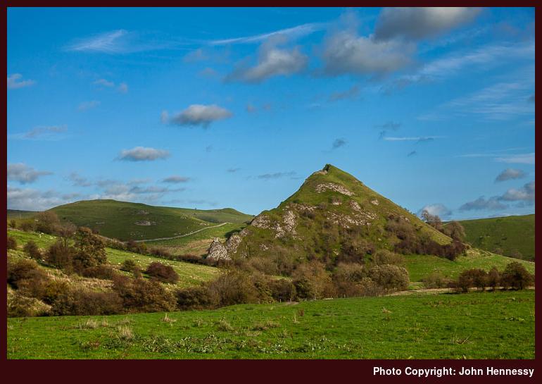
The path rounding Parkhouse Hill deposited me on a lane that I soon left to follow a byway that took me past Chrome Hill. The theme of passing hills rather than reaching their summits was continuing with encouragement being provided by a lunchtime start and the loss of evening light. Accompanying quietude allowing for stilling of the spirit, admiration of surroundings and ambience together with a chance for my brain to drift while I made for Hollinsclough.
That again was a quiet hamlet and I left it to head for Booth Farm along clear paths and tracks. Deciding how to continue after that took some thinking and not a little courage to work out the correct way to Thirkelow. Once I had done that deed, there still was a chance of veering off trail and it took my GPS receiver to stop me going towards Brand End. Earlier fears about such imperfections arousing the ire of landowners were unrealised and another encounter with the effects of industrialisation lay ahead of me.
The last stretch of my amble took me around land owned by the Health & Safety Laboratory with attendant signage to stop any wandering into danger zones where experiments get conducted. The floor of the defunct Stanley Moor Reservoir was another perilous place to avoid and that was passed without much in the way of inspection as I continued towards Buxton Country Park, whose environs ensure a far more amenable feel to the end of my stroll. All was again familiar as I went from there to the nearest bus stop to await the last bus of the day from Buxton to Macclesfield, a feat that was achieved with minutes to spare, so a satisfying day could be reviewed on the way home.
February 2019
As described in another post, the spring of 2019 saw such a frenzy of wandering about England and Scotland that it was very different to autumn 2017 when I was replenishing my energy reserves. Near the start of this outbreak of outings, I returned to Earl Sterndale for a walk close to home in advance of a trip to Ireland.
Looking back through this trip’s photos now, it surprised me how long I spent in Buxton before travelling to the starting point for the day’s ramble. The morning was sunny and mild so it might have been inevitable that I made the most of the layover time. In fact, the weather was to remain like that for the whole day.
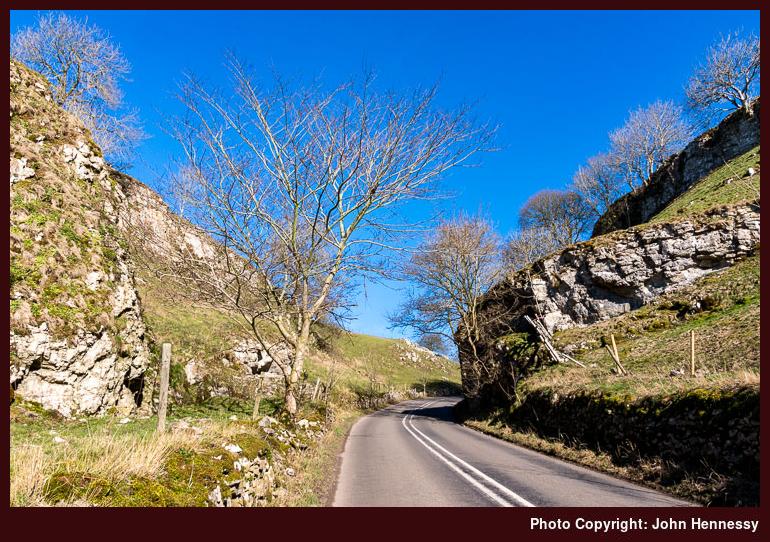
It also was to be one with many variations on the route followed in October 2017. The first of these decided the first stretch of my ramble once I arrived in Earl Sterndale. The re-use of the public footpath from the previous walk would have been expected but I instead chose a way that added road walking involving the B5053 and that gained the sight of Glutton Dale, which looked similar to many a Derbyshire dale that I have encountered apart from its having a tarmacadam road going through it.
The reason for this is lost to me now if there ever was one but I do recall the dismissal of the idea of using a right of way from Glutton Grange because the person who was using it was not a walker like myself but looked more like someone of farming stock. Maybe it was my shyness that intervened but it was to be a day when such decisions recurred even if more outdoors enthusiasts like myself were around.
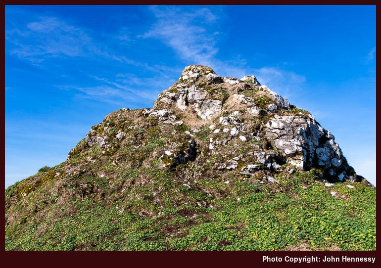
On the approach to Parkhouse Hill, there were figures seen to be ascending its southern slopes. When I left the B50553 for a path leading towards it, they were gone and it could be presumed that they had completed a traverse of the steep-sided rocky little hillock. As it happened, I too was to follow in their wake and reached the top of the hill before deciding to change my route again.
The height gain may have not been that much but the combination of steep ground and a sense of pronounced exposure was enough to cause me to retrace my steps from the summit instead of dropping down through the rocky pinnacles. Doing so needed an element of fortitude but I soon enough found another way: along the hill’s eastern slopes a gentler descent was on offer and it led me north as I wished. As other walkers continued up the hill with their dog, I used this quieter easier terrain to both continue on my way and regain my composure.
Once down on the lane again, I was to see where the northbound descent led and decided that I had chosen a more sensible route. Because Parkhouse Hill is on Access Land, doubts about footpath maintenance also surfaced. The last thing that anyone needs on steep exposed ground is an eroded path that offers reduced traction and I have met a few of those on my ambles. Another summit lay ahead of me so it was better to have saved myself for that.
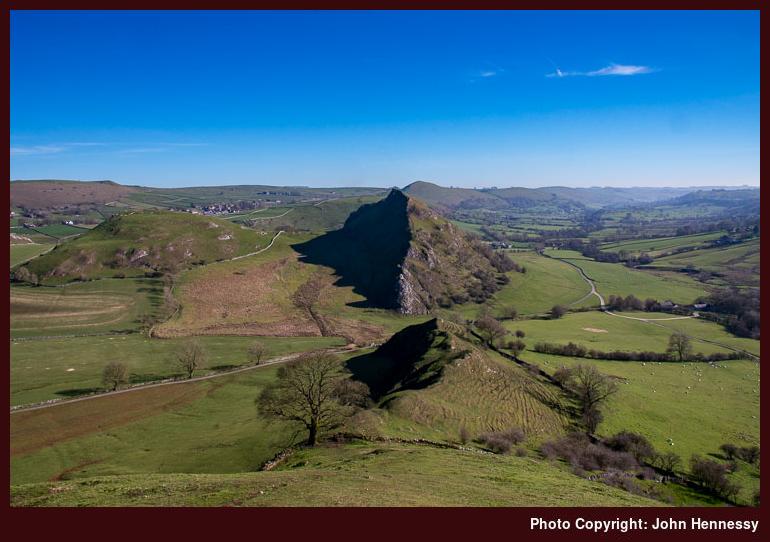
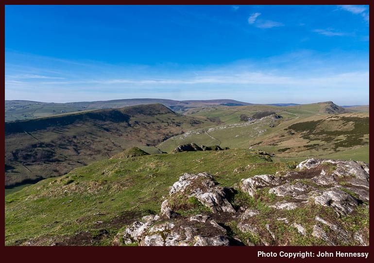
Once down on the lane separating Parkhouse Hill from Chrome Hill, there was time for a little refreshment before I sought out the concessionary path leading onto the Access Land encompassing the latter. Before that, a Land Rover driver stopped to ask me if I had a parked car. Having none, the conversation came to an end there and I recommenced my walk.
The way up the southern flank of Chrome Hill was a more friendly affair compared to that of its neighbour. The greater girth had something to do with that and that was just as well given the higher summit. Though I might have been tempted to continue north from there, the lack of a right of access, let alone a right of way, put a stop to that. The later sighting of a fire demonstrated the wisdom of ascending and descending the hill by the same route.
On returning to the lane, I now reprised the one part of the pair of walks that was identical in each: the section from the feet of Parkhouse Hill and Chrome Hill to Booth Farm via Hollinsclough. Along the way, smoke from that fire on the northern slopes of Chrome was there for all to see. It even caused some fellow ramblers to ask me if I had been on Chrome Hill and if it was alright. In fact, I had seen no sign of a fire while up there savouring unobstructed views of what lay all around me.
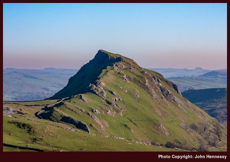
At Booth Farm, the passage of time between encounters ensure the lack of confidence away where a right of way led and the extra activity on the day led me to dismiss the previous route to Buxton in favour of following a lane before leaving it for a more distinct public footpath. Along the way, I could look back towards Chrome Hill with any fire near there by now a smouldering remnant. My sense is that this might have been controlled burning, as dramatic as it looked, but I know no more.
Still following public rights of way, I continued from field to field and across Access Land encompassing High Edge. From there, I dropped down by Staker Hill and found my way onto the road leading to Harpur Hill on the outskirts of Buxton. That was preceded by my traipsing through what might have been someone’s yard, but there was no associated rancour and I ambled along the road for a while before choosing to await a bus at a nearby bus stop. The walk had ended in time to allow preparation for travelling the next morning and the day had brought much satisfaction. It had been a worthwhile second visit to an alluring area.
Travel Arrangements
Both walks saw me making use of service 58 between Macclesfield and Buxton. The 2017 outing saw me use service 441 between Buxton and Sterndale Moor while the 2019 one saw me travel from Buxton to Earl Sterndale on service 442. The latter also involved my using the TransPeak service to get from near Brierlow Bar into Buxton when a variation of the original route presented the possibility of more road walking than was desirable.
Please be aware that comment moderation is enabled and may delay the appearance of your contribution.