Category: Outdoor Gear
No overly intrusive nagging, please…
 15th December 2024
 Over the years, I have stuck with Fitbit for keeping up my level of physical activity. Because devices fail, I have had a few of their devices since the first one, more than ten years ago. Now that Google's ownership is taking effect, some things are coming upon us and customisability is not what it might be.
The latest Charge 6 is one of those because of the way that they changed exercise tracking from what was working on its predecessor. Add in fitness features that are in the app that nag you too often and cannot be switched off if you happen to turn them off again, and you start to look elsewhere (Cardio Load is one of these). Even staring afresh with another account along with removing and reinstalling the Android does not seem to work.
Thus, I am minded to go away from the Fitbit ecosystem to something less intrusive, and this might be the time to do that. For a while, I have had a Garmin watch that is not the accurate altimeter that I hoped it would. Nevertheless, it has 24 day battery life and tracks the measures that matter to me. For those reasons, that might be the only one for me, and that is before I get to look at smartwatches to replace fitness trackers like what I have been using.
Adding a new acquisition is not a priority for me now, so I am minded to give some time to learning what the Garmin can tell me. Since, there is an Android app, that is the way to go. It records the number of stairs climbed, which takes me back to the days of the Fitbit Charge 2. Other useful measures may become known to me as time proceeds. A new start with added learning may be in order.
A question of resoling
11th December 2024 The pair of Scarpa boots that I retain for muddy hiking are showing signs of wear. The uppers are fine, but the soles are another matter. The back of a unit on one of the boots is holed and picking up stones. The other is showing signs of my aberrant pronation, with wear on one side of the heel and not the other. That applies to the first one a little too, and tarmac tramping may not have made for extended longevity.
This dilemma emerged before with an elderly pair of Meindl boots. Then, the uppers were so worn that resoling felt like false economy and replacement became the chosen option. That is not the case with the Scarpas, so I am seriously considering the idea of getting them overhauled, which would involve ensuring that they were well cleaned before being sent away.
Naturally, there is a cost implication. Doing some research online, I found this to be £100, which is reasonable given the cost of replacement. The catch is the amount of time that it takes to get the work done. The quoted nine-week turnaround time that I have seen is not the most attractive, it needs saying. If someone else can do it quicker, that would be better, so long as the quality is acceptable.
While the reason given for the extra time taken is that the work needs added skill to perform it, and that may be the case, losing the use of a pair of boots for two to three months does change the practicality of the process significantly. If you have to have another pair of boots in hand, is it worth doing in the first place? That is fine for someone with the extra pair of boots or the ability to borrow them. Would someone who is active in the outdoors be content with a temporary cheaper while all this is happening? That might depend on the season: summer might be better than winter, depending on the activities undertaken in each season.
One thing is certain: walking boots are more expensive than they ever have been. Those old Meindl items were acquired for around £100 in 2009, possibly because they were the old model when a new one was coming on the market. A good pair of leather boots can set you back around double that amount these days. Thus, the cost works, even if the timing is not the best. The practice also should be the better way to go in what feels like a throwaway society, but not if another pair of boots is need to cover the time that the first boots are away. This conundrum needs a little more thought.
Better fitting boots would have helped as I plodded through some Derbyshire Dales
25th October 2024 "Freedom Day" probably sounded like a great idea to someone at the time. It was supposed to arrive in June 2021, only for an upsurge in infections to be caused by the delayed UEFA Euro 2020 Championship. Looking into any pubs that I passed back then, I could see no sign of social distancing as the punters watched the football games on TV. It did not help that England got as far as the final, either. Still, an important game meant empty trails for evening rambles, as I found that Sunday evening.
If I had hoped for a more phased opening up, I was to be disappointed. Such was the focus on summer holidaying in both 2020 and 2021 that I wonder if political populism overrode public health. Any daydreams about reaching the Isle of Man or the Channel Islands were scotched, and reaching Ireland felt more of a long shot. What was needed were baby steps, and everyone likely would make the same ones at the same time.
Even with two doses of the vaccine, "Freedom Day" did not feel like that for me. Add in a heatwave and a computer upgrade project, and you get a situation where outdoor activity was not on the menu. Hauling computers up and down stairs in a terrace cottage became sweaty work in any case (my workbench was downstairs for these things). Even taking a stroll late in the evening was no guarantor of coolness; overnight sleep was challenging at best. All in all, the three-week break from work in July became a homecation mainly devoted to indoor activities.
By the end of August, something must have been stirring me, for the Summer Bank Holiday weekend saw me embark on nearby outdoor excursions. Both took me to Derbyshire, one through the Derbyshire Dales and another over Combs Moss. The latter became a hub for various wanderings that will be related. The amble through the Derbyshire Dales will do for this account.
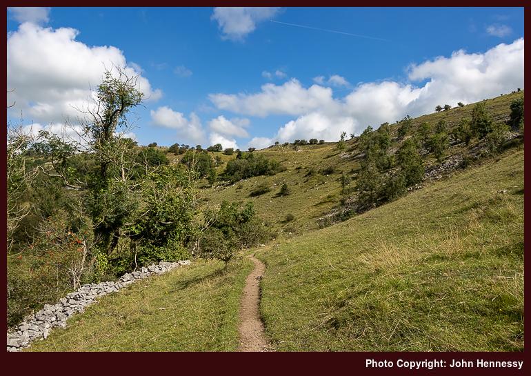
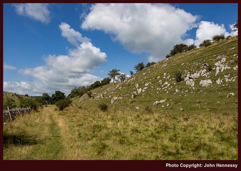
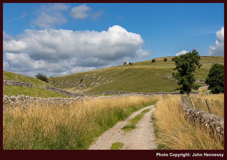
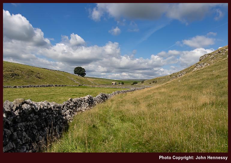
While the route of the Limestone would likely have conveyed me the whole way, I fancied going into Monk's Dale instead. Thus, that is where I headed after arriving in Miller's Dale. Descending to the floor of the dale took some route finding in the woodland, for I followed a little of the Limestone Way at the start. Once down there, there was little to do but go in a general north-westerly or northerly direction, as directed by the steep sides of the narrow valley and any watercourse going along it.
Aside from simple navigation, I also got the place largely to myself. Straggly late summer vegetation may have intruded on the meadows, but the limestone outcrops could not fail to delight. This remained my lot as I continued through Peter Dale, Hay Dale and Dam Dale. Others passed me from time to time, yet this was a confidence building measure for any future return to normal life, that some may have assumed was already well in place.
Aside from dale-trotting, there was another reason for my going this way, and it dated from nearly twenty years before. Then, I was walking from Buxton to Castleton. Around Peak Forest, I lost my way somewhat; OS map sheets OL1 and OL24 do not overlap very well, adding to the confusion. In hindsight, I may not have helped matters by going through Peak Forest itself instead of sticking more closely to the route of the Limestone Way, which was already there back then. This is not a recently instated long-distance trail like so many others.
Thus, I needed to get to the Limestone Way from Dam Dale without messing things up again. With a modern mapping app on a mobile phone, that was a bit easier. Those paper mapping overlaps are an issue no longer, so I could cross the A623 with added confidence to get across fields to Old Dam Lane to continue east without any muddle. Then, I could avoid getting near Bradwell and walking on lanes around quarries to keep things more picturesque.
Another matter was more plain to me, though. The previous Easter, the sole on one of my long-suffering Meindl Burma boots detached from the upper while on a ramble around such locations as Langley and Higher Sutton on the Monday of Holy Week. The uppers looked well-worn, so there was little point in resoling them, especially since they had lasted since 2009.
However, I still needed a pair of boots for mud plugging, and I was reluctant to sully others that I had; these were being kept for when overseas excursions could resume. The result was my acquisition of a pair of Berghaus leather boots that proved to be too big for me. They should have been returned for a pair of a smaller size, yet I persevered with them, possibly for too long. The adage that boots need to fit well should have driven that.
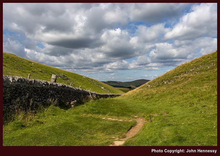
Returning to that self-powered journey to Castleton, those Berghaus boots were to take a toll when I was in busier surroundings. Before that, I threaded my way past such landmarks as The Cop, Old Moor and various disused mines. What lay ahead of me was the descent into Castleton through Cave Dale. It was then that I hurt my feet while passing someone at a health-inspired distance on rougher ground. There was no tumble, only discomfort that did not play well on steeper slopes.
Castleton is a honeypot, so groups were out and about, inadvertently challenging my comfort zone. There had been a hope of seeing and photographing Peveril Castle in sunshine, but that was foiled by cloudy obstruction of the sun. Even so, I got myself to the village and its bus stop for the way home. There surely were refreshments too, even if there were around than I felt to be comfortable.
The offending boots later found their way to a charity shop, and a pair of Scarpa boots replaced. These are better, if imperfect, fitting, but their soles are well-worn at this stage, having seen me through numerous European wanderings. The uppers remain fresh, so resoling may be a more likely outcome than replacement. My feet have healed from any insults from the use of the Berghaus items, too. All is transitioning into a useful set of memories for future reference.
Travel Arrangements
Unlike a previous trip report, public transport experiences were less memorable in a good way. The outbound journey to Miller's Dale was by bus, with a change in Buxton; bus services 58 and 65 were used. The return to Macclesfield is where memory again ails.
Since Castleton does not have a train station, departure by bus was unquestionable. Other questions emerge, though. Was it by service 272 or another one? Did I go all the way to Sheffield or alight near Hope station? From either, a return train journey would have commenced, one with a change in Manchester and another with one in Stockport. Railway engineering works were ongoing that weekend; did they impact the journey by a need to use a rail replacement bus? That seems unlikely because of a memory from the following day. Otherwise, all is blighted by a fug of uncertainty.
Some experiences of Irish hiking maps
5th September 2024 Much of my hiking has been in England, Scotland and Wales, where I have been rather spoiled by the quality of Ordnance Survey mapping. Things are quite different in Ireland, though the mapping offered here is nowhere as difficult to use as in other places where I have been.
The Standard Option
My go-to scale in OS mapping is 1:25000, while 1:50000 is the most common one offered by Tailte Éireann (formerly Ordnance Survey Ireland or OSi). That makes a difference when estimating distances on a ready reckoning basis. The smaller scale makes it easier to underestimate the length of a trail, and hence the amount of time that it will take to complete. With a need to make a bus back from a day hike, that can be a challenge, but one that is eased by doing things more rigorously in advance. Adding extra slack on the day will help too.
Another habit into which I have fallen is to look at a map to see what trails are available. This again is something that Tailte Éireann could improve. One absence is the lack of Greenway depiction; often, you get the disused railway line, which is a hint, but marking the recreational trail would be even better. While someone has put together a web app to show where Greenways are, having something more official would be better and may have more staying power than a volunteer effort.
It may have something to do with publishing schedules, but not all looped walks may get marked. That is what I founded with the Fastnet Trails around Schull and Ballydehob. At least, there is a website for those. Even so, having more of them marked on a map would help even more. Nevertheless, some are marked already, so some credit is due.
The same could not be said so emphatically for the trails around Mount Melleray Abbey near Cappoquin and Lismore in County Waterford. That might have helped me avoid some rough cross-country travel on a day hike around there that ruined a hiking trousers on me. Saint Declan's Way is completely absent too, so I ended up loading a GPX track onto Outdooractive for future reference. Since this goes from Ardmore to Cashel and through the Knockmealdown Mountains, it could offer hiking possibilities for another time.
Alternative Options
Following the aforementioned escapade, curiosity had me explore what is offered by EastWest mapping these days. They still cover the Wicklow and Dublin Mountains like they always have, and Wild Nephin is another area that they have covered for many years, but other ones are included now.
Parts of Munster now benefit, and the range includes the Knockmealdown Mountains, the Galtee Mountains and the Comeragh Mountains, not always ones that you hear much about when it comes to Irish hillwalking. The county of Cork is absent thus far, while the mountains of Kerry around Killarney and Dingle gain deserved coverage. In Connemara, there is a guide to the Western Way between Oughterard and Westport, along with maps of Connemara, Mweelrea and Croagh Patrick, and Achill and Corraun with Clare Island.
While I do have a Wicklow Mountains map in my collection, I have added one for Knockmealdown Mountains. Like many others in the range, it has a scale of 1:25000, which is more like what I find in Great Britain (Northern Irish mapping is much like what you find in the Republic). Those missing trails from the Tailte Éireann maps are noted too. Should a return to those parts come to pass, the new map will have its uses.
All in all, EastWest is on its way to becoming Ireland's answer to Harvey Maps in Scotland. That operation does not abandon Ireland, either. In fact, it offers two more than it once did: Dingle Peninsula and the Mourne Mountains. They complement longstanding coverage of the Wicklow Mountains, MacGillycuddy's Reeks and Connemara. Most are 1:30000, with the Mourne Mountains getting 1:25000 coverage.
What About Digital?
Much of the discussion here would apply to paper maps, yet I often use the Outdooractive app these days. That is equipped with maps from both Tailte Éireann and Harvey Maps. If I were to do the same for EastWest Mapping, I would need the Hiiker app. Since I plan to stick with what I have for now, I will leave the addition of another app until later. Even so, mixing information from different sources only helps when plying the trails, boreens, and ancient paths that criss-cross the Emerald Isle. Having a paper map and compass to complement digital tooling remains essential too. My Irish explorations may be facing a hiatus for numerous reasons, yet there is so much more to explore.
Something for muddy going
12th March 2024 The amount of rain that has beset our lives since last summer has made some places so muddy that I am contenting myself with wellington boots on local walks. They are not the most comfortable, but they deal with the surface water and the greasy conditions underfoot. Also, if you sink in soft mud, it does not mess up your socks as easily.
These are not the times for crossing fields and the like with footwear that you might like to keep in a respectable state. Aside from formal wear, this also includes anything that I might use for hiking overseas. Meindl boots are the mainstay there, so I also have a pair of Scarpa Ranger II Activ GTX boots that I do not mind covering with mud.
In the autumn of 2022, these replaced a pair of Berghaus boots that frankly were far too big for me and even hurt my feet enough for their becoming a charity shop donation. The Scarpa boots fit better, though going a European size down might not do any harm either. So far, even they have gone overseas, although that might change if they start to look too muddy.
Thus far, the Scarpas have been all around Great Britain as well as Ireland, the Channel Islands and France. Aside from a trip beside Loch Morlich (speed and inattention did not help), their size has done no harm and certainly has not caused any foot injury. Thus, I am sticking with these.
It might be useful to have older boots like my now retired Meindl Bhutan pair (after losing a sole, repair was unrealistic given how battered the uppers looked) for muddy walking, but these will do for now. In any case, they themselves are wearing, especially in the soles. Aside from off-tarmac walking, they have done a share of tarmac plodding too. It might be that which is causing the wear that I am seeing. Even so, that is causing no complaint on my part.


