Category: Pennine Bridleway
Better fitting boots would have helped as I plodded through some Derbyshire Dales
 25th October 2024
 "Freedom Day" probably sounded like a great idea to someone at the time. It was supposed to arrive in June 2021, only for an upsurge in infections to be caused by the delayed UEFA Euro 2020 Championship. Looking into any pubs that I passed back then, I could see no sign of social distancing as the punters watched the football games on TV. It did not help that England got as far as the final, either. Still, an important game meant empty trails for evening rambles, as I found that Sunday evening.
If I had hoped for a more phased opening up, I was to be disappointed. Such was the focus on summer holidaying in both 2020 and 2021 that I wonder if political populism overrode public health. Any daydreams about reaching the Isle of Man or the Channel Islands were scotched, and reaching Ireland felt more of a long shot. What was needed were baby steps, and everyone likely would make the same ones at the same time.
Even with two doses of the vaccine, "Freedom Day" did not feel like that for me. Add in a heatwave and a computer upgrade project, and you get a situation where outdoor activity was not on the menu. Hauling computers up and down stairs in a terrace cottage became sweaty work in any case (my workbench was downstairs for these things). Even taking a stroll late in the evening was no guarantor of coolness; overnight sleep was challenging at best. All in all, the three-week break from work in July became a homecation mainly devoted to indoor activities.
By the end of August, something must have been stirring me, for the Summer Bank Holiday weekend saw me embark on nearby outdoor excursions. Both took me to Derbyshire, one through the Derbyshire Dales and another over Combs Moss. The latter became a hub for various wanderings that will be related. The amble through the Derbyshire Dales will do for this account.
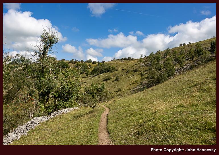
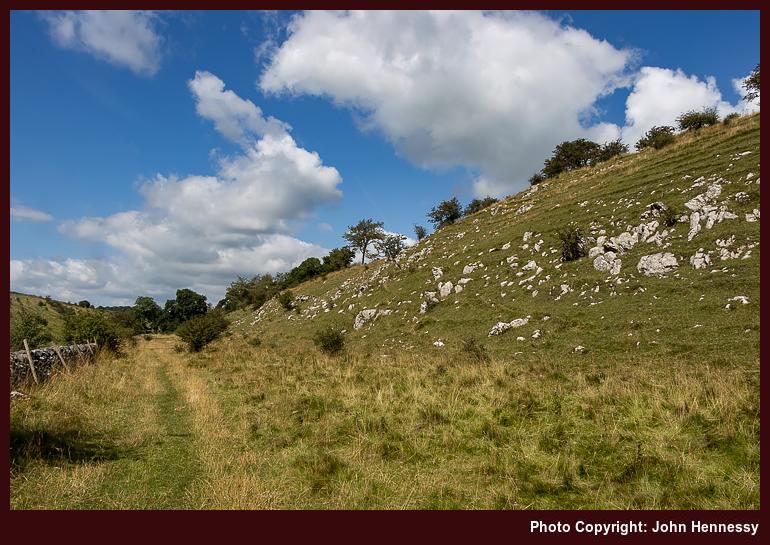
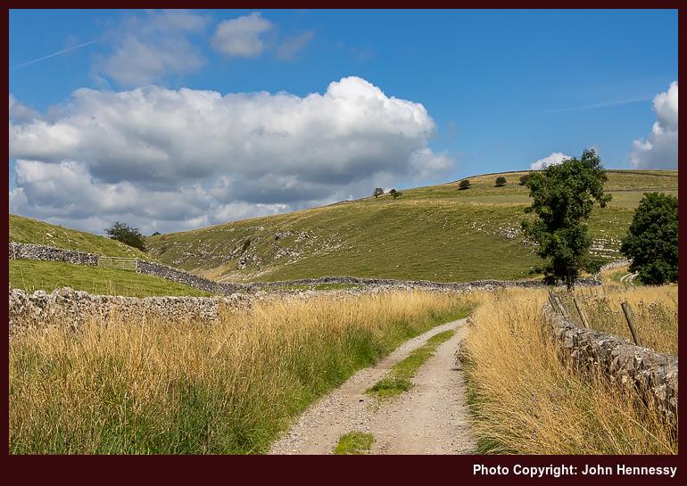
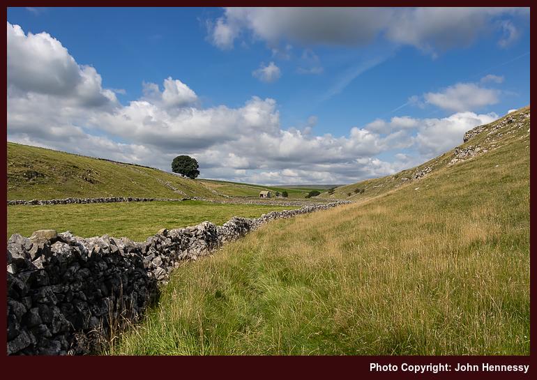
While the route of the Limestone would likely have conveyed me the whole way, I fancied going into Monk's Dale instead. Thus, that is where I headed after arriving in Miller's Dale. Descending to the floor of the dale took some route finding in the woodland, for I followed a little of the Limestone Way at the start. Once down there, there was little to do but go in a general north-westerly or northerly direction, as directed by the steep sides of the narrow valley and any watercourse going along it.
Aside from simple navigation, I also got the place largely to myself. Straggly late summer vegetation may have intruded on the meadows, but the limestone outcrops could not fail to delight. This remained my lot as I continued through Peter Dale, Hay Dale and Dam Dale. Others passed me from time to time, yet this was a confidence building measure for any future return to normal life, that some may have assumed was already well in place.
Aside from dale-trotting, there was another reason for my going this way, and it dated from nearly twenty years before. Then, I was walking from Buxton to Castleton. Around Peak Forest, I lost my way somewhat; OS map sheets OL1 and OL24 do not overlap very well, adding to the confusion. In hindsight, I may not have helped matters by going through Peak Forest itself instead of sticking more closely to the route of the Limestone Way, which was already there back then. This is not a recently instated long-distance trail like so many others.
Thus, I needed to get to the Limestone Way from Dam Dale without messing things up again. With a modern mapping app on a mobile phone, that was a bit easier. Those paper mapping overlaps are an issue no longer, so I could cross the A623 with added confidence to get across fields to Old Dam Lane to continue east without any muddle. Then, I could avoid getting near Bradwell and walking on lanes around quarries to keep things more picturesque.
Another matter was more plain to me, though. The previous Easter, the sole on one of my long-suffering Meindl Burma boots detached from the upper while on a ramble around such locations as Langley and Higher Sutton on the Monday of Holy Week. The uppers looked well-worn, so there was little point in resoling them, especially since they had lasted since 2009.
However, I still needed a pair of boots for mud plugging, and I was reluctant to sully others that I had; these were being kept for when overseas excursions could resume. The result was my acquisition of a pair of Berghaus leather boots that proved to be too big for me. They should have been returned for a pair of a smaller size, yet I persevered with them, possibly for too long. The adage that boots need to fit well should have driven that.
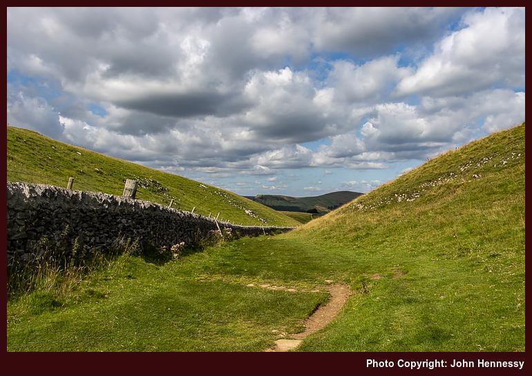
Returning to that self-powered journey to Castleton, those Berghaus boots were to take a toll when I was in busier surroundings. Before that, I threaded my way past such landmarks as The Cop, Old Moor and various disused mines. What lay ahead of me was the descent into Castleton through Cave Dale. It was then that I hurt my feet while passing someone at a health-inspired distance on rougher ground. There was no tumble, only discomfort that did not play well on steeper slopes.
Castleton is a honeypot, so groups were out and about, inadvertently challenging my comfort zone. There had been a hope of seeing and photographing Peveril Castle in sunshine, but that was foiled by cloudy obstruction of the sun. Even so, I got myself to the village and its bus stop for the way home. There surely were refreshments too, even if there were around than I felt to be comfortable.
The offending boots later found their way to a charity shop, and a pair of Scarpa boots replaced. These are better, if imperfect, fitting, but their soles are well-worn at this stage, having seen me through numerous European wanderings. The uppers remain fresh, so resoling may be a more likely outcome than replacement. My feet have healed from any insults from the use of the Berghaus items, too. All is transitioning into a useful set of memories for future reference.
Travel Arrangements
Unlike a previous trip report, public transport experiences were less memorable in a good way. The outbound journey to Miller's Dale was by bus, with a change in Buxton; bus services 58 and 65 were used. The return to Macclesfield is where memory again ails.
Since Castleton does not have a train station, departure by bus was unquestionable. Other questions emerge, though. Was it by service 272 or another one? Did I go all the way to Sheffield or alight near Hope station? From either, a return train journey would have commenced, one with a change in Manchester and another with one in Stockport. Railway engineering works were ongoing that weekend; did they impact the journey by a need to use a rail replacement bus? That seems unlikely because of a memory from the following day. Otherwise, all is blighted by a fug of uncertainty.
Heading south and east from Hayfield in three seasons
8th October 2024 Assembling an account with more than one hike can get tricky; the amount of variation is what catches you. For one thing, the routes can alter, even in the middle of a hike. A chill in the air, a feeling of lethargy and a desire for quieter surroundings all contribute to decision-making. If they were all alike, what would be the point of writing about them and then reading these afterwards?
Here, there are three seasons: autumn, summer and winter. The order may seem wrong, yet in fits the calendar order from 2020 through 2021 to 2022. Photos were made with three cameras: one acquired in 2019, another from 2013 and one more from 2021. Only for the hiking year order, these again would look out of sequence. Not everything gets lined up as one might expect.
All the traipsing around Derbyshire reflects one more thing: the progression of a global pandemic. The revisiting of old haunts and the finding of their previously unexplored corners was a consequence of this. This was not a time for globe-trotting. Otherwise, it was a matter of inspiration and opportunity working within weather windows and other constraints. It all makes for a more organic approach to hill wandering.
Any Illusion of Endless Summer Gets Shattered
The decision to divert an ostensible Hayfield to Hope hike to end in Chapel-en-le-Frith was done up front. The idea of continuing further est never occurred to me. To my mind, the extent felt long enough. However, I was to find that it was shorter than I sensed it would be. Only later did I note Rushup Edge on the map and the possibility it opened.
An unseasonably warm September was coming to a chilly end. Nevertheless, I was lured to Hayfield anyway. This became the finale to a year which turned out better for hill going than the onset of a global pandemic would suggest. There was a lot of good weather and a desire to get out of the house, which helps with these things.
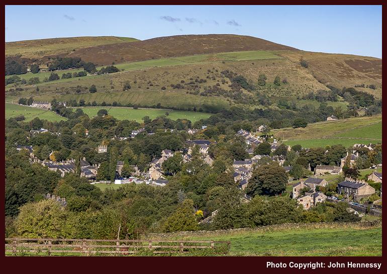
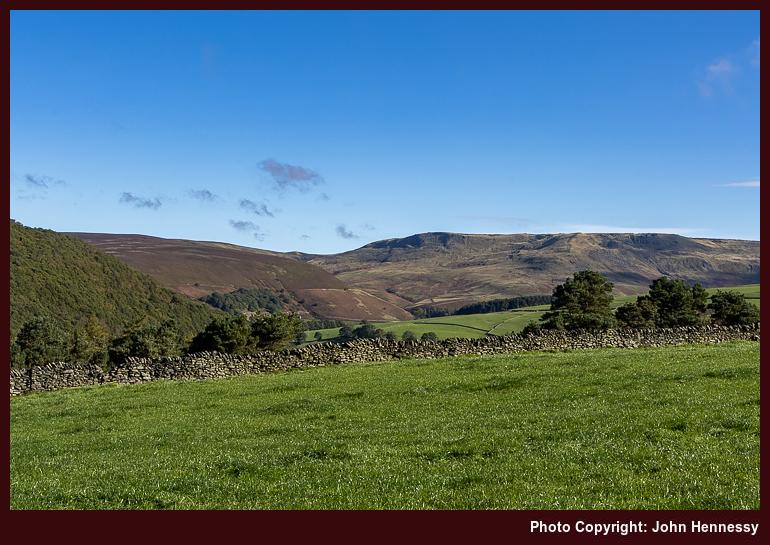
The arrival into and departure from Hayfield was under brighter skies than the previous encounter in July. Even with the portents of clouded skies offered in the forecast, they felt far away at that stage. The first portion of my amble was along the Pennine Bridleway, before I deviated around by Stubbs Farm for added quietness in advance of rejoining the Pennine Bridleway again. A portion of relative solitude had been won.
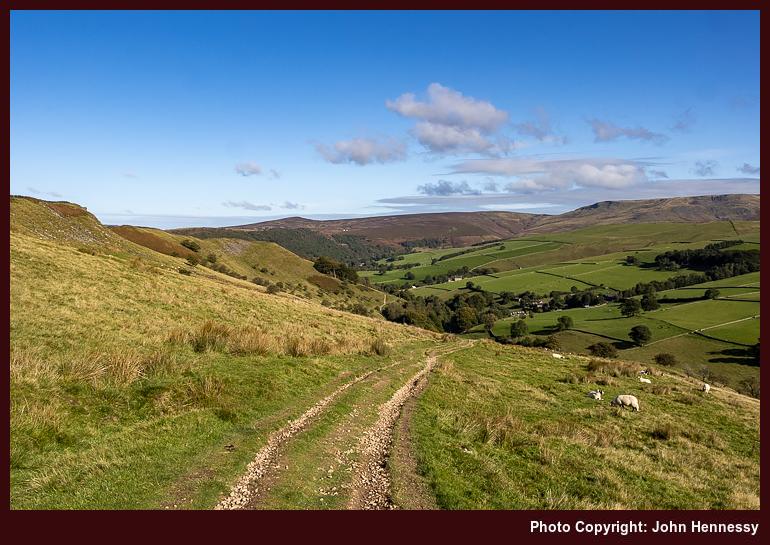
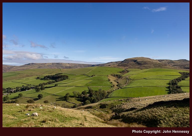
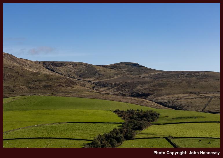
Once I began to gain height, the views began to open up around me. Clouds were on their way from the north, yet there was plenty of splendour to savour before everything changed. This was a vantage point from which to peer at what lay around Kinder Scout, vistas of which I never tire. They offered rest breaks while gradients tested the legs.
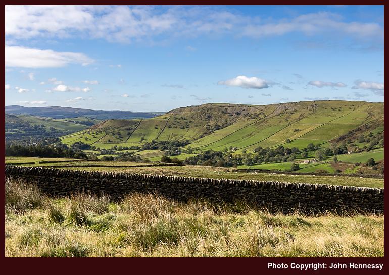
Around Higher Heys Farm, the slopes eased a bit before they stiffened around Mount Famine. An illusion about how far it was to Chapel-en-le-Frith may have kept me off that top. Cloud cover was coming fast at this stage anyway, so views may have been impaired in any case. That certainly was how things became by the time that I neared South Head. Again, I stayed on the Pennine Bridleway instead of reaching its summit.
It was when I was bypassing South Head that I really felt the chill to the point that I concluded that I was underdressed for it. Going more lightweight meant that my layering was less proficient than I needed. Since this was no time to dawdle, I continued on my way. Later, my decision to go this way had me reproaching it until a later walk set it to rights.
A decision point lay ahead and put this question to me: do I stay on the Pennine Bridleway or go around by Brown Knoll? The proximity of Chapel-en-le-Frith had dawned on me at this stage. The hours of daylight may have declining at that time of year, yet arriving there within an hour or two felt too soon to me.
Thus, I left the track to go across the moor on what I was expecting to be a muddy path. That was how it appeared at the start, too. However, it eventually became a flagged affair, which surprised me because this is not a right of way. The ability to travel is supported by this being access land, and I reckon that the Peak District National Park must take a more active part in its maintenance too.
The more appealing surface lured me along. If I had continued straight, the path would have conveyed me to Edale Cross. However, I turned right to pass the trig point at Brown Knoll. Others were out too, so this is not an unknown corner of the High Peak. Even with leaving room for others, good progress was made to reach the Chapel Gate track.
After more decent and noting the way to Rushup Edge, I was on Sheffield Road, not far from where the Pennine Bridleway would have brought me. That might have been rejoined to continue south or even return to Hayfield. Instead, I sought out a public footpath that bring me onto a lane near Sparrowpit that would take me past Blackbrook.
My recollection of this time is of heavy grey skies, yet photos show some blueness breaking through. The surroundings also were far quieter than what I had travelled in the moors. While that was relished, there was also a growing sense of anticlimax. It increased on the approach to Chapel-en-le-Frith on lanes and other roads until I fortuitously met with a bus stop moments before the next bus to Buxton. The greyness would not help to dispel that overriding emotion.
The rest of 2020 would see no more outings as substantial as this one, so there was an element of finality about it. Computing and exercise walks would sustain me through a restricted winter. Something that had waylaid me in spring had come to accommodation in autumn. Others may not have felt likewise at this stage, weathering one dreary spell was one thing, but doing the same for another may have felt like too much. Thankfully, that is not how it was for me.
Doing Some Tops While Bypassing the Great Ridge
A lot had happened between September 2020 and the following June. Vaccines were available, and the inoculation program was in full flow. For me, that meant that one of two jabs were received by the end of April. The initial wait for the second one was until early July before that was cut to the end of June, a weekend when others were invited to come forward, adding to a certain discomfiture at the time.
It was between these vaccination appointments that a return to Hayfield happened. After the number of outings during 2020, 2021 became a pale reflection. Novelty had dissipated, and it did not help that computing and weightier reading material had sapped some of the energy available for it. The way that everything kept changing also was no help, and an exceptional July heatwave added icing to the proverbial cake.
Even so, there were some bright spots that could inspire other trip reports. A hike from Monsal to Bakewell at the end of May is one possibility. In the middle of June, there was another from Leek to Macclesfield that may be worth recounting. At the end of August, two things happened. One was a trot from Miller's Dale to Castleton; the other was a spate of them going across Comb's Moss. Night walking took hold later in the year, not that so much can be written about that. Autumn and winter walks from Buxton and Macclesfield may be worth recounting too.
None of these got into my compilation of trip resumes, a waiting area for extended trip reports. A mixture of distractions, lethargy and loss of interest all possibly had something to do with it. Talking about an ongoing pandemic becomes increasingly tedious as time goes on, which did not help either. Looking back on it now, even with faded memories, possibly works better. It adds more flesh to the writing.
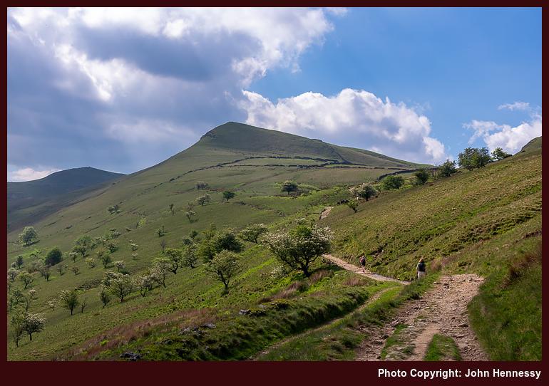
One prompt for getting out in early June 2021 was the prospect of sunny weather. There may have been a wait for a second course of vaccination, but life could not be put on hold. Thus, I could fit in some summits on a hike from Hayfield to Hope. This time, there was no deviation via Stubbs Farm, so it was a case of following the Pennine Bridleway all the way to the flank of Mount Famine, a top apparently named for the Irish Great Famine. The world can feel small at times.
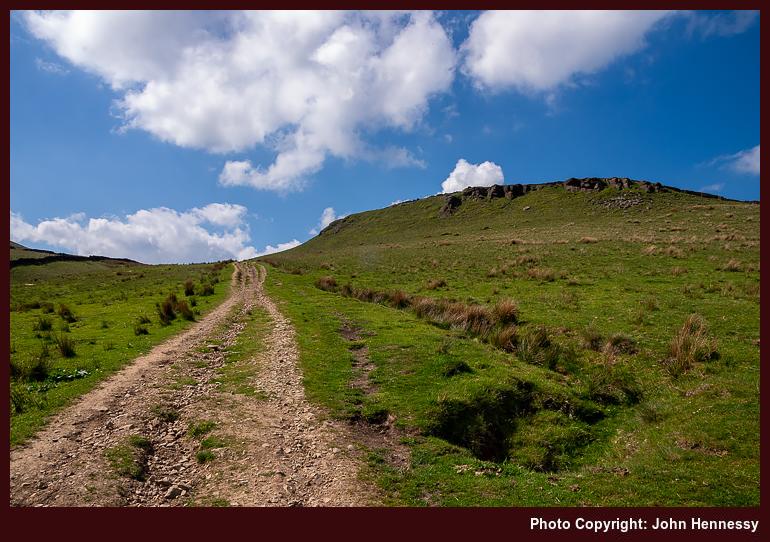
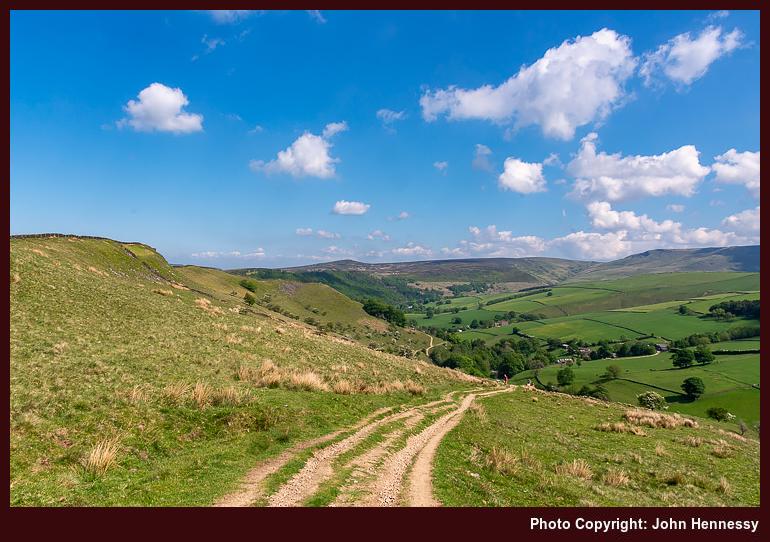
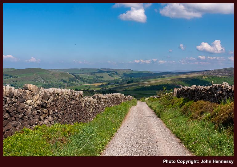
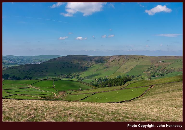
The surrounding views were of cloud-shadowed hillsides, adding a dappled appearance to things. If caught under one, there was a wait before sunlit photography could resume. That was a small grumble given the other goodness on offer. Others were drawn out too, and my wariness about proximity to others had grown over the winter; keeping oneself ready for the completion of vaccination was another contributing factor. Thus, I was glad to leave the Pennine Bridleway to make ample use of the freedom of access land; the routing could be relaxed, and I possibly had the place to myself too.
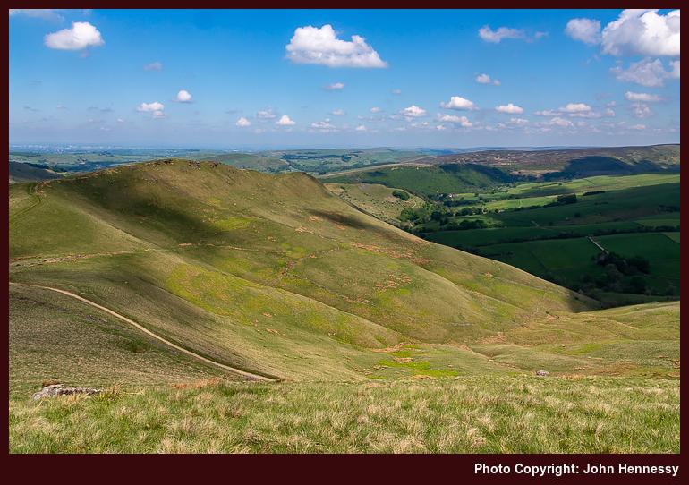
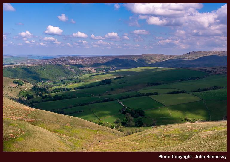
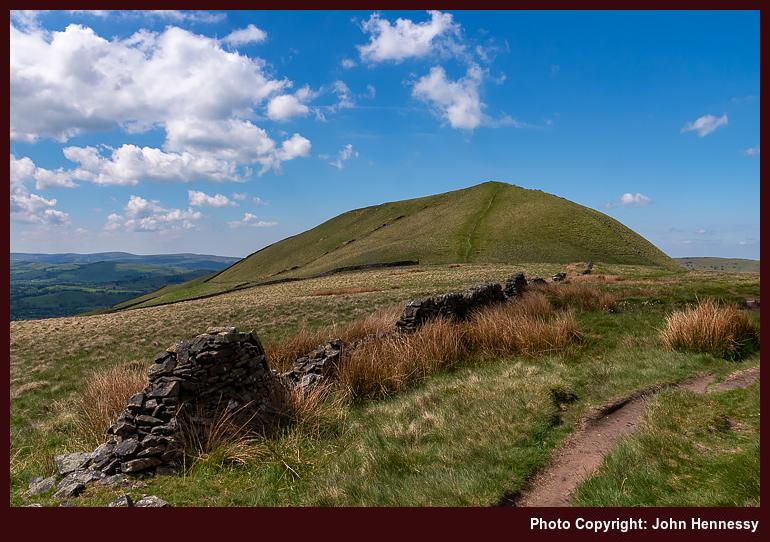
On returning to the Pennine Bridleway, I was set to leave it again very soon after. A crossing of South Head was not refused this time around. While the slopes may have been steep, the resulting views were worth the added effort. It also helped that an annoyance from the preceding September had been remediated. Once I was down on the track again, the path to Brown Knoll was at hand.
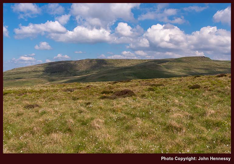
Cloudy skies had beset the previous encounter with Brown Knoll, so it felt good to be in its vicinity under sun-filled skies. Bog cotton dappled the moors as I trampled the mix of boggy and flagged paths around there. On reaching the Chapel Gate track, I turned for Rushup Edge instead of the way leading towards Chapel-en-le-Frith. This was rough underfoot, but the forbearance was rewarded.
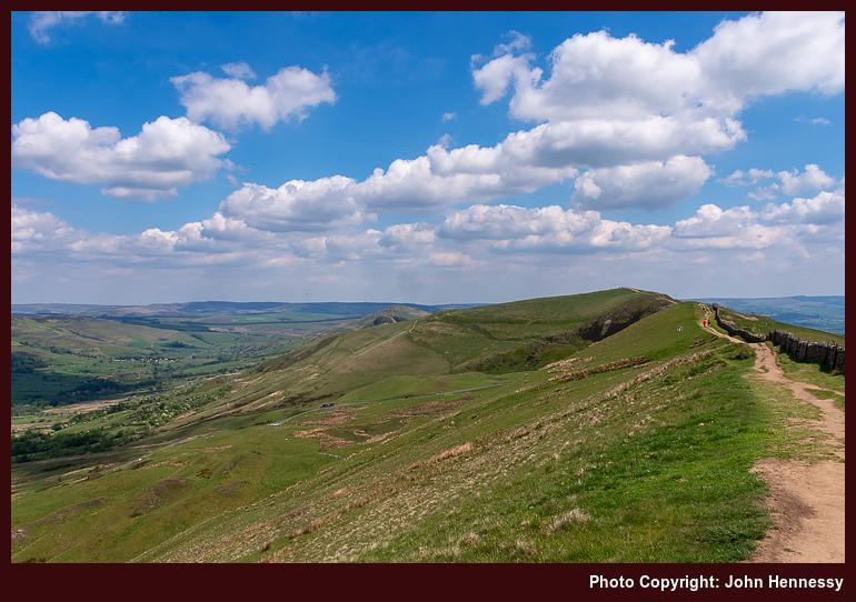
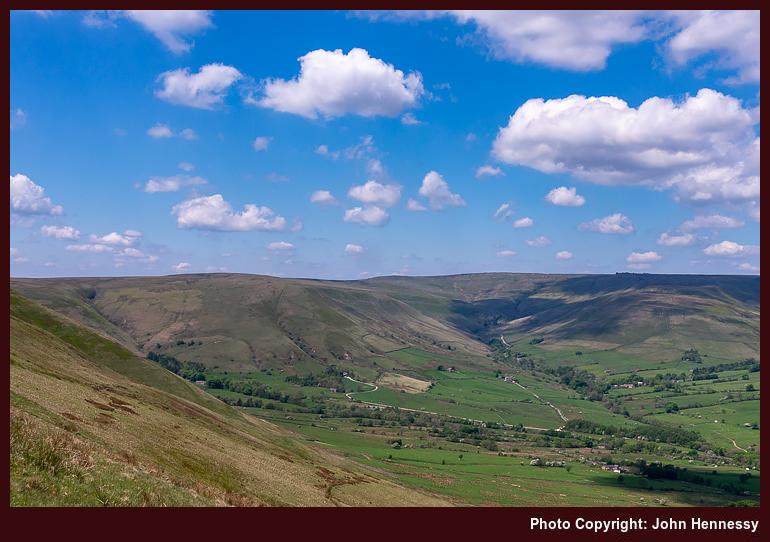
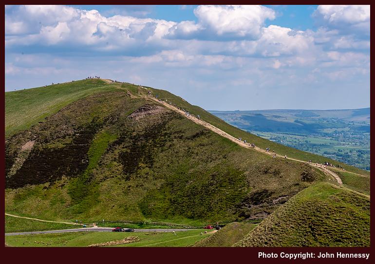
Since the views turned out to be extensive, there was no way that I was going to have the place to myself. To my left, they led the eye into Edale and onto Kinder Scout, and what lay around that. To my right, I was gazing towards Hope and Castleton. Looking straight ahead drew the eye towards Mam Tor and the Great Ridge. If Rushup Edge was attracting attention, then the Great Ridge had to be busy. Restrictions on space and previous visits made me partly bypass it for another way.
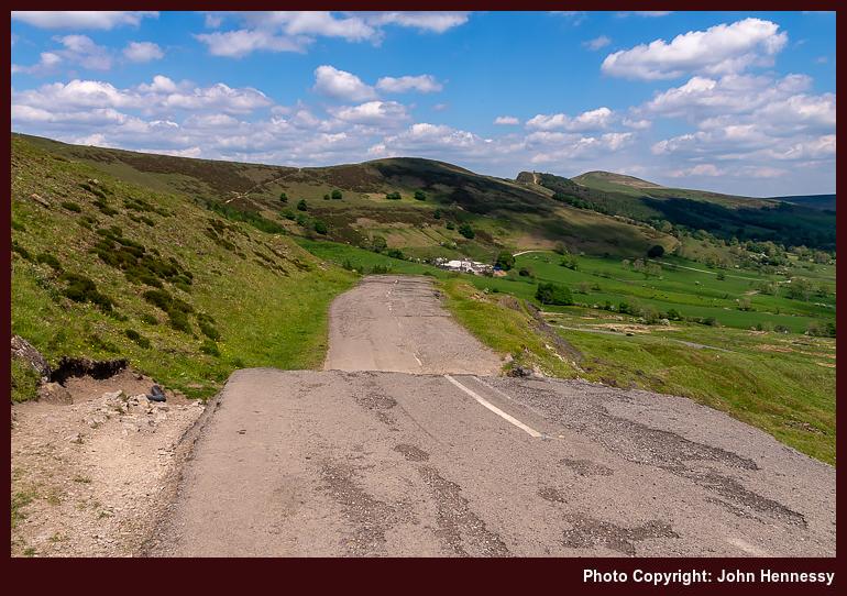
First, I had to get down to the road going past Mam Tor on a way up from Edale. The steepness and the amount of erosion made that inelegant, yet it worked out for me. Another right of way popped me onto tarmac that was offering a more direct way towards Blue John Cavern. While such a honeypot may not have been so apt in the circumstances, it offered a useful opportunity for getting refreshments in the heat of the day.
Seeing the remains of the abandoned A625 and the damage inflicted by underlying unstable geology was another attraction of going around there. The apparent freshness of road markings etched itself into my memory, a surprise given the passage of time. Following this direction of travel led me to Mam Farm and quieter surroundings. While others may have been plodding above me, I felt less troubled as I passed Woodseats and Only Grange Farm.
Beyond the latter, I needed to rejoin the Great Ridge around Back Tor to enter Brockett Booth Plantation. That was accomplished in a less than auspicious manner; the slopes were steep and occasionally boggy, too. Lose Hill got bypassed on the way to Hope village, thus cutting the encounter with the busy ridge to a minimum. Some were asking the way to Castleton as I did so, and I pointed the way as best as I could before continuing on my descent route. Once in Hope, I topped up with more refreshments before heading for the train station to start on my way home.
Including the Great Ridge, While Omitting Previously Trampled Summits
If anyone had thought that two courses of vaccination were enough in the middle of 2021, there was a more infectious variant at the end of the year that meant another inoculation for many, myself included. Restrictions reappeared, which added confidence in my case. These were less onerous, thankfully. Thus, a hike from Buxton to Macclesfield preceded Christmas that year, along with other excursions.
2022 began with a few, too. The first was an urban outing to Sheffield that preceded the trek from Hayfield to Hope that is described here. That became followed by one from Congleton to Macclesfield that reprised another from the previous July. Soon after that, it was back to work again in advance of coming novelties. Ireland became where I found international travel mojo again, while Marsden became the hub of a springtime Pennine Way project. Otherwise, Wales, Cumbria and Scotland all saw my footfall again. Novelty was returning on a phased basis.
Now that I think of it, it must have been the sunlit journeying between Macclesfield and Sheffield that returned the Great Ridge to my mind after largely avoiding it the previous June. Another yomp from Hayfield to Hope was in the offing. This one avoided the tops of Mount Famine and South Head. Otherwise, there was a frosty start along the Pennine Bridleway.
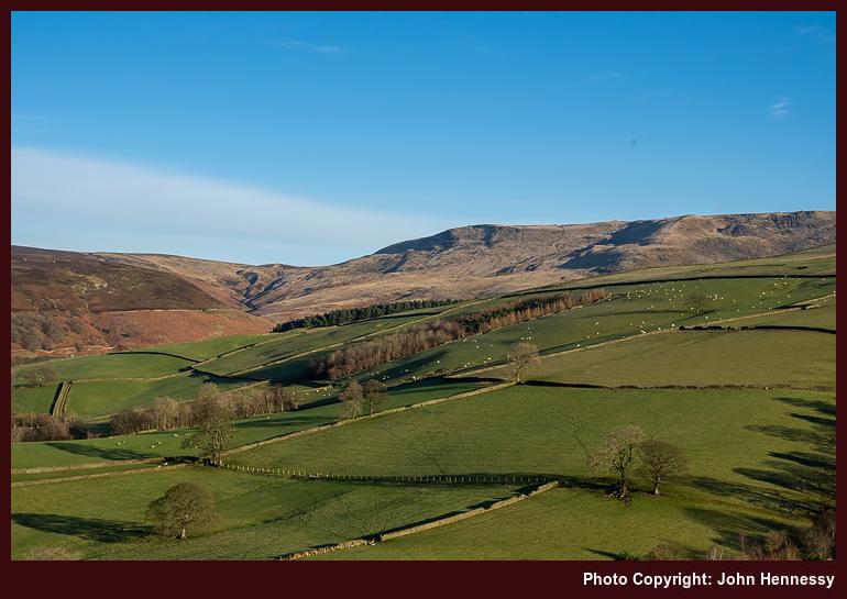
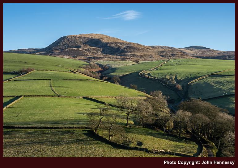
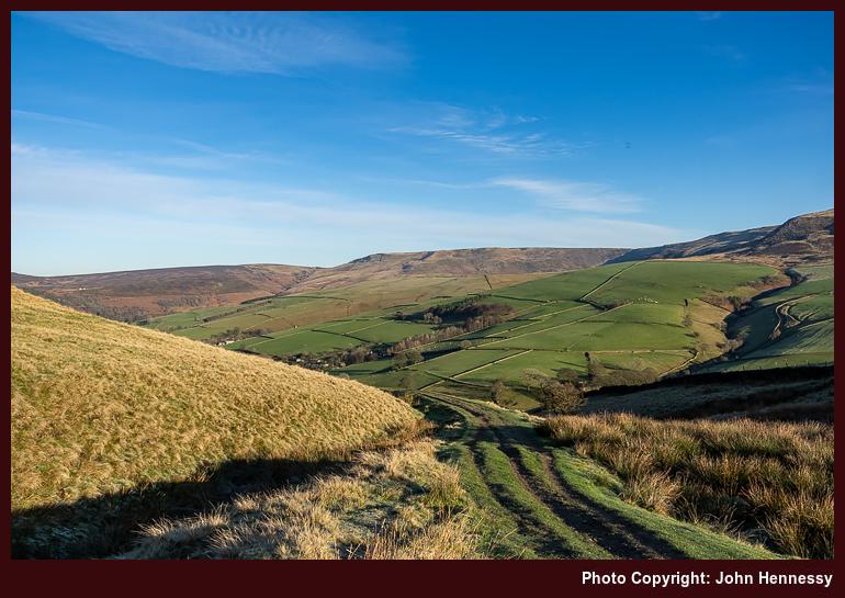
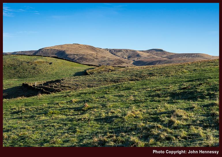
As following the Pennine Bridleway increased how high I was, the views opened around me. Since the sun was lower in the sky, shadows also were longer and there were more of them. None took from the delight at being out among these sunlit hillsides again. One should not tire of these surroundings, especially when they alter through the seasons.
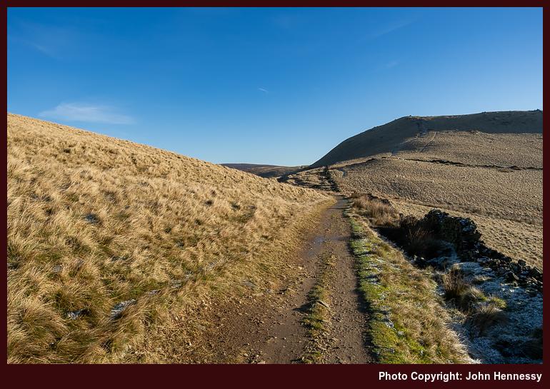
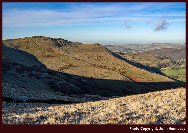
There were no diversions to the tops of Mount Famine or South Head this time round, and no regrets at not doing so either. The curtailed hours of daylight might have been enough cause to keep such forays under control, yet the real decider was my being sated while there in June. In any case, I fancied seeing what I could capture photographically along the northern slopes of South Head. Shadows cast by the low sun would foil this to a point; it was just as well that I made something of the same sights during my June hike.
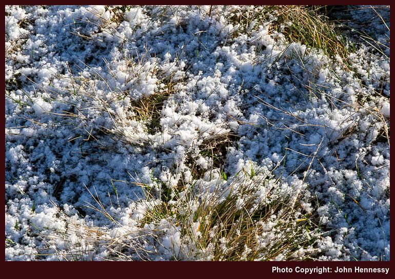
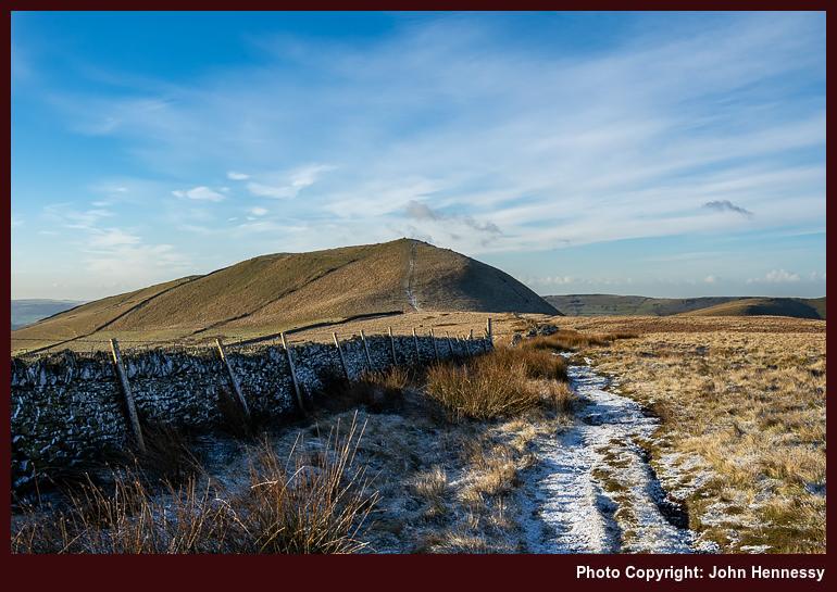
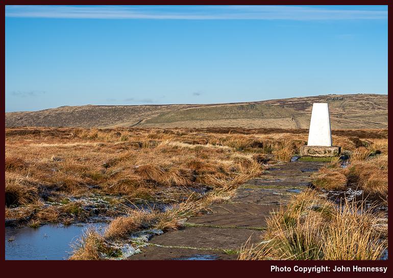
Again, I was bound for Brown Knoll. Thus, I left the Pennine Bridleway like the two walks described earlier. While frozen ground often can be less wetting, I am not sure if that was completely the case around there. Frost was lingering in places after the night before, a feature of crisp January days like the one that I was enjoying.
After Brown Knoll, I was again bound overhead the railway tunnel that carries trains between Manchester and Sheffield, one through which I often travel. It has a name too: the Cowburn Tunnel. In keeping with named objects, I bound for a named track, Chapel Gate. From that, I was headed for Rushup Edge.
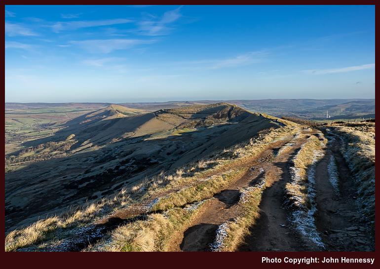
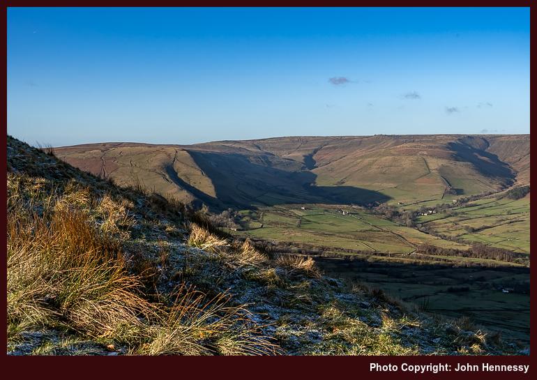
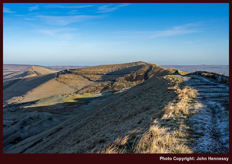
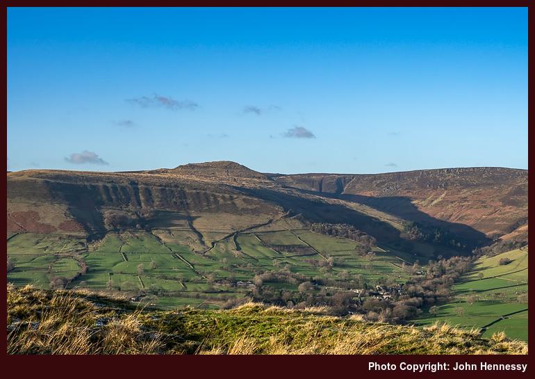
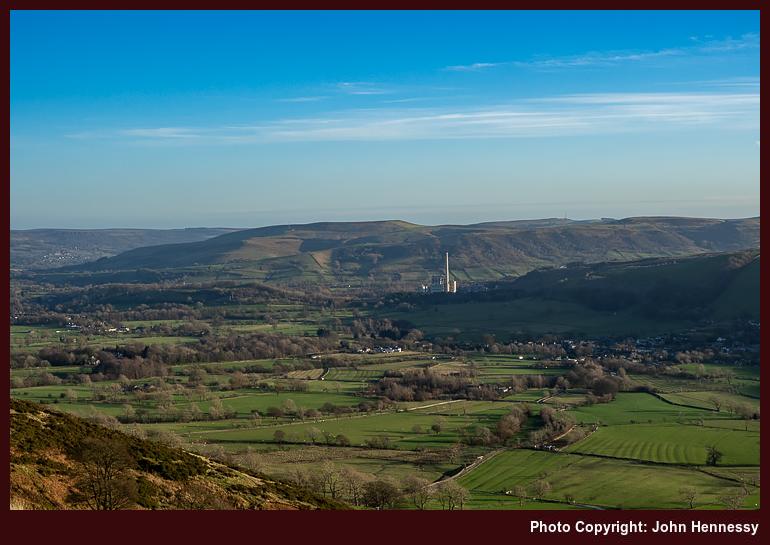
Again, that offered panoramic views all around me. Less were out along it than on my previous trot along it, too. Many shadows were being cast, not that they took from any photos I made. In many ways, they added a little something. This might have been winter, yet there was a lot of green on view, the winter sun lit that wonderfully.
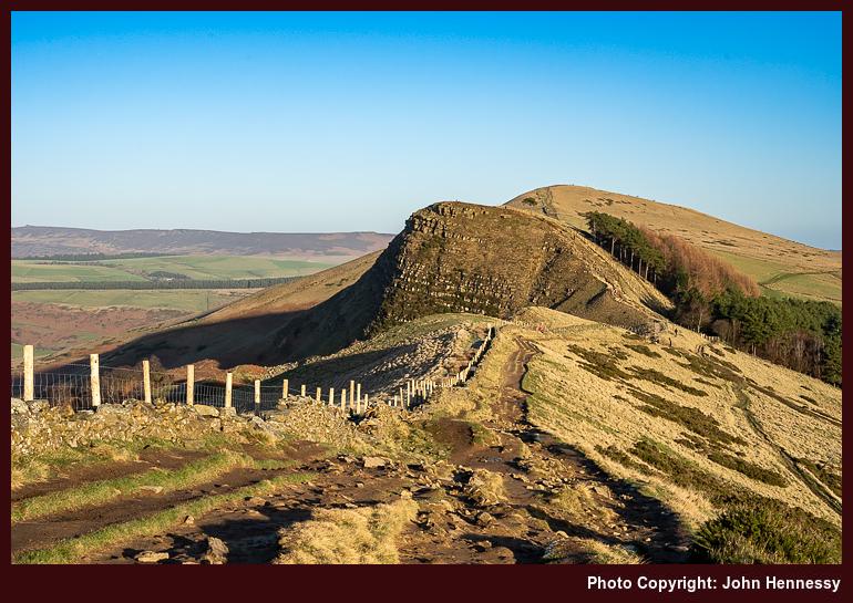
If I had thought that enough were back at work to ensure that the Great Ridge was deserted, I was wrong on that point. Going along the path that runs over Mam Tor, Hollins Cross, Back Tor and Lose Hill was a matter of getting over that state of affairs, not that it intruded that greatly at the time. This still was better than during the previous summer, and there were pleasing sights to savour too.
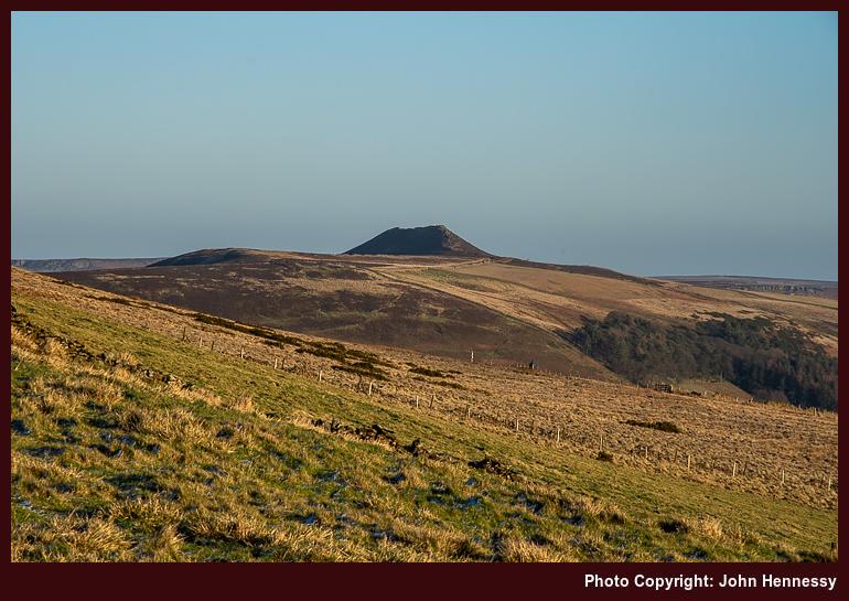
That was while daylight held because the day was nearer the arrival of nightfall. That much is evident from any photos made on the top of Lose Hill. Thankfully, I could capture a scene with Win Hill in it before then. Making for Hope's train station before daylight finally failed became a priority. Even so, care still was needed over steep slopes; one never knows what frozen could facilitate a slip. If it is not frost, then slippery mud can do it on you. Nevertheless, there is no recollection of a mishap, so all must have gone well. That has to include getting home by train.
Reflections
These three hikes extend over a dramatic period. The first felt like an anticlimax with an air of unfinished business. After that, the second was during a time of transition and completed the unfinished work of the first. Lastly, the third acted as part of a bookend marking the end of a period held in stasis and in advance of an increase in novelty that began in March. It looked both ways, as January often does. All provided their own essence of satisfaction, while the final instalment added an element of closure.
Travel Arrangements
All used bus service 60 to get from Macclesfield to Hayfield. The first outing returned from Chapel-en-le-Frith by bus with a change in Buxton. The second and third outings involved getting home from Hope. The former appears to have gone around Sheffield on the evidence of a photo seemingly made in its main train station. After that, a fast train would have got me to Stockport, where another train could be caught to get me the rest of the way. Another plausible and more sensible return option would use the slow train to go as far as Manchester Piccadilly to meet an onward connection to Macclesfield. That may have been used the last time around, but memory fails me here. The way home cannot have been that memorable, a sign that things were moving somewhat towards normality.
Revisiting ruggedness on the way from Hayfield to Edale
26th September 2024 A previous posting on here mentioned the elongated break that I took from work during the summer of 2020. It also collated three longer hikes that took me through hills that line the boundary between Cheshire and Derbyshire. Perhaps wisely, for the sake of not overdoing the length of the piece, I omitted a hike that me over Kinder Scout that came the day after walking from Disley to Macclesfield. Yet, there is a slight link in that the bus conveying me from Macclesfield to Hayfield also passed through Whaley Bridge, possibly sowing the seeds for later hikes from there back to Macclesfield.
However, the Kinder Scout escapade had a few distinctions of its own. Firstly, this was the first hike since the onset of the pandemic that did not end with my walking or cycling back home. Another point was that it no longer felt feasible to use a 50 litre rucksack for day hikes. My attempts to make things less blatant than this attracted some amused comments from a passer-by, so I went and got a smaller Lowe Alpine item from The Climber Shop. Apart from a weekend ascent of Helvellyn and subsequent wandering near Callander and Stirling, and the trip to Paris in May of this year, the smaller Low Alpine pack has become my mainstay on countryside incursions.
By the time that I got on the receiving end of those remarks regarding how I was equipping myself, I already had got as far as the trail going along White Brow to the north of Kinder Reservoir. Recollections of the way there have needed to be rekindled from my memory banks, but the image of my leaving Hayfield village under grey skies and following a largely quiet section of the Pennine Bridleway has returned to me. The lack of activity around the campsite that I passed after leaving that trail is another fragment that helps top rebuild my route in my mind. Because of the lack of sun, photos were made infrequently, possibly because of how familiar the area is to me.
After Bowden Bridge, recall is again vague. However, just going along Kinder Road seems unlikely. Thus, the course more likely passed Hill Houses, The Cote, Booth and Farlands. There is another image from under grey skies that takes me around by Tunstead House and not far from Tunstead Clough Farm before reaching the others. That feels stronger than mere confabulation as I write these words, so I am going with that.
It would mean a crossing of the River Kinder beneath the reservoir dam that resonates with me because of the onward route to the flank of White Brow. From there, things become more memorable again, and there are photos to help too. This may have been familiar ground to me, but the novelty was not lost, either. After crossing Nab Brow, there was the matter of powering my way up through William Clough. My light load may have helped with this, making someone else comment on how well I was going.
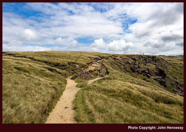
Beyond William Clough, I met up with the Pennine Way. That was going to convey me to the top of Kinder Scout and around by its western edge. After the initial short pull up steeper inclines, it struck me that most of the ascent was on gentler gradients. That initial steepness was over quickly, much to my surprise; William Clough felt much more rugged in comparison. There were others about at this stage, yet the place felt none too crowded, and skies broke overhead to allow the sun to do its uplifting work on a tapestry of hardy grasses and wind-sculpted rocks.
Near Kinder Downfall, there was the option of following the old course of the Pennine Way towards Grindsbrook Clough, perhaps avoiding many of the people that I was to pass later in the day. The horror stories from bygone crossings and my lightweight state meant that I stayed within view of Kinder Reservoir instead.
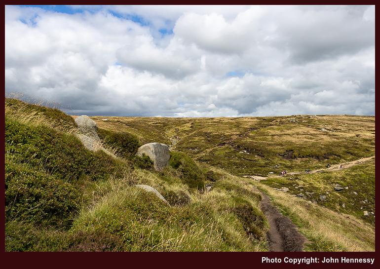
As I grew closer to Edale Cross, it struck me that this was not going to feel like a quiet Monday around there. If I had designs, on following the Pennine Way down to Edale, they were scotched in favour of what I hoped to be quieter informal paths. As with many things with 2020, old experiences became poor predictors of then contemporary behaviour. Thus, I had to share the place with more people than I felt was ideal. It was a matter of making the best of it, and relishing any quieter stretches as I passed Edale Head, Pym Chair and Crowden Tower, some of these being part of nature's gallery of rocky outcrops. Each formation seemed to tell a tale of millennia, weathered yet unyielding.
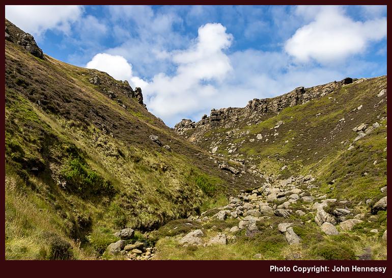
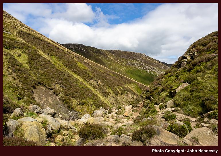
In some ways, the descent into Grindsbrook Clough was a wise choice; it thinned out the encounters with others to near nothing. The steepness of the initial stretches only would have helped to ensure that. This was light scrambling, with plenty of occasions for getting hands on intimacy with the gritstone slabs. Even with an abundance of cool, unyielding stone, keeping three points of contact hereabouts is a frequent necessity. It staggers me to think that the Pennine Way once went this way; there is plenty to remind one of nature's raw beauty and the respect it commands.
Patient resolve was rewarded when the gradients eased. The skies were again packing with cloud cover, which would have foiled any ambition to improve on photos made in August 2001, if there even was one at that moment. Having a pleasant path to follow on the way to more bucolic surroundings was enough for me that afternoon.
Edale felt tranquil with less around it than I found on the edges of Kinder Scout; it prompts the question as to where they came from, but a rural car park or two might explain that. A quirk in the train timetable meant that I spent longer around the place than I was expecting. This proved to be a refuelling opportunity using some refreshments purchased from a kiosk near the train station.
While the day may have been cloudy much of the time, there was uplifting sunshine in the middle of the hike. This also was when I met more people, a discomfort in times of pandemic. Nevertheless, there were moments of treasured, sublime solitude too. These were steps, not just through a majestic and treasured landscape, but part of a journey through an ongoing global upheaval. Despite all the surrounding drama, there remains that ineffable something that calls us all to wander. Few things, it seems, can stop that.
Travel Arrangements
Bus service 60 from Macclesfield to Hayfield. Rail journey from Edale to Macclesfield with a change at Manchester Piccadilly
When promised sunshine scarcely appeared
10th January 2023 These words are being written in a period of ongoing industrial relations turbulence. Whenever this happens, it can seem never-ending. Hope gets lost, but things can be resolved quicker than anyone can imagine.
Much of 2018 was blighted by Saturday-only stoppages that affected Northern Railway. It meant that outings were limited for me because I do not drive a car. In fact, they were an impossibility for many of the places that hill wanderer would go in the north of England. Thus, when the stoppages were halted, it was as if I was unleashed to take advantage of the restored sense of freedom.
Trips to the North York Moors and Derbyshire preceded two outings to the Yorkshire Dales. This piece describes the first of the latter, when sunshine was scarcer than predicted in the forecast. That encouraged another that will be described in a later posting.
The lack of sunshine necessarily limited the number of photos that I made on this trip, so figuring out the route again took some doing. Nevertheless, I reckon that I have recalled it. Recording GPS tracks or even filming hikes is something that I have avoided so far, but that needs a rethink unless I stop leaving it so long before writing trip reports.
On the day, I made my way from Settle's train station towards Castlebergh Plantation. From there, I followed the Pennine Bridleway in the direction of Malham Tarn. That meant passing the turning for the crags that may have lured me out that way in the first place. They would be passed on the way back.
Everywhere lay under grey skies as I followed the track towards Langscar Gate and Malham Tarn. A young walking group was going this way too, so I dallied to give them time to move along for the sake of added solitude. Following the broad track appealed to me, as these so often do, especially when quietude can be found. That made up for any lack of sunshine.
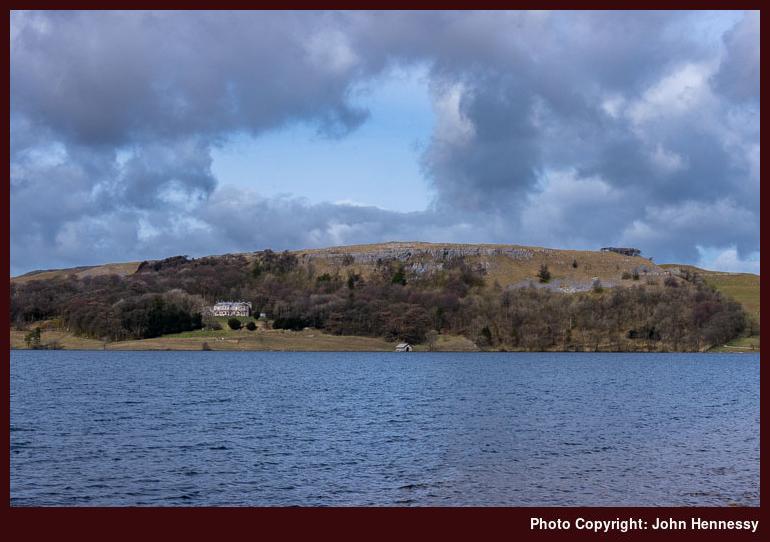
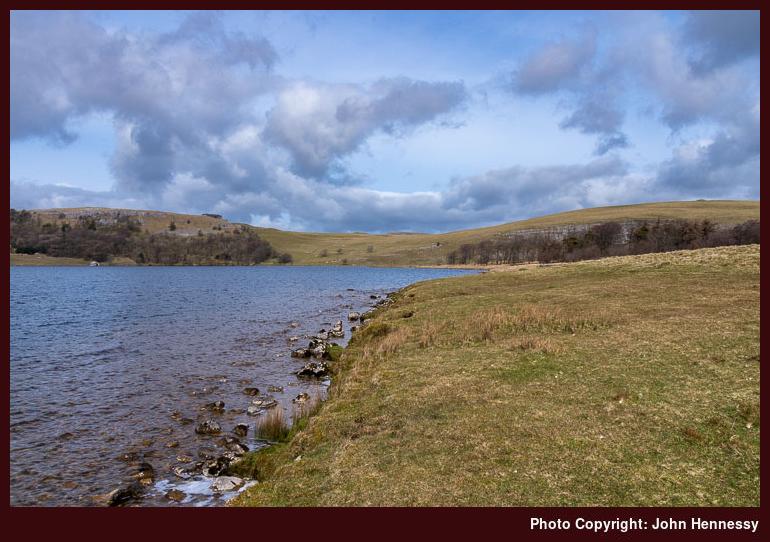
Skies partially cleared of cloud around Malham Tarn, somewhere that I possibly had not visited for more than ten years. That made me linger and attempt a spot of photographic capture. The results may have been incompletely in their success, but they were proof that I was not totally out of luck. Now that I think of it, there may have been more sunshine available than I had thought.
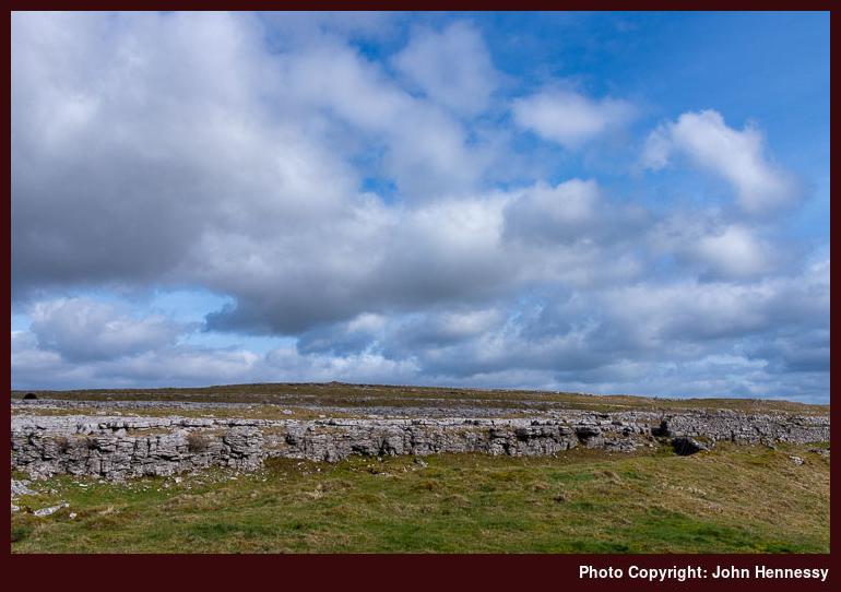
My next move was to make for Malham village. That took me past Broad Scars and Malham Lings before I returned to tarmac again. Descending by Malham Rakes gained me views over Malham Cove as well as getting me to the village where I enjoyed a refreshment stop.
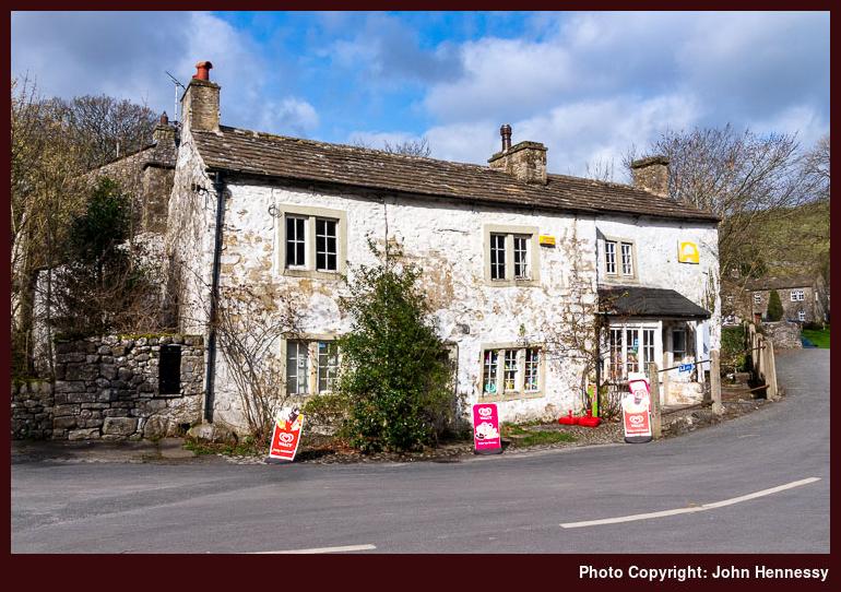
The shop was looking more tatty on the outside than when I was near there on previous visits. The paintwork was wearing off the stonework and the shopkeeper looked aged, which have explained the lack of maintenance to the outside of the building. Skies again broke to allow some sunshine, and I took in sights of the cliffs of Malham Cove on the next stage of my hike.
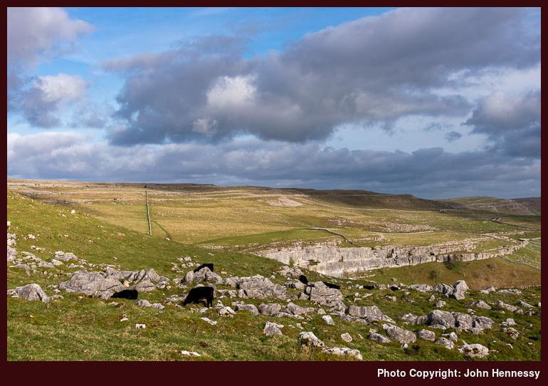
My return to Settle took me near Town Head as I made my way onto Long Lane. That kept me off Cove Road until just before a steep ascent, after which I left the road for a public footpath that would take me back to the Pennine Bridleway near Kirkby Fell. There was empty countryside around Rye Loaf Hill, though I seem to recall seeing some mountain bikers around there.
More civilisation in the form of Stockdale Farm before I left the lane to follow the Dales High Way past crags that I had fancied photographing. The grey gloom put paid to that ambition, so I reconciled myself to enjoying the hike instead. There was one last uphill heave before the final descent into Settle, which felt very distant in the vicinity of the limestone outcrops that I was passing.
Another visit would be needed to make photographic use of the scenic delights that they offer, but the walk had left me content. There may have been a refreshment stop before I started on my train journey home in the knowledge that there was some unfinished business that remained in this part of the Yorkshire Dales. A return would follow.
Travel Arrangements
Return train journey between Macclesfield and Settle, with changes at Manchester Piccadilly and Leeds.


