Stiffness
17th January 2012In weather terms, 2012 started like a lion in some parts with Scotland getting a particular battering. Before that, the second day of the year saw me crossing hills to pop over to Buxton. That act planted in my mind the prospect of exploring more of Macclesfield’s hills this year. However, the following weekend was a quiet one for me.
The weather may have been offering in other places, but a prior commitment was the cause of my staying close to home and not getting out among hills in parts like Shropshire or even wandering along the streets of somewhere pleasing to the eye like Edinburgh or even Shrewsbury. That’s not to say that I wasn’t doing some more playing with ideas for outdoors outings, though.
While adjusting albums in the photo gallery, thoughts were drawn to revisiting places where I haven’t been for a while. The online photo albums that attracted my attention were that for the Pennine Way and the Scottish Southern Uplands and Borders. The refresh involved adding photos were added, removing an old one rewriting a few descriptions. The trip ideas that came to mind while adjusting those photos included a stay in Peebles to explore the surrounding hills as well as getting to walk more of the Pennine Way or even the Southern Upland Way. Old and not so old photos act as reminders for me of past glories and lure me back to where I found them before.
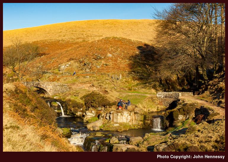
Last weekend’s cold frosty sunny weather was enough to draw out among hills again on Saturday. It was a day when any part of Britain’s hill country would have delighted and I did play with a walk around Sedbergh that involved an out and back yomp into and onto the Howgill Fells. Looking a bus timetables caused me to leave it for later in the year. Remembering how stiff I felt after a trot about Church Stretton’s hills before Christmas was a factor too in not deciding to not set my sights too high. Thus, I opted for a hike from the Cat and Fiddle Inn to Buxton that mainly followed the Dane Valley Way with a deliberate diversion or two. After all, the prospect of seeing the Three Shire Heads bridge in full winter lighting was too good to miss; it may have added to the distance covered but proved to be well worth that. If all goes to plan, more will be said about the walk sooner instead of later.
Though our settled spell of weather is leaving us at the time of writing, there are promising signs for the coming weekend too. While my limbs were stiff on Sunday and Monday, I take that as a cue for trying to get out a little more often than last year and January 2012 isn’t over yet. What I am not planning is anything as frenetic as this month last year when I walked successively in Wales, Scotland and Ireland. Pacing oneself is no bad thing either and quiet moments are needed for collating more ideas too. A recent catch-up with an article from one of last year’s issues of TGO has me wanting to sit with it and pore over maps while ogling the contained photos of splendid Lake District hill country. Wandering needs forethought at times.
It would be a pity to see them go
14th December 2011A recent poke around the SYHA website revealed some sad news: hostel closures. In total, there have been 46 but 5 of them are facing closure. There’s Canisbay near John O’Groats in Caithness, Arden near Loch Lomond and three in the Scottish Borders. These are Broadmeadows, Kirk Yetholm and Melrose. The latter losses will leave the network looking very bare between Scotland’s central belt and its border with England.
A weekend in early July had me staying in both Kirk Yetholm and Melrose. Both seemed well used though neither was completely full. Both are near long distance trails so that should explain their locations. St. Cuthbert’s Way goes by both of these and that’s how I chose them as places to stay. Kirk Yetholm also is the northern end of the Pennine Way and both the Southern Upland Way and and the Borders Abbeys Way pass Melrose. That makes both of these a big loss for long distance walkers who now need to make alternative arrangements unless others take them over and run as independent or affiliate hostels. After all, Melrose also is useful for cyclists.
In the article on the SYHA website announcing the news, the reason given is one that will be eerily familiar to those who have witnessed YHA closure announcements. Yes, the cost of refurbishment has been mentioned in concert with the standards expected by hostellers these days. The upgrades to Oban and Lochranza are mentioned and I can vouch for the one on Arran being a good job. However, it sounds like it took a dedicated husband and wife team to make it happen.
The announcement has me pondering the future of youth hostel associations and it’s a line of thought that may spawn another entry on here regarding the subject yet. There are those who consider that youth hostels are on borrowed time. At Kirk Yetholm, I met a grandmother taking her grandchildren hostelling before she felt it was too late to do so. That Kirk Yetholm now is facing closure makes here views sound prophetic.
Back savouring the variety of Scottish Borders countryside
15th May 2010It’s been a while since my last trip up there, but last weekend saw me back in the Scottish Borders and sampling more of its attractive countryside. 2006 was when I last frequented these parts and so decided that it was high time for a return. Then, it was the turn of St. Mary’s Loch and Ettrick Head while on a trot west along the Southern Upland Way. That followed a reconnaissance visit based in Lockerbie that involved a poke around Moffat on a largely cloudy weekend. That’s not to say that the sun hasn’t been out either with previous hikes around Peebles, Traquair and Innerleithen being blessed by blue skies.
Last August’s visit to Edinburgh had the unfulfilled ulterior motive of an outing to Melrose to savour the delights of the Eildon Hills. However, a forecast of rain raised the prospect of not seeing them at their best and that was one reason why they have lain on the ideas shelf since. It was that and thoughts of seeing Melrose Abbey that drew my mind to the area again.
Everything may have looked sunny in Carlisle, but Selkirk was cloudy when I got there. It stayed like that as I left the town to cross over Ettrick Water as I headed for the Philiphaugh Estate. The possibility of using the Borders Abbeys Way to get to Melrose was set to one side in favour of using the old right of way between Selkirk and Three Brethren before following the Southern Upland Way first to Galashiels and then to Melrose.
To my surprise, the Philiphaugh Estate has set up trails for visitors to follow and a leaflet to go with them. While it may not have been my intention, I ended up sampling a track through forestry that gave me a sneak preview of my surroundings from an elevated vantage point. After retracing my steps, I followed the vehicle track named the Corbielinn (or Corbylinn as the OS has it) Road until it left woodland near a reservoir.
Beyond that, it was onto the slopes leading away from Long Philip Burn with a spot of track hopping until I found myself on one leading me straight towards the Three Brethren. The sun was making a better fist of peering out through the cloud cover and caused me to stop a lot on gradients that otherwise weren’t the unkindest. The views were changing all the while too as I gained height, keeping my mind occupied and warding off any sense of impatience. This observation leaves me wondering if it as unchanging surroundings that were the cause of any rising impatience during my long walk on the Isle of Man, but there may have other factors at play too.
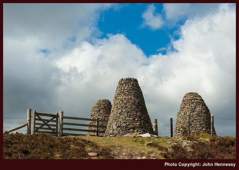
The three cairns that are the Three Brethren came into sight soon enough and grew steadily larger as the approach to them grew ever shorter. They caught the sun too as it ducked out from behind the broken cloud cover sporadically and I started to think it to be a pity that someone placed a fence through them. Once beside the cairns, the line of the old drovers road that now carries the Southern Upland Way stretched out to the east and to the west. A useful signpost confirmed that Galashiels was nearer than Traquair, verifying the sense of my route.
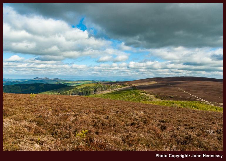
With the highest point of the day behind me, I began to lose height as the day grew ever better; it had all the hallmarks of being one of those delightful late spring and early summer evenings of the kind that I met once around Peebles and never have forgotten. There was no doubt about the way to be followed though I found yet another signpost and it included the option to return to Selkirk if I so desired, via a track that I left further down as it happened, but I was bound for passage through Yair Hill Forest.
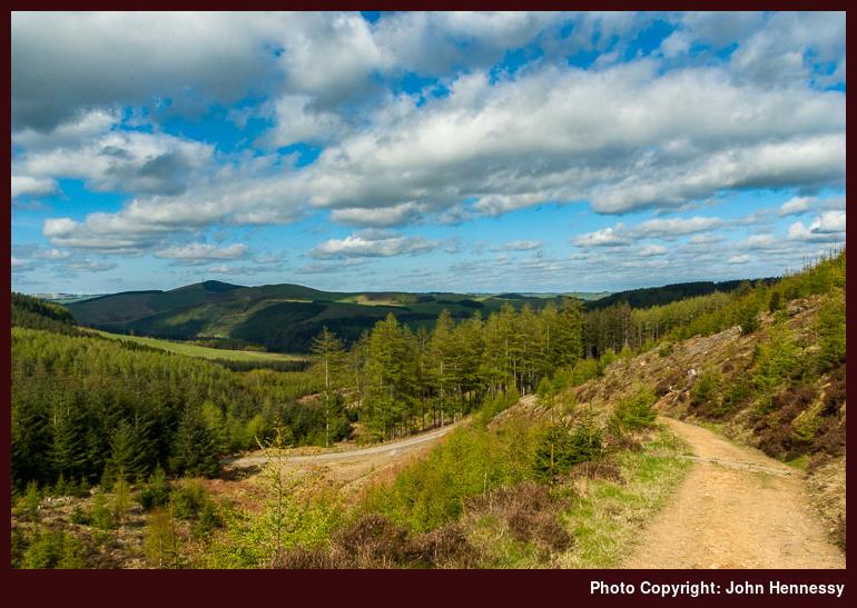
Mercifully, some forest clearing allowed greater views of what lay ahead of me. Yes, there was the sight of wind turbines that no doubt would annoy some but they weren’t all over the place either and enough was left in an unblemished state for unperturbed enjoyment. Woodland wandering demanded good attention to a map but any waymarks that I met were a useful backup too, not that they made good map reading unnecessary. Without going around in any circles, veering off track or any other difficulties, I found myself at Yair Bridge for a crossing over the Tweed as planned.
From Fairnilee Farm, it was all pastoral wandering in pleasing sunshine. There was height gain but it was fairly gradual and views back towards Selkirk opened up behind me; it looked as if it was stuck in constant shadow. Sheep and lambs abounded as did stone wall field enclosures. You’d be forgiven for thinking that you were further south in Britain than Scotland as I crossed from field to field.
In time, the views over Galashiels came too, first from a large neatly constructed cairn much like one of the Three Brethren. From there, it was downhill again as waymarks draw the wanderer closer and closer to Gala Hill. The Southern Upland Way chooses to go around it and skirt Galashiels in doing so. Saying that, there are plenty of paths on Gala Hill shown in Explorer 338 and Galashiels has its share of waymarked paths too, some of which use part of the Southern Upland Way. Though it would mean gaining some height again, I can see the point of including the woods around Gala Hill and the trail gains height after Galashiels anyway. The Galashiels variant can be left for anyone who wants it but I think that having the SUW going over Gala Hill would bring its own rewards too and cut down on any urban walking.
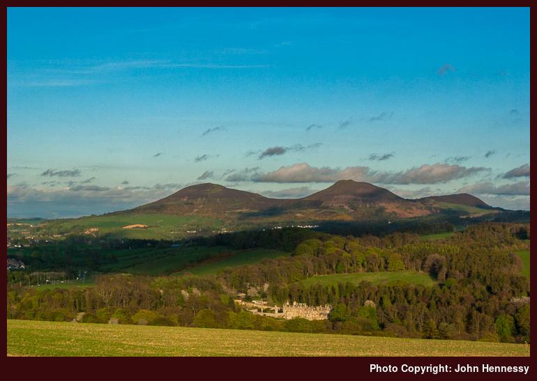
Having to face more ascent was not welcome to tired limbs but it did offer recompense in the form of more views of Eildon Hills, this time with the added interest of Abbotsford, Sir Walter Scott’s former home. After the last loss of height for the day, I was to find myself on the opposite side of the Tweed from Abbotsford and among trees for a last fling before urban walking was to take hold. More river crossings followed with one of Gala Water coming before another of the Tweed.
The latter brought me along a former railway cutting and the tarmac underfoot was taking its toll on the soles of my feet; is it time to get better insoles for my Meindl Burmas? This part of the SUW is shared with part of the National Cycle Network and the distances on their signs did everything that they could to dispel and impression that Melrose and Galashiels are right beside each other. With sore feet, not seeing much in the way of progress can be dispiriting and it was with relief that I gained one final stretch by the Tweed with hard dry grassland underfoot. When that was behind me, there was the matter of pavement pounding until I found my lodgings for the night, but that didn’t seem to take so long.
The next morning began with blue skies before a rain shower came my way and there were a few more before the day set to improving steadily. After the one before, it was to be one of gentler pursuits such as relaxed inspection of Melrose Abbey. Other than that, there was a taste of St. Cuthbert’s Way before I stopped to soak the views that any gain in height revealed. Not having the time to use that trail to continue in among the Eildon Hills, I left the idea of exploring them for another time and subsequent map inspection revealed a possible alternative itinerary that would achieve that end. Following St. Cuthbert’s Way from St. Boswell’s to Melrose not only would take me through the aforementioned hills but also near Dryburgh Abbey too. It only needs one excuse to return to any place and I have found it for the Scottish Borders. Let’s hope that it doesn’t as long to get back as it did before.
Travel Arrangements:
Return train trip from Macclesfield to Carlisle. Outward bus journey onward to Selkirk and more buses to bring me back from Melrose by way of Galashiels.
Revisiting the Scottish Borders
10th May 2010After a bank holiday weekend spent expanding my explorations of the Isle of Man, last weekend allowed a getaway to a part of the world that I haven’t really visited for nearly four years: the Scottish Borders. Since then, a new long-distance trail has appeared on OS maps, the Borders Abbeys Way, and caused me to look at the copyright date that was on the one that I used when I last got to sample the area around Peebles and Galashiels. With the legend “2002” peering back at me, I began whether a new edition was needed, but I persevered with the older one while up there.
It was sufficient for the task of hiking from Selkirk to Melrose via The Three Brethren and, from there, the Southern Upland Way on an ever improving afternoon and evening; I left the Borders Abbeys Way with its requirement for remembering where it went for another time. The Eildon Hills were catching the light sporadically as I grew to realise the distance between Galashiels and Melrose. Very deceptively, the proximity of Galashiels, Tweedbank, Darnick and Melrose would lure you into thinking that everything is close together, but the whole conurbation put together is at least five miles long!
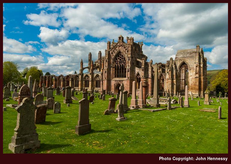
After the exertions of the previous day, Sunday was left as an easy day before I returned home again after a stay in Melrose. That energy expenditure made for tired legs, so I contented myself with enjoying the impressive sight of Melrose Abbey (yes, a camera was set into action too, but it’s often what gets me out and about in the first place) on a day that kept improving after a damp start. There was an uphill potter along St. Cuthbert’s Way to take a closer look at the Eildon Hills but time constraints put a stop to any potentially foolish designs that may have lain in my mind.
A look at a map since then has popped an idea into my mind: using St. Cuthbert’s Way for a walk from St. Boswell’s to Melrose that might grant me glimpses of Dryburgh Abbey and would pass over the Eildon Hills. Those hills are criss-crossed with paths, but there are other possibilities with sections of the Borders Abbeys Way allowing for sampling of the countryside around places such as Kelso, Hawick and Jedburgh. All in all, it looks as if there is plenty on offer to the passing wanderer in search of pleasant countryside with a smattering of low-sized hills.
After all, this is countryside that I should have been exploring when I lived in Edinburgh but for a combination of succumbing to the attractions of a very nice city and being blinded by attractions further north. Then, I would have considered cycling and the practicalities of getting a bike out into the Borders with no car would have raised their heads too. Until the restoration of the rail link to Galashiels and Tweedbank, that one will persist because I saw no evidence of bicycle carriage on any buses that I used over the weekend. In a way, that’s a pity because there is the Four Abbeys Cycle that echoes the intent of the Borders Abbeys Way and there are quieter roads around the area too. That new railway could make things interesting but the prospect of it packing the area with visitors is hard to envisage with all the space that there is for everyone.
One thing that struck me over the weekend was how quiet everywhere was, and it is an area where you unleash your reverie without too much fear of intrusion. Of course, you still have to watch where you are going, but that effectively is the limit of things. Those ideas that have come into my mind already should keep me returning, and I do hope that it’s more regular than it has been.
A weekend visit to Moffat
10th September 2006I am back home after taking advantage of the fine weather by taking myself off to Moffat in Dumfries and Galloway to take in some of the walking missed by the hordes passing north on their way to the Highlands; they do not know what they are missing, even if the hills show themselves to all and sundry proceeding along the West Coast mainline and the A74(M). The Southern Upland Way is a major walking attraction around here, but there are many hills to explore as well. They may not be high like the Munros, but the rough country does demand some preparation and respect.
My previous encounter with the place was last June when I based myself in Lockerbie. That time, I got in the section of the Southern Upland Way between Moffat and Ettrick Head, but the day remained cloudy until my return to Lockerbie for the night. This time, I walked the Southern Upland Way from St. Mary’s Loch back to Moffat, also covering the ground that I explored on my previous visit. I had designs on more walking, but the after effects of a 20-mile stroll and a heavy pack returned me to my senses.
To get to and from Moffat, I travelled by train between Macclesfield and Dumfries (well, apart from a rail replacement bus service between Manchester and Stockport: they were working on the line yet again). On Friday evening, a taxi got me to Moffat and I left the 114 bus to do the honours on the return. There was a bus on the Friday, but a 60-minute wait would have been in order. Mind you, if I had been more patient, I might have avoided a bizarre taxi conversion laden with strange coincidences.
Over the weekend, I stayed at the Balmoral Hotel, which offered exactly what I needed. The only fly in the ointment was the locals talking loudly among each other out on the street until 02:00 in the morning. And no, I have no idea what was going on. It never endangered my plans, though.
A useful Saturday only service (Houston’s 130) got me to St. Mary’s Loch and would have been a useful fallback if I decided not to walk all the way back to Moffat. Both St. Mary’s Loch and nearby Loch of the Lowes looked so magnificent that I could have spent the whole day on their shores but I had other walking on my mind and it really did take some willpower to get going. Most of the Way followed paths and tracks through the hills, but a five-mile road walk was endured in the middle, a minor complaint given what else was on offer. As regards terrain, the only tricky section was around between Craigmichen Scar and Ettrick Head where the effect of landslips is obvious to all. The sight of sheep grazing on steep slopes littered with them was nigh on unbelievable; it looked like reckless behaviour. Recent land movements have resulted in the redirection of the Way around here (be warned if following the OS map) but I suspect that a more permanent route will have to go up and over West Knowe some day, a potentially tiring but safer diversion.