Category: Europe
From canal paths to high ridges: Pondering possibilities for Lochaber returns
 21st October 2025
 The Lochaber and West Highland Way albums in the online photo gallery recently got updates (an overhaul in the case of the former) from trips to the former during April 2009, July 2013 and June 2024. However, this activity itself spurred some notions of returning to Lochaber because I fancy making digital replacements for what I pruned from the gallery. Naturally, it would have been better to have those newer images in place before culling their predecessors.
It was a previous round of curation that led me to traipse me along sections of the West Highland Way last year, one between Fort William and Kinlochleven followed by another from Glen Coe to Bridge of Orchy. Those journeys replaced images of lesser quality than what I prefer these days, efforts that were rewarded, which is just as well given the wearying heat experienced on the former and the wintry showers encountered on the latter. None of this took from the success of the endeavour, an aspect that dulled any wishes to return to the area for a time afterwards.
Returning to those unused excuses for returning, I am collating a few here for further perusal. These go beyond an ascent of the Pap of Glencoe from the village that gives it part of its name or even any continuation as far as Sgor nan Fiannaidh though that looks like a craggy proposition on OS maps even if Harvey Maps show a path up there. Proceeding any closer to the Aonach Eagach is of no interest to me, given its intensity of exposure and the scrambling involved; this also might be going in the wrong direction too.
Otherwise, Glenfinnan may have its monument commemorating the Jacobite Rising at the head of Loch Shiel as well as its cinematic associations because of a famous viaduct, and short paths that lead to classic viewpoints of both landmarks, while longer circuits climb into the surrounding hills and a track up the glen reaches the Corryhully bothy. Bringing us more on topic, Kinlochleven turns up a lot here because of what lies on its doorstep, which is far more than the well visited Grey Mare's Tail waterfall or even the well trodden West Highland Way, which threads past some of what is described below.
Matters of Unfinished Business
Glen Nevis
An encounter with Glen Nevis was among my earliest incursions into the Scottish Highlands. That was a serendipitous affair that included a trot along a very short section of the mountain track leading to the top of none other than Ben Nevis. It granted me ample views of what lay about me after some forest track trampling in advance of an intrusion that met no reproach from others who were better equipped for their hiking. Apart from the possibility of reaching Scotland's country top, other traipsing through the glen on the West Highland Way has left me sated for now.
However, that still leaves other parts much further into the glen. After all, my second visit took me all the way to the car park at the end of the tarmac road on a stroll with my brother. While a dull day might have limited photography, that was not the point at the time. It was only a few years later that I went past the sign asking about visitor preparedness to reach wilder parts on a day laced with heavy rain. Before that, I had loitered around Achriabhach on a wonderful August evening on a circuit that followed forestry tracks from Fort William before sticking with tarmac for the way back. Then, gaining height on the path shadowing Allt Coire a' Mhusgain granted me a vantage point from which to savour my surroundings at a time when directional sunlight cast many shadows.
Surprisingly, there has been no follow up on those incursions for a good while since they were made. It is not before time that this should be something that is set to rights, though the vicissitudes of Lochaber's weather and the numbers drawn by the delights that await them mean that the errand is challenging. Overcoming those will bring rewards, though.
Great Glen Way
Around midsummer this year, I pottered along the Great Glen Way between Drumnadrochit and Inverness. The start was under cloudy skies without much hope of seeing sunshine, yet there were breaks in the cloud cover later and a fine end to the day. For a long time, my dalliance with the trail was at the other end: between Clunes of the western bank of Loch Lochy, Gairlochy, Banavie and Fort William.
The sprawling rambles started from Spean Bridge and passed the impressively situated Commando Memorial. Their reach included the shores of Loch Arkaig as much as Loch Lochy, with Achnacarry and the Mìle Dorcha as landmarks on my traipsing. Along the way, I surveyed sightings of the Grey Corries as much as the more dramatic side of Ben Nevis and its neighbouring hills. Since all got captured on film, I would fancy returning to make digital images of these alluring panoramas too.
An added sense of adventure could send one's mind to ponder the heights of Meall na Teanga and Sron a' Choire Ghairbh, often suggested as a joint ascent in guidebooks. My first reaction to such an idea was that the realities of carless hiking make this implausible, until I got around to looking at timetables. An early start could make this happen with a spot of care, and Laggan sounds a better starting point than significantly more distant Fort William. However, routing by Mìle Dorcha could increase transport options with a diversion to Spean Bridge.
The stretching of logistical realities sent another flight of fancy into my mind: walking from Laggan to Fort William using the Great Glen Way. This is no quick stroll at 36 kilometres (22.5 miles), though it can be managed in a single day given adequate hours of daylight. The aforementioned section between Drumnadrochit and Inverness was around 32 km (20 miles), after all. If required, a 5 km (3 mile) diversion to Spean Bridge would shorten the distance with access to bus and rail services. However, the section beyond Gairlochy would add digital photos for me when the weather is offering, so the full distance still appeals and seeing those aforementioned hillwalking summits would do no harm either.
Loch Treig, Lairig Leacach & Glen Spean
It was May 2006 when I walked from Corrour station to Spean Bridge after overnight travel got me to Fort William, an escapade that inspired one of the first trip reports on here at a time when brevity was more my style. The sunlit landscapes, still brown after the winter and awaiting greening for the summer, caught my eye as much as Loch Treig itself and any remaining snow on the surrounding hilltops. Though the start may have been later than was ideal, I was still in ample time for a train back to Fort William, and I seem to remember that there were later bus services available in those friendlier times too.
While I might have had a digital camera with me then, film photography was my mainstay at the time and later fumbling meant that I lost the photos anyway. Thus, going that way again is something that appeals to me should such an opportunity arise. Lairig Leacach and the Grey Corries would again have my ephemeral company, though there are other route options in the area that may appeal just as well.
The descent to Spean Bridge had me skirting Leanachan Forest, which offers possibilities such as the 9.8 kilometres Leanachan and River Lundy circular, offering a sheltered outing when weather conditions make higher routes inadvisable. However, the mixture of walkers and mountain bikers does mean that you need to pay more attention at junctions, without being distracted by views of Ben Nevis through the trees.
Adjoining that is Torlundy and the Nevis Range gondola that lifts walkers to opportunities that would otherwise require long approaches. From the Top Station, well-made paths lead to the nearby Sgùrr Finnisg-aig and Meall Beag viewpoints, as well as a more challenging 9.5 kilometre route to Aonach Beag and Aonach Mòr for those possessing the required stamina and navigational skills. In contrast, the Snowgoose Trail turns the approach on its head, climbing for 6 kilometres from the car park to the mid-station restaurant, with the gondola available either up or down to ease the effort.
Staring from Kinlochleven offers another possibilities, with some of these passing Loch Eilde Mor, another location visited a good while ago and with remaining digital photos too, some of which now being in the Lochaber album to which I alluded earlier. One is a circuit that also takes in the 13 kilometres long Blackwater Reservoir and its one kilometre wide dam, an intriguing prospect that frequents quiet countryside with views towards the Pap of Glencoe.
Another trail links with the track between Corrour station and Loch Treig from where there can be a reprise of the hike to Spean Bridge made in 2006, while continuing past Loch Eilde Beag to meet the Abhainn Rath could be another option. Heading north from there towards Lairig Leacach means a potentially tricky river crossing, even if it could make use of the pair of Crocs that I acquired after a similar necessity in Gleann Eanaich during May of last year. While the map may show a ford, the width of the river remains concerning, espcially when weather conditions mean a spate is in full flow.
Otherwise, a more committing possibility might be to continue west to Glen Nevis, an idea with which I have toyed in the past, albeit with a start at Corrour station after arriving there on a northbound Caledonian Sleeper train. The economics of that mode of arrival are not so favourable these days, and securing a booking is challenging enough, possibly because of overtourism. With a sufficiently early start, the Kinlochleven start might be a more feasible option.
A Spectrum of Underused Prospects
Ardgour
It was December 2009 when I made my only crossing of the Corran Narrows to savour what lies on the other side of Loch Linnhe. Leaden clouds packed the sky to ensure a dark and sunless encounter. Nevertheless, seeing these parts on a brighter day remains an unused prospect. Once you get there, the council-commissioned Corran Ferry gets you to the other side in minutes to reach perhaps deserted hills and more remote walking to boot.
The Druim na Sgriodain loop is one of the more convenient possibilities in an area more amenable to backpacking than day hikes, especially given the sparse bus timetable that is prioritised for locals more than visitors. Returning to the route, it is one that includes 12.2 kilometres of walking with 795 metres of ascent, an undertaking that would engage you for much of a day with its challenging terrain. After that, there is Garbh Bheinn, at 885 metres, often compared to a Munro and demanding of the kind of respect, making it one for dry, settled weather when visibility remains good.
This is an area for those seeking solitude and remoteness, especially when you venture into neighbouring Morvern and Sunart. As with much of the Scottish Highlands, it helps to have calm conditions along with a sense of self-sufficiency. While my incursions may be limited, I retain hopes of witnessing panoramas that sprawl over water and hill, gifts of clear sunlit days.
Ben Nevis
For someone with a fascination with a fascination with hill country and a long history of frequenting Fort William, it may come as a surprise to you to hear that I never visited the 1,345-metre high top of Ben Nevis. All that I have is a little taste of the Mountain Track from my first-ever foray into Glen Nevis. Advancing awareness of how ill-equipped I was for the full venture throttled any uprisings of ambition, assuming there ever were any, which exceeds any sense of reality.
My brother was wondering about reaching the summit when we went this way on our round trip of Scotland. The answer that seven or eight hours (allowing oneself nine might be no bad idea) were needed was sufficient for dulling any ambitions. Parking up a car at the youth hostel would have gained us a starting point for a 14.2 kilometre out and back hike if we were so equipped. If we had known, a partial climb might have been in order: after all, following the Mountain Trail to Halfway Lochan offers a 7.7 kilometre return route to a fine viewpoint at around 610 metres, one that offers views over Lochan Meall an t-Suidhe.
While the Mountain track might be my choice if I get to make an ascent, there are other possibilities for more experienced walkers, and the Càrn Mòr Dearg Arête is a celebrated adventurous option. This 17.9 kilometre ridge route from the North Face car park is exposed and steep, involving scrambling and pathless sections that require assured footing and good judgement, particularly if cloud presses low over the massif. Thus, this is no place for novices.
Returning to the subject of partial ascents, the North Face approach to the CIC Hut is another fine outing in its own right. This 11.1 kilometre return route climbs steadily beside the Allt a' Mhuilinn to reach the memorial hut beneath Ben Nevis's towering cliffs. Nevertheless, you can continue to the summit from here, stretching your hiking distance to around 25.6 kilometres on a challenge that can take 11 or 12 hours with some backtracking as you round the mountain to reach the upper section of the Mountain Track.
Continuing the theme of combining the Mountain Track and the North Face Path, I spied another option on the map that gains views along its length, if not the top of Scotland's highest hill. This opens up going from Torlundy to Fort William via the CIC Hut, a 17.5-kilometre route that opens with a sustained climb. As a means of getting to know the terrain, this has its appeal and opens up possibilities for reconnaissance before committing to any sort of summit attempt, as grandiose as that makes things sound.
The Mamores
Continuing on the mountaineering thread brings me to things that are flights of fancy to someone who normally summits on a single hill (maybe two at times) in one day, rather than doing a round of them. There are some of those with renown to be found among the Mamores. This is the kind of hill country where safety needs added care. For example, the north-eastern ridge of Sgùrr a' Mhàim should never be used for descent, as it has been associated with fatalities. After all, you are covering the kind of ground that needs added experience, a head for heights, proper equipment and the ability to navigate in poor visibility.
One is the 15.9 kilometre Ring of Steall, linking four summits in a committing loop, and the 13.4 kilometre Stob Bàn and Mullach nan Coirean round. Both are technical and strenuous with ridge walking, scrambling, traversal of narrow arêtes and steep descents. Both are dwarfed by the 39.8 kilometre Mamores Tour that takes in the summits of Mullach nan Coirean, Sgùrr a' Mhàim, Am Bodach, An Gearanach, Na Gruagaichean, Binnein Mòr and others, and the descent from Binnein Beag that requires great care.
Glen Nevis acts as an access point for much of this, as does Kinlochleven, from which stalker's paths will convey you to the likes of Sgurr Eilde Mor, Binnein Mor, Sgor nam Fiannaidh and Am Bodach. While reaching those heights on more modest incursions appears tempting, the potential of these making for challenging mountain days provides pause for thought.
From coast to highland: A selection of hiking routes across six continents
6th October 2025 Recently, I finished reading through DK's Hike: Walk the World. This follows their Outdoor Europe, regarding which I compiled another piece on here. In the same vein, here is one inspired by the more recently read title. The included routes range from rail beds reimagined as greenways to high passes braided between glaciers, allowing for a variety that is wide enough to cover moods, seasons and levels of ambition. Since the volume is a global collation, it offers is a tour through options on several continents, moving from cold coasts to jungled interiors and back to highlands again, with each region contributing trails that say something different about the land and the people who have used it.
North America: Pacific and Mountain West
On the Pacific edge and across North American mountains, routes range from the historic Chilkoot Trail, which once carried prospectors between tidewater and interior valleys, to the contemporary ʔapsčiik t̓ašii that shares the beaches and forests of Vancouver Island's wild outer coast. Volcanic plateaux and rainforest carve their own paths on the Hoh River Trail, while sea cliffs appear again on the Ka'ena Point Trail at the far end of O'ahu. Inland, granite basins and reservoirs frame the Wapama and Rancheria Falls Trail, and high ranges shape long days on the Pacific Crest Trail. Red rock country invites detours such as the East Mesa Trail to Observation Point and the Fairyland Loop Trail, both giving grandstand views over canyons. Further north and east, the Tonquin Valley Trail and the Plain of Six Glaciers Trail bring ice-carved scenery into reach, while the Teton Crest Trail and the classic Rim-to-Rim crossing push deep into mountain and desert environments. In Colorado, the West Maroon Pass Trail strings together alpine meadows, and the Black Elk Peak Trail crowns the Black Hills with a granite outlook.
North America: Northeast and Great Lakes
In the northeast and along the Great Lakes, shoreline and escarpment are the guiding lines. The Bruce Trail traces the Niagara Escarpment for hundreds of kilometres, while the Fundy Footpath and the Skyline Trail make the most of the tides and highland plateaus in Atlantic Canada. Nearer the ocean again, the East Coast Trail strings together headlands and kittiwake colonies along Newfoundland's ragged shore, and the Charlevoix Traverse adds a wilderness link across Quebec's shield country. South of the border, the Superior Hiking Trail follows the scalloped edge of Lake Superior, the Northville–Placid Trail cuts a quieter course through the Adirondacks, and the Lake Chicot Loop creates a gentle circuit around an oxbow in the American South. In the desert south-west, the Pueblo Alto Loop Trail explores masonry and viewpoints above a great house complex, and the idiosyncratic Spite Highway offers a different kind of straight-line progress through a chain of islands.
North America: Long-Distance and Island Trails
North America also remains the home of through-routes that many recognise by name. The Appalachian Trail links ridgelines from Georgia to Maine and continues to inspire section walks that fit around everyday life. The Bermuda Railway Trail, once the province of rolling stock, now invites an unhurried crossing of the islands by foot, while the Blue Mountain Peak Trail climbs to Jamaica's high point for cool dawn views. Island walking continues on the Waitukubuli National Trail across Dominica, where rainforest, ridges and fishing villages pass by in a slow procession. Much further north, the Arctic Circle Trail in Greenland introduces a different register again, with silence and long horizons guiding the stride through a treeless interior.
Central and South America
Southwards from the Caribbean and Gulf shores, the choice widens into jungle, canyon and altiplano. El Mirador remains a draw for those interested in long days among the remnants of a forested civilisation. Wildlife-rich slopes and cloud forest link together on the Quetzal Trail, while Corcovado National Park keeps the Pacific meeting wildland on its own demanding tracks. The Valle de Cocora and Quilotoa Loop combine wax palms with crater rims in an Andean double act, and Choquequirao adds its terraced amphitheatres to the list of remote objectives. Elsewhere in the highlands, the Colca Canyon / Isla del Sol duo places terraced valleys beside a lake of myth, each with paths that rise and fall through successive pockets of history and everyday life.
Further east and south, Atlantic rainforest and island circuits form their own collection. The Trilho do Ouro keeps company with river, bridge and old stonework, and the Ilha Grande Circuit circles beaches and coves under forested hills. Patagonia brings precise outlines and clearer air, with Laguna de los Tres offering a close encounter with Fitz Roy's buttresses, while the Dientes de Navarino Circuit adds a subpolar alternative just beyond the Beagle Channel. Out in the Pacific, the Birdman Trail tells another story in rock and sea as it loops over a volcanic isle where legends once carried real weight.
North Atlantic Islands
Across the North Atlantic, volcanic corridors and fjord-side paths set the tone before gentler farmland returns. In Iceland, Laugavegur Trail & The Postman's Path stitch together rhyolite ridges, geothermal flats and sea-cliff ledges in two very different moods of the same island. The Besseggen Ridge presents a confident arc above turquoise and slate-blue lakes, while Skåneleden drifts past skerries, beech woods and old walls along the south of Sweden. A lighter project again, Camønoen turns a Danish island into a multi-day stroll that never strays far from sea breezes and village harbours.
Britain and Ireland
Britain and Ireland add coastal circuits, ridge paths and heritage themes to any itinerary. The National Famine Way follows a poignant migration route that threads together river, canal and market town. Out on the peninsula and headland country of England's south-west, the South West Coast Path breaks the shoreline into digestible edges, while the Peddars Way and Norfolk Coast Path marry a Roman marching line with dune-backed beaches. Inland, Cat Bells remains a short yet airy Lake District ascent, and Cwm Idwal distils mountain geology into a half-day circuit that feels larger than it is. Long-distance connectors include the Great Glen Way, making use of glens and lochs to pass from west to east in Scotland, and the Fife Coastal Path that gives a more intimate, village-to-village alternative. A more experimental flavour appears on the Twin Valley Ley Line Trail, which borrows from folklore while traversing moorland and field.
Continental Europe: North and Alps
Continental options move from lowland long-distance footpaths to dramatic limestone and gneiss. The Dutch Pieterpad shows how a flat country can reveal its variation when taken step by step, and the Escapardenne Eislek Trail does something similar among the ridges and valleys that link Luxembourg and Belgium. The Moselsteig threads vineyards and meanders; the Malerweg turns the Elbe Sandstone Mountains into a gallery of pinnacles; and the Heidschnuckenweg explores heath, woodland and quiet villages with seasonal colour. The Alps provide classic waymarking with the Inn Valley High Trail giving balcony views above Tyrolean towns, the Adlerweg joining key passes, and day routes such as Tre Cime di Lavaredo and the Faulhornweg taking in limestone towers and grassy spines. Multi-country circuits like the Tour du Mont Blanc remain perennially popular, while the GR20 on Corsica keeps testing legs on a granitic spine that asks for sure-footedness as well as patience.
Southern Europe and Mediterranean
Southern Europe and its islands broaden the palette. The Loire Valley softens the stride with river bends and cultural landmarks, whereas the Cares Gorge turns the Picos de Europa into a limestone slot with airy walkways. The Sámara Circuit offers a volcanic take on circular walking, and the Camino de Santiago provides a network of routes whose destination is as important as the journey. Atlantic islands contribute their own wet rock and levadas, with Levada das 25 Fontes tracing channels through laurel forest, while the Seven Hanging Valleys Trail in the Algarve brings clifftop arches and ochre layers within easy reach. Further east, the Viru Bog Trail makes sense of peatland with boardwalks that lift the walker above mirror-like pools, and the Wooden Architecture Route presents timber churches and wayside details across rolling lowlands. Newer additions include the Via Transilvanica, which strings together villages and forest edges through a long Romanian corridor, and Planinica, a shorter name for an ascent that opens onto wide views above limestone and lake. Beyond the Adriatic, the Samaria Gorge carries stream and footpath between walls that almost meet, the Carian Trail repurposes old mule paths along a rocky Aegean coast, and Upper Svaneti blends stone towers with Caucasian valleys where glaciers remain part of the skyline.
Middle East and North Africa
To the south and east of the Mediterranean, walking meets canyon, desert and high plateau. Wadi Ghuweir Trail takes advantage of sandstone corridors where palms and water persist in sheltered places. In Oman, The Balcony Walk follows a ledge high above a canyon floor, providing lofty views with minimal exposure to the midday sun, and in North Africa the Toubkal Circuit brings the highest Atlas summits into a planning horizon that can be adjusted to the season.
Sub-Saharan Africa
Sub-Saharan Africa offers rainforest, highlands and coastlines that reward careful timing. In West Africa, the route from Gola Rainforest to Tiwai Island brings primate calls and river islands into the day's rhythm. The Simien Mountains National Park contains escarpments and grasslands with long-ranging views that change with the light, while the Congo-Nile Trail in the Great Lakes region mixes lake shore with cultivated hillsides. East Africa contributes emerald glades and blue pools in the Ngare Ndare Forest, and the Mulanje Grand Traverse in the south turns a granite massif into a multi-day expedition. Island walking appears again among the Grands Circuits, a term that covers extended tours with a feel for volcanic amphitheatres, and desert becomes a companion on the Tok Tokkie Trails, which make good use of dawn and dusk. Finally, the Otter Trail threads coastal forest, river mouth and rock platform into a five-day sequence that rewards steady attention to tide and weather.
Asia: High Ranges and Subcontinent
Asia carries some of the world's highest ranges and a great many quieter corners as well. The Ak-Suu Transverse traverses alpine meadows and passes with a steady progression that makes sense on a map as well as underfoot, while the K2 Base Camp Trek adds moraine and glacier travel to the repertoire for those with the time and stamina. India and its neighbours provide further contrasts, from the Chhattisgarh Jungle Trek with its village-to-village intimacy to the Valley of Flowers where monsoon-fed meadows frame a short season of blossoms. South across the Palk Strait, World's End and Baker's Falls combine cliff-edge viewpoints with shaded sections that keep temperatures tolerable. The Langtang Valley shows how a single valley can be enough for a week of walking, and the Druk Path steps between lakes and ridges to link two Bhutanese towns across high ground.
Asia: East and Southeast
Further east and south-east, tropical limestone and island summits sit beside urban long-distance routes. Thailand's Tab Kak Hang Nak Nature Trail earns its viewpoint with a warm climb through forest; Kulen Mountain in Cambodia mixes jungle paths with relics and riverbeds; and the Viet Hai Trail on Cát Bà Island introduces karst scenery from a human scale. In the Philippines, the Batad Rice Terrace Trail uses centuries-old engineering to shape a route, while the MacLehose Trail in Hong Kong and the Teapot Trail in Taiwan show how metropolitan areas can leave room for multi-day walking. Mainland China maintains massive walls that double as routes in their own right, and the Tiger Leaping Gorge Trail remains a classic high balcony above one of Asia's great rivers. To the north, the Great Baikal Trail links villages and bays with Siberian water and taiga as constant companions, the Seoul City Wall Trail traces history along a ridge of fortifications, and Japan provides both the primeval forests around Mount Miyanoura and the sweeping shoreline of the Michinoku Coastal Trail as study in contrast.
Australia
Australia's choice spans Indian Ocean capes, sandstone escarpments and long South Australian ridgelines. The Cape to Cape makes a point of coastal geology and surf along the Margaret River region, while the Barrk Sandstone Walk turns a loop over ancient rock country where galleries and lookouts appear in turn. The Heysen Trail ranges for many weeks through wine country, ranges and mallee, and the Grampians Peak Trail gathers the highlights of a serrated mountain chain into a well-defined traverse. Cooler air and button grass arrive with Dove Lake-Cradle Mountain, a circuit that frames a well-known crag, and the K'gari (Fraser Island) Great Walk makes use of island lakes, dunes and forest tracks to craft inland and coastal days. New South Wales contributes the Solitary Islands Coastal Walk, which links headlands, beaches and lagoons with regular public transport options for shorter sections.
New Zealand
Across the Tasman Sea, New Zealand takes the idea of single-day highlights and longer undertakings and offers a choice of both. The Rakiura Track sets a gentle rhythm on Stewart Island with bays and bush, while the Hooker Valley Track presents a straightforward approach towards ice and moraine under Aoraki's shadow. Multi-day classics such as the Milford Track and the Queen Charlotte Track combine boat landings with high passes or ridgeline strolling, and the Tongariro Alpine Crossing guides walkers through an active volcanic zone of craters, lakes and pumice. The Lake Waikaremoana Track completes the picture with a journey along a forested shore and over a bluff-backed ridge that looks out across a broad inland sea.
Conclusion
One issue with a compilation such as this one is that you almost know you cannot walk every trail that it includes. In short, you have to pick and choose, since it is all too easy for a mind to range around a planet compared to the realities of getting a body about it. Speaking of realities, there were places featured that are not as accessible as they once were; these have been removed. While some magazines feature such places (I encountered examples in issues of Wanderlust and Wired for Adventure), albeit with caveats, that is not what I do on here. Also, there are more hiking and walking trails in the world than are featured above, meaning that going deeper forsakes any sense of depth, and that is more than acceptable too.
Second chances and clearer skies: Revisiting Ely and Cambridge with a camera in hand
12th September 2025 Last weekend, I forced a return to England's eastern reaches despite ongoing workload, political upheavals, hotel room assignment errors by distracted staff and personal blundering with technology (a new phone was presenting me with a learning curve). This time, it was the turn of Cambridgeshire, with a base in Cambridge itself following a Friday night arrival.
My real target was Ely, after my previous incursion into these parts left me seeing the place under skies laden with heavy cloud and dampness in the air. That was to occupy me on Saturday, though the state of the skies did not fill me with confidence regarding photographic prospects. Patience was to answer that, with breaks in the cloud cover to allow for pleasing photos to be made of the city's cathedral and its environs.
There also were chances to venture into some adjoining countryside courtesy of following short sections of the Hereward Way and the Fen Rivers Way. While I stuck with train travel, the latter would have taken me all the way back to Cambridge if I so desired; timing likely was restricted for that anyway. The small taste of fenland wandering was enough to sate me in any case, especially when I had photographic satisfaction in other ways.
On returning to Cambridge, I attended to a matter after sorting out hotel room confusion caused by my being booked into one room and given a key card for another. A quiet evening ensued beyond all this before I set to sauntering around Cambridge again the next morning. Next to ten years had passed since my last dalliance with the place, mainly on a Sunday after a Saturday arrival.
This time, I remained more central than I may have done on my previous visit, which may have taking in Midsummer Common before I serendipitously arrived into the grounds of St. John's College, where I spent a deal of my time back then. This time around, they were off limits without paying a £15 entrance fee. Not wanting to devote the time needed to get value from such an investment, I spent my time elsewhere, and the same applied to the Botanic Gardens later on my rambles. After all, there were ample other places for strolling, some of which were beside the River Cam and other watercourses.
Pembroke College became one of these places to tarry awhile, as much as the grounds of Trinity College in the Backs. It was while I was in the grounds of the former that clouds grew more obstructive of sunshine, giving me a hint that my time of departure might be near. Given that other parts of England were having it wetter than where I was, I could not feel shortchanged to any extent. After all, there had been much pleasing photography to savour, even if the whole venture had happened against the run of play in some respects.
Travel Arrangements
On Friday evening, after work, I travelled by train from Macclesfield to Cambridge, making connections at both Stoke-on-Trent and Nuneaton along the way. Next day, I took a return journey to Ely and back. For the homeward journey on Sunday, I caught the train from Cambridge back to Macclesfield, this time changing at Birmingham New Street rather than retracing my original route.
Hiking over Lingmoor Fell and along Loughrigg Terrace: A journey from Great Langdale to Rydal
28th August 2025 In the summer of 2014, I left some unfinished business after another seed had been planted in my mind back in February 2009, when I hiked from Old Dungeon Ghyll Hotel back to Ambleside, and the experience sparked an idea that stayed with me. There was nothing to dispel what lay in my mind, not even a December 2016 trek from Great Langdale to Grasmere in stunningly crisp and sunlit if frigid circumstances.
It took until May 2022, as I began to shake off the constraints of the pandemic, for these inspirations to be merged into a fulfilling day hike. Thus, I finally realised a vision that had lingered for years: reaching the top of Lingmoor Fell and making new photos of Grasmere. This was a day trip in a time before I again began to stay away from home in the U.K., though a trip to Ireland had involved exactly that. My sequential arrivals in Windermere, Ambleside and Great Langdale offer occasion to potter about Ambleside while awaiting the bus to the last of these. Once I got there, my traipsing on foot could commence.
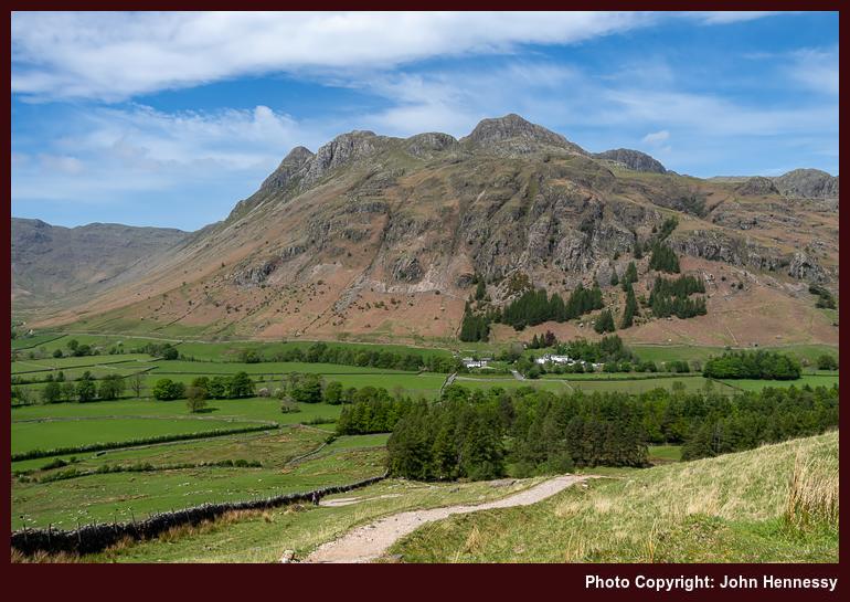
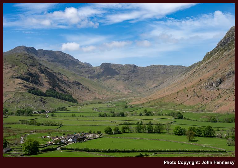
Once in Great Langdale, I began to make my way towards Blea Tarn, first along the lane leading to Little Langdale before peeling off onto public rights of way for the rest of the way. As I gained height in the heat of the day on the flank of Side Pike, views opened out below and around me. It was one thing to witness again the craggy eminences of the Langdale Pikes and quite another to peer along the line of the Mickleden Beck, one that I followed south under clouding skies at the end of May 2008. Seeing that under brighter skies was a definite bonus.
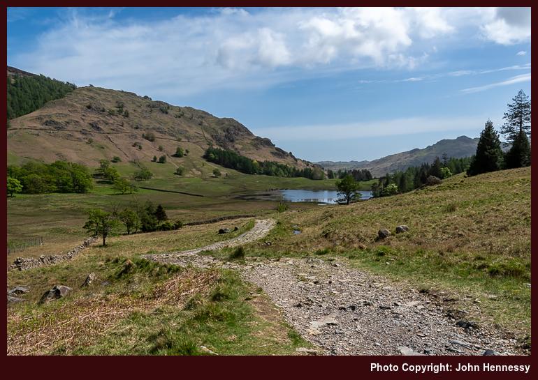
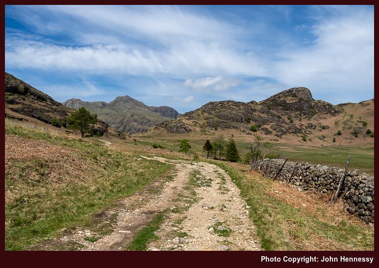
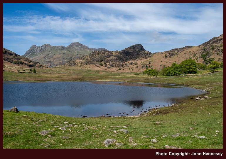
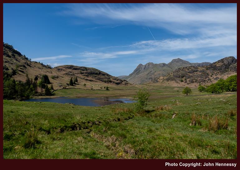
The way up from Great Langdale was unrelenting until I crossed the road to commence a trail below the slopes of Rakerigg. The easing of gradients beyond this point was welcome, though that meant losing those downward views that I had been enjoying before then. Nevertheless, there remained plenty to savour on the way to and around Blea Tarn. Some young people had music playing, something that was less easy to comprehend with the soundtrack that nature was offering. Maybe you have to live a little to grow to appreciate those natural sounds.
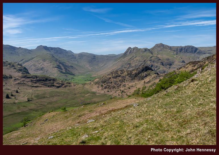
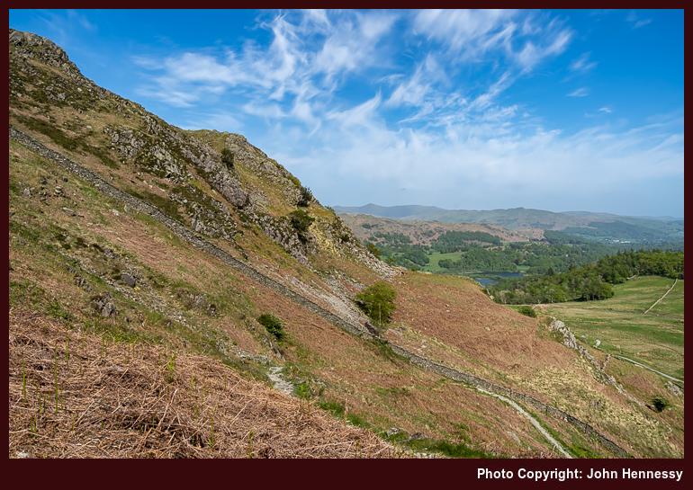
After crossing more level ground, a sterner test awaited: the ascent of Lingmoor Fell via a steep pathless flank. While going around by Bleatarn House to pick up an informal path following the line of a beck may have been wiser, I saved on distance by taking a more direct approach. Pausing to take in what lay around me was demanded by the gradient, as much as patience with my then under pressure legs. At least, the terrain had yet to be choked by bracken, making it easier to see where to place my feet. Fronds were slowly unfurling, though, a hint of what was to come.
In time, the slopes relented near Brown How, the summit of Lingmoor Fell. Naturally, I had to visit that top to witness the splendour that lay around me. All the while, I had been on access land, ensuring that no charge of trespassing could be made against me for the way that I went. A useful wall acted as a handrail for continuing on my way until I finally began the descent to Dale End, with glimpses of Elter Water and Little Langdale Tarn.
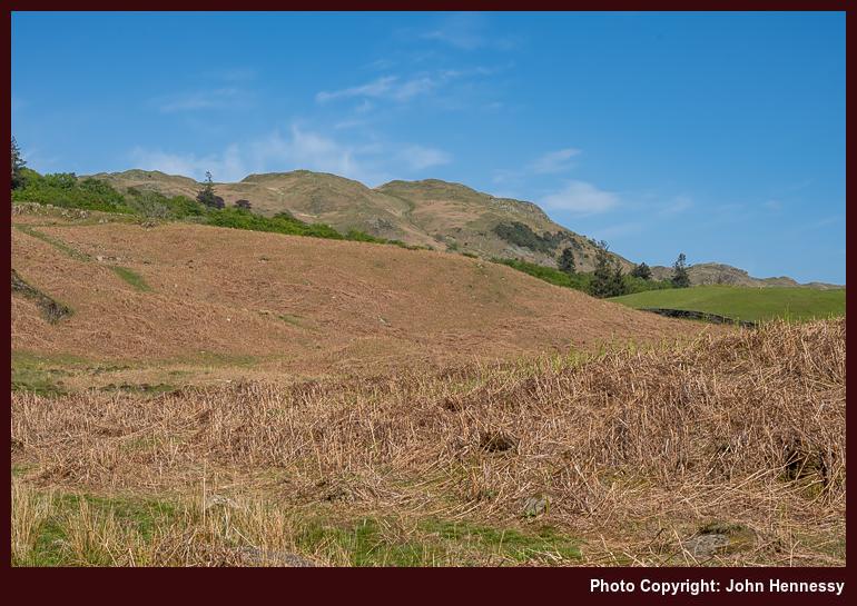
From Dale End, I pressed on towards Elterwater village in the afternoon heat. Kinder gradients meant that reasonable progress could be made, and I felt the need to push on in any case. A diversion around by Elter Water (the lake) was not on the cards this time around. That may be an excuse for a return to sate a photographic need. Instead, I crossed the B5343 to commence a taxing ascent to High Close, entering into countryside last frequented in August 2014.
Then, I stayed in the YHA hostel around there on a day through grew increasingly dull until rain arrived while I was exploring the surroundings after arriving at my lodgings for the night. Even under overcast skies, everything looked appealing, and I hiked to Grasmere village the following morning. The whole escapade had an end of summer feel to it and pervaded the journey home afterwards.
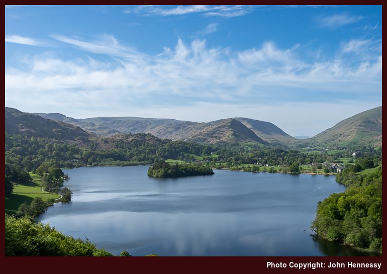
This time around, it was a lake that drew me and not a village. The afternoon was reminding me of an even earlier incursion, on a Sunday when transport foibles frustrated a trip to Wales. Then (which could have been in 2004), I ventured forth on foot from Ambleside before crossing Loughrigg and making photos as I went. However, the film stock that I used made exposures appear too red for my liking, inspiring the August 2014 reprise. Nevertheless, there was much to savour that earlier afternoon, etching it into my memory even now.
On leaving the lane during the 2022 ramble, I reached Loughrigg Terrace, the vantage point for the above photo. One thing that struck was that my timing might have been better because shadows were being thrown by the sun in places where having them lit might have given a better result. That brought challenges with composition that I may have overcome. After all, the outcome beats anything that I got before then.
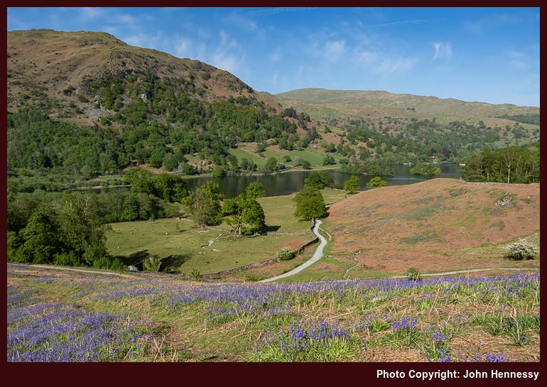
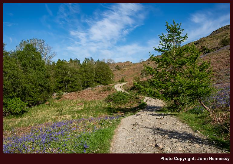
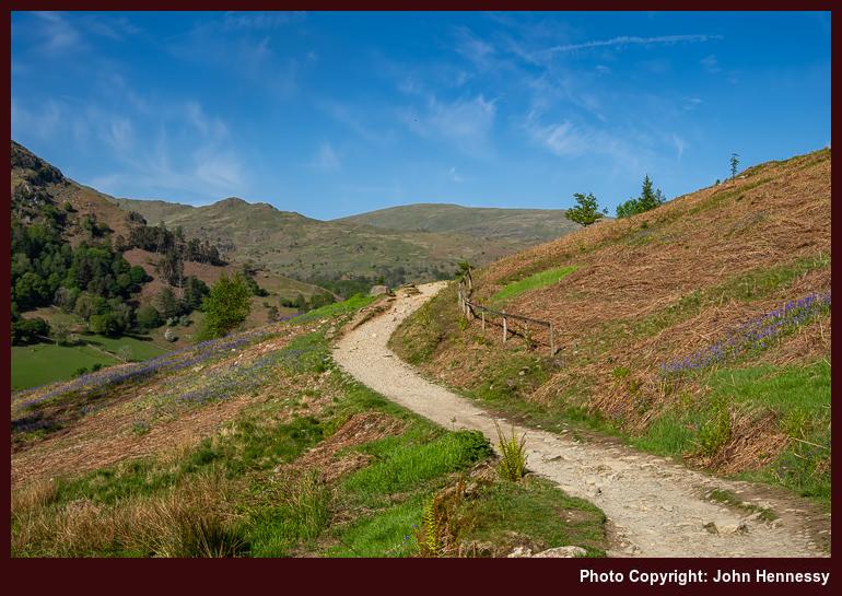
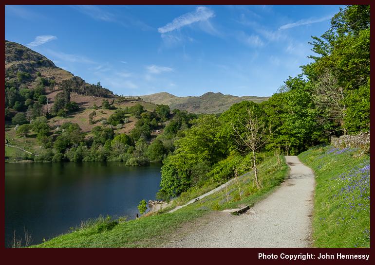
Unlike earlier sections of my walk, this one was busier. Others doubtless were drawn by the countryside and the weather, and their presence influenced my routing. Even with weary limbs, added uphill travel on a permissive path brought added quietude and more expansive views. As I continued on my way, I was reminded of that earlier Sunday afternoon. Then, whitethorn bushes and trees were in flower, while it became a moment for bluebells to hold my attention during the most recent encounter. All that lay around Rydal Water was catching the sunlight perhaps better than Grasmere, a happy accident of positioning.
My time around there ended with a wait at a bus stop for the next service to Windermere after getting to Pelter Bridge on a byway and subsequently walking back towards Rydal after that. Unlike a preceding occasion when a similar walk had continued to Ambleside, no such inclination arose this time. After all, rest was needed after all the exertions on what had been a satisfying day of rambling; it is days like these that draw you back time and again. In summary, the whole enterprise had drawn on previous encounters whilst also adding something distinctive to boot.
Travel Arrangements
For this outing, I took a round-trip train journey from Macclesfield to Windermere. From Windermere, I hopped on bus service 555 to reach Ambleside before bus service 516 took me the rest of the way to Great Langdale. Service 599 was used to get back from Rydal to Windermere at the end of my hike, allowing a chance to get some refreshments before I continued on my way home again.
Previously overlooked opportunities for walking and hiking near Oslo
27th August 2025 During last summer, two trip ideas entered my mind, only for them not to move any further. One was centred in Inverness in Scotland, which might have been progressed last September if I was organised to make use of a spell of fine weather while I was back in the U.K. A feeling of commitment to my new base in Ireland was the cause of scuppering that one.
The other was more adventurous: a trip to America's Pacific Northwest that could have taken me to Oregon (Portland was a possibility) and Washington State (Seattle being the obvious hub to use). A combination of complexity, not wanting added exposure to ongoing political travails, the complexity of such a venture and having other matters on my plate meant that nothing came of it. Given what has been happening since January, I may choose to leave North American escapades on the long finger for now.
That brings my mind back to Europe. For one thing, Switzerland has seen a good deal of me this year, and I passed through France too. Otherwise, conference attendance could take me to Hamburg in Germany later in the year if things fall into place. While I passed through the country on my way to and from Innsbruck in 2017, a multi-day stay would be a first for me. Speaking of 2017, not was that the last time that I was in Austria, the same could be said for Norway. Returning to either feels long overdue.
The odd thing about my Norwegian trips in 2016 and 2017 was that both saw me continue out of Oslo to reach Bergen and Stavanger, respectively. To be fair, my second encounter was longer than the first. Even with wandering around the city centre and shore, and embarking on a fjord cruise, that still left its northern forests and lakes unfrequented. With some ongoing time away from work, I thought about putting that to rights, only for the weather not to be encouraging. In any case, I could do with some rest after all the upheaval of this year anyway.
Thus, I need to pop this on my shelf of ideas for now. As a non-driver, it helps that the city’s public transport network makes this green hinterland accessible. That means that there are options that are easy to reach by train or metro. With an eye on future possibilities, I want to log some of them here so that I and others have them to hand for reference. A look on AllTrails should reveal many others of the same ilk if more inspiration is needed.
Quick Escapes Near the City Centre
Vettakollen
For those who wish to keep travel time short, Vettakollen stands out as a quick escape, offering a dramatic panorama without a long approach. With metro and bus links from central Oslo, it involves a short ascent to a summit that looks over the Oslofjord with a clear line of sight to Holmenkollen at 419 metres above sea level. The effort-to-reward ratio is conspicuously generous, which explains the steady mix of locals and visitors at the top when the weather invites lingering. Because the hike is short, it fits well at the start or end of a day and pairs neatly with other nearby walking if time allows.
Frognerseteren to Sognsvann Traverse
Another near at hand favourite is the traverse between Frognerseteren and Sognsvann, a multi-kilometre path across the southern edge of Nordmarka that connects two metro termini. Starting at the end of line 1 at Frognerseteren (469 metres above sea level) or the end of line 5 at Sognsvann, it delivers a marked trail through varied terrain, including stands of mature forest, wetlands and stretches of single track. Both stations sit within a five-minute walk of trailheads and the route is fully reversible, so the choice of direction can align with wind, light or onward connections. There are multiple rest spots along the way, some with views and others tucked in quiet hollows, so progress can be as swift or leisurely as the day dictates.
Frognerseteren to Lake Store Tryvannet
Those seeking a gentler outing often favour the path from Frognerseteren Metro Station through the forests of Oslo's Nordmarka, covering approximately 9.4 kilometres. The trail begins at an elevation of 469 metres and passes over Tryvannshøgda at 529 metres before descending to Store Tryvannet lake and continuing to the historic Tryvannstua lodge. Hikers can expect moderate elevation changes through classic Nordic woodland scenery with scenic views over Oslo and the surrounding forests, particularly from the elevated sections. The route connects efficiently to public transport via Oslo Metro Line 1, allowing for flexible return options, including loops back through parallel trails or continuing to other stops like Sognsvann. Those seeking a shorter alternative can opt for the 3-kilometre variation from Frognerseteren to Tryvannstua, which avoids the full lake circuit while still providing forest views.
Medium-Distance Routes
Kolsåstoppen
Those who prefer a clearer objective with a touch more effort often turn to Kolsåstoppen. This is an 8 kilometre loop with about 360 metres of elevation gain, reached by public transport to the Stein Gård area (bus 150) and best from April to November. The path rises over rocky slabs to exposed bedrock where the view takes in Bærum, the city and the fjord beyond. The route consists of two peaks: Nordre Kolsås at 379 metres and Søndre Kolsås at 342 metres, with a picturesque small lake called Setertjern between them. The loop format avoids retracing steps, and the underfoot interest remains steady thanks to a mix of soil, roots and granite. It stands out because it delivers broad vistas within a half-day format and rewards a moderate push.
Skar, Lake Øyungen and Mellomkollen
From the Maridalen side of the city, a route linking Skar, Lake Øyungen and Mellomkollen threads through lush woodland to a viewpoint that rewards the modest climb. Reached via transport links into Maridalen (bus 51 to Skar from Nydalen station, or train on the Gjøvik Railway Line to Movatn station), the walk is mostly easy underfoot with a few slightly hilly sections on the way to the summit. The highlight is the outlook from Mellomkollen where Oslo and the Oslofjord lie spread beneath, a satisfying contrast to the lakes and forest passed earlier in the day. The total distance is approximately 12 kilometres, with 500 metres of elevation change. It suits walkers who enjoy a mix of shaded paths, open rock and a defined target.
Lake Circuits
Sognsvann
Sognsvann itself remains one of Oslo's most accessible nature gateways. The 3.3 kilometre circuit around the lake begins a short stroll from the terminus of metro line 5 and can be walked by most abilities. Those with a little more time can extend the outing to Ullevålseter along well-graded paths. The extension keeps the easy character but lengthens the experience, taking in charming woodland and occasional views while staying within reach of a frequent metro service back to the city.
Lake Nøklevann
On the city's eastern side, the circuit around Lake Nøklevann combines shoreline scenery with space to slow down. The trail loops around this 3 kilometre long lake on the outskirts of Oslo, covering approximately 8 kilometres in total. Accessible via metro line 3 to Bogerud, the route passes green areas where families spread blankets for sunbathing, ball games and picnics. It is the kind of setting where a short walk readily stretches into an extended day by the water.
Urban-Nature Blends
Akerselva River Trail
Not every walk leaves the urban fabric behind straight away. The Akerselva river trail threads a protected cultural corridor from Maridalen to the city centre and can be joined at many points. As the path follows the water, the surroundings shift from forested stretches to older industrial buildings, interspersed with waterfalls, swimming spots and places where anglers try their luck. It is a route as popular with commuters seeking a peaceful detour as it is with tourists on a day's sightseeing, promising a sense of urban wilderness without ever losing sight of Oslo's neighbourhoods. Because the full length is flexible, it can be broken into segments to match the time at hand.
Lysakerelven River Walk
A similar blend of variety without steep climbing characterises the Lysakerelven river walk. Starting near the Oslofjord and running upstream to Bogstadvannet, the river transitions from a tidal outlet to woodland cascades and contributes waterfalls, narrow valleys and calmer stretches under a leafy canopy. Buses and the metro offer access at several junctions, which makes it easy to plan a one-way walk and return from a different stop. For some, the trail forms a segment in a longer day that links other paths, while others treat it as a stand-alone outing that foregrounds the changing character of the watercourse.
Bygdøy Peninsula
For a taste of the sea and a different set of attractions, the Bygdøy peninsula offers a pleasant waterfront walk that can be extended along side-paths as energy allows. The main line follows the shore, with frequent views and easy access to resting and swimming spots. Cultural sites and museums lie within short detours of the route, allowing a combined day of gentle hiking and visits. The ambience is relaxed and comfortable, which makes it a common recommendation for visitors looking to balance city and nature in one sweep.
Longer Treks
Krokskogen
For those with time to go a little further, Krokskogen lies beyond the city boundary and promises deeper woods with longer crossings. Peaks such as Oppkuven at 704 metres and Gyrihaugen at 682 metres give clear objectives and tie the day together, especially when combined with historical trackways that cross the forest. It is a good choice when the aim is to spend a whole day among trees and quiet lakes with a summit stop built in.
Maridalen Routes
Maridalen broadens the field with routes that combine history, a sense of space and room to lengthen a circuit. The valley's patchwork of forest and water sits on the city's edge yet can feel unexpectedly quiet due to its low population density. One option begins on the Gjøvik Railway Line at Movatn station and travels south to Skar, passing terrain that varies enough to keep the mind engaged. A poignant detail along the way is the site of a Second World War plane crash, which adds a reflective note to an otherwise bucolic day. The loop around Maridalsvannet itself runs to 12.6 kilometres and typically takes a little over three hours for an average walker, though it is often used for mountain biking and running as well. Buses from Nydalen (bus 51) bring walkers into the valley and dogs are welcome on these routes provided they remain on a lead.
More on Those Adjoining Forest Areas
Nordmarka
Spanning approximately 430 square kilometres north of Oslo, this vast forested wilderness forms part of Oslomarka, a larger conservation area covering two-thirds of the Norwegian capital. The landscape features elevated viewpoints such as Mellomkollen and Vettakollen that provide sweeping panoramas of Oslo, alongside the highest peaks of Svarttjernshøgda at 719 metres and Kirkeberget at 630 metres, the latter serving as a historically significant parachute drop site for Norwegian resistance fighters during World War II. A network of public cabins scattered throughout the forest offers places to rest, enjoy refreshments or spend the night, whilst the well-marked trail system accommodates everyone from casual walkers to seasoned adventurers. Easily accessible by public transport from central Oslo minutes, this protected natural playground embodies the Norwegian concept of friluftsliv and provides locals with an integral space for hiking, running, cycling, picnicking, skiing and sledding just a short journey from urban life. Access points include Frognerseteren (metro line 1) and Sognsvann (metro line 5).
Østmarka
To the south-east, Østmarka offers a counterpart to Nordmarka with hills and lakes that sit slightly lower but give the same impression of stepping into broadleaf and pine woodland. Entry points are spread around the edge of the forest, which encourages experimentation over several days, using different approaches to assemble a picture of the area's character. Metro line 2 to Ellingsrudåsen provides access to the northwestern corner, while line 3 serves the Nøklevann area. As with Nordmarka, waymarked routes run between lakes and tops, so days can be set to a preferred length and linked to a return by public transport.
Bærumsmarka
Located west of Nordmarka as part of the Oslomarka wilderness, this forested area (covering 70 square kilometres) offers gently rolling hills, tranquil lakes and an extensive trail network that attracts fewer visitors than its more popular neighbour. The region carries historical significance, with visible remnants of coal pits and ironworks from previous centuries scattered along various routes. Visitors can reach the area within 30 to 40 minutes from central Oslo using metro, bus or car transport, with common entry points including Øverland, Fossum and Sørkedalen. Well-marked trails throughout the forest connect to both Nordmarka and Krokskogen, providing options for brief walks and extended hiking expeditions through the quieter paths of this western forest region.
Closing Remarks
While compiling the above, I encountered some comments regarding the seasonality of these routes. My interest here is in hiking rather than winter pursuits like cross-country skiing or snowshoeing, and that is reflected in the descriptions that you find above. Also, I assume self-sufficiency here and overlook the presence of any facilities offering refreshments. There is an embarrassment of riches here by all accounts, making the previous oversights all the more remarkable. Should the opportunity arises, there is every reason not to leave Oslo on a future return to Norway. Bergen, Stavanger, Trondheim and the Lofoten Islands may have to wait.


