Category: Reminisces
Hiking over Lingmoor Fell and along Loughrigg Terrace: A journey from Great Langdale to Rydal
 28th August 2025
 In the summer of 2014, I left some unfinished business after another seed had been planted in my mind back in February 2009, when I hiked from Old Dungeon Ghyll Hotel back to Ambleside, and the experience sparked an idea that stayed with me. There was nothing to dispel what lay in my mind, not even a December 2016 trek from Great Langdale to Grasmere in stunningly crisp and sunlit if frigid circumstances.
It took until May 2022, as I began to shake off the constraints of the pandemic, for these inspirations to be merged into a fulfilling day hike. Thus, I finally realised a vision that had lingered for years: reaching the top of Lingmoor Fell and making new photos of Grasmere. This was a day trip in a time before I again began to stay away from home in the U.K., though a trip to Ireland had involved exactly that. My sequential arrivals in Windermere, Ambleside and Great Langdale offer occasion to potter about Ambleside while awaiting the bus to the last of these. Once I got there, my traipsing on foot could commence.
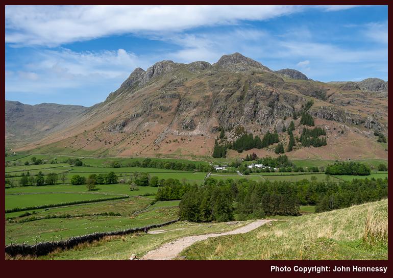
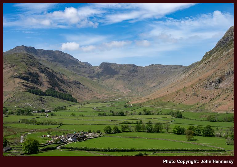
Once in Great Langdale, I began to make my way towards Blea Tarn, first along the lane leading to Little Langdale before peeling off onto public rights of way for the rest of the way. As I gained height in the heat of the day on the flank of Side Pike, views opened out below and around me. It was one thing to witness again the craggy eminences of the Langdale Pikes and quite another to peer along the line of the Mickleden Beck, one that I followed south under clouding skies at the end of May 2008. Seeing that under brighter skies was a definite bonus.
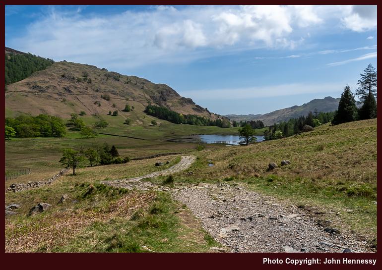
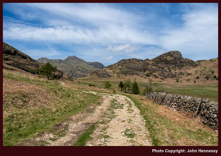
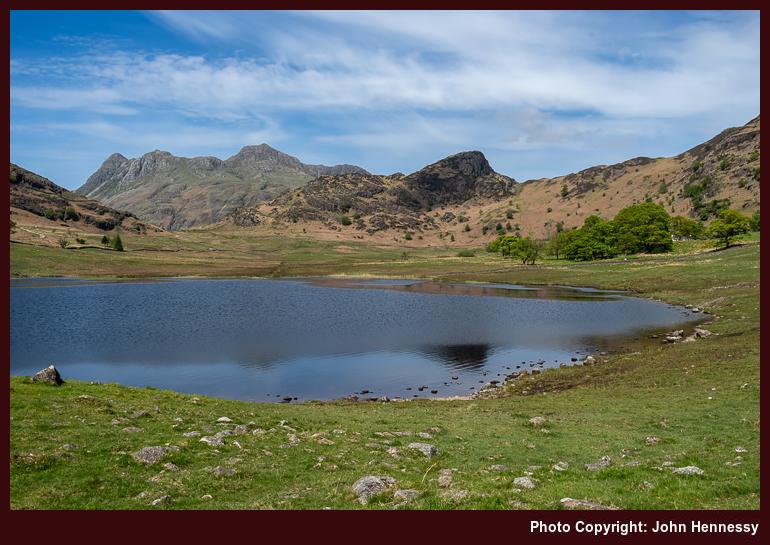
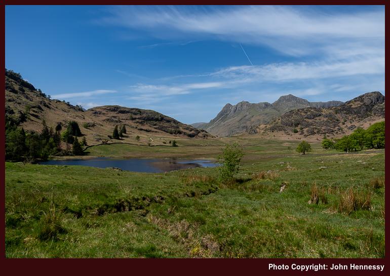
The way up from Great Langdale was unrelenting until I crossed the road to commence a trail below the slopes of Rakerigg. The easing of gradients beyond this point was welcome, though that meant losing those downward views that I had been enjoying before then. Nevertheless, there remained plenty to savour on the way to and around Blea Tarn. Some young people had music playing, something that was less easy to comprehend with the soundtrack that nature was offering. Maybe you have to live a little to grow to appreciate those natural sounds.
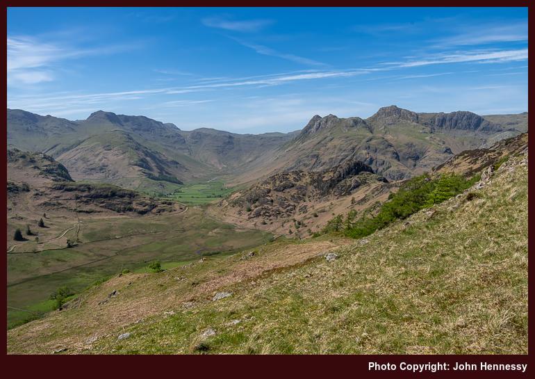
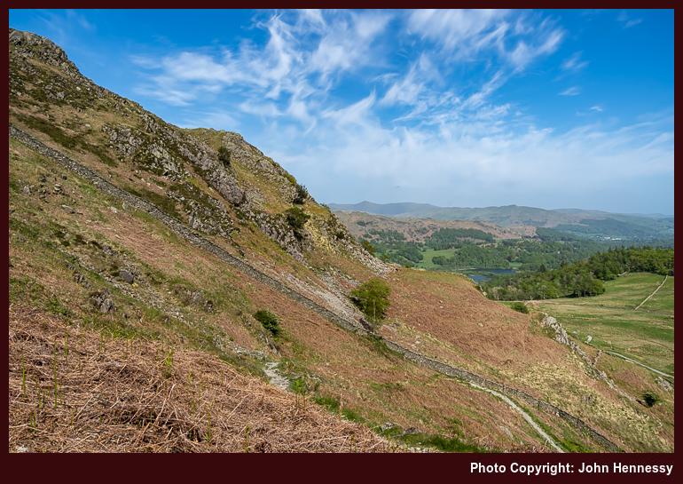
After crossing more level ground, a sterner test awaited: the ascent of Lingmoor Fell via a steep pathless flank. While going around by Bleatarn House to pick up an informal path following the line of a beck may have been wiser, I saved on distance by taking a more direct approach. Pausing to take in what lay around me was demanded by the gradient, as much as patience with my then under pressure legs. At least, the terrain had yet to be choked by bracken, making it easier to see where to place my feet. Fronds were slowly unfurling, though, a hint of what was to come.
In time, the slopes relented near Brown How, the summit of Lingmoor Fell. Naturally, I had to visit that top to witness the splendour that lay around me. All the while, I had been on access land, ensuring that no charge of trespassing could be made against me for the way that I went. A useful wall acted as a handrail for continuing on my way until I finally began the descent to Dale End, with glimpses of Elter Water and Little Langdale Tarn.
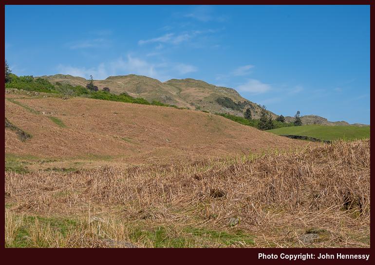
From Dale End, I pressed on towards Elterwater village in the afternoon heat. Kinder gradients meant that reasonable progress could be made, and I felt the need to push on in any case. A diversion around by Elter Water (the lake) was not on the cards this time around. That may be an excuse for a return to sate a photographic need. Instead, I crossed the B5343 to commence a taxing ascent to High Close, entering into countryside last frequented in August 2014.
Then, I stayed in the YHA hostel around there on a day through grew increasingly dull until rain arrived while I was exploring the surroundings after arriving at my lodgings for the night. Even under overcast skies, everything looked appealing, and I hiked to Grasmere village the following morning. The whole escapade had an end of summer feel to it and pervaded the journey home afterwards.
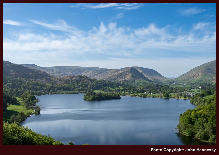
This time around, it was a lake that drew me and not a village. The afternoon was reminding me of an even earlier incursion, on a Sunday when transport foibles frustrated a trip to Wales. Then (which could have been in 2004), I ventured forth on foot from Ambleside before crossing Loughrigg and making photos as I went. However, the film stock that I used made exposures appear too red for my liking, inspiring the August 2014 reprise. Nevertheless, there was much to savour that earlier afternoon, etching it into my memory even now.
On leaving the lane during the 2022 ramble, I reached Loughrigg Terrace, the vantage point for the above photo. One thing that struck was that my timing might have been better because shadows were being thrown by the sun in places where having them lit might have given a better result. That brought challenges with composition that I may have overcome. After all, the outcome beats anything that I got before then.
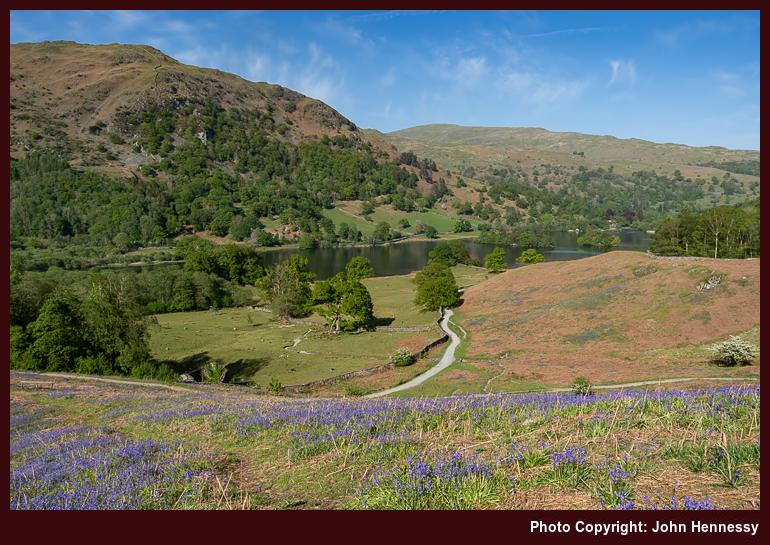
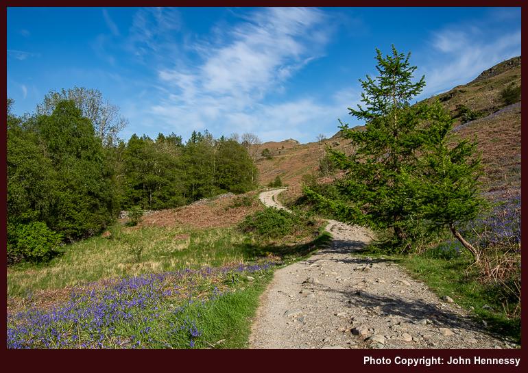
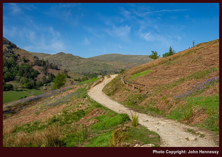
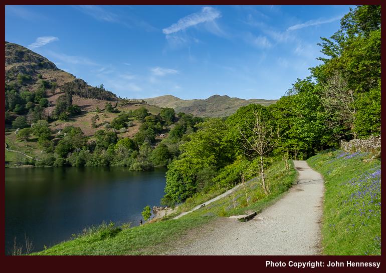
Unlike earlier sections of my walk, this one was busier. Others doubtless were drawn by the countryside and the weather, and their presence influenced my routing. Even with weary limbs, added uphill travel on a permissive path brought added quietude and more expansive views. As I continued on my way, I was reminded of that earlier Sunday afternoon. Then, whitethorn bushes and trees were in flower, while it became a moment for bluebells to hold my attention during the most recent encounter. All that lay around Rydal Water was catching the sunlight perhaps better than Grasmere, a happy accident of positioning.
My time around there ended with a wait at a bus stop for the next service to Windermere after getting to Pelter Bridge on a byway and subsequently walking back towards Rydal after that. Unlike a preceding occasion when a similar walk had continued to Ambleside, no such inclination arose this time. After all, rest was needed after all the exertions on what had been a satisfying day of rambling; it is days like these that draw you back time and again. In summary, the whole enterprise had drawn on previous encounters whilst also adding something distinctive to boot.
Travel Arrangements
For this outing, I took a round-trip train journey from Macclesfield to Windermere. From Windermere, I hopped on bus service 555 to reach Ambleside before bus service 516 took me the rest of the way to Great Langdale. Service 599 was used to get back from Rydal to Windermere at the end of my hike, allowing a chance to get some refreshments before I continued on my way home again.
Revisiting the Fairfield Horseshoe: A stirring trek through some of the Lake District’s craggy beauty
17th January 2025 The overriding memory of July 2022 is that of the record-breaking temperatures endured during the middle of the month. In hindsight, it would have been more productive not to have tried working through this at all, telling my client as much at the time. Scarcely anything could be accomplished in these conditions.
Not having air conditioning in a terraced cottage in the north of England was no preparation for temperatures exceeding 30° C around the clock, which meant that nights largely were sleepless as a result. Having a place near the coast in Ireland might have made for a good holdout while this was happening, something that only came into my possession last year, two years too late for that episode.
Before all that meteorological fury, I scurried north to the Lake District for a day hike. The destination was inspired by reappraisal of photos in my online gallery, a pervasive trend throughout 2022. It had been the most of twenty years since I first completed the Fairfield; a reprise came not before time. Since film photography was my mainstay back then, this was an opportunity to engage in some digital capture of what is found around there while following a similar route.


The preceding night may not have been as restful as I might have liked, yet I got to Rydal at around 10:00. On that round all those years ago, there were fewer people around until I got as far as Fairfield. The reprise was busier, especially on the ascent of Nab Scar, where the steep slopes caused others to clump together on rest breaks. Even at that stage of the day, there was summer heat to be felt, so the ascent was sweaty work.


When the gradients relented, I found somewhere to stop for a while to take on board some refreshments and savouring views of Rydal Water, Loughrigg Fell, Grasmere and whatever else lay about me. Because it was likely that there was a bolus all staring at once that morning, I left others pass on their way. One joked that they were on their second way around when they passed me again after my overtaking them during the initial ascent. It might have been prompted by the pandemic strictures easing substantially, but there was a feeling of added camaraderie on this round.

Once I got going again, Heron Pike was my next landmark. With everyone now more scattered, each could have more space, and that also applied to me. The going was now gentler than before and greater views were opening around me. It never ceases to amaze me how stiff the first few hundred metres of an ascent can be, only for things to ease off once you are higher up; then everything can feel a little more plateau like. This can catch you at the end of a descent too, as I found on this hike, and glacial action often is the cause of such arduous going.


The summit of Grey Rigg was my next staging post as I navigated the undulations atop a narrowing ridgeline; gradients again stiffened on the final approach to the summit to open up more views for me. To my left lay the narrow valley leading up to Grisedale Hause and then Grisedale Tarn. It was a scene showing the latter that I had in my mind's eye for its capture using newer technology than I had all those years ago. The further up and the further in that I went, the more that I got to savour.


Even with reaching the top of Great Rigg, I was not done with uphill gradients just yet. The last heave on the way to the flat top of Fairfield needed to be surmounted first. Patience was in order at this point before things became much kinder. On the way, I could glimpse my return route as it threaded between Dove Crag, Hart Crag and other eminences. Once on the top, the high point of my day's walking, I could glimpse St. Sunday Crag and Helvellyn to the north. The former was the subject of a yomp around eight years before, and the end of August would see me surmount the latter. There was topological majesty in every direction anyone could face, all brightly lit on the day.


Once you reach the greatest height of your day, the only way is down, not that such a reality means that it gets easier from there. Initially, the inclines were kind enough, and I could peer into Patterdale and make out the outline of Place Fell, a summit I surmounted in January 2010 at the start of a year of career turbulence for me. The list of fell tops that I would cross became Hart Crag, Dove Crag, High Pike and Low Pike.
It was after the penultimate of these that gradients again stiffened, that being my lot until I reached the floor of Scandale at High Sweden Bridge. Walking poles were essential for saving some knee strain, and patient foot placement was my lot while allowing the fleeter of foot to pass me; everyone has to hike their own hike. For a time, it seemed easier to follow the informal path by the stone wall instead of seeking out the line of the public footpath.
That came to an end when a challenging down scramble lay before me. Then, I sought out the public right of way to High Sweden Bridge, leaving the topological drama of High Brock Crags and Low Brock Crags behind me. This also left a walking group to go their way, possibly towards Low Sweden Bridge, mine turning out to be a quieter affair; the rest of the descent to Ambleside was now at hand. This broad track better suited wearied limbs, allowing patient progress to convey me safely onto busier streets, where I sought out the main bus stop after a satisfying day.
In summary, I had experienced what I came to encounter, making many images and enjoying the round. Though I normally seek quietude, the moments of shared camaraderie added its own special moments too. Any challenge posed by the warmth of the day has faded from recollection now; it was a scenic grandeur that stood out for me. This was a reprise more than worth doing as it took me around places that I have frequented before. It was great to see them all again.
Travel Arrangements
A return train trip from Macclesfield got me to Windermere. From there, I had a choice of bus routes for getting to Rydal for the start of the hike. The same applied for getting from Ambleside to Windermere. You can use either service 555 or 599 for this; the latter goes between Bowness-on-Windermere and Grasmere, while the former goes between Lancaster and Keswick.
Hiking lofty Helvellyn: A commendable scenic detour on the way to Scotland
15th January 2025 2022 was the year when I really began to emerge following the constraints of the pandemic. Trips to Ireland allowed me to become reaccustomed to staying away from home, as well as seeing more of the place than I had before then. While there had been day trips to the South Pennines, Wales and the Lake District, none had featured a stay away from home in the U.K. before the end of August.
My not having been in Scotland since 2019 was what drew me north. Other than having a client meeting, I cannot explain why I did not take Friday as a non-working day for travel to Stirling. That might have got me some better days for hiking up there, negating the return visits that I have described in other trip reports on here. We live our lives with so much unknowing.
Another complication was the performance of Avanti West Coast and Transpennine Express. Both operators were unable to operate their full timetables because of staffing challenges, resulting in many cancellations. That, and the Friday evening travel time, meant that I spent two nights in Carlisle, facilitating the third (and final) Lake District day hike of the year. Having pondered an ascent of Helvellyn during July, that became my choice. Terry Abraham's Life of a Mountain: Helvellyn was one inspiration behind that endeavour, and I reaped the rewards of my day around the Cumbrian landmark.

On Saturday, I headed to Glenridding from Carlisle, first by train as far as Penrith and then by bus from there. Car parks were full and visitors were struggling to find a space as I made my way towards Greenside Road, a gravel track despite the name. At one point, I found myself being asked if I was leaving, meaning that I was freeing up a space for someone. My mode of travel meant that I was no help in that regard, and I carried on from there to quieter surroundings. The sunny weather, the long weekend and the still reduced nature of international air travel all contributed to the busyness as much as the proximity of Ullswater and the surrounding fells.


Thankfully, I picked a quiet way to Helvellyn. It meant that I had much of the place to myself, though others very occasionally passed me. Naturally, there was an ascent too, and I noticed a certain lack of strength in my legs. Because the outing was part of a weekend away, I brought a heavier rucksack with me, the one that I used to use all the time before the pandemic came our way. Since the difference between that and the Lowe Alpine that I acquired in 2020 was easily perceptible, the effect on my legs was attributed to that. Taking things steady was the only option available.
Others could be seen on a track on the other side of the valley, highlighting that numerous route options are available. Because Striding Edge and Swirral Edge, well known though they are, seemed too airy to me, I opted for a gentler route. They may have been busy too, not the best when there is not so much space for everyone. Instead, I was bound for Whiteside Bank, from which the way to Helvellyn would take me over Lower Man. A longer option might have been to go via Stick's Pass and include Raise on the way; eschewing Helvellyn altogether, that might have opened up a myriad of routes leading north. One thing is certain: there is no shortage of hiking possibilities in these parts.


The skies might have been full of dispersed clouds, yet they still obstructed the sun from time to time. A few of episodes cam my way while I was ascending the flank of Glenridding Common and around Whiteside Bank, and there was less luck with sunshine for anyone around Catstye Cam. Looking back towards Patterdale drew my eyes to what lay behind me and how far I had come. The lack of rapidity was no concern of mine, given the delights through which I passed. After all, shortcuts can take longer, especially when there is significant height gain involved.


While I was up high, a pervading thought struck me: the views from a lofty vantage point can save much traipsing along the ground. When you have distant Skiddaw and Blencathra in your sights, as well as nearby Ullswater and Thirlmere, that point is rather rammed home for you. Throw in a sighting of Bassenthwaite Lake and the suggestion becomes incontestable. It is little wonder that Helvellyn draws so many, some of them from the Grasmere side of the fell.

Though this might be rugged countryside, Helvellyn's summit was a busy place when I was there that day. So many were making selfies around the trig point that I never got to touch it, a very human inclination that can possess me when I am near them. With all the scenic drama that lay around me, that was no omission and there could be no sense of loss. Though there may have been a compulsion to linger, there was a descent ahead of me. That meant that I needed to get going.

The way down to Thirlmere was unrelenting, possibly even brutal; this is not one to recommend for winter conditions when a fall could have consequences. In my case, it certainly took its toll on my knees, even with many breaks to savour the surrounding scenery. The hint of all this when a passing walker said that one of their number turned back on the ascent from Thirlmere. Others that following the same line uphill clearly were labouring and some were suffering, showing such signs of not being regular hill walkers that you could see them quitting. Even on the descent, pacing oneself became essential; this is not one to rush.

As often happens, the last part of the descent began to drag on for me. The routing felt indirect around Highpark Wood; it was a case of having come far yet having further to go. Once down on the A591 beneath Highpark Wood, the next move was to locate a bus stop to await the next service to Keswick. Thirlspot was in my mind, though it was not necessary to even go that far, which was just as well after the descent. While the terrain may have been more level, any rest was appreciated, and I marvelled at what I managed to get down while looking back on the route.
The bus to Keswick came soon enough, which felt just as well given that I was near a car park that was located away from so much. Even so, there are numerous trails around there would be more suitable for some of those trying to go up my descent route. My time in Keswick was brief, since I fancied getting going back to Carlisle as soon as I could. Cancellations of train services lay on my mind a bit, and they affected my eventual departure from Penrith so much that I wondered at my haste to get there. It felt like a ghost town after the busier spots in the Lake District, especially when so much natural glory had been my lot that day.
Travel Arrangements
Bus service 508 got me from Penrith to Glenridding after a train journey from Carlisle. The train journey to the latter featured changes at Manchester and Wigan. Bus service 555 got me to Keswick from the end of my hike, while bus service X4 or X5 got me from there to Penrith for a train back to Carlisle. The next day, train travel conveyed me from Carlisle to Stirling, with a change in Edinburgh. The rest of that story is elsewhere on here.
Added springtime serendipity around Stirling and the Trossachs: From Forthside to lochside
14th January 2025 To complete, the Stirling series of trip reports, I am leaping forward to April 2024 to relate the rest of the excursion to Stirling that closed out my rambling around Ben Ledi. That portion of the trip has been described already as part of the collection of hikes around Callander's main local hill. That was not the only highlight offered by a few days of sunshine that contrasted with previous dull weather stints in the area.
Footsteps Around the Forth
Stirling is not always a dull weather spot for me, though. While my first encounter with the place in 2002 might have gone like that, others have not been so. Typically, they have been weekend affairs, with a Saturday arrival and a Sunday departure. There are a few that stand out in my memory. One from November 2023 is among these with its incursion into the Ochil Hills on a gravel track shod with lighter footwear, not my usual way of working. That too has been described elsewhere as one of a collection of hikes around the said hills. There has been some slicing of hill walking trips to the area, of which this is another example.
Returning to Stirling walks, one from February 2016 remains lodged in my mind, coming as it did in a period of great change for me. The Sunday of that weekend came as a crisp, chilly, sunny day that I could not waste. Going inside to see what is in Stirling Castle or the Wallace Monument did not feel right to me, so I stayed out of both of them. When there is a significant fee, there often is a commitment that I am not willing to make.
My traipsing then took me around Gowanhill, the caste perimeter and Old Stirling before I wandered in the direction of Cambuskenneth Abbey, or what remains of it, which sadly is not that much. Then, I pottered around the Wallace Monument before circling around to Old Stirling Bridge. All this occupied enough of the day beside part of the River Forth that I had no inclination to approach the Ochil Hills, which I was then viewing from further afield.
Stirling's Castle has its photographic attractiveness, and that brings me to May 2019 when I arrived in the city to make use of some evening lighting. Otherwise, it was a case of retracing old steps before returning south after the last of a string of Scottish incursions, mainly centred on Edinburgh and starting around Easter of the year. For later visits, the motivation was photographic, while the Easter escapade featured much walking and slaying of old wounding memories from my time living in the city for educational advancement.


The first evening of my stay in April 2024 drew on those previous visits to Stirling. Wandering by the River Forth took me by the Cambuskenneth Abbey ruin. After a photographic vigil, I set on for the Wallace Monument while more photographic exertions resulted before I started to explore the trails around Abbey Craig. Since the monument was shut for the day, there were few about to intrude on any solitary ambling. There was much to savour in this compact area before I again struck on for Old Stirling Bridge and followed the River Forth as far as Forth Valley College before turning towards the castle while the day wore on towards sunset. The light was faded, so photography was near halted, or at least the results got regarded as mere record shots. Going around by King's Knot, I made my way towards the lodgings for my stay, noting in the west where I was headed the following morning.
Lochside Rambling from Callander to Aberfoyle
It is often that an outing inspires a follow-up excursion. It was during the hike around Ben Ledi that I spotted an information board mentioning the prospect of circumnavigating Loch Vennacher among other possibilities. Naturally, that popped an idea into my head. With the Ochil Hills being closed off by an incursion in November 2023, that left a day free to make use of the idea. It all was in the spirit of serendipity, and that was set to affect the execution as well.
Thus, I returned to Callander after the gifts of the previous day. Hovering over the day was a throwback to the English August Bank Holiday weekend in 2007 when I ventured north to Scotland to hike part of the Rob Roy Way from Drymen to Callander with a stopover in Aberfoyle. A tumble in a train station rather cast a shadow over the proceedings because of my having hurt my ribs at the time. That made the use of a rucksack more challenging, especially since I was carrying quite a load for the weekend. Nevertheless, I managed to follow through on my plans with an overcast arrival in Callander after a sun blessed start in Aberfoyle. Even so, there were many thoughts about coming back to the area that were lost to me until I revisited that old trip report, even giving a little re-editing for clarity.


Thus, when I followed the A81 across the River Teith after a circuitous deviation caused by my stocking up on refreshments, I probably was reversing a route taken nearly seventeen years before, albeit in continuous bright spring sunshine. It was as if I were using an idea parked in my writings for years before. Once off that A road, which can be busy, I was on quieter tarmac. Since this also is part of National Cycle Network route 7, I also had cyclists for company, even leap frogging a duo until they got going and left me after them. Heavier traffic like timber lorries can go this way, so care is needed, and there was one that passed me at one point. Mostly, though, I was in quiet surroundings.


Patient trotting conveyed me to the shore of Loch Vennachar, which I had viewed from around Ben Ledi the day before. Some wild swimmers were in the water, and I left them to their pursuit, surveying what lay north of me. Naturally, one of the hummocks was Ben Ledi and its neighbouring hills. One of these, Stuc Odhar, even appeared its equal in a distance of some kilometres; in reality, the summit heights differ by over two hundred metres. Nevertheless, these were to detain my attention for much of the way.
All the while, there were constant reminders that Aberfoyle is not that far away; Scottish Rights of Way Society signage offered evidence of that, tempting me to reprise the former route from August 2007, albeit in reverse. Even so, I stuck with the cycling route because that hugged the loch shore. After an awkward meeting with others near the Sailing Club premises around East Lodge, I continued past West Dullater with a brief stop at the Invertrossachs Scout Activity Centre, where I was reminded of days spent at the Firbush Field Centre during my university days in Edinburgh.
Around Invertrossachs, I left the roadway for a narrower track that still acted as a cycle path, forming part of NCN 7. It amazed me that the trail was in use by bicycle tourers, given the lack of width. Thankfully, it was quiet and a pleasure to stroll, with only one cyclist passing the way. While the bucolic woodland may have limited views, they had been somewhat unchanging anyway.
That had altered by the time that forest cover began to thin to allow views of the western extent of Loch Venachar, which was petering out, unlike its eastern end, which is dammed. All this may have started below the dam of Loch Drunkie, which I would meet later; at that stage, it was hidden among the trees around a kilometre away to my left. My surroundings began to feel more peopled as I approached the track junction where there was a sign for Aberfoyle, one of several that I had passed that day.
A desire for ice cream lured me onto the route of the Three Lochs Drive to find the way to Brig o' Turk. If I had stuck with my initial plan, the Great Trossachs Path would be carrying me back to Callander. Instead, I had decided to make for Aberfoyle, conscious that its last bus to Stirling was earlier in the day than that from Callander. Nevertheless, I continued to Brig o' Turk on what became a fool's errand, for there is nary a service station in the place. However, I did get to spot the way to Glen Finglas, somewhere that tickles my fancy for another time.

On the way back from Brig o' Turk, I took a chance and went as far as Loch Achray before circling back to the junction where I left the NCN 7. Time was on my mind at this point because the twists and turns of the trail to Aberfoyle made for difficult ready reckoning of progress. Even with the noticeable strength of the sun and the heat of the afternoon, I pressed on uphill.

In time, I would meet with Loch Drunkie and stop for photographic exertions on a periodic basis. The Forest Drive was being well-used by then, not necessarily the most relaxing situation for a passing hiker, though it was to have a compensation later. Many were stopped by the loch, which hardly was a surprise in the circumstances. Once past this sprawling watery landmark, the heat experienced on broad forestry tracks was punctuated by a random act of kindness: a Tunnock's Tea Cake was offered through a car window, and it would have been rude to refuse it. Profuse gratitude after acceptance could be the only response.
Near an unseen Lochan Reòidhte, the Forest Drive route was left behind me as the trail entered shadier surroundings, another blessed relief from the weather. While warm sunshine is great and is sought, there can be a cost for a journeying rambler; using sunscreen is a must (especially for fair skinned types like me), as is keeping hydrated. A descent laden with progress lay ahead of me, yet my thoughts turned to anyone coming the other way on this steep track. It was becoming clear that my timing worries were for nought; there was plenty of time in the end.
Once the gradients slackened, aching limbs needed coaxing to continue the rest of the way. Thankfully, the end was in sight by then, and refreshment supplies were augmented ahead of a replenishment break before the bus appeared. That left me about an hour in Aberfoyle, a very quiet place, while I was there. Protesting knees got some respite as information boards were surveyed. Not without reason has Aberfoyle been highlighted as a centre for mountain biking, with all the tracks and trails that thread the Queen Elizabeth Forest Park. The moniker "Gravelfoyle" has been invented to reflect this, for there is much here, though some steep slopes can be expected. To one weary wanderer, all that felt far away, so the arrival of the last bus to Stirling was a welcome sight.
Looking through photos now, I realise that I pottered around Stirling again before retiring for the night. There should have been continuing fatigue after the day's exertions, yet the sunny evening drew me outside again, though not for an extensive stroll like the first evening in the city. The next morning, sunny surroundings may have attempted to hold on to me only for life's responsibilities to ensure that I returned south again. Nonetheless, there remained an air of satisfaction as I did so. Scottish sunshine had done its magic and its landscapes gleamed as a result.
Prospects and Reflections
Though I might be less inclined to focus my attention on Aberfoyle, I am left with some ideas for possible future visits to these parts. Hiking the northern side of Loch Venachar is one option with a few added extensions. Glen Finglas is the first of these that could be part of a larger circuit around Ben Ledi. After that, there is Loch Katrine, which lay some kilometres west of where I found myself, and time was against my reaching its shores. A lengthy out and back trot from Callander would fit in that one during longer daylight hours. Sometimes, adding to one's ideas collection can prompt a fear that one will remain ever distracted by them and unable to attend to the essential matters of life. Even so, it is even worse not to have any at all.
From distant viewings to up-close encounters and incursions: autumnal traipsing in the Ochil Hills
12th January 2025 It was a series of weekend visits to Stirling that drew my eyes towards the Ochil Hills to the east of the city. My first recollection of that happenstance takes me make to February 2016, in a period when other life activities sapped energy for exploring the outdoors. Just finding a hotel for a night and wandering around the historic citadel was enough for me. There were other visits, like a photography inspired one in May 2019, part of a run of Scottish incursions that year. The pandemic confined me to local wanderings, yet the possibility of a Scottish one based in Stirling never left my head.
When Scottish hill country outings came to mind, the lures lay further north and further west. It was too easy to pass Stirling en route to elsewhere. Eventually, thoughts turned to using the place as a springboard for exploring less familiar parts. Overlooked though they might be by many, that meant the Ochil Hills; they inspired a first trip to Scotland late in August 2022. While heading up there, the idea of Ben Ledi also popped into my mind, dividing my loyalties in the process.
The Ben Ledi forays get described elsewhere, while this report collates those centring on the real inspiration for the August bank holiday weekend excursion. There was a return several weeks later in September, around the time of the Royal funeral for Queen Elizabeth. That was to attend to some loose ends from the first traverse when a soaking was my lot. Though there was an added consolation at the end of August before I headed south again, it took until November 2023 for some photographic closure to be reached.
A Tillicoultry Circuit That Got Me a Soaking
If the weather that I had enjoyed during the ascent of Helvellyn on the last Saturday of August 2022 had continued, there would have been no dilemma posed by my dreaming up an ascent of Ben Ledi to complement an incursion into the Ochil Hills. However, the run of Scottish weather did not make life that easy, even if it looked promising when I got to Stirling on the Sunday of the same weekend when I hiked up and down Helvellyn.
Based on the height of Ben Ledi, I decided to visit that on the bank holiday Monday when I had a guarantee of clear summits. The bank holiday was English and not Scottish, which made public transport work better for me around Stirling than it would have done around Macclesfield. The decision meant that I left the lower tops of the Ochil Hills for a day when summit visibility was not a foregone conclusion. There was a price to be paid for that.
There is an enduring memory of dark dreich mornings during this August sojourn. Even so, that must not have been the whole story, for I got some brightness to start my Ben Ledi foray and a brief incursion into the Ochil Hills in bright sunshine before my journey south. Two mornings would have brightened on that evidence.

The problem then was the morning of my first Ochil Hills traverse. However, the air remained drier at lower levels; the problem was when enough height was gained. There was another hitch: the initial plan had been to ascend Ben Cleuch from Tillicoultry and then proceed east from there. Though there was a warning about a collapsed section of path in Mill Glen, I decided to see if the difficulty could be surmounted. When I found that was not a possibility, I more or less retraced my steps to go west towards and through Ochil Hills Woodland Park. There would be no ascent of The Law, not that it bothered me that much.
From there, I went across Silver Glen to pick up the track leading past The Gowls and The Nebit. If I had wanted an escape route, the way to Alva was signed, but my mind was decided by then. In time, I left the main track to ascend Ben Ever and go into the clag that would soak me until the descent towards Dollar. While visibility was reduced, making use of navigational handrails like fences kept me from going astray. At least, I could not see anything of the wind turbines that were near at hand.
From Ben Ever, I made my way to the summit of Ben Cleuch, the highest top in the Ochil Hills. Given the restrictions on visibility, any descent to Tillicoultry via The Law would not appeal to me; it felt too risky to me in the circumstances. Avoiding that original planned ascent of The Law, found in a guidebook, might have made me use slopes that were less punishing, never a bad thing. In a similar vein, manageable undulations were my lot as I continued from Ben Ever to Ben Cleuch and then to Andrew Gannel Hill. The name of the latter may suggest that it was named after a real person, yet it is more likely a corruption of an earlier Gaelic name.
After Andrew Gannel Hill, the subsequent descent and ascent needed to reach King's Seat Hill was more noticeable, and peering along the glen leading back to Tillicoultry made me wonder what delights could be savoured if the weather so allowed. This could have been another escape route if I had wanted it too. With a certain determination, I crossed the last major summit of the day before beginning my descent to Dollar.
That dropped me out of the damp cloud to allow my gear to dry a little. The views were clearer too, though there remained a pervading general greyness. Now that I think of it, I had the hills to myself, which was more of a bonus than a consolation. Maybe there are times when dreich and off-putting weather has its upsides.
My descent route took me past Kames and the Banks of Dollar before crossing the top of Bank Hill to commence the final descent into Dollar Glen. The ruin of Castle Campbell lay below me as I continued downhill. Once on the floor of the glen, I may have tarried a while for some refreshments before continuing; lunching on the tops was out of the question. Students of the Dollar Academy, one of Scotland’s independent schools and an alma mater of Hamish Brown, well known for a first continuous self-powered round of Scotland's Munros, were out and about. That did nothing to stop me acquiring more refreshments, for my journey was not over yet.
Dollar had lost the regular bus service that it had before the pandemic, so I needed to reach Tillicoultry for the nearest stop with a regular service. This feels a bit odd since the southern side of the Ochil Hills is bedecked with places that are not far from each other. In any event, I made for the combined Devon Way and National Cycle Network route 767 that ran along the trackbed of a dismantled railway. Shadowing the River Devon, I shortened the journey to Tillicoultry while glimpsing as much as I could see of the nearby hills, among which I had spent much of the day. This last portion did not take that long to complete, so I could catch the bus to Stirling and dry out even more after my wetting.
Much Drier, Albeit with Limited Sunshine
The combination of a feeling of unfinished business and the instatement of an extra bank holiday due to a royal funeral, that of Queen Elizabeth, meant that I had a chance to go north again. After travelling on the Saturday of that weekend, Sunday was available for what became a walk from Alva to Dollar and Tillicoultry that diverted through the Ochil Hills. There may have been some breaks in the cloud, yet conditions remained largely overcast, not that it troubles me as I write these words.
From Alva, I made for Alva Glen before climbing out of there to approach Silver Glen. My route instead shadowed the glen as I reprised the way that I went a few weeks before. Passing The Gowls and The Nebit, I did not continue to Ben Ever, but instead kept going until the track petered out near Ben Buck. As I kept looking back, I marvelled at what lay behind me and wondered how the landscape would appear if the skies had been more cooperative.
Once on Ben Buck, I realised how close the wind turbines were. Though we have an ongoing climate crisis, these fixtures are controversial in any landscape, and the Ochil Hills are no different. Not being a fan of such industrialisation, they intruded on how I previsualise my preferred photographic results to be. Once something is in place though, we just have to bear with me, and I kept walking according to my plan.

An undulating course took me across Ben Cleuch and Andrew Gannel Hill. To the north of where I was wandering, I could glimpse sunlit hills, perhaps wishing for a swap or a bit more inclusion from those breaks in the cloud cover. It needed patience, but some magic began to happen when I was around King's Seat Hill. It started when I was still ascending after the hefty height loss on the way down off Andrew Gannel Hill. Would it deny me while I was labouring uphill?
Thankfully, it did not. In fact, it gave me time to be in position for the desired lighting and made me wait for it, too. Thus, I dawdled on a photographic vigil that yielded some passing success. When the show ended, I began to make for Dollar again. While the route was similar to that of weeks before, my mood differed after the light show I had been gifted. The day of the week allowed more to be around the town while I continued on my way to Tillicoultry, going the same way as before.
Consolations and Resolutions
This part of the account is going to hop and jump in time. The overarching connection is autumnal sunshine, though in different years and circumstances. It illustrates the strange ways in which closure can be reached. A certain sense of being underequipped is associated with this portion of the compendium of accounts.

Firstly, we head back to the last morning of the first trip at the end of August. Inadvertently, I left my Pentax DSLR on overnight and the battery was exhausted. Thus, I resorted to a Canon RP instead, even if that was not as well-endowed with battery capacity and also was not fully charged; some recharging was attempted when morning sunshine was noted. Thus, I headed to Alva while shod in Merrell trail shoes. They did the needful as I climbed out of Alva Glen on the way towards The Gowls, and sufficed for the descent too.
Numerous photos were made before the Canon's battery ailed, meaning that I needed to use my phone to capture what other delights were on offer. Time was at a premium, too, since I needed to check out of my hotel and travel south. Even so, I was not denied, as the above photo should show you; that was made with the Canon, too. The experience likely encouraged me to return to Stirling a few weeks later.
The same trail shoes, albeit older and showing their age a bit, facilitated another incursion into the Ochil Hills, this time in November. Having halted in Edinburgh a little that day before, mainly for seeing what I could do with eastward views from Corstorphine Hill. That night was spent in Stirling, though, and I had designs on gentler strolling the next day.

Before something more expansive happened, I had to visit Gowanhill in Stirling before sampling its delights. After that, I caught a bus thinking that I was going to Alva. However, I blundered and was on the bus to Alloa via Tullibody instead. It might have been my Irish accent, but the driver should have told me when I said Alva. Realising my mistake, I made do with starting from Alloa for Tillicoultry on a wonderful morning. This was no hardship and placed no restrictions on my rambling on a November day with shorter hours of daylight.

This time, the Devon Way and NCN 767 combination would get me to Tillicoultry from Alloa, expanding the extent of the route that I have followed over the course of time. Others were out and about, some walking dogs. Once beyond Alloa and nearing Tillicoultry, the Ochil Hills were laid out beside me, making me wonder if I could see Ben Cleuch. In short, they were showing nicely.


On making my way through Tillicoultry, I joined the Hillfoots Diamond Jubilee Way near Lady Ann's Wood. That showed me more of the hills while on the way to the place where I once had hoped to ascend The Law on that first damp traverse of these hills. Passing that, I followed a more direct way than before; the first visit had seen me traipse through the grounds of a disused quarry that I avoided on the November stroll. This was to be a far more civilised amble.

The Ochil Hills Woodland Park was the next landmark on my way. The trees were barer than on that August hike from more than two years before. The sun broke through too to make for a far more happy passage among the trees. While proceeding uphill took me towards Silver Glen again, there was much to relish.


Once beyond the woods, I found myself below The Gowls. When a lady rambler asked if I was going far, I gave a partial answer because I felt not a little underequipped for hill wandering. People are so friendly in these parts that I wonder if they know me without my knowing them. On my second time in Dollar, I found a lady giving me a broad smile from her car that set me wondering.


Once I began to follow the track in earnest, the human encounters declined to nothing, and I could savour the scenic delights in the wonderful afternoon sunshine. The experience showed me what was missing on that second time in the area. At the end of the track, I just turned back. It felt adventurous having even got that far; the top of Ben Buck may have been near, but I prefer to use boots for off track travel like that. Shadows were lengthening, too, reminding me that getting to Alva was pressing. Thus, I set to doing just that and retracing steps from before for that descent. The gradients made me wary until I got to Alva Glen, especially around The Gowls and even when nearing the glen itself. Confidence in one's footwear makes a big difference.
Once on Alva's main thoroughfare, I set to awaiting the next bus to Stirling, keenly aware that I might have been cutting things fine for the rail journey home, especially for getting beyond Stockport to Macclesfield; trains stop running earlier on a Sunday. There must have been no issue in the end because that surely would reside in my memory. The trail shoes would be partially retired after I noticed stitching giving way on one of them while on a trip to Limerick a few weeks later. Over the course of three years, they had acquitted themselves well enough to encourage me to get a new pair anyway.
Reflections
One thing that has not been mentioned in these accounts is what inspired me to go following the trails that I did. The short answer is that a Cicerone guidebook had its part to play. In some ways, I ended up assembling routes from portions of what it described while combining others. As ever, there is more to explore, even if that needs more commitment than using the local bus service 52 (it was service 51 that I inadvertently used in 2023). So much has been savoured so far that other designs can wait while other places get their time too.


