Category: Places Explored
Journeying through rock-strewn moorlands on crossings from Staffordshire into Derbyshire
The notion of trekking from Leek to Buxton on foot had long lingered in my mind. Quite how my mind returned to it for the idea to get used more than four years ago is a bit of a mystery to me now. All that I can suggest is that there was a bit of returning home by means of a hike going on that year, and this might have been part of that trend. In June 2021, I embarked on a Leek to Macclesfield hike that shadowed some of the places encountered on this pair of treks; there have been a few of those over the years.
A Long-outstanding Journey
Given that I was ascending and descending a lot during a day trip to the Shropshire Hills near Church Stretton In Shropshire the previous day, one might have thought that an arduous jaunt, spanning over seven hours, would not have been in order. However, that is not how my mind was working in 2020; the need to get out of the house for a while was a strong impulse then.
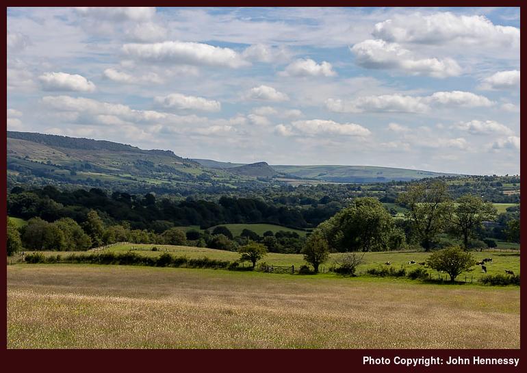
Once propelled to Leek by my intentions, I then set off on a circuitous route that rounded Tittesworth Reservoir. That passed Brough Park to reach the lane leading to Abbey Green, where I joined with part of the Staffordshire Moorlands Walks. There was a lot of quiet at this time as I traipsed towards North Hillswood and then shadowed the reservoir all the way to Meerbrook, first off-road and then on tarmac with many cars parked, and some people around them.
Passing Meerbrook took me away from any congregations of humanity that there might have been and onward towards Frith Bottom and Middle Hulme. All this kept me away from the reservoir itself, which was likely busy because of the August Bank Holiday weekend, at a time when overseas travel remained heavily restricted.
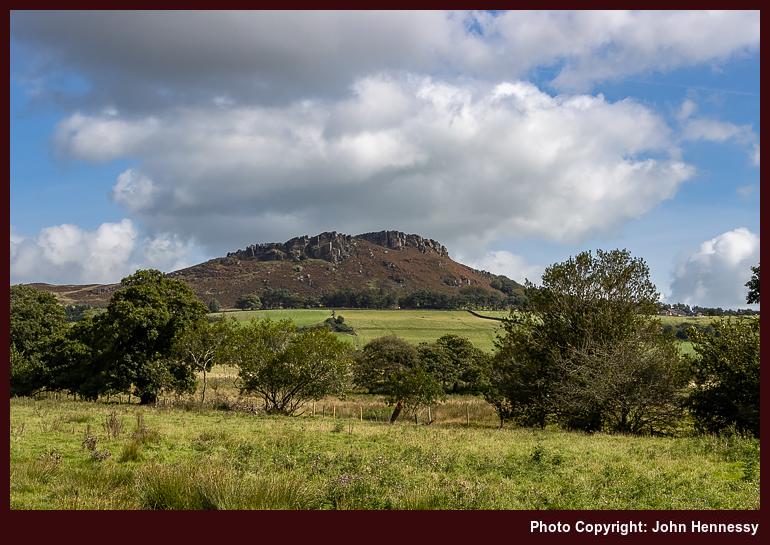
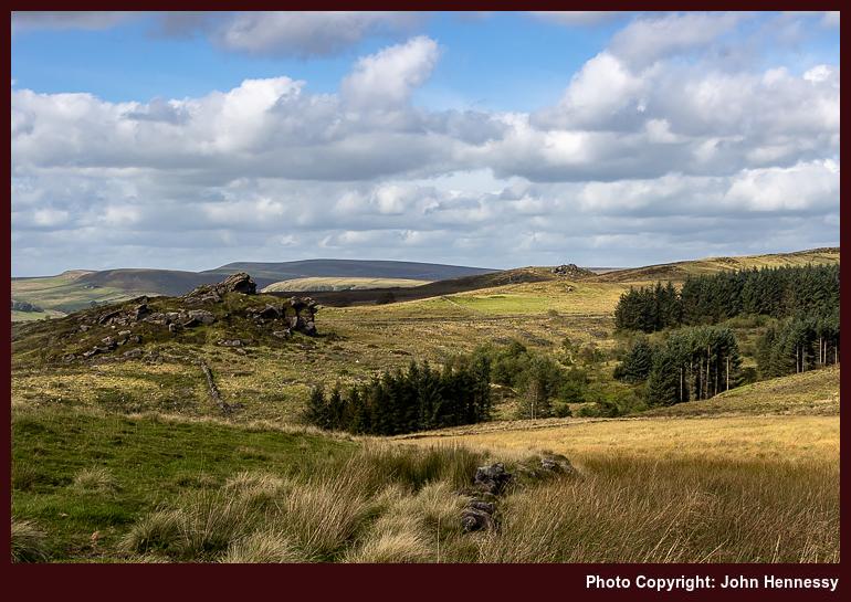
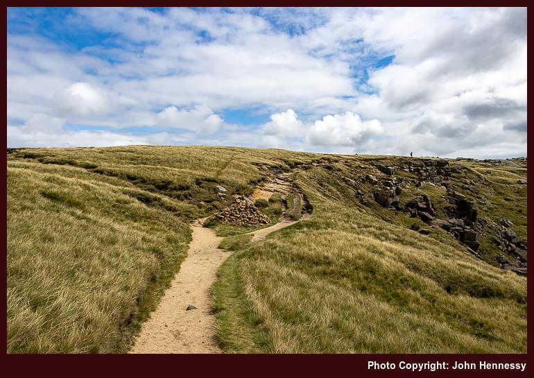
Following Whitty lane took me to Upper Hulme, where I again encountered more people out and about. By this time, I was on the Churnet Way and nearing Ramshaw Rocks, partly the lure for my strolling. While there had been much sunshine in Stoke-on-Trent, nearly causing me to miss a bus connection, this had declined steadily over the course of the day to leave things largely cloudy by this point. Nevertheless, I stuck with my plan.
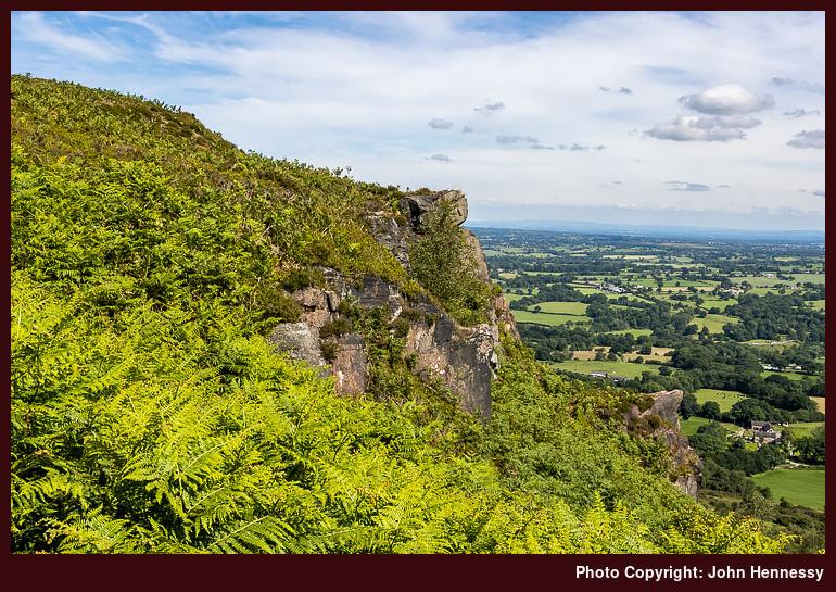
The rocks attract their share of climbers too, though The Roaches may be the bigger draw. There certainly were plenty of cars parked along the lane beneath them whenever I stole a look earlier in my hike. The dull weather nullified any photographic point in making anything other than shots of them for record as I was passing. Proximity needed to be enough for me, until I found the kind of sunshine that accompanied walks along The Roaches from which I could see them from a distance.
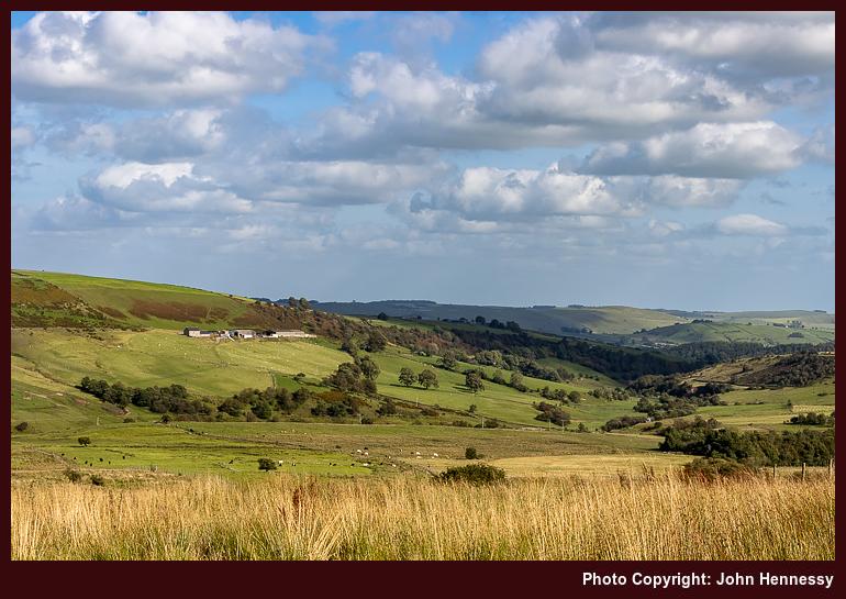
Beyond Ramshaw Rocks, my surroundings grew quieter again, and I was going to have a lot of this on the rest of the way to Buxton. Leaving the Churnet Way, I continued towards Black Brook Nature Reserve. In places, more rocky outcrops were to accompany me, yet there is another more abiding memory: the land was waterlogged, later affecting my choice of route. Before that, I passed Gib Torr Farm, Adder's Green and Ann Roach Farm (careful navigation was needed around the last two) to reach Flash Bottom and tarmac.
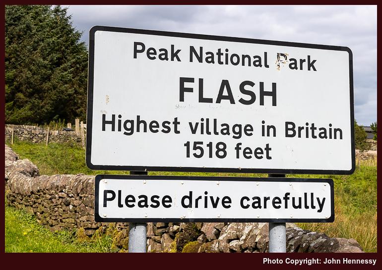
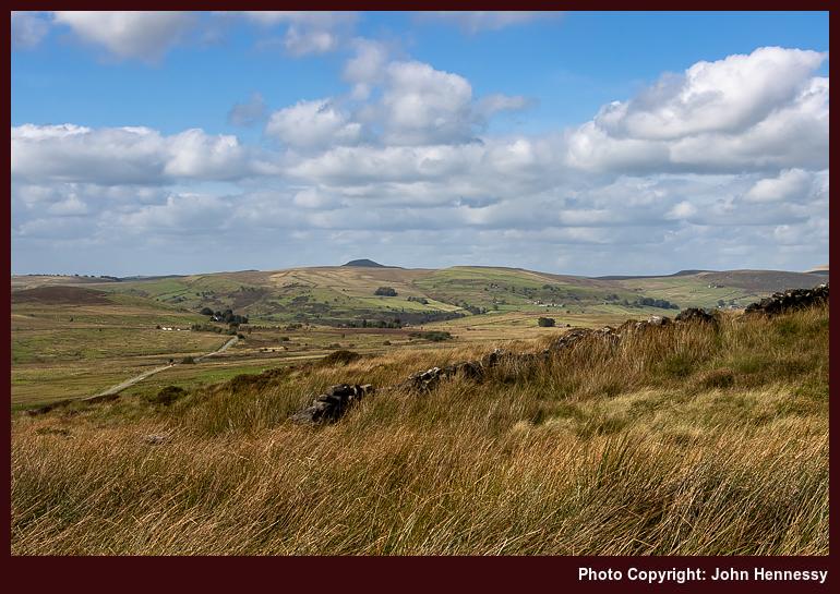
All the soggy plodding convinced me to stick with the road, not only as far as the village of Flash but also onto Flash Bar Stores, to whose webcam I have linked elsewhere on this portal. Though going by the A53 is not my normal routing, it also was a concession to my wearying limbs. The village itself was a quiet agrarian place, so I was content to pass on my way. Later views of Axe Edge were to give visual occupation.
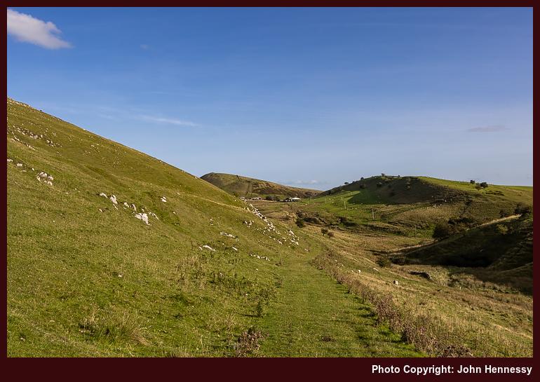
It is just as well that I noted the landmarks dotting the final approach to Buxton, such is the number of options available to any rambler. Figuring out where one went otherwise would be toil. Quiet lane walking took me to Dove Head before a gravel track got me to Brand Side. Somewhere in the middle of all this, I took some refreshments that I had with me, maybe it was beyond the latter. The ups and downs on tiring legs may have convinced me to do just that before getting as far as Stanley Moor. On the way from there to Grinlow Tower, someone may have asked me how about finding out where to go, and I had to admit there was an app that I was using. These were lightweight times, even if I always had a paper map with me.
With a longer wait for the next train, I opted for bus travel instead. Even after all the distance that had been travelled, I was there in ample time for the next one. The skies may have been grey much of the time, yet this was a satisfying outing. A return would be needed to see more of the countryside in sunshine, and that was to happen. Given the fears of the time, social distancing was a given most of the time, and there was a lot of restorative tranquillity too.
A Sun-Kissed Reprise
The dearth of sunshine on my previous excursion from Leek to Buxton provided ample motivation for a partial encore. Catching a bus from Macclesfield meant that I did not continue into Leek town centre. Doing so would have delayed the start, given the bus takes a roundabout route around the town. Thus, I began at Bridge End and used part of the Churnet Way to get to Abbey Green, the first of numerous hiking route variations.
The morning was sunny, and the forecast was for more of the same for the rest of the day. All of this was already apparent as I rounded Abbey Wood and shadowed Tittesworth Reservoir, reprising where I travelled the previous time around. That reprisal continued as far as Frith Bottom, the next major route variation commenced after that.
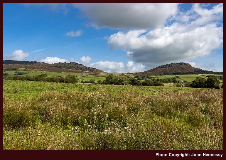
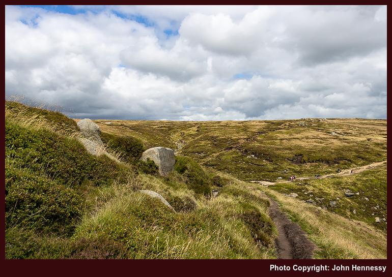
Forsaking the paths leading around by Middle Hulme and Upper Hulme, I instead went around by Windygates while heading for the saddle between Hen Cloud and The Roaches. Others were encountered on that saddle, and a line of parked cars extended under The Roaches, as is the case on many weekends, this one being no different. Nevertheless, that was left after me as I continued around by Well Farm, Ferny Knowl and Naychurch to take a shorter route to Ramshaw Rocks.
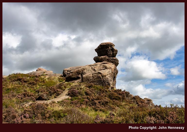
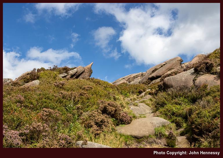
This time around, my encounter with Ramshaw Rocks was sun blessed. Thus, I could come away with some pleasing photos, as I had hoped. It helped that the area was notably less peopled than on my previous visit, with most ramblers and climbers staying around Hen Cloud and The Roaches instead.
From Ramshaw Rocks, it was a matter of plodding through quiet moorland as far as Black Brook Nature Reserve, negotiating any waterlogged patches that I encountered as I went. This time, I had sunshine to enliven the views; splashing through moorland under grey skies is less alluring. The mention of underfoot conditions may not sell the route, yet it was not all like that, and there was plenty of restorative solitude anyway.
Beyond Black Brook Nature Reserve, my route diverged significantly from that followed by the earlier trek. From Gib Torr Farm, it became a trot along lanes as far as Morridge Top Farm on the A53. From there, the route is less clear at this stage. There is a memory of asking to get through a gate and having it flung open for me that suggests a right of way shadowing farm buildings. Not pushing the gate back because of disease deference left me with a pang of regret, which is why it remains in my mind. The mix of lively cattle, an open gate and a farming upbringing is what drove that emotion. Still, she did call her dogs back from following me, so it might have been the lapse that I then thought it to be.
Stitching it together from the map now, where there are numerous options, it looks likely that I crossed a field from the A53 to Pethills Farm. From there, a lane would have conveyed me to Lower Petthills Farm, beyond which I was again following rights of way. Smallshaw Farm then would have been where the gate incident happened before I continued to Thick Withins. After that, I would find my way onto the Manifold Trail in a way that matches faded memories.
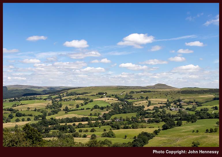
If the Manifold Trail got me the rest of the way to Buxton, that would make describing it a far easier, but I soon left it to cross a road to pick up yet another right of way. This one offered glimpses of Chrome Hill to the east, complementing earlier views of Croker Hill and Shutlingsloe, adding to a day of varied vistas.
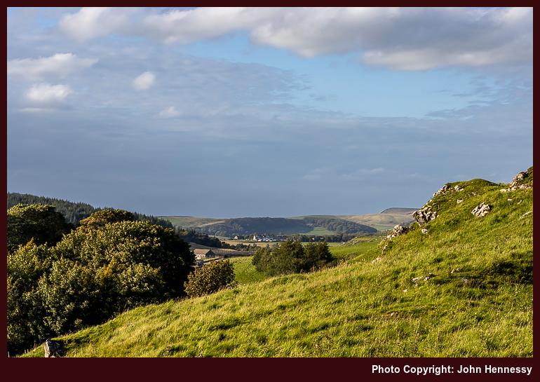
By then, I was navigating a thick network of paths and tracks that would carry me into limestone country and drier ground. The sequence of landmarks included Tenterhill and Brand End as I negotiated the ups and downs of complex terrain. Later on that glorious evening, I would pass Thirkelow Rocks on my way back to more familiar ground.
Crossing a lane led me onto the lands of the Heath and Safety Laboratory, where there are access warnings placed at more hazardous locations; these experiments are not human-friendly. My route took me around by Diamond Hill and Countess Cliff, while I noted the foam in a watercourse with a certain dislike. In the near distance, Grinlow Tower lay ahead of me, with a collection of silage-making machinery parked somewhere between the landmark and where I was.
Meanwhile, advancing cloud cover, and the lowering of the sun in the sky, meant that the sunlit show was coming to an end for me. Equally, the vigour of my legs was ebbing. Thus, it took one last heave to get past the hill hosting Grinlow Tower before everything downhill for much of the remaining distance into the centre of Buxton. Since the day had brought ample satisfaction, there could be no sense of deprivation at its ending.
Travel Arrangements
The first hike took place on a Sunday, so the outbound journey involved travelling by train from Macclesfield to Stoke-on-Trent, followed by a walk to Hanley bus station and a journey on bus service 16 to Leek. The last portion was nearly forfeited by a late arrival caused by dallying in Hanley Park, but for a scurry across the busway that did not impress a bus driver ("That was dangerous, that was", he said before giving me a ticket for the journey). The return from Buxton to Macclesfield was by bus as far as Stockport and by train for the rest of the way.
Details of transport for reprise are somewhat lost to me now, but I have almost no doubt that the return journey from Buxton would have been by train, though going by bus to Stockport remains another possibility for making it a hybrid of bus and rail. An outbound journey on bus service 109 from Macclesfield to Leek is more likely too because this was on a Saturday.
Revisiting ruggedness on the way from Hayfield to Edale
A previous posting on here mentioned the elongated break that I took from work during the summer of 2020. It also collated three longer hikes that took me through hills that line the boundary between Cheshire and Derbyshire. Perhaps wisely, for the sake of not overdoing the length of the piece, I omitted a hike that me over Kinder Scout that came the day after walking from Disley to Macclesfield. Yet, there is a slight link in that the bus conveying me from Macclesfield to Hayfield also passed through Whaley Bridge, possibly sowing the seeds for later hikes from there back to Macclesfield.
However, the Kinder Scout escapade had a few distinctions of its own. Firstly, this was the first hike since the onset of the pandemic that did not end with my walking or cycling back home. Another point was that it no longer felt feasible to use a 50 litre rucksack for day hikes. My attempts to make things less blatant than this attracted some amused comments from a passer-by, so I went and got a smaller Lowe Alpine item from The Climber Shop. Apart from a weekend ascent of Helvellyn and subsequent wandering near Callander and Stirling, and the trip to Paris in May of this year, the smaller Low Alpine pack has become my mainstay on countryside incursions.
By the time that I got on the receiving end of those remarks regarding how I was equipping myself, I already had got as far as the trail going along White Brow to the north of Kinder Reservoir. Recollections of the way there have needed to be rekindled from my memory banks, but the image of my leaving Hayfield village under grey skies and following a largely quiet section of the Pennine Bridleway has returned to me. The lack of activity around the campsite that I passed after leaving that trail is another fragment that helps top rebuild my route in my mind. Because of the lack of sun, photos were made infrequently, possibly because of how familiar the area is to me.
After Bowden Bridge, recall is again vague. However, just going along Kinder Road seems unlikely. Thus, the course more likely passed Hill Houses, The Cote, Booth and Farlands. There is another image from under grey skies that takes me around by Tunstead House and not far from Tunstead Clough Farm before reaching the others. That feels stronger than mere confabulation as I write these words, so I am going with that.
It would mean a crossing of the River Kinder beneath the reservoir dam that resonates with me because of the onward route to the flank of White Brow. From there, things become more memorable again, and there are photos to help too. This may have been familiar ground to me, but the novelty was not lost, either. After crossing Nab Brow, there was the matter of powering my way up through William Clough. My light load may have helped with this, making someone else comment on how well I was going.
Beyond William Clough, I met up with the Pennine Way. That was going to convey me to the top of Kinder Scout and around by its western edge. After the initial short pull up steeper inclines, it struck me that most of the ascent was on gentler gradients. That initial steepness was over quickly, much to my surprise; William Clough felt much more rugged in comparison. There were others about at this stage, yet the place felt none too crowded, and skies broke overhead to allow the sun to do its uplifting work on a tapestry of hardy grasses and wind-sculpted rocks.
Near Kinder Downfall, there was the option of following the old course of the Pennine Way towards Grindsbrook Clough, perhaps avoiding many of the people that I was to pass later in the day. The horror stories from bygone crossings and my lightweight state meant that I stayed within view of Kinder Reservoir instead.
As I grew closer to Edale Cross, it struck me that this was not going to feel like a quiet Monday around there. If I had designs, on following the Pennine Way down to Edale, they were scotched in favour of what I hoped to be quieter informal paths. As with many things with 2020, old experiences became poor predictors of then contemporary behaviour. Thus, I had to share the place with more people than I felt was ideal. It was a matter of making the best of it, and relishing any quieter stretches as I passed Edale Head, Pym Chair and Crowden Tower, some of these being part of nature's gallery of rocky outcrops. Each formation seemed to tell a tale of millennia, weathered yet unyielding.
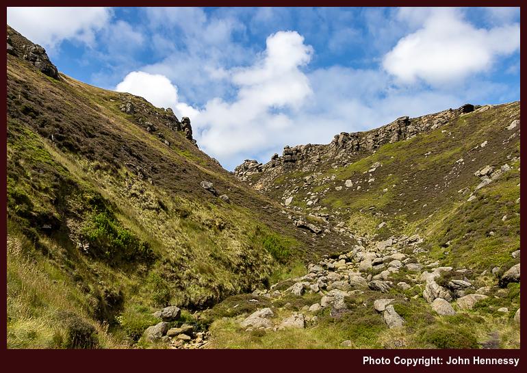
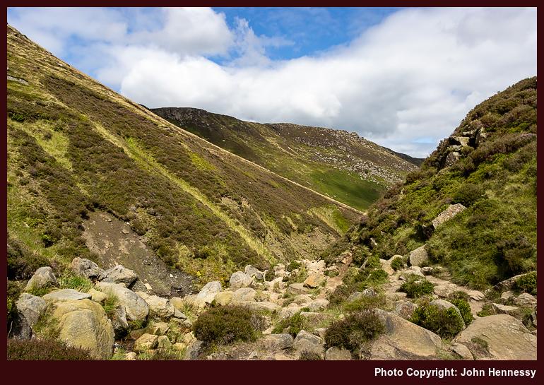
In some ways, the descent into Grindsbrook Clough was a wise choice; it thinned out the encounters with others to near nothing. The steepness of the initial stretches only would have helped to ensure that. This was light scrambling, with plenty of occasions for getting hands on intimacy with the gritstone slabs. Even with an abundance of cool, unyielding stone, keeping three points of contact hereabouts is a frequent necessity. It staggers me to think that the Pennine Way once went this way; there is plenty to remind one of nature's raw beauty and the respect it commands.
Patient resolve was rewarded when the gradients eased. The skies were again packing with cloud cover, which would have foiled any ambition to improve on photos made in August 2001, if there even was one at that moment. Having a pleasant path to follow on the way to more bucolic surroundings was enough for me that afternoon.
Edale felt tranquil with less around it than I found on the edges of Kinder Scout; it prompts the question as to where they came from, but a rural car park or two might explain that. A quirk in the train timetable meant that I spent longer around the place than I was expecting. This proved to be a refuelling opportunity using some refreshments purchased from a kiosk near the train station.
While the day may have been cloudy much of the time, there was uplifting sunshine in the middle of the hike. This also was when I met more people, a discomfort in times of pandemic. Nevertheless, there were moments of treasured, sublime solitude too. These were steps, not just through a majestic and treasured landscape, but part of a journey through an ongoing global upheaval. Despite all the surrounding drama, there remains that ineffable something that calls us all to wander. Few things, it seems, can stop that.
Travel Arrangements
Bus service 60 from Macclesfield to Hayfield. Rail journey from Edale to Macclesfield with a change at Manchester Piccadilly
Hikes that took me back home through some Cheshire and Derbyshire hill country
The trouble with recounting tales of local hikes is that the locations often are too familiar; they lose their novelty with frequent encounters. That applies even with the backdrop of a pandemic, so I am bundling these three hikes from the summer of 2020. Each is different in its own way, yet there is a connecting thread linking them all. After all, my traipsing through the countryside hardly ever is just exercise, since any tranquillity is sought, relished and savoured as I go. Quietude was prized whenever it came.
Initiating a Longer Break
Given the effect that all the upheaval and disruption was having on my mental health, I decided on a three-week staycation that flowed from July into August, much longer than I normally do. Even with never straying far from home, it was to help a lot. Even so, there were more than a few day trips.
Some were less consequential, at least from the point of view of an outdoors blog like this one. Visits to Rostherne, Knutsford, Tatton Park, Buxton and Sheffield (even if I did wander its parks, encountering its Cholera Monument, a stark resonance that summer) are not the kind of things that are related here. There is too little to say about short encounters that often involve revisiting the familiar, even if they had their uses at the time.
The same might be said for a visit to Lyme Park, but for one thing: it was en route during a hike from Disley back home to Macclesfield. This also was my second journey since the start of the pandemic and involved a change at Stockport; courage was increasing with added experience.
While the arrival in Disley was delayed, that is something that matters less when you are walking all the way home when there are long hours of daylight. Picking up the Gritstone Trail near the train station, I started on my way. Going through Lyme Park was another act of increasing courage. However, I avoided its front gate to go in and out of the back ones. That was the way that the trail went anyway, though there is a route alternative if I had wanted to avoid the busier stretch passing Lyme Hall.

Beyond that, things became quieter again. The terrain was familiar to me as I went up and over Sponds Hill. That perhaps was just as well, when so much else was peculiar at the time. The illusion of an unchanging countryside added a badly needed fulcrum and was as important as the feeling of freedom and solitude that was being gained. The church tower at Pott Shrigley could be glimpsed from a distance, while the same happened with Bollington. That was not a halting point, especially with there being no Sunday bus service and how it drew many out from Macclesfield that spring and summer.

To skirt Rainow, I left the Gritstone Trail to follow Oakenbank Lane, another discovery from earlier in the year, the Friday immediately preceding the Spring Bank Holiday weekend in fact. This hike may not have been as unpeopled as the photos show, yet there was every chance that decreasing restrictions allowed people to spread out to leave more space for each other. Nothing everything had opened, but there were more possibilities than there were a few weeks or months before.

Passing Ginclough brought me to a way leading to Lamaload Reservoir that was another discovery from prior sorties into nearby countryside, especially a circuit starting from and ending at home that took in Shining Tor. Everything might have been close to home, yet there were new places traipsed as well. The way from Lamaload Reservoir to Walker Barn may have been another of these paths that I came to travel during the pandemic times that I have not frequented since then. The same might be said of the way that I took by Tegg's Nose Country Park as I closed in my place of residence again. In some ways, the ways taken were so familiar that maps hardly were needed and decisions could be taken on the hoof as well.
On reflection, the whole route was a collation of different possibilities that led this way and that. There was Disley to Bollington, Bollington to Ginclough, Ginclough to Lamaload Reservoir, Lamaload Reservoir to Walker Barn and Walker Barn to Macclesfield. While some of those staging points did not get entered, each portion was a hiking possibility in itself. The longer evenings allowed a pick and mix approach to be taken. It really helped that there were quieter stretches where solitude could work its magic after what was becoming a wearying year.
Taking a Chance with the Weather
The previous week was laden with melancholy. The idea of facing into a trying autumn while fatigued by ongoing events was enough to send me away from home, doing anything to go get out of the house. Macclesfield Library, Buxton and Knutsford (even on a scorcher of a day, such was the need; getting better photos of Rostherne was a draw too) all had been visited along with other local spots while out on evening walks and cycles.
Remembering photos made during autumn rambles in 2007 was what put going around by Windgather Rocks into my head. The rain radar may have been showing showers approaching from the west, but I was determined to get to Whaley Bridge for a hike, such was my state of mind.
Things began well enough, and it looked as if showers might be escaped. There was a sunny start as I commenced from the railway station in Whaley Bridge to pass beneath the dam of Toddbrook Reservoir, still drained and under repair following the previous year's structural issues, and alongside the River Goyt. It was no threat by this time, so I continued to Macclesfield Road and went up that thoroughfare to join the Midshires Way to get to Taxal, where I lingered by its church in some sunshine.
That long-distance trail was left soon enough to cross fields on the way to Taxal Moor Road. The quietness of the morning air struck me, though a walking group was to be heard behind me at times. They were left behind me as I continued to the top of Taxal Moor before descending to a lane on the Cheshire side.
That was when the illusion of escaping a wetting was being punctured. The surrounding hillsides were cloaked with signs of rain. Undeterred, I continued, not without some hope of meeting only light showers. While making my way to Taxal Edge, the rain caught me, and it was of the “soft Irish day” variety: light and steady but not too wetting.
If things remained at that, my gear would have coped. When things escalated, the lack of rain trousers meant I got a proper soaking while waiting for the rain to move away. This kind of thing always seems to leave more slowly than it arrives; my more lightweight way of working met its match, and this was not something to repeat. A newly acquired smaller rucksack had endured the wetness with aplomb, though.

The pleasing photos that I hoped to get around Windgather Rocks failed to materialise, and I got moving when the rain eased. All I got were some atmospheric record shots that I do not feel are worth sharing. As the air dried, I did too. Pym Chair was the next landmark, somewhere I had not been very much since my earlier hill wanderings.
From there, I continued to Cats Tor and Shining Tor on a quiet morning on the tops and relished the freedom to travel along the slabbed track at my own pace without the need for much thought about social distancing. After reaching the trig point on Shining Tor, I retraced my steps and started my descent to Lamaload Reservoir after accommodating mothers with children by giving them some space. The ground was looking drier as I dried out, too. Things were starting to look brighter again: the band of showers had passed, and I was not to be bothered by such things for the rest of the day.


The way back to my house from Shining Tor was the reverse of the outbound route from June. As the skies continued to break over me, temperatures increased until the heat was readily perceptible around Rainow. Getting there took me around by Lamaload Reservoir (a service road got me from the reservoir to the village), a place that I was finally exploring after years of glimpses while travelling between Macclesfield and Buxton by bus. There may have been an educational wetting, but none of this was in evidence on my person by the time that I got home.
A Last Sunny Reprise
Mainly motivated by the previous Monday's soaking and the prospect of better weather, I returned to Whaley Bridge the following Saturday. The desire for better photos had something to do with it too, especially around Windgather Rocks. Another factor was the imminent end to my elongated summer break and the uncertainties of the coming autumn. It felt better to settle accounts while one could, on this second Saturday in August.


The way to Taxal Moor essentially was a retracing of previous steps, albeit with much more sunshine. Beyond there, deviations set in, firstly by following an informal path on the Open Access Land on the moor itself. That set me going onward to Taxal Edge and Windgather Rocks by a different route, one that passed closer to Goyt Forest.


The weekend timing and enticing sunshine drew out others, but it was easy to keep apart if you wanted, as was needed in those extraordinary times. In other places, climbers may have been closer together than was ideal, but that was their concern. On the paths and trails that I was travelling, some even let me pass first, as if their time were their own, and I was happy to oblige in kind. There was space for photography too and the results still appeal to me, bringing a sense of closure to one part of the outing.


With photos made, I continued to Pym Chair and Cats Tor as before, while stepping away from the path to let others pass. When you have had something to yourself once (as I had the previous Monday), it becomes easier to share with others. Then, Shining Tor was crossed before I went down to the A537 by way of Stake Farm. The way along these tops is one that I never tire of tramping with its undulations and its paved stone surfacing.


Crossing the road, I followed a permissive path to the access land around Cuckoo Rocks. They were not a destination for me though, so I followed another permissive path to join a public footpath to get to Bottom-of-the-Oven, a small place with a curious name, before heading up to Forest Chapel along a byway. These were much quieter parts than the places that I had passed on the other side of the A537. Legs were wearying with all the ascent and descent. The slopes leading to Forest Chapel felt a little more foreboding because of that. Just taking everything one step at a step overcame that, especially beyond Bottom-of-the-Oven.
Making use of another byway beyond Forest Chapel, I reached Charity Lane. Along the way, I overheard a comment from a passing family group about not realising what is on one’s doorstep. That probably is a story of 2020, given its lockdown and my finding people in places where I never encountered them before. On reaching Walker Barn, I then went towards Tegg’s Nose Country Park along Old Buxton Road, but left it for a byway leading to Back Eddisbury Lane. The latter took me onto Buxton Road under clouded skies, and I was on the home run straight to my house. The reprise had been worth the effort, with plenty of quieter moments as recompense for making more space for others where this was needed.
Reflections
In hindsight, it may have been better to make an entry for each of these. Once memories were rekindled, the accounts became longer than intended. Each hike had its own personality, a combination of location, weather and state of mind. Even the restrictions of a global pandemic did little to eliminate variety. Everything might have been local, yet there was much that offered respite, solace, consolation and healing too.
Travel Arrangements
All of these only needed outbound transportation. The first was a train journey with a change in Stockport while going from Macclesfield to Disley (there is something in my mind about trying to catch a bus that never appeared, but memories may be combining, so I am leaving things as they are). The others used bus service 60, which was then working to a reduced timetable because of reduced demand and staff availability.
In need of some tidal awareness
Recent Irish rambles have brought home to me an important lesson to which I hardly devoted much attention before. It may be because I have spent much of my life inland and that I am attracted to a variety of hill country. The subject pertains to tides.
It is true that I made my over and back from the tidal Cramond Island near Edinburgh without incident. That perhaps was because the tide tables were posted on signs nearby. Then, I could assess if such a crossing was feasible so as now to get marooned. That is one of the few, if not the only tidal island that I recall visiting.
Otherwise, risk averseness has its part to play. Worms Head near Rhossili on the Gower in Wales comes to mind. The sight of others did little to encourage me out there. Knowing that I was without important knowledge was enough to stop me needing the services of the Coastguard. No rescue is needed when the risk is not taken.
The same applied to a visit to Galway where I did make my way out and back from Illaunafamona, near Salthill, without getting stranded on there. However, the encroaching tide forced me to go through a caravan park to get back on the return route to Galway to catch a coach back to Cork. Leaving later would have been better but for having made an advance booking; the evening was brightening, so it would have been worthwhile. Still, I got to the Coach Station with minutes to spare. My trespassing nearly cost me that too, and landowners may not have been impressed with a stranding on an island that they owned if it were to happen. The caravan park owners did not intercept me either, yet it is not something that I plan to repeat.
A stroll around Crosshaven was nowhere as dramatic. However, the tide was in, which meant that the absence of a cliff path sent me on a circuit that I had not planned. Given the other delights that were encountered, I do not feel short-changed. There had been a walk along the Greenway from Carrigaline in good autumn sunshine, and all else was favourable until I had to alter my route. In fact, I had the sun at my back, a favourable position for photographic exploits.
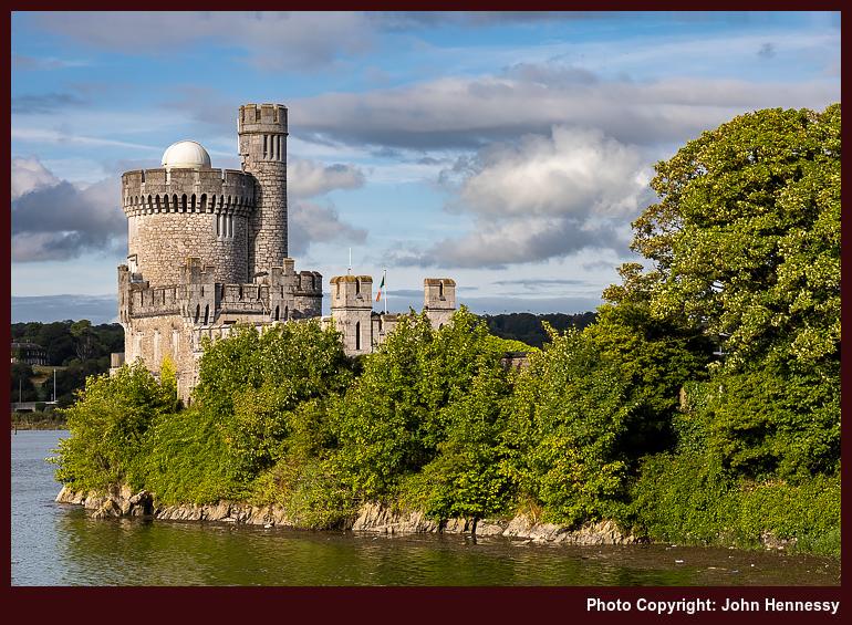
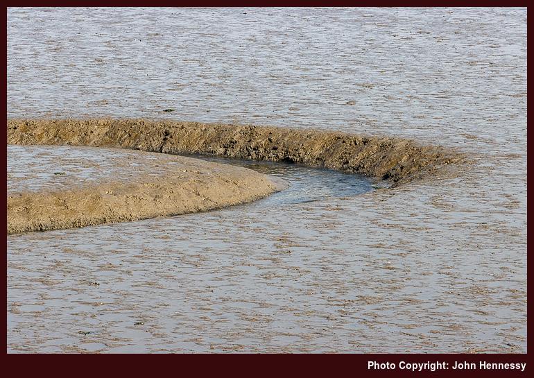
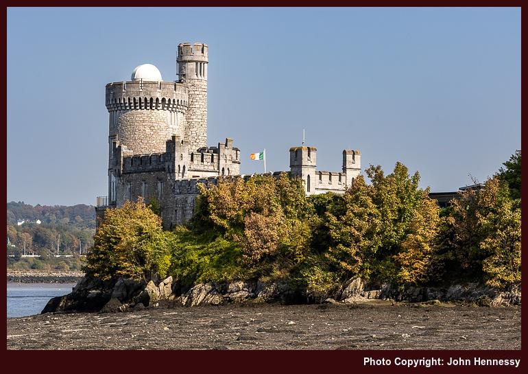
My having acquired a new base in Cork means that I now am nearer the coast than I ever have been and for longer too. That means that I get to notice the coming and going of the tides more than I ever have. A walking route that goes along the shore of Lough Mahon assures that. The mudflats that low tide exposes attracts its share of bird life too, so a set of binoculars has its uses here.
The subject of tides also cropped up on a circuit of Cork Harbour's Great Island that started and ended in Cobh. A narrow road along the north side of the island was seeing some encroachment through the very drainage culverts that ought to drain it. There were no such issues around Marloag Point and any other place that I passed, yet I did not delay. The hour of day ensured that as much as the chances of getting wet feet.
The cumulative effect of these encounters with sections of coastline is that I need to add checks of tide times to weather, transport and other things. Recalling the speed of tides on the island of Jersey accentuates this. It is little wonder that the U.K.'s Met Office includes this kind of information with its coastal location forecasts. It builds out the picture, especially when seas are roughened by gales.
There was an easier way home…
During a weekend of two hikes, and with one occupying me for the whole day, anyone would think that an easier day after all that exertion would have made sense. That, in fact, was the plan. Walking back to Macclesfield from Congleton via The Cloud should have traipsed through Cheshire farmland and through North Rode and Gawsworth, shadowing previous walks and cycles in the area. The sunshine was not there to be wasted anyway. However, temptation got the better of me and a more hilly diversion ensued.
Before all that, there was the matter of getting to Congleton first. Pandemic bus service reductions (this was July 2020) meant that bus travel was not an option. Handily, there were occasional local train services that Sunday, and I caught the first of those. This was the first time that I had travelled by train since the onset of the pandemic and, if there was any apprehension about this, it would have been dispelled by my having an entire carriage to myself. Passengers were fewer in those days.
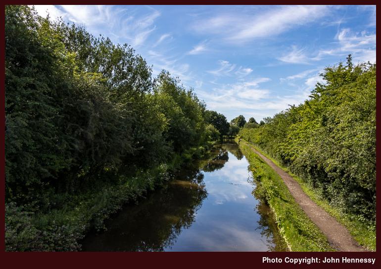
Much like Kidsgrove further south, Congleton also has a train station beside the Macclesfield Canal. By going by train there, I also had saved myself an uphill schlep from its town centre. The photos above show an unpeopled canal towpath, but that is not how I remember it. Disquiet about the pandemic had me recording that it was a little busier than I might have liked. The weather was such that others were lured out for walking, jogging and cycling; the temptation was not mine alone.
Leaving the canal might have brought me onto quieter paths, but I was never without sharing the space with others at times. Nevertheless, there were an ample number of occasions when solitude could work its magic. All the while, I was bound for The Cloud. A stretch of level field crossing was replaced by an ascent that tested wearied limbs. That the summit was occupied should have been no surprise to me. The sunshine and preceding restrictions would have led to that outcome. Everyone needed a break after the weeks of lockdown, and this was one location where that could happen.
Quite what turned me from my original plan is somewhat lost to me. The quality of the day's weather surely must have had something to do with it, as would my sensing any extra strength in my legs. There also was my having more company than I felt comfortable having in those times. Taking to the Gritstone Trail quickly alleviated the latter.
Any quietness that there was along the Gritstone Trail between The Cloud and the A523 really mattered near Cloudwood End Farm and Raven's Clough, where the trail narrowed to a shaded single track path. Beyond that, everything broadened as fields were crossed beside the River Dane. By this stage, my course was shared by the Dane Valley Way and the Staffordshire Way. Sometimes, long-distance trails overlap each other.
Once across the A523, crossing a field led me to the muddiest part of the hike: a towpath shadowing a conduit that was greening over in places. The water looked as if it were anything but moving. Others passing the way stayed in the nearby fields to avoid the conditions underfoot. Having boots meant that I stuck with the right of way instead, thus staying legal.
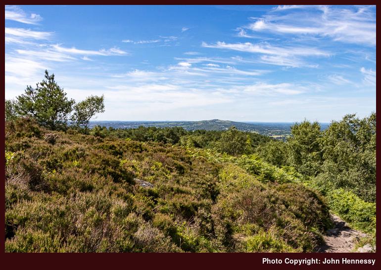
Leaving the conduit, I crossed the River Dane by means of Barleigh Ford Bridge. Beyond this, I encountered more walkers than I had done for a while. This was not so intrusive though and was behind me soon enough. Beyond this, the mind was focussed by the ascent on the way from Dumkins to Hawkslee. It was during that section that views south towards the Roaches began to open out before me.
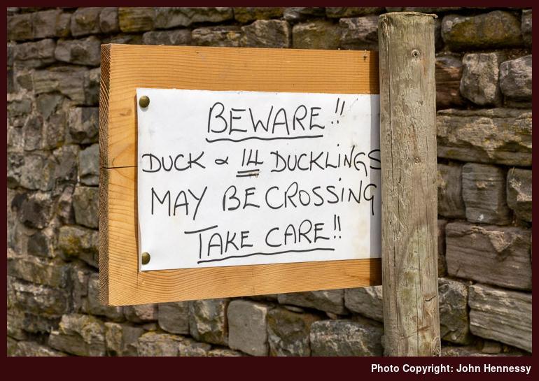
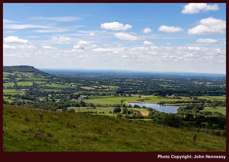
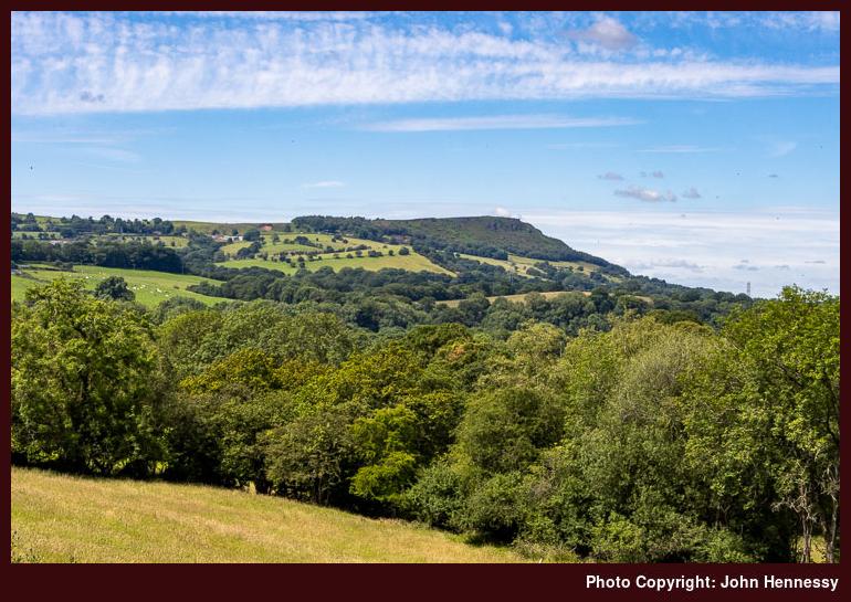
Beyond Hawkslee, I found myself on Minn-End Lane all the way to the A54. A quizzical sign warning about the passage of ducks and ducklings entertained early in the time. Later, as opening views of Croker Hill drew me onward, I also gazed down on Bosley Reservoir and beyond whenever I could. The Cloud was in view too during these westward sightings.
After crossing the A54, the ascent of Croker Hill began, Views eastward towards Shutlingsloe abounded and looking north drew my eyes towards Tegg's Nose. While I do not recall the effects of climbing Croker Hill, fatigue certainly kicked in after that. Even going downhill can have that effect on you, and the descent of Fox Bank to reach Lowerhouse, not far from Rossen Dale, would have been enough for that to happen.
Coaxing was the order of business from there onward, especially as far as Meg Lane, where I was going uphill more than I might have liked. Someone out for a run went past me at one point as I marvelled at his energy. There might have been a certain amount of temptation to stay on Meg lane to reach Sutton after going past Higher Sutton, yet I did not do even that. Thankfully, the way towards Ridgegate Reservoir was easier on my legs than that around by Smallhurst.
Proximity to home helped to provide encouragement too. The way to Clarke Lane is well known to me, as is the way from there through Langley. That may explain the uphill deviation around by Birch Knoll, too. Familiarity can make it easier to mark off progress to reinforce the internal messaging that there is not much further to go. That pull may be even stronger than coaxing, even on the second of two long days of hiking.
Wearied yet sated, I arrived home. Spontaneity had intruded yet again, and for the better. The pandemic onslaught had zeroed things on me, so this was part of a journey of reinstatement that is still ongoing in some ways. Returning to public transport usage and finding those quieter spaces where solitude could be healing became important steps for getting through a disruptive and scary period. Such escapes retained their importance throughout. Simpler pleasures can be so sustaining.
Afterword: A Winter Reprise
Looking through my mini trip reports posted in advance accounts, I notice that there is nothing for 2021. The cause was not that I was distracted with other things, as I had supposed, but a certain lack of variety. In short, I went over old ground rather a lot. It is difficult to find anything to write about a repeated hike. There were some unique strolls like one from Miller's Dale to Castleton and various saunters around Combs Moss near Buxton. Mostly, though, it was a year when much felt as if it was frozen in anticipation rather than moving into novelty.
2022 started in a likewise manner before the South Pennines, the Lake District, Ireland and Scotland returned to the fray for me. Novelty was returning. Before all that, I ended up doing a reprise of the route described here on a crisp day near the start of the year. Restrictions had returned in part, which allowed me to get going outdoors again. The day was less peopled than the one in 2020, partly because of its being a working day and the time of year. Either way, it was a healthy way to get 2022 on the way. The year turned out to be less about repeats than its predecessor.
Travel Arrangements
Train journey from Macclesfield to Congleton with Northern Trains