Category: Places Explored
Sun, rain and Irish explorations: Journeys along the Dingle Way and more
With a few matters to address in Ireland and a wish to steer clear of the Jubilee celebrations, I found sufficient motivation for embarking on another journey to the Emerald Isle. After the success of a previous stay in Limerick, I fancied the prospect of basing myself in Killarney for a change. However, the timing included the Whit Weekend Bank Holiday in Ireland, which I blame for my encountering exorbitant accommodation costs. My trip later took me to Killarney for a day outing, when I found the real reason for the extortionate costs: Bikerfest was in town and had attracted a huge following.
Meanwhile, I had settled on Tralee as my base. While that put the Dingle Peninsula on my doorstep, there was another trip to West Limerick to check on things there. In the background, there were things to progress to which an inclement Thursday allotted some time after a morning stroll in the greyness. Friday started out grey too, so that allowed one or more phone calls to be made. This was not the full mix of weather, for eastward bands of rain blighted the bank holiday weekend, making decisions about where to go that bit more difficult.
Serendipity on the Kerry Camino
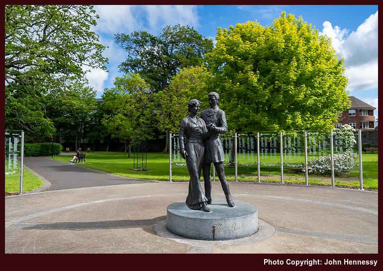
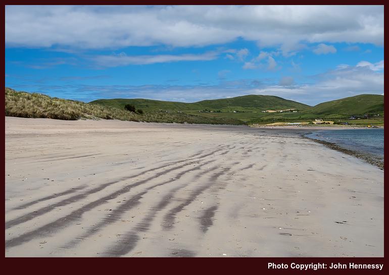
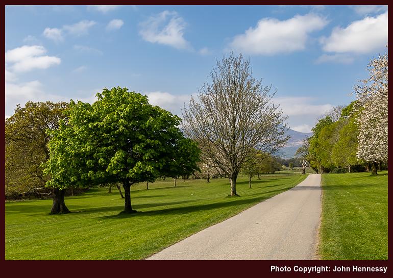
It took until Wednesday for any sunshine to successfully break through the cloud cover, too; this was a sojourn that needed patience and perseverance for any photographic rewards to be savoured. As the clouds broke overhead, I spent some time around Tralee's town park, using any photographic opportunities that arose. That afternoon, I followed the trail of the Dingle Way out of the town for what, I thought, was an out and back hike.
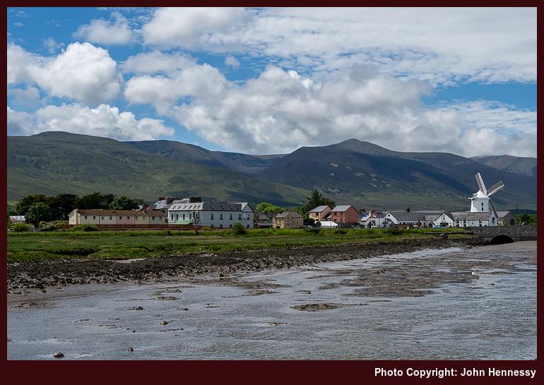
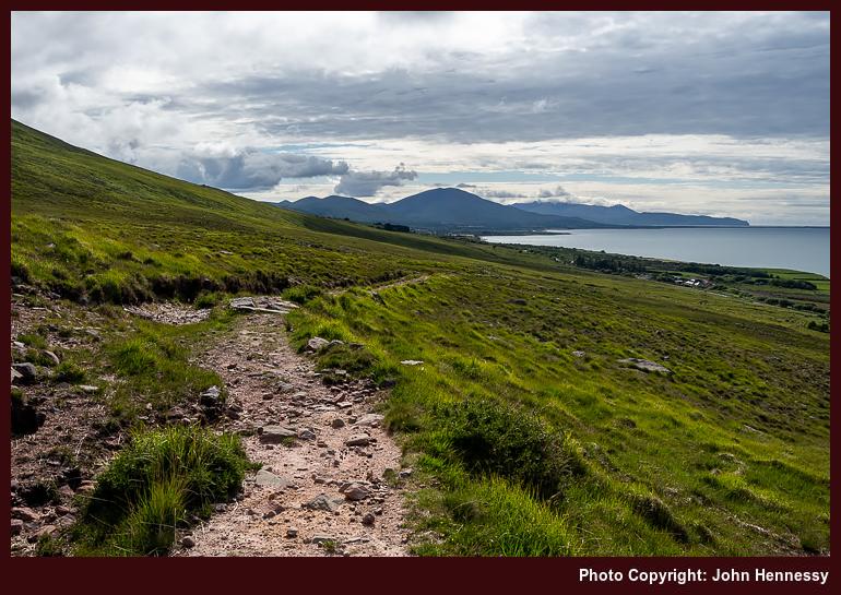
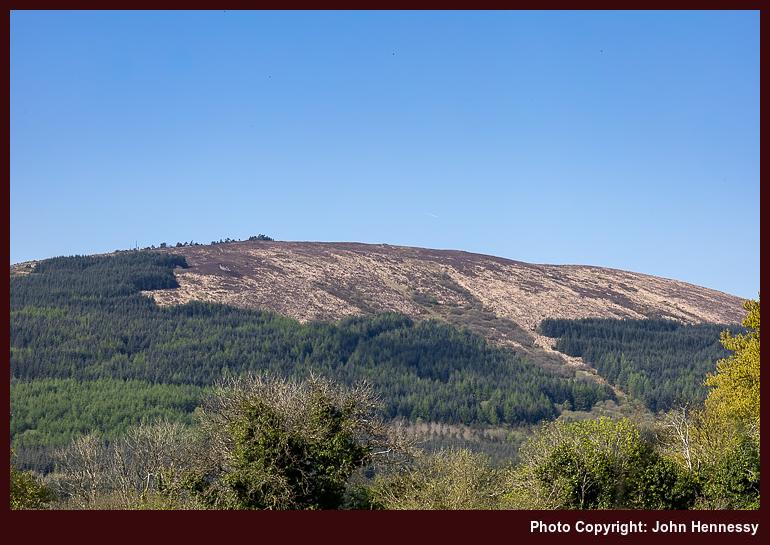
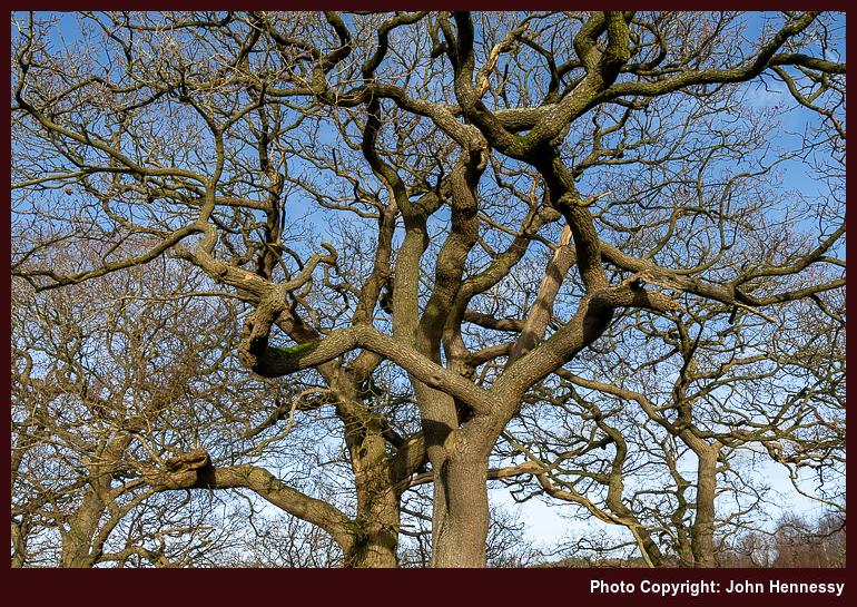
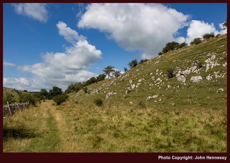
While following the towpath of the ship canal was an option, I kept more closely to what the map showed to be the route of the long-distance trail, which ended up with my walking by the side of the N86 as far as Blennerville, with its iconic windmill in view all the while. Once through the village, I ended up leaving the trail for a circular foray into the foothills of the Slieve Mish Mountains. Unlike my time in Limerick, I was shod for the travel over rougher ground. The Berghaus boots may have been intended for lighter wear, yet they acquitted themselves well in the circumstances.
On returning to the Dingle Way, also known as the Kerry Camino between Tralee and Dingle via Annascaul, I still had intentions of circling back to Tralee. However, the splendour of the scenery in the sunshine continued to lure me along until I made a spur of the moment decision to continue to Camp; the availability of a decent bus service between Tralee and Dingle was what decided me as much as what was delighting me.
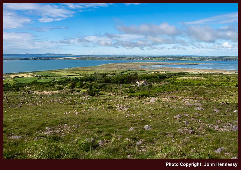
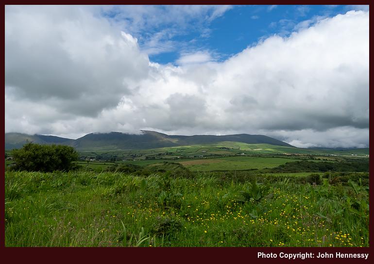
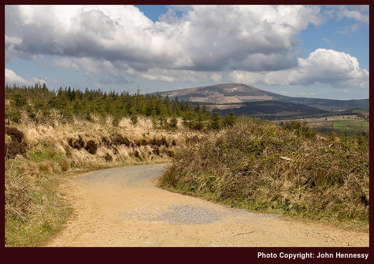
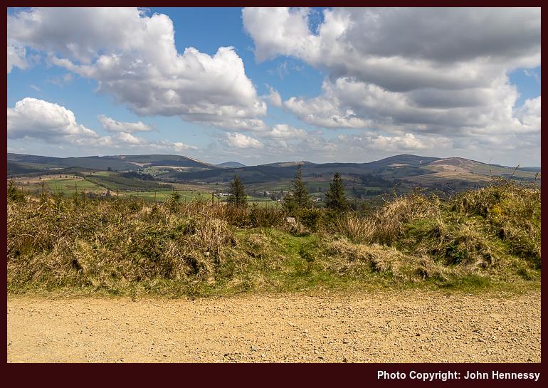
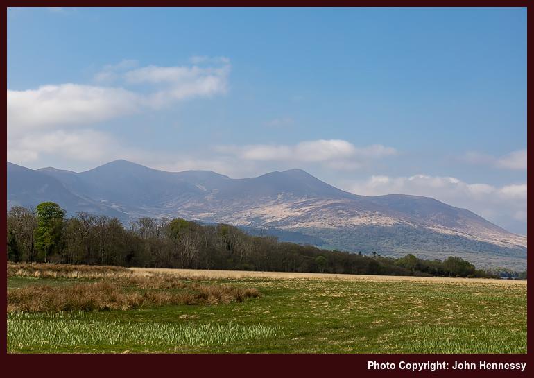
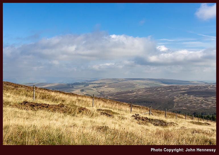
Views across Tralee Bay and inland towards Stack's Mountains and Glanaruddery Mountains drew my eyes away from where I was. Even so, it was looking back along the slopes of the Slieve Mish Mountains that really held my attention. However, any peering into the dramatic setting of Baurtregaum was curtailed by the need to reach Camp. In the end, there was no hefty time constraint, so I could have lingered and gazed for a while. Even with the emotional recollection of hurrying by, I still ended up with more images than the sense of rush would have suggested. That has calmed things for me.
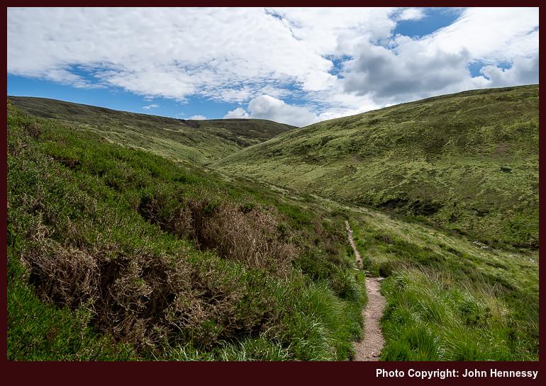
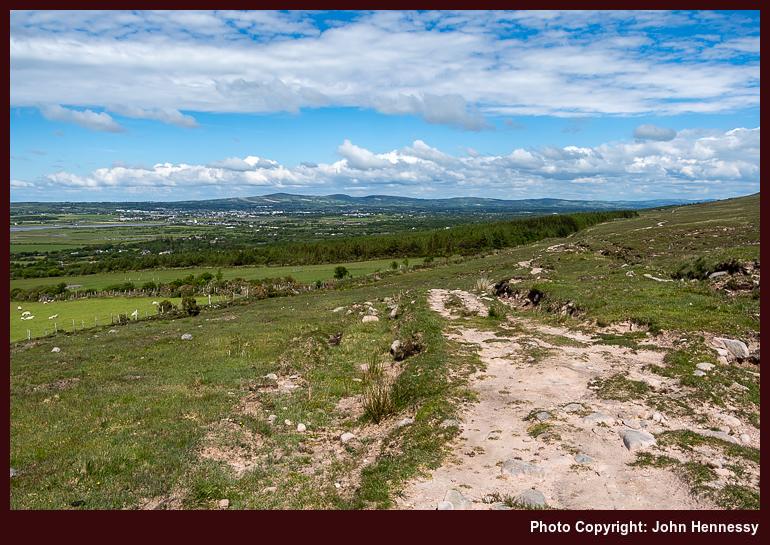
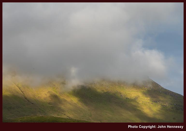
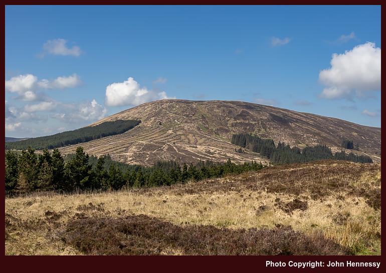
Thus, any regrets regarding a rude rapidity of my passage have faded; advancing clouds were calling time on any dawdling anyway. The sunshine was receding and I on the most rugged stretch of the path. There was height gain too to go with any western views that made one wonder about the possibility of glimpsing Brandon and its neighbouring hills.
Any ascent came before a gradual descent on a trail disinclined to show me my eventual destination; having to go up while knowing that you need to go down needs some forbearance. That was not all, for patience under grey skies was the order of the moment before I reached the N86 again. Wearying limbs carried me into Camp, where refreshments were obtained in advance of awaiting the bus back to Tralee. While there had been some serendipity regarding the hike that I had completed, much felt magnificent on what was my deepest incursion into Irish hill country at that time.
An Impromptu Ventry Circuit
In advance of an onslaught of rain on Thursday, I pottered around Tralee and went out along its ship canal, an entity that had been unknown to me. The skies were overcast yet dry, so I went as far as I could go before the shoreline halted me. Then, I made my way back to Tralee via lanes to reach cover before any inclement weather arrived. During the stroll, I spotted signs for the North Kerry Way, a trail that had its uses only days later.
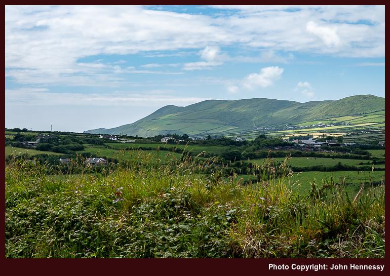
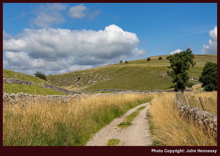
With all obligations met, I had Friday afternoon to myself. Even with overcast skies, I still went to Dingle. Once there, I had the gift of well broken cloud cover that allowed long spells of sunshine. Making use of that situation, I followed the Dingle Way westward. Traffic on the R559 was such that I was happy to leave it for a far quieter minor road. As I followed that, views towards an unclouded Brandon were a feast for one's eyes, even if an uncooperative foreground and occasionality of the sunshine made for challenging photographic composition.
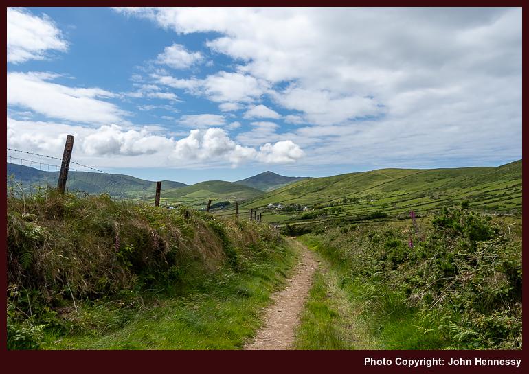
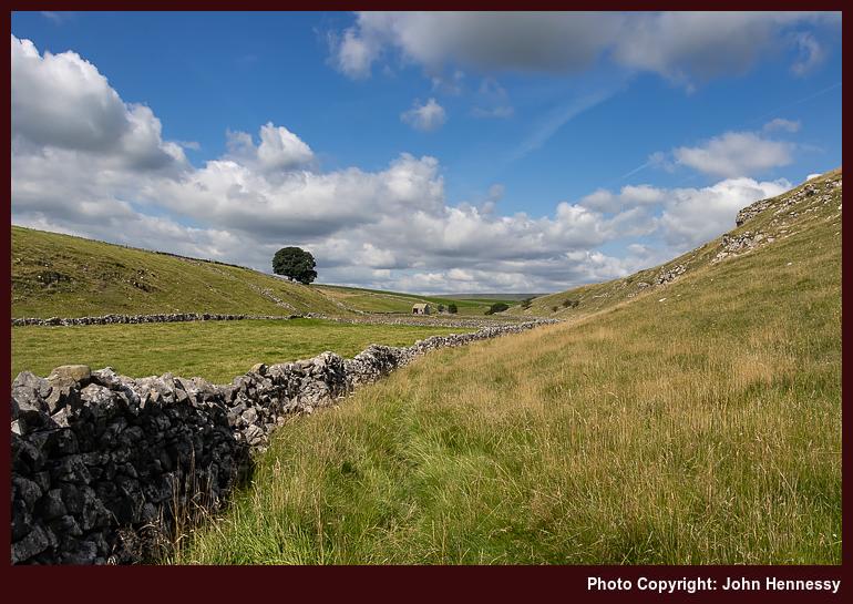
Tarmac was left after me for a time on the way to the route of Siúlóid Cholmáin, a looped walk that passes Cill Cholmáin and Rathinane Castle. The former is the ruins of an Early Christian Monastery founded by Saint Colmán, and the latter is a fifteenth-century castle built by the Fitzgerald family, perched in a ring fort. As with many of these things, I have little recollection of the monastic ruins and the castle was on private, so I only could view it from a distance.
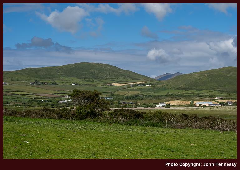
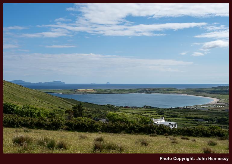
All this took me back on tarmac again yet in pleasing surroundings on quiet back roads. Others were out in the sunshine too, so there was at least one cheery greeting coming in my direction. Leaving the true route of the circuit, I ventured onto Ventry beach. Looking ahead brought me eyes to a gap where I might have been seeing Brandon or one of its neighbours. Looking right brought my gaze across Dingle towards the northern shore of the Iveragh peninsula and smaller landmasses lay further west. My contention is that I was seeing the distant Skelligs on a clear day.
Once off the large expanse of sand with its own lifeguard on duty, I was hailed by cheeky youngsters as "Bandito" because of the hat that I was wearing to keep off the sun. All that could be done was to laugh at their impetuousness and carry on; little harm was being done. Returning inland involved an ascent with ever expanding views before I returned to the Dingle Way to reprise the way back to Dingle.
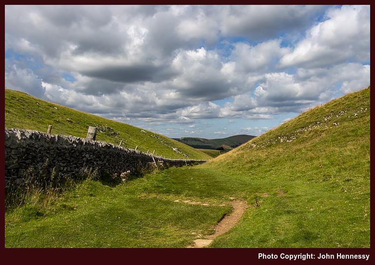
A piece of cartographic fiction caused me to vary the route while on a false errand. That also brought me past barking dogs, an ever intrusive experience in the Irish countryside. On attempting to find it on private land and coming to an impassable obstruction, I had to give up on Cosán na Naomh and traipse tarmac all the way back to Dingle after adding more distance to my return route. Nevertheless, the exercise offered me more views of a by now clouded Brandon. The cost was something of a dash to make the penultimate bus of the day from Dingle to Tralee. Cloudier skies meant that I could do so without distraction.
An earlier departure from Tralee might have allowed for a longer circuit or a visit to Dunquin, familiar to many an Irish student of the life of Peig Sayers. A lower level circuit of Sliabh an Iolair (Eagle Mountain, in English) would have its appeal. Saying that, what I sampled gave plenty of satisfaction, so I do not feel short-changed in any way at all. Given the weather prospects of the weekend to come, it was best to snatch any opportunity with both hands.
A Morning's Meander
In the words of a local shopworker, Saturday evening turned out nasty. Heavy rain had arrived, not from the west as most would expect, but from the east. If I had known that it take until around 18:00 to do this, I might have made more of the day. Going on a day trip to Killarney would have been a possibility.
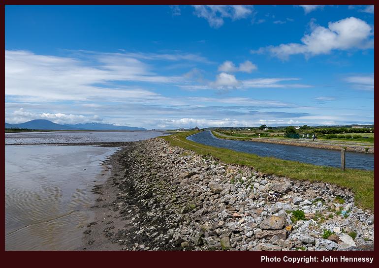
Thinking that I only had the morning, I made use of the Greenway to see how far I would get to Fenit. The answer was: not very far. Curiosity led me onto the R551 to see how things looked and works to convert the old railway remained in progress. Given how busy the road was, that possibly was a case when inquisitiveness was best left aside, especially when I inadvertently walked in front of an oncoming car, making it stop, yet without any harm being caused to anyone. The Greenway has been opened since then, and surely must be a boon for off-road recreation, and bus services have been enhanced too.
Suitably chastened and disabused of the idea of going to Fenit, I made my way on to the North Kerry Way near Spa, using lanes that were busier than was ideal. Thankfully, things were quieter after I had passed the entrance to the golf club. Once off the road at Spa, things were better again. This was following up on an idea that came my way on Thursday morning.
The morning was bright with some hazy sunshine too, which was more than could be expected. Westward views along the Dingle peninsula were there to be savoured on a trail that shadowed a stone shoreline. Eventually, I would follow the towpath of the ship canal, where an unexpected inconvenience intruded on my day: the local rowing club's training session. One of their number was using a bike to follow their progress, stopping rather too often for my liking. Constant leap-frogging is not the most restful.
When I got to Tralee's town park, the heat of the day was there to be felt. The sunshine was strong, and I attended to some shopping needs that I had. It felt rude to go indoors when it was not inclement outside, yet I possibly felt the need to do just that after a morning of walking. This was a period when it looked as if Met Éireann was struggling to predict what was coming to a greater level of precision.
Between Crowds and Clouds
Figuring out what to do on Sunday became a challenge because of the lack of apparent certainty. Seeing that Killarney could be drier was enough for me to give the place a go. Until the previous encounter in April, expectations were not high. The weather information did no better than that.
If I had known that Bikerfest was there, Killarney may not have been an option at all. All too often, I arrive somewhere not knowing that an event is happening there. Fort William, Dolgellau and Bath all fall into this category, though there were ample workarounds in those cases. Visiting a crowded location soon after the zenith of a global pandemic was not my intention, not that the timing bothered many around there. Those attending Bikerfest simply behaved as if there were never a pandemic at all, not a situation that I found comfortable.
On the way back to Muckross, vehicles were parked everywhere. The impression was that Killarney was overwhelmed and any management of roadside verges for wildlife went by the wayside. Motorcycle engines sounded everywhere, with many going towards Moll's Gap and powering up throaty engines on the way. It is an utterly alien situation for a quietude seeker to meet.
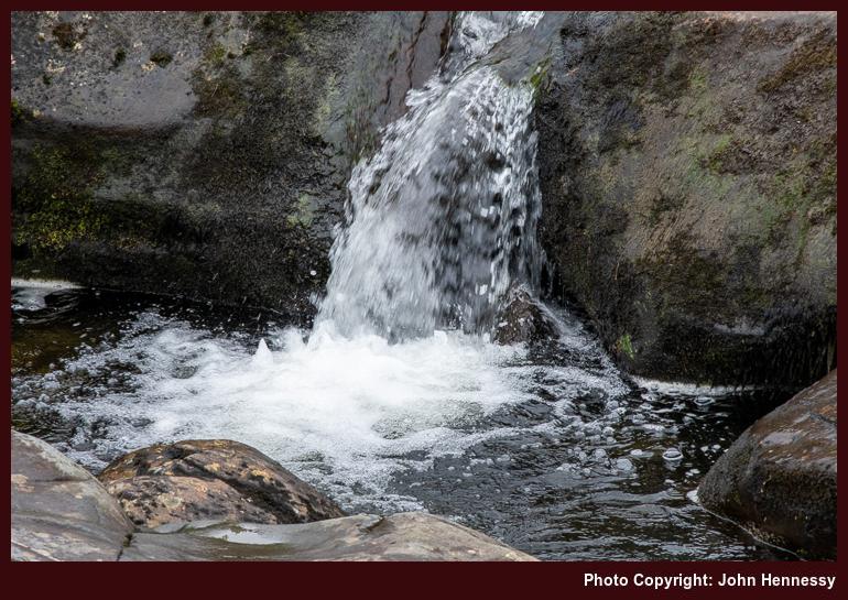
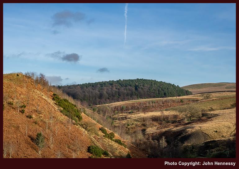
Thankfully, Muckross was blissful in comparison, The racket and the crowds were distant there, gifting the much-needed respite. The day remained overcast with low clouds on the hills. Even so, I continued to the top of Torc Mountain, passing Torc Waterfall on the way. Even with poor visibility at the top, the well-made path made it straightforward to get there. It was best not to move around too much on the summit, so I made my descent again with ideas planted in my mind for later. One was revisiting Torc Mountain in clearer conditions, and another was following the Kerry Way from Kenmare back to Killarney. An August incursion would make use of those prospects.
The way back to Killarney again tried me until I escaped through Maurice O'Donoghue Memorial Park to less crowded surroundings. From there, I made my way into Knockreer Park in the ever dampening air. The attendant lack of people was a balm to the soul, regardless. Passing the cathedral, I made for the train station, where a wetting accompanied a wait for the next train to a much wetter Tralee.
A Walk in Manannan's Mist
After being a little unnerved around Killarney, I fancied a quieter day in the Kerry countryside. Prompted either a perhaps overoptimistic forecast or an overly hopeful self, I set off for Dingle for a hike to Annascaul. While going from Camp to Annascaul was a possibility too, I scotched that in light of the likely conditions. The sights from the bus ride along the N86, which shadows the route of the Dingle way, validated my reasoning: the cloud base was too low.
On that Bank Holiday Monday, Dingle was blissfully quiet as I set to attend to a few needs in advance of setting off in the direction of the Connor Pass. It was another section of the Dingle Way that I was using as I did this. A little route was needed to get going, and the air grew damper as I gained height. Visibility was another matter; even with being near the aforementioned pass, I could not see it. Even so, I ventured off the long distance trail in its direction, only for the wetting from damp vegetation to send me back. Some things are best left for days with better weather.
In time, the air was to get drier. That was not before whimsical thoughts emerged regarding Manannan's mythical nightly shower in the Dingle mountains and his leisurely morning routine. Losing some height on the way to Lispole helped with the dryness, though care was needed with navigation. At one point, I nearly followed a mucky farm roadway before seeing sense and turning back to find the correct route. Any spatters would need attention later.
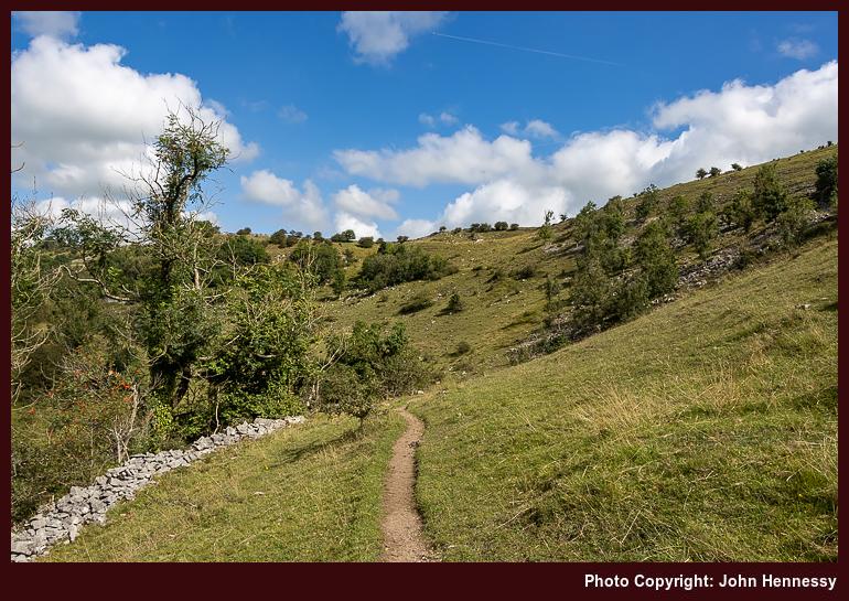
If it were not for boreens, there would have been less pleasure on this day of walking; it appears to me that they are an Irish speciality for long distance walking, a unique feature that I have not met elsewhere. All was quiet as I peered towards the southern shore of the peninsula. It even looked as if there might be some brightness, though any that came only was fleeting. Kilmurry Castle beckoned to me as a landmark, and I was to tarry around there for a while. Then, gazing west showed that my decision to go east was not ideal for enjoying sunshine. Going to Ventry or Dunquin might have made a better option if bus times facilitated such designs.
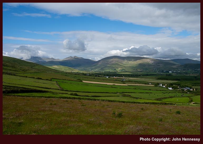
On the way from Kilmurry to Annascaul, views of the hilly spine of the Dingle peninsula were vastly more plentiful than the amount of sunshine that I was getting, though there was some. Some of the houses that I passed were unoccupied and falling into nature's embrace, making me wonder if anyone might use them as a starting point for a restoration project. The present cost of living clearly limits that kind of thing, though.
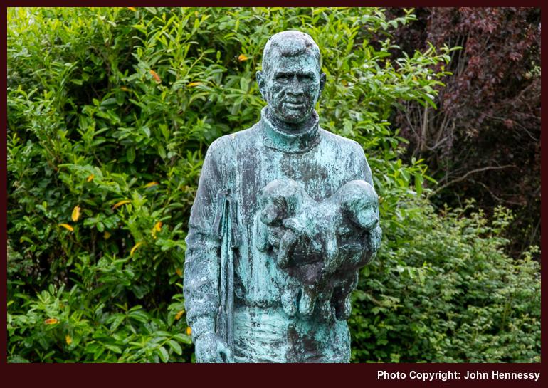
Road travel took me into Annascaul where I was greeted by the sight of the South Pole, the pub operated by Tom Crean after his Antarctic adventuring came to an end. Finding the bus stop was the next task before topping up on refreshments. Before the vigil for the next bus could commence in the rain, various signs were perused to learn some history of the place, such as the fate of its Church of Ireland place of worship. If my memory is not confabulating again, others highlighted walking possibilities in the area, some featuring nearby Lough Anscaul. There is more than the Dingle Way around here.
An Underestimated Gateway to Kerry's Hills
In summary, Tralee has much to offer as a hill wandering base. While it may be overshadowed by the delights of nearby Killarney and is a working county town, the proximity of the Dingle peninsula is in its favour. Public transport options are workable too if you do not want to use a car. For section walking of the Dingle Way, using your transport becomes much more awkward anyway.
As in my case, the weather may be unpredictable, yet it is possible to work around that. When the sun shines, all looks all the more magnificent when you realise what a gift that is. While some may be focussed on climbing Brandon, a challenge that commands competence with navigation to avoid steep ground in low visibility, there is much else that is more accessible. Even with much gained, there are sufficient excuses that prompt my return. Sometimes, anywhere that is overshadowed can be more valuable than what is overshadowing it.
Travel Arrangements
This multi-city journey through Ireland commenced with a Ryanair flight from Manchester Airport to Dublin, an opportunity to see how restrictions had been eased even further, albeit with added trepidation. Any chaos that affected outbound flights from Dublin the previous weekend did not impact me at all, though they were a sign that service restoration was not keeping pace with increasing demand. Thus, I could board Dublin Express service 782 to get to Dublin's Heuston station, where I boarded an Iarnród Éireann train service to Tralee, transferring at Mallow station, as planned.
Regional transportation was facilitated by Bus Éireann, using their service 275 for connections between Camp, Tralee, and Dingle. For the Killarney day trip, I employed Bus Éireann's Expressway service 40, returning via rail transport. The return from Tralee comprised a combination of Iarnród Éireann and Bus Éireann services from Limerick to Cork Airport, where I continued the journey with a Ryanair flight back to Manchester, followed by a train journey to Macclesfield, reversing my outbound mode of travel.
A stay In Limerick city that yielded more hill wandering than could have been foreseen
After all the reports of walking in English moorland, it is not before time that some variety was added. In the spring of 2022, there was a hiking project around Marsden, but I will leave that until after a brace of accounts from Irish hill wandering episodes. The year can be summarised as being one with returns to the South Pennines, the Lake District, Scotland and, of course, Ireland.
The first of those Irish incursions took the form of a day trip in March. This was another confidence building measure following the pandemic's arrival. First, there was a return to air travel. Things had not fully opened up at that stage, so airports were quiet, and face coverings were mandatory. Though low staffing in security meant a run to the outbound plane, things otherwise were pleasant. It was the gentler reintroduction that I needed.
Once in Dublin, airport ground public transportation was not at full strength and very busy. While mask wearing was suboptimal, there were no lasting after effects. Some personal business got done in Dublin's city centre, freeing me up for a saunter around the city. That took in Phoenix Park, Stoneybatter and Stephen's Green before I caught a coach back to the airport from the Custom House. That felt a bit tight, yet everything went smoothly. This day trip really moved things along for me and allowed me to contemplate a longer trip to Limerick.
Limerick Bound
After a two-year absence from Ireland during 2020 and 2021, my business affairs there needed attention. While I might have made the trip in 2021, I had remained fixed on the old pattern of staying at my usual place. This was no longer viable: the house's hot water system had failed, and arranging lifts from pandemic-wary locals as a non-resident non-driver seemed unwise. The solution presented itself: a hotel stay in Limerick city with public transport access. Conveniently, a Local Link bus route passed near the old house anyway.

This was the scene that led to a week-long stay in Limerick city that included a weekend too, with some traipsing here and there around the place. My accommodation was on the banks of the River Shannon, so I got in a few circuits taking in both side of the river. It helped that there were landmarks like King John's Castle and St. Mary's Cathedral to make some ventures all the more interesting. Much of what you find by the side of Ireland's longest river has been gentrified, making it more pleasant than was the case only decades ago. This now is a not unpretty place, though the old milk powder factory remains undeveloped and is due for civic regeneration.
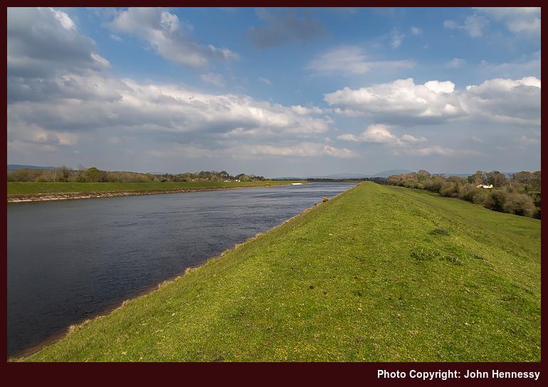
Business affairs took me beyond the city limits to West Limerick. Along with property visits and another meeting, there was an opportunity to explore Adare as well as sample the part of the Limerick Greenway between Newcastle West and Ardagh. Otherwise, there was an impromptu sortie from the city centre along the Lough Derg Way that shadowed the banks of the River Shannon until I left that trail to traipse alongside the canal conveying water to Ardnacrusha power station. Seeing that staggered me on realising that this was a project completed in the first decade of the then newly independent Irish Free State. From there, I wound my way back to the city again during an enjoyable afternoon while other business was completed on my behalf further west.
Going East for a Day
Local wandering around the city and county of Limerick more likely whetted my appetite for long explorations instead of sating it. The initial prompt had been what I could see glistening in the sunshine from my hotel room once Tuesday's drenching downpours had abated. Those sights had me checking out what was there on any maps. By Saturday, a design including a visit to the Clare Glens and an associated incursion into the Slieve Felim Hills had come together in my mind.
Handily, there was a bus service for getting me to Newport in Co. Tipperary and back again, though its infrequency timeboxed the outing. Traipsing along roads in the direction of Murroe, a place in Co. Limerick, got me to the Clare Glens, somewhere that I had not been for decades. Though compact, this is a pleasant spot and, if my recollection is sound, I had the place to myself too. The draw of the Slieve Felim Way and the Glenstal Looped Walk was too strong on a fine sunny day, so I did not dally.
Though much of the walking was on roads and good tracks, the footwear that I was using would not have been my first choice for this kind of thing. These Merrell trail shoes were meant for better wear than longer distance traipsing, yet they were well-made too and more than coped with what I was putting their way. However, the sight of a forestry firebreak may have made me wonder about getting to a summit while going around the Glenstal Loop, only for the choice of footwear to allow me to shelve the idea, even if forestry had been curtailing the views until then.
They later opened out for me on leaving the Slieve Felim Way, in any event. Though suffering from some haze, the sights of the surrounding rolling hills was what brought me, and I was not short-changed. While hiking along forestry tracks may be limiting in some ways, this was a good extension to what, before then, was limited exposure to Irish hill country. The heat of the day was on my mind as I followed track and roadway to return to Newport for the bus back to Limerick, the last of the day and one that I certainly did not want to miss. As often happens, I had time to spare before it came. Even so, it was better to end the outing that way.
A Day Around Killarney
After the preceding day's perambulations around the Slieve Felim Hills, I embarked on a day outing to Killarney, one of Ireland's iconic spots and a place that is well known to me from many family outings. However, there is something to be said to encountering a place in your own time without the constraints of group timing or others' preferences. For example, I went for a stroll while there with my parents before a change of job, conscious of increasing impatience the longer I was away from them.
As familiar as anywhere is, you nearly always can find a corner that is new to you. Knockreer Park was one of those that I happened upon through serendipity, only in this case because I made a beeline for Killarney's cathedral before going anywhere else. My route through the place took me to Ross Castle while savouring any sights in the morning sunshine along the way.
Since Ross Castle is one of Ireland's iconic antiquities, I just had to make some photos of a place that I last encountered nearly two decades before. Luckily, it stayed sunny for this because the weather forecast was for cloudy skies during the afternoon. While I was hoping that the sun would stay, the forecast sadly held true. Thus, dullness took over on the way to and through Muckross. Even so, the prospect of circling Muckross Lake was too good to leave, putting to rights a partial encounter from years before. The sights appealed to me, adding to the sadness of having clouded skies. A return would be in order; there have been a few since then.
The way to Killarney involved a ride on an express coach, yet a sense of disappointment sent me back by train, with changes in Mallow and Limerick Junction. More hill country was there to be glimpsed and checked out using a mobile mapping app. More sun was on offer, too, as I built up ideas for future escapades.
Wandering Near Lough Derg
Some might see it as an act of mockery to experience sunshine after a day that clouded over to dent emotional steadiness. However, it also offered an opportunity to put any sense of disappointment behind me. Thus, I ventured north to Killaloe to make use of what had come my way. This was a chance to earn some recompense.
Thus, I left Killaloe by following the East Clare Way after attending to a matter. The early morning quietude applied balm to the soul as I trod along rural roads; this was much appreciated. Tarmac was left after me near Feenlea only to find some soft ground and wet patches that were not ideal for the footwear that I had. Careful footwork got around this, and I began to gain some height.
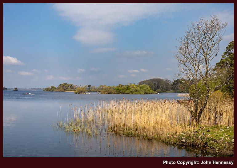
Looking left sent my gaze towards Moylussa, Clare's county top. That information was not in my mind on the day, so I left that top behind me to stand on Feenlea Mountain instead. That act was serendipitous; curiosity sent me following a trail that I saw a runner use. Below me lay the astonishing expanse of Lough Derg. That is what I recall above all else, for I never realised how large Irish lakes could be.
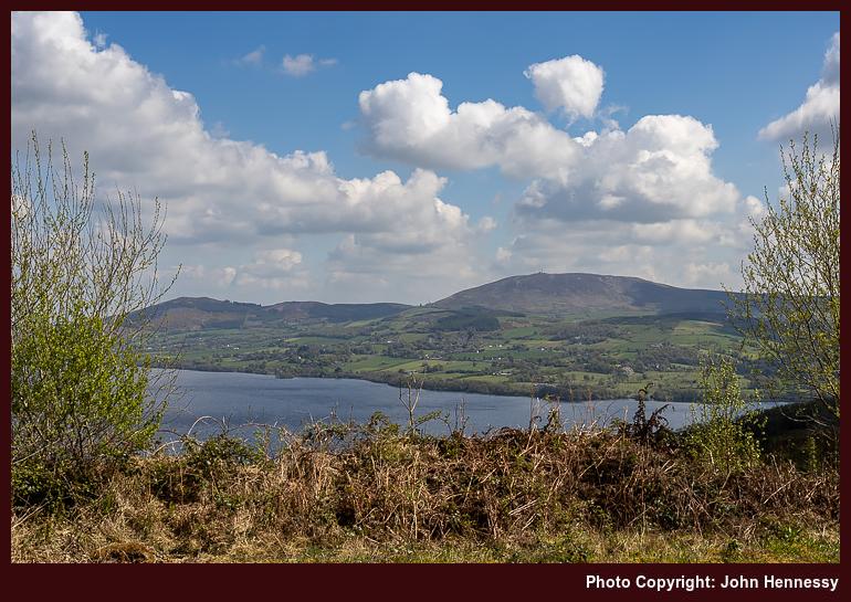
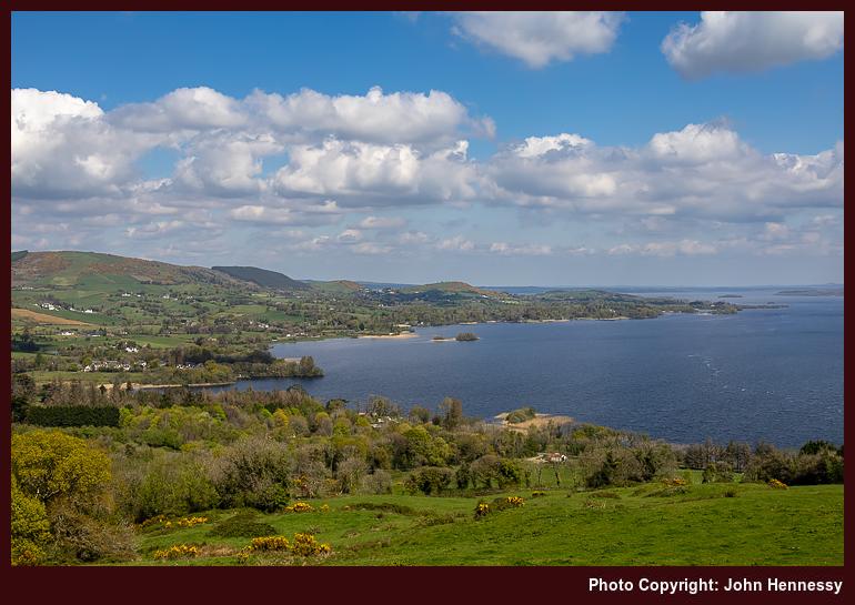
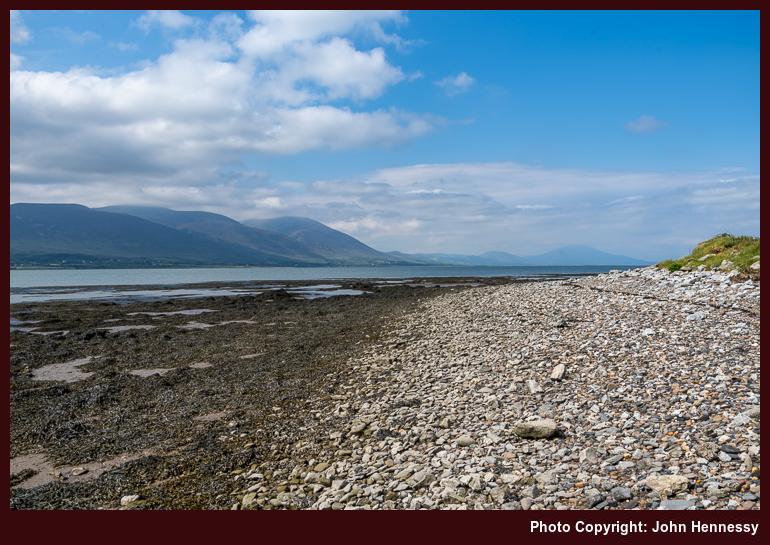
By now on the route of the Crag Wood Walk, I began my descent to the lakeside, all the while taking in the views as I went. On the Tipperary side of the lake lay the Arra Mountains and a tempting hiking prospect that would make more use of the Lough Derg Way. The skies were again filling with clouds as I went to and tarried around Rinnaman Point. However, these were not to bring any dulling of the spirit, for much satisfaction was coming my way.
Road walking was my lot on the way back to Killaloe. On the way, I encountered Béal Ború, another serendipitous discovery. More dallying resulted around this earthwork from times of antiquity; the naming connects to the Celtic king and champion against Scandinavian invaders, Brian Ború. Bus timings lured me across the Shannon from Killaloe and Clare to Ballina and Tipperary under skies that occasionally released sunshine. It struck me that many of the bridges across Ireland's longest rivers are single track affairs, needing traffic lights in some places; a few had been encountered on my travels that day.
A Bequest of Inspiration
As I went back and forth between these different destinations, I began to note other possibilities for exploration, some of which have been used since then. While the Galtee Mountains remain unlisted, the same cannot be said for the Ballyhoura Mountains, the Knockmealdown Mountains or the Comeragh Mountains. Kerry has seen multiple visits, as has West Cork, a place well outside the range of all this freestyle Eastertide wandering.
That brought me a sense of liberation that I had not experienced in my own home country. There was something special about immersing myself in nature, surrounded by the beauty of the Irish countryside. As I savoured the hills and valleys, I felt grateful for the opportunity to experience this part of the world, and I could look forward to many more adventures exploring its secrets.
Travel Arrangements and Observations
The Dublin trip involved a return flight from Manchester with Aer Lingus and the use of Dublin Express route 782 for getting between the airport and the city centre. Train travel got me between Macclesfield and Manchester Airport.
Airports were still quiet at that stage, especially compared to today. Cork Airport felt like a ghost town, and I did not dally at Shannon Airport. The latter was used on the arrival from Manchester, while the former was used on the return. Both flights were with Ryanair, with train travel getting me to and from Manchester Airport.
Bus Éireann Expressway route 51 got me from Shannon Airport to Limerick city, while Bus Éireann Expressway routes 13 and 14, and Dublin Coach route 300, got between the city and West Limerick when needed. The latter also got me to Killarney; while the services of Iarnród Éireann got me back again. Local Link bus route 391 got me to and from Newport. Bus Éireann route 345 got me from Limerick to Killaloe while Bus Éireann route 323 got me from Ballina to Limerick. Both Iarnród Éireann and Bus Éireann conveyed me from Limerick to Cork Airport.
Sometimes normality is just an illusion
In the autumn of 2021, one could be forgiven for believing that the pandemic was beyond everyone. In Europe, most had two doses of the vaccine, so the climax may have been past us. However, there was once more variant at the end of the year that added more caution, at least for a while. Additional vaccinations were performed, and many still caught the infection. Thankfully, the symptoms were milder and this episode became part of the way out. This corresponded with a thought that I had before the full onslaught reached us.
Twice from Buxton to Macclesfield
Near the end of September, I walked from Buxton to Macclesfield during what now looks like an interlude between two waves of infection. The route took me from Burbage onto Goyt's Moss before I went down by Berry Clough to reach a lane leading to Goyt Valley. That was not my destination, so I instead headed for Shining Tor via Deep Clough and Stake Clough, and no sighting of Goytsclough Quarry, hidden in the tree cover. From Shining Tor, I made my descent to Lamaload Reservoir and then went from there back to Macclesfield.
With new restrictions in place, I again set to wandering in more confidence, which may look odd to some. Thus, a reprise of the September amble happened on the last Sunday before Christmas. Until Lamaload Reservoir or even Rainow, both itineraries were alike. A stoppage on photographic recording obscures the end of the September tramp, but a new camera may have helped with that the second time around, for it tells me that I joined the Gritstone Trail as if to make for Tegg's Nose Country Park, though I suspect that the place was avoided in favour of going via Back Eddisbury Lane and Buxton Road in declining light.
The overriding memory that I have of the September hike is one of greyness, and how busy things were around Derbyshire Bridge. The latter remains, while the former is disproved by the photos that I have. There was a bright start and end to the stroll, especially on the way out from Burbage and then again from Gout's Clough onward; sometimes, your memory plays tricks on you. Otherwise, there was a lot of quite rambling, exactly what I needed at the time.
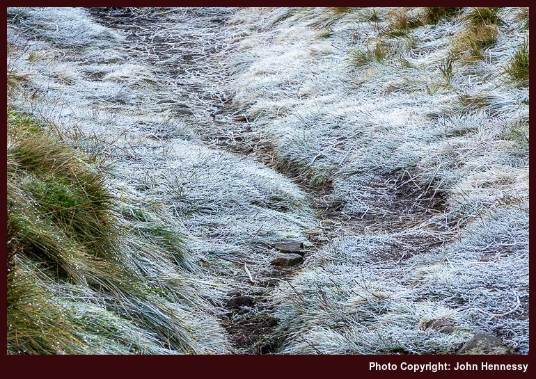
Aside from added restrictions that were nothing like what was in place at the start of 2021, the other thing in the background of the December outing was the presence of fog on the Cheshire plain. This affected flights in and out of Manchester Airport too, though there were not as many of those at the time. One thing that was unaffected was my strolling on higher ground; the bank of cloud lay further west. Thus, I got a fill of much-needed quietude in the winding down of the year. The added crispness gifted by a preceding overnight frost was another blessing that comes with a spell of December sunshine, even if low sun makes for longer shadows. Nothing could take from out in the hills anyway.
The Long Way Home from Poynton
While some risked infection by celebrating on New Year's Eve, I instead opted for an elongated trot behind Poynton to Macclesfield that started in daylight and ended in darkness. Both places are not that far apart, but I added quite an elbow to the route by passing Lyme Park without entering it before continuing around by Jenkin Chapel. In declining light, I shadowed Cat's Tor to rendezvous with the trail leading down to Lamaload Reservoir. From there, I ventured towards Vale Royal in the dark, equipped with a working head torch and knowledge of where I was going. Once I passed Hordern Farm, I was bound for Buxton Road and the last stretch to lit-up surroundings and home.
A fuller list of landmarks goes like this: Poynton train station, Poynton Pool, Prince's Wood, Higher Poynton, Middlewood Way, Macclesfield Canal, Platt Wood, West Parkgate, Dale Top, Sponds Hill, Bakestonedale Road, B5470, Bank Lane, Jenkin Chapel, Howlersknowl, Thursbitch, Lamaload Reservoir, Valeroyal, Gulshaw Hollow and Buxton Road. Most farm names have been omitted from the list for the sake of added brevity, but it might remain sensible when compared with a map.
The canal was attracting others, as were the paths near Poynton, yet things grew steadily quieter the further along I went. This became a day laden with solitary wandering, which was just as well at the time. Some of it recalls an evening when I went from Poynton to Lyme Park, only to discover that I had arrived near closing time. That had taken me by surprise after previous experiences, so I wonder if pandemic reductions in staffing had anything to do with an earlier end of day for the place.
On the way towards Sponds, the skies opened to allow better photographic results from a new camera. A chapel, seemingly opened for the time of year, was passed as I shadowed the boundaries of Lyme Park. My hope was to spot The Cage, a folly atop a hill there, from my route. That got fulfilled, though I was a little too far away for photographic purposes, and there was a certain haze in the air too. Nevertheless, there were other pleasing sights to behold, and I was not left unsated.
Beyond Sponds Hill, the journey began to follow deserted paths in lesser frequented places, particularly after leaving the Gritstone Trail. The surroundings recalled a stroll from October 2007, when I needed respite after something I was doing went against me. Some people were around Jenkin Chapel and there was no throng. After that, it was unbothered wandering into the night, part of a pattern that emerged that autumn. Much of the ground was familiar to me from daylight ambling, and there was a certain release from being out in the nighttime air.
Even so, I was conscious of my use of a head torch near where people lived and worked, and did no dallying. A gate that was not friendly to cross drew my ire because of barbed, yet nothing was ripped or shredded; it became more of a challenge than an obstruction. It reminded me of a nuisance barking dog near a public footpath that appeared during a lockdown and since appears to have disappeared without a trace. It might that any tension caused by increased usage of local paths has ebbed now that everyone has more freedom in choosing where they want to go.
The day and night had brought an element of adventure, while overseas travel remained mostly off limits. Once past a bolus of infection, minds could turn to wider roaming in 2022. Mine was among them: getting to Ireland, staying away from home again, reaching Scotland, and visiting Yorkshire and Cumbria all came to pass that year. In some places, people came across as being more friendly. Having stability helped as well; it is easier to rebuild confidence if you are the only one making the changes.
Travel Arrangements
Bus service 58 from Macclesfield to Buxton on two occasions. Train from Macclesfield to Poynton on New Year's Eve.
Seeking oases of calm in a time of unsettling change
At doing something similar for three hikes starting from Hayfield, there is every reason not to repeat that again. The variation in routes and the different seasons within which they were followed all made the narrative long and tricky to tell. Sometimes, though, the residual commonality is what prevents the giving of three different accounts.
Solitary Ambling Under Grey Autumnal Skies
On 2021's August Bank Holiday weekend, the walk from Miller's Dale to Castleton on that Saturday was not the only excursion. Whatever caused me to embark on another that Sunday is unclear to me now; the passage of time has fogged my recollection of that. Nevertheless, one can think of possibilities: retracing steps along the Midshires Way from nearly twenty years before and fitting in a visit to Combs Reservoir after seeing it from passing trains for too long. Either of these would work, perhaps in consort.
The quietude of Buxton, though, has not been lost to memory; few were around under grey autumnal skies. This was a blissful situation in the middle of a pandemic, and it helped that I chose an unpopular way to go as well. While tempted by Corbar Woods, I continued along the A5004 until I could leave that after me for the Roman road shadowing Combs Moss.

Views of what surrounded me were as plentiful as sunshine was scarce. The above photo may lead one to think otherwise, but any outbreak of sunshine was fleeting and ephemeral. The lure of Corbar Wood also applied to Combs Moss. However, I also left this for another time to continue towards White Hall Centre, before which I turned off the track for a public footpath in the direction of Combs. That left the course of the Midshires Way, which, if followed, would have led me into the Goyt Valley all those years ago.
My new direction took me downhill, with views of the edge of Combs Moss that would have been more of a delight if I had sunshine for making photos of it. Any sightings of Hoo Moor were declining behind me as I passed various farms around Allstone Lee to reach a lane near Rye Flat Farm.
Once on tarmac again, I passed a quiet Combs before leaving the lane for a path taking me under the railway from which I had been viewing the reservoir on evening returns from Buxton. Staying close to the shoreline of Combs Reservoir, I continued on my way to Tunstead Milton. No boats were out on the water as I passed; the deserted atmosphere of the day was persisting, though some were passing my way at times.
The rest of the way to Whaley Bridge has become unmemorable after the passage of time, though I left the course of Chapel Road; a busy thoroughfare is not me choice of route for hiking. Here then are a few guesses. Following Milton Lane to Hilltop sounds more likely than using a footpath to go by Woodside Farm, as does leaving the lane near Horwich Farm in order to go via Throstledale.
By then, clouds were breaking to allow more sunshine as I came to the end of my stroll in Whaley Bridge. There were more people around there than other places where I had been that day. Nevertheless, the pervading stilly atmosphere continued to prevail. This had been a quiet outing in quiet places that had to commend it for stilling one's spirit.
Joining Places Together Under September Sunshine
The lures of Corbar Woods, Corbar Hill and Combs Moss drew me back to Buxton again. Whenever I had gone on quick sorties to Buxton, my strolling often took me to Buxton Country Park and Grinlow Tower once I had got away from the delights of Spring Gardens or the area around the Slopes. Never had I gone near Corbar Woods or Corbar Hill, though the former also gets managed by Buxton Civic Association. It simply had not entered my awareness until that Sunday saunter from Buxton to Whaley Bridge during the preceding Bank Holiday weekend.


This time around, I sought to address that non-visitation on what was a brighter day. Finding my way into Corbar Woods was the first task. Once that happened, there was the steady ascent through the trees in a small but pleasant space. Beyond that lay pasture, before crossing a wall led me onto moorland. An escarpment lay before me and I scaled that using a frequently used path to reach where a cross had been installed on the top. Pottering around there allowed to savour the panoramic views of the town and what lay around it.
Once on access land, at least partly owned by the University of Derby, I began to make my way towards Combs Moss, passing near Moss House Farm. If Buxton had been peopled, the moor was next to deserted. Only a few souls were wandering these parts while I was there. Distant views were obscured somewhat by haze as I followed an informal path around by Flint Clough and Black Edge, where a trig point could be seen catching the sunlight with its whiteness.
This was a journey along the moor's eastern edge, so there were sightings of the effect of quarrying on the landscape around Dove Holes. The A6 below there too, and there was not that much to please a seeker of the picturesque. Passing Hob Tor and Short Edge had me wondering quite what the fascination was in staying so close to the edge with there being a steep drop. At times on the way to the fort atop Castle Naze, I kept in from the drop, even if it meant travelling over rougher ground than what the path had levelled.
After visiting the fort, thoughts turned to making a descent. The path marked on the map did not thrill me, so I tried going another way. Getting down worked well, but my problem was getting on to the lane. Getting on and off access land is not always easy, finding the entrance can be tricky, as I would find later in the day. Scaling an unfriendly gate was what it took in the end; the use of barbed wire looked peevish in the circumstances, for the access land reached up to the road.
Some bumbling around preceded my choosing a path for the descent to Combs; the reconnaissance probably was needed, for there were a few options that curtailed tarmac travel. One would have taken me towards Chapel-en-le-Frith's train station, which itself is quite an uphill schlep from the town, before turning towards Combs. Another would have avoided farm buildings altogether, though memory cannot pick between the options at this point of remove.

There was no dallying as I passed Combs, since I wanted to follow the western shoreline of Combs Reservoir in the hazy sunshine. Sailing vessels were out on the water this time around. If there were more in the vicinity then, that is largely lost to me now. If so, their presence cannot have been that much of an intrusion.

This time around, I was not bound for Whaley Bridge. It is not clear if continuing to Chinley and New Mills was an intentional decision taken before setting out, or something that fell into place during the ramble. Either way, I made my way from Tunstead Milton to Eccles Pike, more likely via Sparkbottom and Woodside Farm. Once on Eccles Road, yet another lane of many, I sought the way onto more access land. Someone had been knocking fences around, a perhaps questionable if understandable act that made entry easier.

Leaving Eccles Pike and the access land around it, I followed a right of way down to another road. Familiar hills like South Head lay before me as I made my descent. Reaching Chinley would need my going over the A6; thankfully, a road did that for me, avoiding a crossing of the busy thoroughfare itself. If I had wanted to shorten my walk there, going by train would have been the only option; there was no Sunday bus service.
In the event, it became a refreshment stop, since there was a shop open and a green park nearby. More uphill travel was ahead of me, so a rest break was needed before that. Crossing over the railway took me onto Old Hill Road, where I spotted a Royal Mail van doing Sunday deliveries, a striking thing when you are more accustomed to their normal six-day delivery.

As the ascent got my heart going, there was a route choice ahead. Did I stick with the Old Hill Road in the form of a track, or use another one? The alternative was what I chose; the possibility of easterly views was what decided me. It was hardly busy, yet others were out using it too. Once the gradients slackened, I could peer in the direction of Kinder Scout and what lay about it. Kinder Reservoir could be glimpsed too, and I wondered if I could spot Hayfield as well.

Evening was approaching by this time, and I decided against a descent to Hayfield in favour of one to Birch Vale. That got me nearer to New Mills and onto the Sett Valley Trail, where I had not trod since my first encounter with Kinder Reservoir the most of twenty years before. Given the time of day and the need for some to walk their dog, the uptick in human usage came as no surprise. The converted railway alignment also meant easier work for my legs, and I dawdled at times too.
There was an illusion of everlasting summer that September evening, as there so often is. Even so, the lengthening hours of night encouraged me to reach the bus stop for my journey home after a satisfying day on foot. In many ways, the route connected places that I had known apart from each other. It was good to join the lot together.
Quiet Saturday Strolling Over Combs Moor
After two Sunday strolls, we now come to a Saturday one. Quite apart from the opportunity of a day with less haze, it is difficult to say what inspired this departure to and from Whaley Bridge. One thing is certain: this was no reprise of the first hike; there are too many differences for that.


The way out of Whaley Bridge is among those. The exact details may be lost to me now, but it did lead me south to Long Lane, which I used to round Ladder Hill with views over Combs Reservoir and towards Chapel-en-le-Frith. This was not a close encounter with that reservoir but part of a more direct route to Combs. Much of the way more likely was road walking; that would change.
Though much of the way from Combs to Combs Moss is no longer memorable, it is plausible that it avoided tarmac tramping for much of that. The final approach is beyond question, though: there was an ascent of the path that I rejected while en route from Buxton to New Mills. It was not as fearsome as I considered it to be on that occasion.


Thankfully, the rest of the way to Buxton is easier to relate. This went along Combs Edge and continued south and west to show me a different side to the moor. There were views back towards Combs Reservoir as much as what lay on the other side of the Goyt Valley. Though the sun came and went, there were ample photographic opportunities with any gritstone outcrops that I passed. Navigation on an informal path was simple, too, which was just as well on this access land.


Relaxing progress in a place with few if any about was my lot, and I relished it all. In time, I would shadow the outbound route from Buxton that I took on the way to Whaley Bridge at the end of August. The way off the moor would reverse the way taken while going from Buxton to New Mills. Some familiarity was beginning to help me as I passed Moss House Farm on the way to Corbar Hill. This was one lasting halt before the descent into the busier confines of Buxton. These were not so comfortable, yet I rushed nothing before catching a bus back to Macclesfield after a satisfying day with much respite from the world's affairs.
Travel Arrangements
Bus service 58 got me to Buxton for the start of the first hike. The remarkable part of the return is the rail replacement bus from Stockport and how few were using face coverings. Between Whaley Bridge and Stockport, I could have travelled by either train or bus, more likely the latter, even if I am not fully sure of that.
Bus service 58 again did the honours for getting me to Buxton for the second ramble. The way home from New Mills is less clear. Was some of it by bus or all of it by train? The former seems more likely, and that would have got me to Stockport for an onward connection. For the last trot, bus service 60 got me to Whaley Bridge, while bus service 58 returned home from Buxton.
Better fitting boots would have helped as I plodded through some Derbyshire Dales
"Freedom Day" probably sounded like a great idea to someone at the time. It was supposed to arrive in June 2021, only for an upsurge in infections to be caused by the delayed UEFA Euro 2020 Championship. Looking into any pubs that I passed back then, I could see no sign of social distancing as the punters watched the football games on TV. It did not help that England got as far as the final, either. Still, an important game meant empty trails for evening rambles, as I found that Sunday evening.
If I had hoped for a more phased opening up, I was to be disappointed. Such was the focus on summer holidaying in both 2020 and 2021 that I wonder if political populism overrode public health. Any daydreams about reaching the Isle of Man or the Channel Islands were scotched, and reaching Ireland felt more of a long shot. What was needed were baby steps, and everyone likely would make the same ones at the same time.
Even with two doses of the vaccine, "Freedom Day" did not feel like that for me. Add in a heatwave and a computer upgrade project, and you get a situation where outdoor activity was not on the menu. Hauling computers up and down stairs in a terrace cottage became sweaty work in any case (my workbench was downstairs for these things). Even taking a stroll late in the evening was no guarantor of coolness; overnight sleep was challenging at best. All in all, the three-week break from work in July became a homecation mainly devoted to indoor activities.
By the end of August, something must have been stirring me, for the Summer Bank Holiday weekend saw me embark on nearby outdoor excursions. Both took me to Derbyshire, one through the Derbyshire Dales and another over Combs Moss. The latter became a hub for various wanderings that will be related. The amble through the Derbyshire Dales will do for this account.
While the route of the Limestone would likely have conveyed me the whole way, I fancied going into Monk's Dale instead. Thus, that is where I headed after arriving in Miller's Dale. Descending to the floor of the dale took some route finding in the woodland, for I followed a little of the Limestone Way at the start. Once down there, there was little to do but go in a general north-westerly or northerly direction, as directed by the steep sides of the narrow valley and any watercourse going along it.
Aside from simple navigation, I also got the place largely to myself. Straggly late summer vegetation may have intruded on the meadows, but the limestone outcrops could not fail to delight. This remained my lot as I continued through Peter Dale, Hay Dale and Dam Dale. Others passed me from time to time, yet this was a confidence building measure for any future return to normal life, that some may have assumed was already well in place.
Aside from dale-trotting, there was another reason for my going this way, and it dated from nearly twenty years before. Then, I was walking from Buxton to Castleton. Around Peak Forest, I lost my way somewhat; OS map sheets OL1 and OL24 do not overlap very well, adding to the confusion. In hindsight, I may not have helped matters by going through Peak Forest itself instead of sticking more closely to the route of the Limestone Way, which was already there back then. This is not a recently instated long-distance trail like so many others.
Thus, I needed to get to the Limestone Way from Dam Dale without messing things up again. With a modern mapping app on a mobile phone, that was a bit easier. Those paper mapping overlaps are an issue no longer, so I could cross the A623 with added confidence to get across fields to Old Dam Lane to continue east without any muddle. Then, I could avoid getting near Bradwell and walking on lanes around quarries to keep things more picturesque.
Another matter was more plain to me, though. The previous Easter, the sole on one of my long-suffering Meindl Burma boots detached from the upper while on a ramble around such locations as Langley and Higher Sutton on the Monday of Holy Week. The uppers looked well-worn, so there was little point in resoling them, especially since they had lasted since 2009.
However, I still needed a pair of boots for mud plugging, and I was reluctant to sully others that I had; these were being kept for when overseas excursions could resume. The result was my acquisition of a pair of Berghaus leather boots that proved to be too big for me. They should have been returned for a pair of a smaller size, yet I persevered with them, possibly for too long. The adage that boots need to fit well should have driven that.
Returning to that self-powered journey to Castleton, those Berghaus boots were to take a toll when I was in busier surroundings. Before that, I threaded my way past such landmarks as The Cop, Old Moor and various disused mines. What lay ahead of me was the descent into Castleton through Cave Dale. It was then that I hurt my feet while passing someone at a health-inspired distance on rougher ground. There was no tumble, only discomfort that did not play well on steeper slopes.
Castleton is a honeypot, so groups were out and about, inadvertently challenging my comfort zone. There had been a hope of seeing and photographing Peveril Castle in sunshine, but that was foiled by cloudy obstruction of the sun. Even so, I got myself to the village and its bus stop for the way home. There surely were refreshments too, even if there were around than I felt to be comfortable.
The offending boots later found their way to a charity shop, and a pair of Scarpa boots replaced. These are better, if imperfect, fitting, but their soles are well-worn at this stage, having seen me through numerous European wanderings. The uppers remain fresh, so resoling may be a more likely outcome than replacement. My feet have healed from any insults from the use of the Berghaus items, too. All is transitioning into a useful set of memories for future reference.
Travel Arrangements
Unlike a previous trip report, public transport experiences were less memorable in a good way. The outbound journey to Miller's Dale was by bus, with a change in Buxton; bus services 58 and 65 were used. The return to Macclesfield is where memory again ails.
Since Castleton does not have a train station, departure by bus was unquestionable. Other questions emerge, though. Was it by service 272 or another one? Did I go all the way to Sheffield or alight near Hope station? From either, a return train journey would have commenced, one with a change in Manchester and another with one in Stockport. Railway engineering works were ongoing that weekend; did they impact the journey by a need to use a rail replacement bus? That seems unlikely because of a memory from the following day. Otherwise, all is blighted by a fug of uncertainty.