Category: Cheshire
Sometimes normality is just an illusion
In the autumn of 2021, one could be forgiven for believing that the pandemic was beyond everyone. In Europe, most had two doses of the vaccine, so the climax may have been past us. However, there was once more variant at the end of the year that added more caution, at least for a while. Additional vaccinations were performed, and many still caught the infection. Thankfully, the symptoms were milder and this episode became part of the way out. This corresponded with a thought that I had before the full onslaught reached us.
Twice from Buxton to Macclesfield
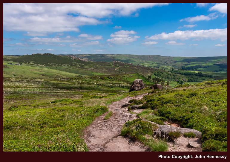
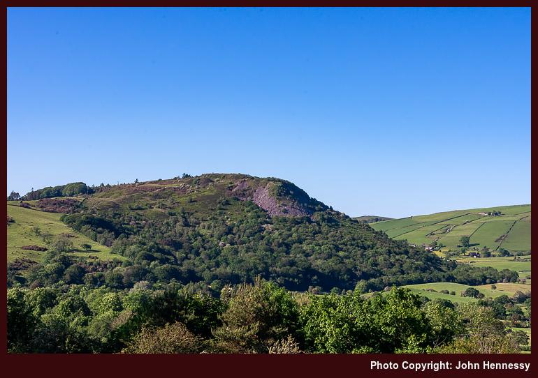
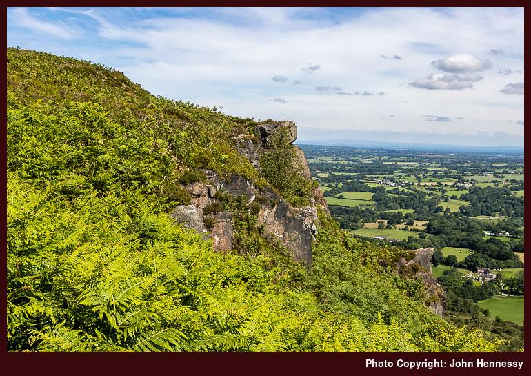
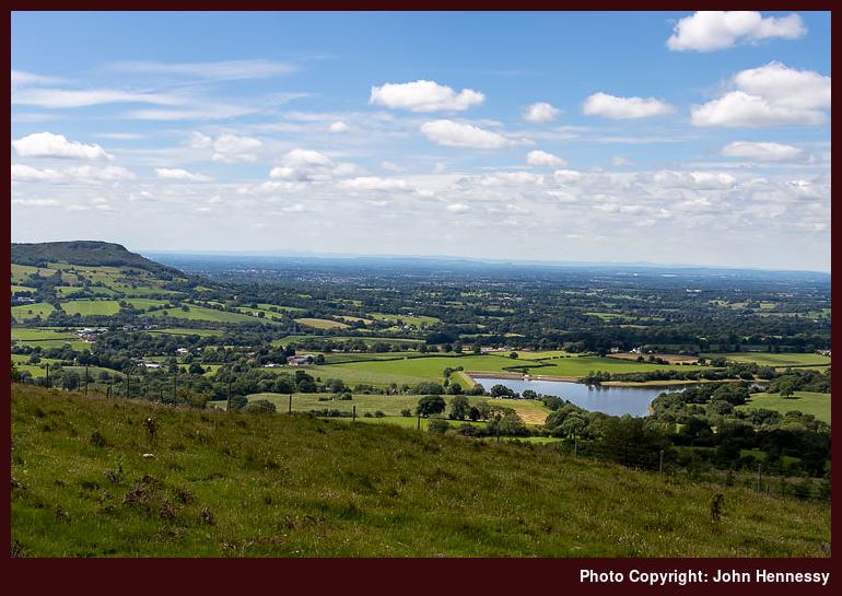
Near the end of September, I walked from Buxton to Macclesfield during what now looks like an interlude between two waves of infection. The route took me from Burbage onto Goyt's Moss before I went down by Berry Clough to reach a lane leading to Goyt Valley. That was not my destination, so I instead headed for Shining Tor via Deep Clough and Stake Clough, and no sighting of Goytsclough Quarry, hidden in the tree cover. From Shining Tor, I made my descent to Lamaload Reservoir and then went from there back to Macclesfield.
With new restrictions in place, I again set to wandering in more confidence, which may look odd to some. Thus, a reprise of the September amble happened on the last Sunday before Christmas. Until Lamaload Reservoir or even Rainow, both itineraries were alike. A stoppage on photographic recording obscures the end of the September tramp, but a new camera may have helped with that the second time around, for it tells me that I joined the Gritstone Trail as if to make for Tegg's Nose Country Park, though I suspect that the place was avoided in favour of going via Back Eddisbury Lane and Buxton Road in declining light.
The overriding memory that I have of the September hike is one of greyness, and how busy things were around Derbyshire Bridge. The latter remains, while the former is disproved by the photos that I have. There was a bright start and end to the stroll, especially on the way out from Burbage and then again from Gout's Clough onward; sometimes, your memory plays tricks on you. Otherwise, there was a lot of quite rambling, exactly what I needed at the time.
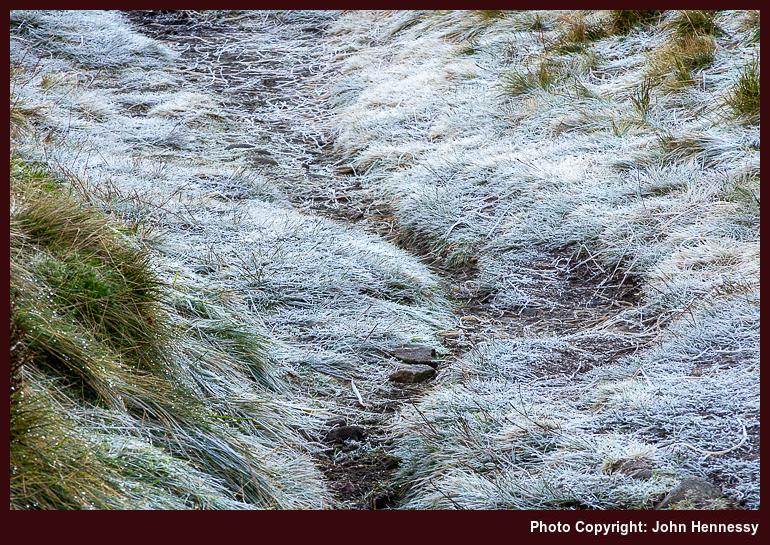
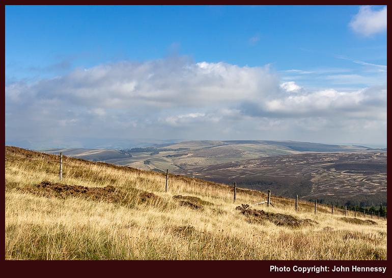
Aside from added restrictions that were nothing like what was in place at the start of 2021, the other thing in the background of the December outing was the presence of fog on the Cheshire plain. This affected flights in and out of Manchester Airport too, though there were not as many of those at the time. One thing that was unaffected was my strolling on higher ground; the bank of cloud lay further west. Thus, I got a fill of much-needed quietude in the winding down of the year. The added crispness gifted by a preceding overnight frost was another blessing that comes with a spell of December sunshine, even if low sun makes for longer shadows. Nothing could take from out in the hills anyway.
The Long Way Home from Poynton
While some risked infection by celebrating on New Year's Eve, I instead opted for an elongated trot behind Poynton to Macclesfield that started in daylight and ended in darkness. Both places are not that far apart, but I added quite an elbow to the route by passing Lyme Park without entering it before continuing around by Jenkin Chapel. In declining light, I shadowed Cat's Tor to rendezvous with the trail leading down to Lamaload Reservoir. From there, I ventured towards Vale Royal in the dark, equipped with a working head torch and knowledge of where I was going. Once I passed Hordern Farm, I was bound for Buxton Road and the last stretch to lit-up surroundings and home.
A fuller list of landmarks goes like this: Poynton train station, Poynton Pool, Prince's Wood, Higher Poynton, Middlewood Way, Macclesfield Canal, Platt Wood, West Parkgate, Dale Top, Sponds Hill, Bakestonedale Road, B5470, Bank Lane, Jenkin Chapel, Howlersknowl, Thursbitch, Lamaload Reservoir, Valeroyal, Gulshaw Hollow and Buxton Road. Most farm names have been omitted from the list for the sake of added brevity, but it might remain sensible when compared with a map.
The canal was attracting others, as were the paths near Poynton, yet things grew steadily quieter the further along I went. This became a day laden with solitary wandering, which was just as well at the time. Some of it recalls an evening when I went from Poynton to Lyme Park, only to discover that I had arrived near closing time. That had taken me by surprise after previous experiences, so I wonder if pandemic reductions in staffing had anything to do with an earlier end of day for the place.
On the way towards Sponds, the skies opened to allow better photographic results from a new camera. A chapel, seemingly opened for the time of year, was passed as I shadowed the boundaries of Lyme Park. My hope was to spot The Cage, a folly atop a hill there, from my route. That got fulfilled, though I was a little too far away for photographic purposes, and there was a certain haze in the air too. Nevertheless, there were other pleasing sights to behold, and I was not left unsated.
Beyond Sponds Hill, the journey began to follow deserted paths in lesser frequented places, particularly after leaving the Gritstone Trail. The surroundings recalled a stroll from October 2007, when I needed respite after something I was doing went against me. Some people were around Jenkin Chapel and there was no throng. After that, it was unbothered wandering into the night, part of a pattern that emerged that autumn. Much of the ground was familiar to me from daylight ambling, and there was a certain release from being out in the nighttime air.
Even so, I was conscious of my use of a head torch near where people lived and worked, and did no dallying. A gate that was not friendly to cross drew my ire because of barbed, yet nothing was ripped or shredded; it became more of a challenge than an obstruction. It reminded me of a nuisance barking dog near a public footpath that appeared during a lockdown and since appears to have disappeared without a trace. It might that any tension caused by increased usage of local paths has ebbed now that everyone has more freedom in choosing where they want to go.

The day and night had brought an element of adventure, while overseas travel remained mostly off limits. Once past a bolus of infection, minds could turn to wider roaming in 2022. Mine was among them: getting to Ireland, staying away from home again, reaching Scotland, and visiting Yorkshire and Cumbria all came to pass that year. In some places, people came across as being more friendly. Having stability helped as well; it is easier to rebuild confidence if you are the only one making the changes.
Travel Arrangements
Bus service 58 from Macclesfield to Buxton on two occasions. Train from Macclesfield to Poynton on New Year's Eve.
Sunlit journeying under a cloud of condescension
"I could wait here all day", he said condescendingly. That is not a response that you need from a bus driver when buying a bus ticket using a debit card. Every other ticket machine that I encountered did not need the card to be placed on the machine like this one did. Not being a regular, I did not think of that. That driver came across as a jobsworth and was not at all helpful. It felt like I met someone who was killing time until retirement, and the experience was such that I got off the bus in Leek when someone else did. It felt better not to share space with that driver.
The payment was made on the day when it was required, so I did my part. The operator dropped the service later in the year; it is difficult to keep going if you have staff that are not customer-friendly, but there may be other reasons. Later on, another driver with the same company, albeit working a different route, came across as more anxious yet was helpful at the same time; he reminded me what to do with a debit card as you would hope. That cannot be faulted. The previous summer, I overheard a conversation involving yet another driver from the same company. The topic was how uncomfortable passengers felt about a different driver. It makes one wonder when you hear things like that.
The real disappointment is that this was a more mainstream company and now the dominant operator in Cheshire East. Their having facilities beyond those of a smaller operator made me fancy walking around Leek more often. The truth is that I have not been there since that day in June 2021, and that a previous operator regained the route under council contract after a messy transition.
Since I now have another place to put them, I normally do not share musings on public transport on here any longer. There was a time when I did so, but that has passed. Such was how I took the response at the time that it cast a shadow over the rest of the day. Hence, it needs mentioning. Thankfully, I had decided on walking all the way home, avoiding a repeat encounter; my nature is conflict averse at the best of times.
Once off the bus, I could begin to put the whole thing behind me; the day was sunny, so distractions could come my way. There was overlap with previous traipsing between Leek and Buxton the previous year, yet the public transport experience and the effort involved in collating route variations for various hikes from Hayfield was enough to put me off including this account in that narrative.

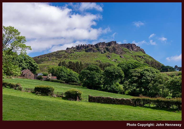

The way from Leek to the Roaches probably was a quiet affair, as it so often is, yet details of the route taken are lost to me now. Even photos are not much help, since pastoral countryside can look similar in all sorts of places. However, I did make for the Roaches without visiting Hen Cloud. There were quite a few up there, which might have deflected me as much as have being there before. Being between vaccination doses continued to keep me cautious.
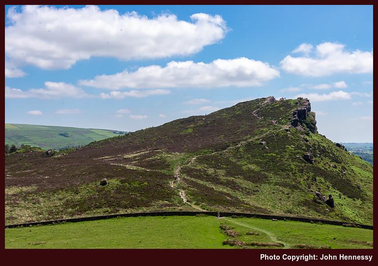
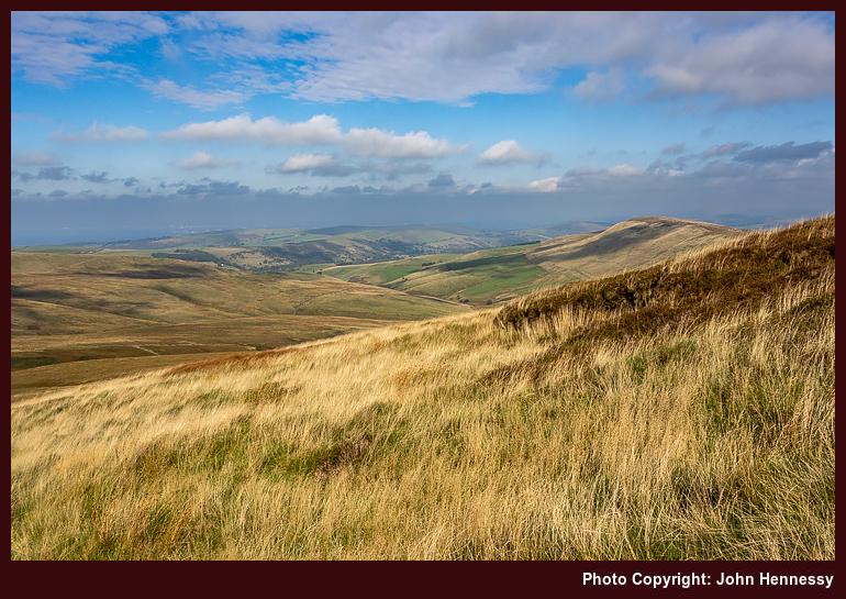
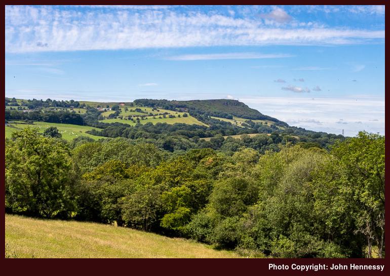
As I continued north, much was as familiar to me as it was good to see it again, especially with sunshine. Tittesworth Reservoir lay below, Ramshaw Rocks were there to the east and in the west there was Croker Hill and Shutlingsloe. While making tracks in one county, it was possible to glimpse towards two more. The day was feeling much better.
However, it was having its busier moments as well. Seeing a large group going around was a reminder that many were getting more relaxed. Restrictions were easier and the ongoing vaccination programme had gifted political benefits, ones that were not to last. After the Roaches, my wandering took me over Back Forest and near Lud's Church, which is where that large group intruded on my day somewhat; my sense is that they were staying in group accommodation (possibly the former YHA in Gradbach, now an outdoor adventure centre?) and this was part of a circular route that they were following. Nevertheless, there were ample views over Gradbach and the nascent Dane Valley that compensated as much as those towards Shutlingsloe and what was near there.
Things grew quieter around Hangingstone Farm, which was to my taste. By this stage, I was near where I had first gone on the Sunday of a Spring Bank Holiday weekend in 2009. Danebridge was the next landmark on my route and where I would cross the River Dane to re-enter Cheshire. It would have been tempting to think that I was most of the way home, yet that would have been wishful thinking.
Initial impressions that the route from Danebridge had slipped from recollection now look pessimistic, for there remain some reminders. Hammerton Farm and Longgutter are made probable by my remembering that the latter was peopled with a family or families enjoying a country stay. It might have been that I needed to ask the way through there as well. Bonhomie was the general air thereabouts, a contrast to the start of the day. Eventually, I would have alighted on the lane leading me to Higher Sutton, Ridge Hill and beyond to Macclesfield. This is supported by the appearance of Tegg's Nose in my photographic records, and Shutlingsloe looms large here too.
The spirit may have been wounded, yet the day was not spoilt. That is how things feel to me now, having shared my thoughts on how it all began. Maybe that is the point of writing these accounts; the act helps to deal with any wounds and other things that may have gone awry. As I worked through this one, I was reminded of when my elderly Meindl Burma boots failed the preceding Easter. Their successors set the scene for a tale of a trot from Miller's Dale to Castleton over two months later.
Travel Arrangements
Outbound journey on bus service 109 from Macclesfield to Leek.
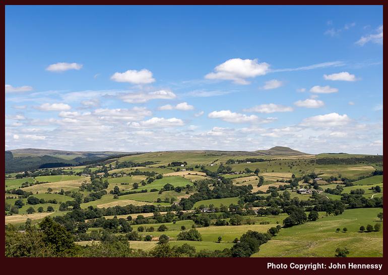
A sunny amble through the Goyt Valley: Going from Whaley Bridge to Macclesfield
Once grey July Saturday during the early noughties, I set off from Buxton on a hike that may use of the Midshires Way. There was a lengthy walk along the A5004 before I left it for an old Roman Road. That skirted Combs Moss before continuing east from White Hall Outdoor Pursuits Centre. Eventually, I would cross the A5004 on the way to the dam at the end of Errwood Reservoir in the Goyt Valley.
My next steps would take me away from the long-distance trail to follow the shore of Fernilee Reservoir more closely. By then, the skies were beginning to break overhead as part of a change to periods of sunshine and showers, the latter being annoying when it came to photography. When the sun was out, it was raining and then the sun went way when the rain stopped. While that might be an oversimplification, there were times like that which remain etched in my memory.
That pestering really got going after I rejoined the Midshires Way after being under cover of trees while near the reservoir. The twists and turns of the trail needed close attention to a map, not the best when it was made of paper and that gets wet. It is little wonder that I acquired a waterproof version that I retain to this day. Regardless of all the irritations, I made it to Whaley Bridge in sunshine and made my way to a rendezvous point for onward travel by public transport, bus or train.
My reason for going down that memory lane is that it partly inspired the routing for a hike that would take me from Whaley Bridge to Macclesfield via the Goyt Valley during September 2020. This was another of those hikes that conveyed me home after an outbound bus journey. The initial stretches, those between Whaley Bridge and Taxal, were shared with hikes between the two places that went via Windgather Rocks. This time around, they were trampled under grey skies in hope of later sunshine.
Thus, the way to the Goyt Valley would be a reverse of the direction taken all those years before. The weaving of the trail around Overton Hall Farm, Madscar Farm and others like Normanwood was etched somewhere in my mind anyway. Images of the farms were absent, yet the essence of the trail was not.

At Oldfield, I decided not to descend to the lower path that I followed those years ago and several times since then. This time, I stayed on the Midshires Way and on higher ground. Forestry surrounded me as the cloud cover disintegrated over my head. Tree harvesting added holes through which I could look out on what lay across the valley, a fortuitous development even if it meant timber stacks, warning signs and a rougher track. It all made for a more interesting stroll along the slopes of Hoo Moor.


The trail would return me to tarmac for the descent to the dam of Errwood Reservoir, where a photo stop was inevitable with all the sun on offer. After leaving the reservoir dam, Bunsal Cob was where I took my leave of the trail that I had been following. This time around, I was not bound for Buxton; it was not to be a complete reprise of the way followed those years before. The section of the Midshires Way leading north from Buxton would play its part in introducing me to Combs Moss nearly a year later.


Paths and tracks taking me down the eastern side of Errwood Reservoir became my lot after Bunsal Cob. Some of these recalled a hike from October 2012 in advance of a year when everything changed. 2020 was another for many people, so the wonderful weather and an illusion that all was well allowed a momentary escape from all that was happening.


Going beyond Errwood Reservoir was leading me into familiar moors where there was ample space for us all. Wild Moor always catches my eye, and the sogginess of Goyt's Moss dirties many a rambler. Since it is all access land, it hardly matters whether you are on a right of way or not, so long as you are heading in the right direction. This makes for good map and compass countryside and was a test for the mobile app that I was using; rights of way can be challenging to locate in a bog.


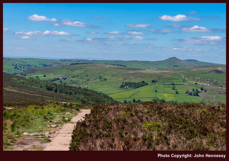
Goyt's Clough became where I again alighted on tarmac. My next step was to find the right of way that would convey me across Deep Clough and Stake Clough on the way towards Stake Farm and the A537. This meant a steep ascent with many breaks to take in what surrounded me; this was also ground that I travelled on that October 2012 hike. Having been to it several times already in 2020, I skipped Shining Top, an act that cut the endurance being demanded of my legs. Variation adds a bit of novelty to life, anyway.


The haul up to Forest Chapel lay ahead of me as I began to follow a concessionary path leading towards Torgate. Since this had been traipsed earlier in 2020, I knew that I needed to go down to Chest Hollow and pass near Cuckoo Rocks. That descent accentuated the ascent to be made after the distance already covered on the way from Whaley Bridge. Taking things slowly was the answer.

Getting as far as Torgate Farm was the first part of this. From there, a right of way conveyed me to the curiously named Bottom-of-the-Oven, with a right turn that took me across Torgate Hill. The byway going up to Forest Chapel was a real test. Overcoming that was not the end, for another ascent followed it, the one along the byway taking me into Macclesfield Forest, where a surprising route decision would be made.
But for the proximity of Tegg's Nose Country Park playing on my mind, logic would have dictated that going down to Clough House and then proceeding via Langley might have made more sense. Instead, more uphill travel, some of it steep, became my lot on the way to Walker Barn. That took me past Hacked Way Lane and Warrilowhead Farm, yet I got through it without much drama. This was quieter ground, which might have been another reason for going this way.
Good sense again took hold from Walker Barn to Macclesfield. On the way, Tegg's Nose Country Park was skirted (the sun might have made the place and its paths and trails more busy than I fancied), primarily using a byway leading onto Back Eddisbury Road, before that allowed me to reach Buxton Road.
Home was near at hand by then, so steady and patience progress got me the rest of the way. Given that it had been a day with nearly as much variety as there was sunshine, it would have been rude to complain. The September illusion of endless summer had pounced yet again; it was best to sate oneself through participation in the charade.
Travel Arrangements
Bus service 60 from Macclesfield to Whaley Bridge
Hikes that took me back home through some Cheshire and Derbyshire hill country
The trouble with recounting tales of local hikes is that the locations often are too familiar; they lose their novelty with frequent encounters. That applies even with the backdrop of a pandemic, so I am bundling these three hikes from the summer of 2020. Each is different in its own way, yet there is a connecting thread linking them all. After all, my traipsing through the countryside hardly ever is just exercise, since any tranquillity is sought, relished and savoured as I go. Quietude was prized whenever it came.
Initiating a Longer Break
Given the effect that all the upheaval and disruption was having on my mental health, I decided on a three-week staycation that flowed from July into August, much longer than I normally do. Even with never straying far from home, it was to help a lot. Even so, there were more than a few day trips.
Some were less consequential, at least from the point of view of an outdoors blog like this one. Visits to Rostherne, Knutsford, Tatton Park, Buxton and Sheffield (even if I did wander its parks, encountering its Cholera Monument, a stark resonance that summer) are not the kind of things that are related here. There is too little to say about short encounters that often involve revisiting the familiar, even if they had their uses at the time.
The same might be said for a visit to Lyme Park, but for one thing: it was en route during a hike from Disley back home to Macclesfield. This also was my second journey since the start of the pandemic and involved a change at Stockport; courage was increasing with added experience.
While the arrival in Disley was delayed, that is something that matters less when you are walking all the way home when there are long hours of daylight. Picking up the Gritstone Trail near the train station, I started on my way. Going through Lyme Park was another act of increasing courage. However, I avoided its front gate to go in and out of the back ones. That was the way that the trail went anyway, though there is a route alternative if I had wanted to avoid the busier stretch passing Lyme Hall.

Beyond that, things became quieter again. The terrain was familiar to me as I went up and over Sponds Hill. That perhaps was just as well, when so much else was peculiar at the time. The illusion of an unchanging countryside added a badly needed fulcrum and was as important as the feeling of freedom and solitude that was being gained. The church tower at Pott Shrigley could be glimpsed from a distance, while the same happened with Bollington. That was not a halting point, especially with there being no Sunday bus service and how it drew many out from Macclesfield that spring and summer.

To skirt Rainow, I left the Gritstone Trail to follow Oakenbank Lane, another discovery from earlier in the year, the Friday immediately preceding the Spring Bank Holiday weekend in fact. This hike may not have been as unpeopled as the photos show, yet there was every chance that decreasing restrictions allowed people to spread out to leave more space for each other. Nothing everything had opened, but there were more possibilities than there were a few weeks or months before.

Passing Ginclough brought me to a way leading to Lamaload Reservoir that was another discovery from prior sorties into nearby countryside, especially a circuit starting from and ending at home that took in Shining Tor. Everything might have been close to home, yet there were new places traipsed as well. The way from Lamaload Reservoir to Walker Barn may have been another of these paths that I came to travel during the pandemic times that I have not frequented since then. The same might be said of the way that I took by Tegg's Nose Country Park as I closed in my place of residence again. In some ways, the ways taken were so familiar that maps hardly were needed and decisions could be taken on the hoof as well.
On reflection, the whole route was a collation of different possibilities that led this way and that. There was Disley to Bollington, Bollington to Ginclough, Ginclough to Lamaload Reservoir, Lamaload Reservoir to Walker Barn and Walker Barn to Macclesfield. While some of those staging points did not get entered, each portion was a hiking possibility in itself. The longer evenings allowed a pick and mix approach to be taken. It really helped that there were quieter stretches where solitude could work its magic after what was becoming a wearying year.
Taking a Chance with the Weather
The previous week was laden with melancholy. The idea of facing into a trying autumn while fatigued by ongoing events was enough to send me away from home, doing anything to go get out of the house. Macclesfield Library, Buxton and Knutsford (even on a scorcher of a day, such was the need; getting better photos of Rostherne was a draw too) all had been visited along with other local spots while out on evening walks and cycles.
Remembering photos made during autumn rambles in 2007 was what put going around by Windgather Rocks into my head. The rain radar may have been showing showers approaching from the west, but I was determined to get to Whaley Bridge for a hike, such was my state of mind.
Things began well enough, and it looked as if showers might be escaped. There was a sunny start as I commenced from the railway station in Whaley Bridge to pass beneath the dam of Toddbrook Reservoir, still drained and under repair following the previous year's structural issues, and alongside the River Goyt. It was no threat by this time, so I continued to Macclesfield Road and went up that thoroughfare to join the Midshires Way to get to Taxal, where I lingered by its church in some sunshine.
That long-distance trail was left soon enough to cross fields on the way to Taxal Moor Road. The quietness of the morning air struck me, though a walking group was to be heard behind me at times. They were left behind me as I continued to the top of Taxal Moor before descending to a lane on the Cheshire side.
That was when the illusion of escaping a wetting was being punctured. The surrounding hillsides were cloaked with signs of rain. Undeterred, I continued, not without some hope of meeting only light showers. While making my way to Taxal Edge, the rain caught me, and it was of the “soft Irish day” variety: light and steady but not too wetting.
If things remained at that, my gear would have coped. When things escalated, the lack of rain trousers meant I got a proper soaking while waiting for the rain to move away. This kind of thing always seems to leave more slowly than it arrives; my more lightweight way of working met its match, and this was not something to repeat. A newly acquired smaller rucksack had endured the wetness with aplomb, though.

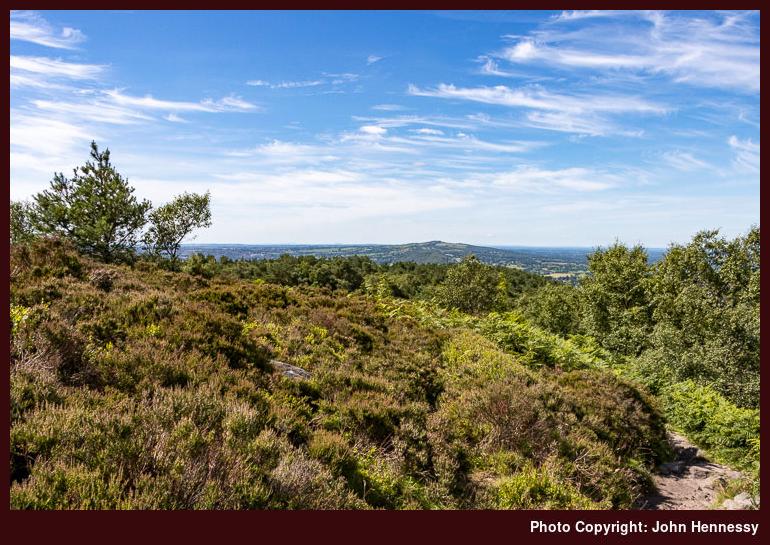
The pleasing photos that I hoped to get around Windgather Rocks failed to materialise, and I got moving when the rain eased. All I got were some atmospheric record shots that I do not feel are worth sharing. As the air dried, I did too. Pym Chair was the next landmark, somewhere I had not been very much since my earlier hill wanderings.
From there, I continued to Cats Tor and Shining Tor on a quiet morning on the tops and relished the freedom to travel along the slabbed track at my own pace without the need for much thought about social distancing. After reaching the trig point on Shining Tor, I retraced my steps and started my descent to Lamaload Reservoir after accommodating mothers with children by giving them some space. The ground was looking drier as I dried out, too. Things were starting to look brighter again: the band of showers had passed, and I was not to be bothered by such things for the rest of the day.


The way back to my house from Shining Tor was the reverse of the outbound route from June. As the skies continued to break over me, temperatures increased until the heat was readily perceptible around Rainow. Getting there took me around by Lamaload Reservoir (a service road got me from the reservoir to the village), a place that I was finally exploring after years of glimpses while travelling between Macclesfield and Buxton by bus. There may have been an educational wetting, but none of this was in evidence on my person by the time that I got home.
A Last Sunny Reprise
Mainly motivated by the previous Monday's soaking and the prospect of better weather, I returned to Whaley Bridge the following Saturday. The desire for better photos had something to do with it too, especially around Windgather Rocks. Another factor was the imminent end to my elongated summer break and the uncertainties of the coming autumn. It felt better to settle accounts while one could, on this second Saturday in August.


The way to Taxal Moor essentially was a retracing of previous steps, albeit with much more sunshine. Beyond there, deviations set in, firstly by following an informal path on the Open Access Land on the moor itself. That set me going onward to Taxal Edge and Windgather Rocks by a different route, one that passed closer to Goyt Forest.


The weekend timing and enticing sunshine drew out others, but it was easy to keep apart if you wanted, as was needed in those extraordinary times. In other places, climbers may have been closer together than was ideal, but that was their concern. On the paths and trails that I was travelling, some even let me pass first, as if their time were their own, and I was happy to oblige in kind. There was space for photography too and the results still appeal to me, bringing a sense of closure to one part of the outing.


With photos made, I continued to Pym Chair and Cats Tor as before, while stepping away from the path to let others pass. When you have had something to yourself once (as I had the previous Monday), it becomes easier to share with others. Then, Shining Tor was crossed before I went down to the A537 by way of Stake Farm. The way along these tops is one that I never tire of tramping with its undulations and its paved stone surfacing.


Crossing the road, I followed a permissive path to the access land around Cuckoo Rocks. They were not a destination for me though, so I followed another permissive path to join a public footpath to get to Bottom-of-the-Oven, a small place with a curious name, before heading up to Forest Chapel along a byway. These were much quieter parts than the places that I had passed on the other side of the A537. Legs were wearying with all the ascent and descent. The slopes leading to Forest Chapel felt a little more foreboding because of that. Just taking everything one step at a step overcame that, especially beyond Bottom-of-the-Oven.
Making use of another byway beyond Forest Chapel, I reached Charity Lane. Along the way, I overheard a comment from a passing family group about not realising what is on one’s doorstep. That probably is a story of 2020, given its lockdown and my finding people in places where I never encountered them before. On reaching Walker Barn, I then went towards Tegg’s Nose Country Park along Old Buxton Road, but left it for a byway leading to Back Eddisbury Lane. The latter took me onto Buxton Road under clouded skies, and I was on the home run straight to my house. The reprise had been worth the effort, with plenty of quieter moments as recompense for making more space for others where this was needed.
Reflections
In hindsight, it may have been better to make an entry for each of these. Once memories were rekindled, the accounts became longer than intended. Each hike had its own personality, a combination of location, weather and state of mind. Even the restrictions of a global pandemic did little to eliminate variety. Everything might have been local, yet there was much that offered respite, solace, consolation and healing too.
Travel Arrangements
All of these only needed outbound transportation. The first was a train journey with a change in Stockport while going from Macclesfield to Disley (there is something in my mind about trying to catch a bus that never appeared, but memories may be combining, so I am leaving things as they are). The others used bus service 60, which was then working to a reduced timetable because of reduced demand and staff availability.
There was an easier way home…
During a weekend of two hikes, and with one occupying me for the whole day, anyone would think that an easier day after all that exertion would have made sense. That, in fact, was the plan. Walking back to Macclesfield from Congleton via The Cloud should have traipsed through Cheshire farmland and through North Rode and Gawsworth, shadowing previous walks and cycles in the area. The sunshine was not there to be wasted anyway. However, temptation got the better of me and a more hilly diversion ensued.
Before all that, there was the matter of getting to Congleton first. Pandemic bus service reductions (this was July 2020) meant that bus travel was not an option. Handily, there were occasional local train services that Sunday, and I caught the first of those. This was the first time that I had travelled by train since the onset of the pandemic and, if there was any apprehension about this, it would have been dispelled by my having an entire carriage to myself. Passengers were fewer in those days.
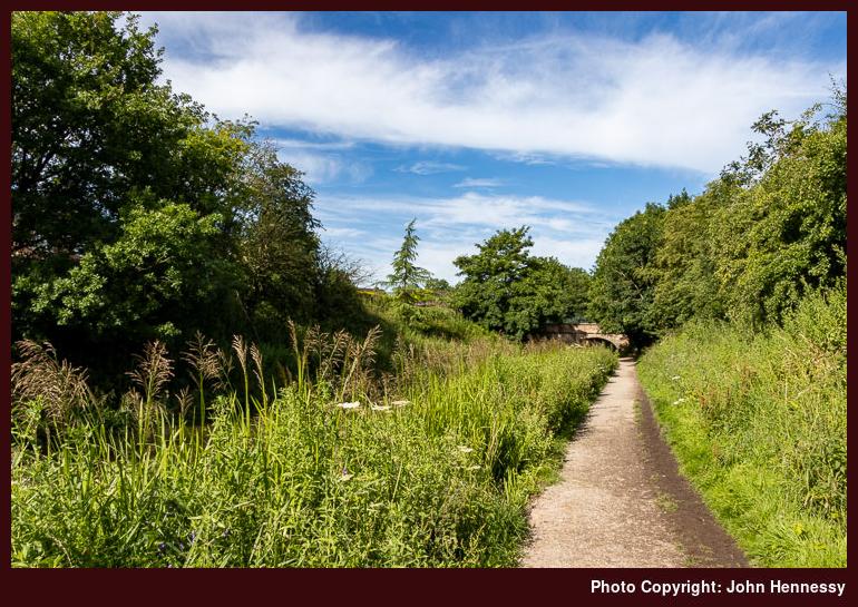
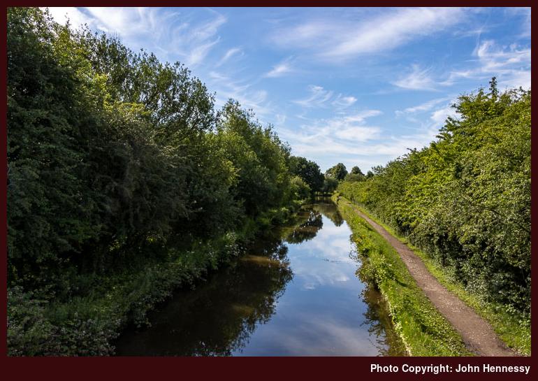
Much like Kidsgrove further south, Congleton also has a train station beside the Macclesfield Canal. By going by train there, I also had saved myself an uphill schlep from its town centre. The photos above show an unpeopled canal towpath, but that is not how I remember it. Disquiet about the pandemic had me recording that it was a little busier than I might have liked. The weather was such that others were lured out for walking, jogging and cycling; the temptation was not mine alone.
Leaving the canal might have brought me onto quieter paths, but I was never without sharing the space with others at times. Nevertheless, there were an ample number of occasions when solitude could work its magic. All the while, I was bound for The Cloud. A stretch of level field crossing was replaced by an ascent that tested wearied limbs. That the summit was occupied should have been no surprise to me. The sunshine and preceding restrictions would have led to that outcome. Everyone needed a break after the weeks of lockdown, and this was one location where that could happen.
Quite what turned me from my original plan is somewhat lost to me. The quality of the day's weather surely must have had something to do with it, as would my sensing any extra strength in my legs. There also was my having more company than I felt comfortable having in those times. Taking to the Gritstone Trail quickly alleviated the latter.
Any quietness that there was along the Gritstone Trail between The Cloud and the A523 really mattered near Cloudwood End Farm and Raven's Clough, where the trail narrowed to a shaded single track path. Beyond that, everything broadened as fields were crossed beside the River Dane. By this stage, my course was shared by the Dane Valley Way and the Staffordshire Way. Sometimes, long-distance trails overlap each other.
Once across the A523, crossing a field led me to the muddiest part of the hike: a towpath shadowing a conduit that was greening over in places. The water looked as if it were anything but moving. Others passing the way stayed in the nearby fields to avoid the conditions underfoot. Having boots meant that I stuck with the right of way instead, thus staying legal.
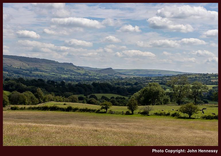
Leaving the conduit, I crossed the River Dane by means of Barleigh Ford Bridge. Beyond this, I encountered more walkers than I had done for a while. This was not so intrusive though and was behind me soon enough. Beyond this, the mind was focussed by the ascent on the way from Dumkins to Hawkslee. It was during that section that views south towards the Roaches began to open out before me.
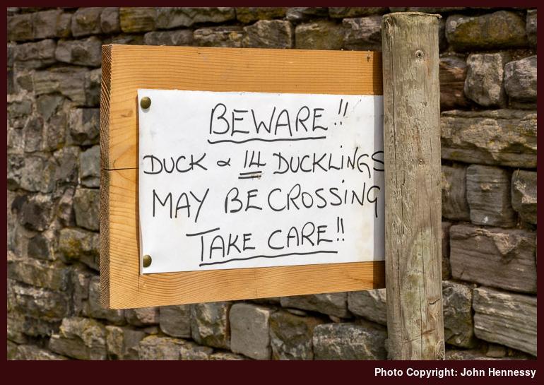
Beyond Hawkslee, I found myself on Minn-End Lane all the way to the A54. A quizzical sign warning about the passage of ducks and ducklings entertained early in the time. Later, as opening views of Croker Hill drew me onward, I also gazed down on Bosley Reservoir and beyond whenever I could. The Cloud was in view too during these westward sightings.
After crossing the A54, the ascent of Croker Hill began, Views eastward towards Shutlingsloe abounded and looking north drew my eyes towards Tegg's Nose. While I do not recall the effects of climbing Croker Hill, fatigue certainly kicked in after that. Even going downhill can have that effect on you, and the descent of Fox Bank to reach Lowerhouse, not far from Rossen Dale, would have been enough for that to happen.
Coaxing was the order of business from there onward, especially as far as Meg Lane, where I was going uphill more than I might have liked. Someone out for a run went past me at one point as I marvelled at his energy. There might have been a certain amount of temptation to stay on Meg lane to reach Sutton after going past Higher Sutton, yet I did not do even that. Thankfully, the way towards Ridgegate Reservoir was easier on my legs than that around by Smallhurst.
Proximity to home helped to provide encouragement too. The way to Clarke Lane is well known to me, as is the way from there through Langley. That may explain the uphill deviation around by Birch Knoll, too. Familiarity can make it easier to mark off progress to reinforce the internal messaging that there is not much further to go. That pull may be even stronger than coaxing, even on the second of two long days of hiking.
Wearied yet sated, I arrived home. Spontaneity had intruded yet again, and for the better. The pandemic onslaught had zeroed things on me, so this was part of a journey of reinstatement that is still ongoing in some ways. Returning to public transport usage and finding those quieter spaces where solitude could be healing became important steps for getting through a disruptive and scary period. Such escapes retained their importance throughout. Simpler pleasures can be so sustaining.
Afterword: A Winter Reprise
Looking through my mini trip reports posted in advance accounts, I notice that there is nothing for 2021. The cause was not that I was distracted with other things, as I had supposed, but a certain lack of variety. In short, I went over old ground rather a lot. It is difficult to find anything to write about a repeated hike. There were some unique strolls like one from Miller's Dale to Castleton and various saunters around Combs Moss near Buxton. Mostly, though, it was a year when much felt as if it was frozen in anticipation rather than moving into novelty.
2022 started in a likewise manner before the South Pennines, the Lake District, Ireland and Scotland returned to the fray for me. Novelty was returning. Before all that, I ended up doing a reprise of the route described here on a crisp day near the start of the year. Restrictions had returned in part, which allowed me to get going outdoors again. The day was less peopled than the one in 2020, partly because of its being a working day and the time of year. Either way, it was a healthy way to get 2022 on the way. The year turned out to be less about repeats than its predecessor.
Travel Arrangements
Train journey from Macclesfield to Congleton with Northern Trains