Category: Outdoor Skills
Clambering over Cumbrian crags
 22nd June 2009
 Because my head for heights is far from being in the top tier, I usually watch the gradients that I am crossing so to avoid ever being frozen by fright. The same consideration means that scrambling is not one of my outdoor pursuits and may explain why climbing holds no appeal for me. Nevertheless, that doesn't mean that I never ever end up successfully negotiating rocky crags while on the way up or down a slope. A walk from Kirkstone to Windermere a week ago on Sunday was a case in point and the question that continually entered my mind on the more challenging stretches pertained to finding a way to negotiate something rather than whether it was possible or impossible for me. To my own mind, that's a positive step forward from the usual trepidation. The trick is always to remain safe either when going up and, especially so, on the way down. There was only one occasion on the descent when I asked myself whether there was a way around a difficulty. In the event, there was and I gingerly got myself around it with a certain amount of satisfaction.
Starting from the Kirkstone Pass meant that I already had a head start with regard to altitude but it did not make things effortless. The way up to St. Raven's Edge was steep and crags underfoot made for careful footwork on the way. Once atop the Edge, the gradients eased markedly. In fact, there was some gentle height loss as I continued until it was gained again on the way up Pike How. It took longer to reach the summit of Stony Cove Pike than I might have liked, but the longer distance made for easier slopes and opportunities to take in the fells round about me. To my east, Ill Bell and its fellow summits of Yoke, Froswick, Park Fell and Thornthwaite Crag lay in the shade while I was enjoying the sunshine. The last of these hosts a beacon that was clearly visible and all were to get their turn in the sun as the day wore on. The fells to the west, those lining Scandale or making up the Fairfield horseshoe, already were catching the sun.
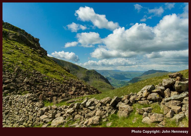
The gradient of the descent from Stony Cove Pike to Threshthwaite Mouth was far from kind and I was set to feel the effects on my thigh muscles for several days afterwards. Nevertheless, steady and calm progress was the order of the day as I got myself down. This is also where I met the aforementioned crux of the entire walk: a downward step that looked far too high and the idea of a leap didn't appeal to me one bit given the amount of rock that was on view. Too many stories about what happens to those who bump themselves have detained my attention for me to take risks like that. Even so, retaining a cool head and taking my time allowed for a less adventurous or foolhardy diversion about the obstacle; all was done with presence of mind rather than terror, easier to do when you know that no one is being held up by your deliberations.
It's one thing to be negotiating crags on a steep hillside but deciding the route you will be following next at the same sounds like overdoing multitasking. The ardour of the way down and the sight of steep slopes ahead reinforced my view that picking up a path towards Troutbeck village was the best thing to be doing with the time that was available to me; a higher route around by Ill Bell tempted, but sense prevailed and it was stored on an ideas shelf that has been getting depleted lately. That gives me time to ponder the route and starting from Hartsop may be a better way to approach things, even if it means more ascent.
The path down Park Fell Head wasn't exactly conspicuous but having a handrail such as Trout Beck does ensure that navigational nerves were held at bay. In fact, it wavers between distinctness and non-appearance along its length, depending on whether the terrain is stony or boggy (a great path eraser). Progress was steady as I emerged from the breezy coolness of the tops into the heat of the valley bottom. Walls were met and passed and photos were taken as distance until The Tongue became ever shorter. The Tongue itself took a while to pass and I started to encounter the first folk since Threshthwaite Mouth. A bridge that I needed to cross over Trout Beck was passed in error, so backtracking was to find the slate construct and get back on track. The inclination of the residents of Troutbeck Park to put up signs that aren't the friendliest to walkers (the fact that paths have been diverted since my map was published didn't help either...) caused me to opt for a diversion for Hagg Bridge that avoided any cause for upset.
Before Ing Bridge, I cheekily hopped east to the track that is known variously as High Street or Longmire Road for different parts of its length. By this point, any glimpses at my watch weren't reassuring me so I was unable to devote much time to stopping and staring at my surroundings on what was a fabulous evening; it would have been deserved. The result was that I made for the A592 perhaps sooner than I might have done to ensure that I caught my train home. Apart from the surface underfoot, it's not that as walker unfriendly as might be supposed with footways appearing for some stretches with others having unmetalled paths shoehorned between the edge of the carriageway and the field fences; I think that the latter is a consequence of National Trust ownership of the adjacent land. The A591 was joined at Troutbeck Bridge with a check for any useful buses. There weren't any so I maintained my on foot course for Windermere's train station, getting there with some time to spare. On the way home, I was allowed a chance to steady myself after the blistering progress at the end of my walk. I am still asking myself if I tried to squeeze in too much, but that's a consideration for planning future escapades. The day had been another cracker and very different in feel to my previous Cumbrian outing with its mix of quieter places and more challenging terrain, the latter perhaps ensuring the former.
Travel Details:
Return rail journey from Macclesfield to Windermere with coach transfers between Macc and Wilmslow due to engineering works (changes at Manchester, Preston and Oxenholme on the outbound trip and at Oxenholme and Manchester on the way back). Bus 517 from Windermere to the Kirkstone Inn.
Still here…
8th May 2009 I don't know which JH Darren Christie had in mind when he included a link to here among his illustrious list of blogging TGO Challengers. What I do know is that I'd be extremely surprised if it was me and I hope that I haven't disappointed you with that admission. For one thing, I don't believe that I've ever mentioned the Challenge on here before so I suspect that the link came (many thanks, anyway) amid the last minute rush before departure. Getting ready for something like this cannot be the simplest of tasks and I wish all of them the very best in their endeavours. Doubtless, there will some tales appearing online in time and I only hope that they are happy ones.
However, the episode does prompt a question for me about the Challenge and this is its thirtieth year, after all: what about it? There is one thing in its favour, and that should be apparent from various blog postings that you find here, is that the parts of Scotland through which an itinerary would take me are among my favourite parts of the world. Nevertheless, the idea of a two week crossing adds other points to ponder. Back to back multi-day treks are something that I really haven't been doing much since I finished off the West Highland Way and made a more concerted start on the Rob Roy Way. Then, there's the matter of lessening dependence on serviced accommodation (well, hostelling is gaining some favour with me over hotels and guest houses) in favour of a more independent alternative; some may use the former option for the whole Challenge but it seems to be the exception rather the rule. After that, there's the subject of personal fitness and I very much realise that work is needed there too.
So, my answer to the question of doing the challenge is not just yet. What I am not saying is that it is not for me because many of the things that I enjoy these days were activities that I was happy to leave for other folk at one point. Apart from the whole hill wandering habit, this is true to an extent also of how I earn my living. When you ease yourself into something at your own pace, things start to happen and heaven only knows how far you'll get.
In the meantime, the longer days of summer are now at hand. Of course, that is no guarantee of fine weather in these parts and I don't like it too hot anyway. Even with those caveats, my mind is turning to multi-day excursions again. Having a selection of Graham Uney's Backpacker's Britain Cicerone Guides, I shouldn't be short of a few ideas and the prospect of managing walks for which public transport logistics might be tricky has a certain footloose appeal. Much of Chris Townsend's The Backpacker's Handbook has been read and there is nothing at all to stop re-readings. Gear has been building over time up but more acquisitions remain in order. What I really need to do is decide when I am sufficiently equipped for stepping just across that threshold from walker to backpacker while not going in too deep too soon; that should keep the wish list under control. Suspicions are building that there could be some tinkering and familiarisation before I embark on anything more adventurous. A summer of exploring the paraphernalia of independent backpacking might be no bad thing, even without their being used in anger on an escapade.
Stark warnings
9th February 2009 While out on a trot from Langdale to Ambleside on Saturday, I spotted a stark notice on a gate. It was on a path leading towards the Langdale Pikes and issuing a strong message that ice axe and crampons were needed above 300 metres in height; I was staying low with plenty of hillside bereft of snow while the white stuff made itself plain to see at higher altitudes. Of course, there have been fatalities on the "Pikes" so the strong wording was not without good cause. It was also a reminder of similar unfortunate outcomes in Wales and Scotland. I can't say that I have heard of anything like this from Ireland, but something tells that full winter conditions must be blanketing those hills too.
The trouble with official warnings is that we have seen so many that could be termed an overreaction that heretical thoughts begin to percolate into your consciousness not long after you have seen the warnings. There are those who issue shrill warnings without they being truly needed, acting in a manner akin to the shepherd boy who cried "Wolf!" in the Aesop's fable. This time around, I am inclined to think that the "wolf" is real and have got to moderating my usual questioning. This is for a number of reasons. First, the warnings were coming from mountain rescue folk, and they didn't overreact to events around the time of the OMM in Cumbria when a deluge came from the heavens and caused raging roads to turn into rivers. The other chastening observation supporting that suspension is that there have been those serious accidents and fatalities.
Another factor in all of this is that we have been spoilt with the milder winters of late. Apart from the shorter days, the occasional spell of snow and ice or a storm, winter walking became perhaps no less accessible than at any other time of year. In contrast, this winter is a sharp reminder that what we have enjoyed of late isn't always the case and preparedness for winter walking can be another matter entirely. The whiteness is attractive, but there's a certain "here be dragons" element lurking too, particularly with inexperienced folk being drawn out to enjoy the prettiness. That could be the reason behind the advice given by the head of the Lake District National Park last weekend, particularly with the school half-term holidays and their bringing more folk with many perhaps without the requisite equipment, knowledge, skills and experience (the LDNP is between a rock and a hard place: in these trying times, they need the visitors, yet safety remains vital too).
Speaking of experience, assessment of conditions is a big part of it, and any disparity between those on high and those in the lowlands makes it tricky unless you have some experience of being up high in the first place. For instance, snow coverings among the hill country lining the Cheshire-Derbyshire boundary are measured in feet while those on the Cheshire plain are inches in thickness if they lie at all. Increasing the height differential can only exacerbate that sort of difference and entrap the unwary. Saying that, it doesn't take much to realise that any whitened hills look very different to the green valley bottoms with their icy patches due to paths having turned into stream beds; that was very typical of the Langdale that I encountered on Saturday. Mountains and hills do make their own weather, and it seems that winter conditions bring that into sharp relief.
The warnings and the fatalities can make one feel that they are on the outside of a different world, looking into it. They certainly challenge any perception of readiness for winter conditions and set you to thinking, particularly about those who have been left behind by those deaths. That certainly is the case for me, but barriers should be overcome carefully rather than allowed to stop you in your tracks. Even so, the mountains won't melt away overnight, even if the snow does.
Update 2009-02-10: It now appears that winter conditions have gripped some of Ireland's hills too. In fact, the Irish public service broadcaster RTÉ has a report on two men lost on Lugnaquila, Wicklow's highest mountain with a height of above 3000 feet, after dropping their map in foggy conditions. They have been out all night and mountain rescue teams are searching for them, but there is a glimmer of good news: mobile phone contact has been maintained throughout. Let's hope it all ends well.
A useful discovery
19th January 2009 There are times when you learned something new that you wonder why you didn't find it before. My discovery is that I have in my possession a part of boots that take crampons, even if their maker recommends emergency use. The boots in question are the Scarpa ZG10's that have featured on here a few times already; I think that I may be beginning to get a handle and making them fit me better, so long as laces don't loosen, that is. Apparently, they are rated B0/B1 and that means that they can take flexible crampons like Grivel's G10 New Classic (classified as C1). The result of that revelation is that any barrier to a greater enjoyment of those ephemeral episodes when white wonderlands greet us has lowered just a little for me. For my tentative steps forward, it looks as if the Scarpas have a little more to offer, and I intend to treat the possibilities in a manner to acquiring a first SLR camera: there are advanced functions that allow you to grow and advance, but a spot of learning is in order first. I suppose that I need to watch that recently acquired BMC winter skills DVD before proceeding any further. I may not need new boots, but I need to know what I am doing with crampons before attempting to use them to avoid doing anything daft, overly adventurous or unsafe. A journey continues...
An imperfect rights of way network?
16th December 2008 Access to the countryside has always been a contentious area and a recent piece of blundering of mine along a public footpath returned that very much to mind (I ended up straying away from where I should have been to earn some yelling from a passing gent atop a quad bike on a nearby road). Within the last decade, Scotland has got its very enlightened access legislation and a less extensive variant has made its appearance south of the border in England and Wales, with legal wrangles forcing up the cost of implementation of the latter.
Until these innovations, public rights of way did next to all the access backwork in England and Wales and the question as whether the network that has come into place over time is all that useful for the purposes of exploring the countryside. In a similar vein, Graham Wilson, in his book Macc and the Art of Long Distance Walking, comes up with some thoughts on the subject:
Many of these exist for reasons long since forgotten and to insist that the world and his wife can march through someone else's back garden because a postman from Time Immemorial has had to take this route to deliver a letter to a neighbouring farm is as equally unreasonable as it is for us to be denied the right to walk in a straight line across rough country direct from the summit of Shutlingsloe to the hospitality of The Hanging Gate.
I must admit that I find it hard to improve on that well put sentiment from the time prior to the Countryside Rights of Way Act that has given us tracts of Open Access Land with all their limitations in size. It just seems to capture so much and very much fits in with my wonderment as whether we are using a network designed in another era and for another purpose for very different ends. To my mind, it seems that we are using paths and tracks that came into use to link up houses and their ilk to explore the countryside. Add to that the very modern need of privacy and security and path diversions come to life, adding to the complexity that was there in the first place and things become more tricky as you approach civilisation. All that's needed is a momentary slip of concentration and the ungainly activity of map inspection and not always in the most opportune of places either.
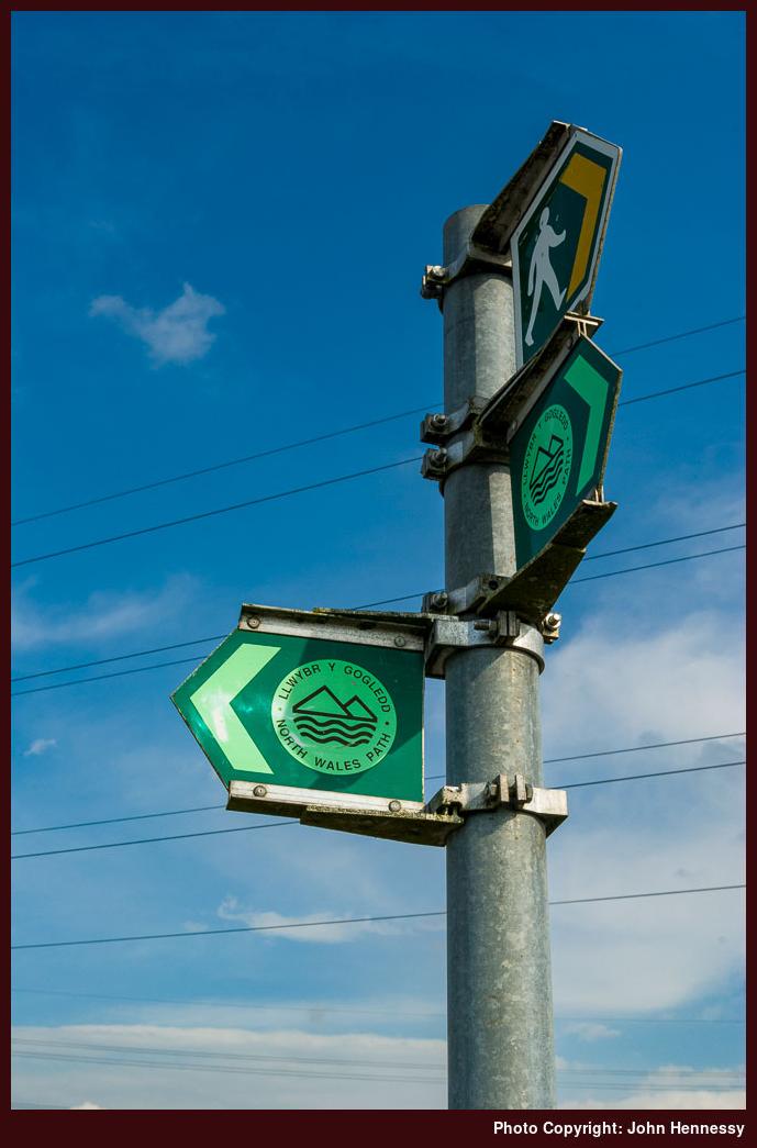
That intricacy and complexity makes waymarking even more important and it's not always up to scratch; even the best OS mapping cannot be expected to show every twist and turn of a path within a field with complete accuracy. With circular waymarks, the rotation of the arrow can confound if one is without the understanding that an arrow in the 2 o'clock position means that you are meant to take a sharp right! Apart from poor waymarking, other ways to make walkers a little unsure of themselves include the condition of stiles and the state of a path. Some areas do well on this and Cheshire would seem to be among them. Surprisingly, North Yorkshire is poor for waymarking away from its national parks while overgrown paths in North Wales are things that I have encountered a few times now. All of this doesn't aid one's sense of self-confidence if an unwelcoming soul were to be encountered (yes, the countryside is like anywhere and they surely exist there too). It seems that those spontaneous on the fly decisions to see where a right of way takes might be best replaced by a modicum of planning unless it's an area that I already know.
The impression that starts to build from this is that we might need a simpler network of rights of way in place of the rag bag that we use now. What I wouldn't want to see is a reduction in ease of access to any area, but diversions away from houses and farmyards would suit me better; I like my explorations to be uncontentious rather than appearing to be prying. However, I cannot see that scale of improvement happening because there are always other things that command the attentions of governments and local authorities and that is never more true than in these times of economic upheaval. Inertia probably rules anyway with a major push being needed to get anything like a path and bridleway reorganisation through; it took a huge effort to get the "Right to Roam" legislation implemented and I cannot see a government again confronting vested interests in the countryside quite like that for a while.
My conclusion from these ramblings? It sounds like making the best of what's there is the sensible approach, sharpening those navigational skills along the way. My days of spontaneously following a tempting signpost might be best put behind me in place of some more advance planning and noting of field exits or wanderings in open country where few are likely to feel threatened or annoyed. As with everything, you always can learn more and I am open to the idea, with thoughts of perusing the Open Spaces Society's book on rights of way coming to mind.


