Category: Long Distance Trails
Tales of patient persistence: ascents of Ben Ledi
 10th January 2025
 It was during my early incursions that I first found myself near Ben Ledi. That was in August 2002, and I started from Stirling, staying in Bannockburn to be precise, before my touring carried me across Scotland. One of my stops was in Callander before I continued to Fort William and then to Portree on the Isle of Skye where rain finally caught up with me. From there, it was a sodden journey to Edinburgh via Inverness, most of which I was inside a coach, thankful for being under shelter. After an autumnal stint in Edinburgh, I returned south to Macclesfield again.
My brief time around Callander, essentially a day, saw me venture out along what is now part of the Rob Roy Way and past the Falls of Leny. The day started cloudy but brightened up later to offer some pleasing scenes to capture on film; this was in the days before I converted to digital photography. Any combination of dramatic skies and sunlit scenery still appeals to me today.
On looking at the map now, I am unsure as to what I did next. After being around that area a few times now, it bewilders me as how I did not follow the track to the top of Ben Ledi only to go blundering along other trails that I now struggle to locate in the forestry. Given that, it was not before time that I made an ascent of such a prominent hill in the area. After all, someone sharing a breakfast table with me the next morning was going to do just that. All I can say is that I might have been put off by a cloud start to the day. Otherwise, a certain lack of confidence or even lack of knowledge could have accompanied this.
A Day That Was Better than I Recall
The first time I got to the top of Ben Ledi, it was not even the lure that drew me to Stirling after not being in Scotland since the arrival of the pandemic. For a variety of reasons, it went back to 2014 when I last was in the highlands on an elongated weekend stay in Oban. Ben Ledi is just on the right side of the Highland Boundary Fault to be considered within the Scottish Highlands.
The previous Saturday, I had enjoyed a sunlit hike over the top of Helvellyn from the shores of Ullswater to the shores of Thirlmere. The descent was brutal, while any coming up from the western side really was making it tough for themselves. In the hill, the shorter the distance, the steeper the gradients and the slower the going. The weather overcompensated for any hardship, though my luck was not to come north with me.
My reason for being in Stirling was to explore the Ochil Hills; that incursion will be described separately. The distraction by a spur of the moment though was enough to cause me to use the better day for the higher summit. Thus, I found myself in Callander on the English Summer Bank Holiday (Scotland and Ireland have theirs at the start of August). With a mind connecting to twenty years before, I ventured along the Rob Roy Way, taking in the hills beyond Garbh Uisge and recalling that encounter from years before.


Near Creag Dubh, I picked up the trail leading uphill and began my ascent. This is a direct approach, so the often steep gradients can feel relentless. Thus, it is just as well that the views opened out below to offer excuses for rest breaks. Though my enduring recollection is of cloud cover limiting photography, there remained some opportunities of I would have the images that you see above. For some reason, I was hoping for more than I got. Maybe I was spoiled by what came my way around Helvellyn.

Reaching the summit needed patient progress. As well as needing some self-compassion for one's physical condition, there also are false summits on the way. Frustration can set in if you are not keeping a lid on expectations. Once I reached the top, I pottered about a bit before starting on the descent. While others were about, we were not in each other's way. It was possible to benefit from the quietude that was on offer.
With much of the descent completed, I fancied a deviation around by Boschastle Hill, though signs indicated ongoing forestry operations. It seemed quiet, but I eventually heard the noise of machines at work; thus, I needed to retrace my steps while conscious of the times of buses to Stirling. As things happened, all worked out well for the walk back to Callander and the transport connection back to my base. The next day brought a soaking that made me eager to return when the opportunity arose. Then, it looked as if I needed to await the following spring.
Including a Summit within a Circuit
The opportunity for a reprise came sooner than I had the right to expect. It came courtesy of events in Scotland around the time that I was there; the Queen fell ill and soon passed away. The result was an extra bank holiday that could be used for some hill wandering. Not being a royalist and feeling a certain disaffection after political events freed me up to do this, when the loyalties of others compelled them to be elsewhere.


Thus, I found myself in Callander on the day of the funeral after a day spent traversing the Ochil Hills in drier weather when I encountered them before. That Saturday had been a time for travelling north, while Sunday was spent in the Ochil Hills, making the best of what was on offer. Things looked promising for sunshine in Callander, though low clouds decked some of the surrounding hills. That did little to frustrate my Ben Ledi designs.

Since the previous encounter, I had happened on a circular route in a guidebook that appealed to me. The result is that I made for the shore of Loch Lubnaig before turning back on myself to go through Stank Glen after a refreshment stop while the events of the day were displayed on a screen. Some breaks in the cloud cover allowed the sun to light up the surrounding hillsides for a while, doing a better job than it did around Loch Lubnaig. Others were going this way too, so it was just as well that they did not witness a clothing failure that I needed to cover up by wearing overtrousers.
By carefully navigating up steep slopes with faint paths, I made my way onto the shoulder of Ben Ledi not so far way from Bealach nan Corp. Again, patience was needed to reach the top before starting on a by now familiar way down. The sun was making no headway through the clouds by this point, not that it mattered so much at the time. Getting back to Callander to avoid getting stranded possibly was that little more important at that moment.
Enjoying Sunlit Surroundings
The most recent encounter was during a sunny weather window in April of last year. That was when I based myself in Stirling, without any inclination to wander the Ochil Hills after a pleasing incursion on a sunny Sunday the previous November. It was only later that the prospect of a hike by the shore of Loch Vennachar entered my mind.

Unlike the previous occasions when morning sunshine faded over the course of the day or a cloudy start restrained me, this was to be a day of constant sunshine with ample opportunities for capturing the beauty that lay around me. So successful was the photographic side of the venture that I struggled when it came to picking the photos to accompany this account; there were so many from which to choose, like the one showing Ben Ledi from Callander that you see above.

The way from Callander was a conventional one that made use of a cycle trail along what once was a railway alignment. My surroundings looked resplendent as I made my way from Callander on legs that did not feel so strong. While one might blame strolling around Stirling the evening before, there also might have been the after effects of a seasonal hiatus in the works too.


Near Boschastle Hill, I departed from previous convention to follow the forestry track that I might have travelled following the ascent made at the end of August 2022. The provided a more gradual ascent to acclimatise those unready limbs. The effects of forestry operations had opened out the views too, which was an added attraction, especially in the bright morning sunshine.


The part of the ascent with its attendant ever-increasing steepness was not to be put off indefinitely, though. Leaving the forestry track, I made my way uphill through the trees to emerge into bare hillsides with someone ahead. At around the tree line, they stopped for a rest and I carried on past them with the views opening out around me as I had been hoping. Those to the south and east were challenged by the position of the sun, so it is others that you see here. Steady progress with photography stops became a way to coax my limbs to convey me to the top.


Once at the top, the next step was to commence my descent towards Stank Glen, reversing the ascent route from my second hike around by Ben Ledi in September 2022. Since paths became indistinct, careful route finding was in order until a more distinct trail was found. Otherwise, it is easy to go awry and end up nearer Bealach nan Corp than is desirable, especially when visibility is suboptimal. For those fancying other summits, there are ample options when you have the required energy and strength to go with any weather opportunity.
When a clear path became a well-used track, thoughts could turn to reaching the shore of Loch Lubnaig. That sent me around and beneath Creag Gobhlach while traversing Meall Dubh. Other waymarkers on that descent were Creag Chrom, Creag na h-Olla and Tom Bheithe. Since all was sheathed in tree cover at this stage of the hike, views were eliminated, not that such a thing perturbed me. Because much had come my way on the day, there could be no cause for grumbling; any ingratitude would have been rude.

While photographic opportunities may have been limited near Loch Lubnaig because of the position of the sun in the sky, I remained sated with those that were allotted to me. It also helped that my whereabouts were essentially unpeopled, which allowed me to linger a little before commencing my way back to Callander. My passing the Strathyre Forest Holidays resort meant that I could acquire some refreshments in their shop (which has provisions and a café for anyone staying in a cabin) before continuing my return to Callander; while there was an early closure that day, it remained open long enough for my purposes. Suitably reenergised, I got going again on a glorious evening.
While I remained on the tarmacked trail for the rest of the way, there was one part where I deviated from it for the sake of added novelty and extra quietude. The alteration made no deviation to my ability to get back to Stirling by bus that evening; it perhaps shows that an ever present curiosity drives me a lot of the time. At the time, it formed part of an act of closure that freed my mind to go off on other explorations.
Reflections
In some respects, this is a tail of four incursions, from a reconnaissance encounter to a fully sunlit circuit with a summit visit on the way. Though there were different decades, there are some common themes. The hit-and-miss with the lighting is as much one of those as a sense of building a connection to the Scottish Highlands. That was nascent in the early years of the century and became a post-pandemic rebuild more recently.
The whole combined narrative is one of patience and persistence paying off, certainly for photographic purposes. That is never to say that each trip did not bring it share of delights when they all did. An equipment failure was part of the tail, proving that a certain resourcefulness cannot be anything other than essential. All in all, repeat traipsing on foot is a great way to get to know an area intimately.
It also helped that bus service 59 made it so easy to reach Callander without a car, though its operator changed ownership during the sequence of trips related here. The first encounter made use of an infrequent Scottish Citylink service, only for the more local service to be a better enabler for the more recent trio of visits.
2024: A year of Celtic trails and French summits
31st December 2024 There once was a time when every year would get a retrospective review at the end, or not long afterwards. That has slipped for various reasons. However, this piece reinstates that for this year. Whatever happens in coming years cannot be known; we only know the present, and our recollections of the past are prone to the ravages of time, though some have better memories than others.
Highland Rambles to Start a Year
For me, this year began in Aviemore after the preceding disruption of storm Gerrit. New Year's Day was spent hiking around Rothiemurchus, with many wishing Happy New Year to each other. Lochan Mor, Loch an Eilein, Loch Gamhna and Loch Morlich all featured as landmarks on an amble on a crisp sunny winter's day. The volume of traffic along the road between Aviemore and Glen More was more akin to a motorway than a thoroughfare in a protected part of Scotland. With no public transport in operation, private transport possibly was the only realistic option for getting around.
The next day saw a return to Inverness for a hike from there to the shores of Loch Ness at Lochend. The paths by the River Ness and the Caledonian Canal were pleasant, though sunshine was scarce. The same could not be said for walking along the side of the A82, yet seeds were sown for future rambles that use Inverness as a base. Walking back from Drumnadrochit to Inverness along part of the Great Glen Way is among these, as is a circuit through the hills near Achnashellach train station in Scotland's more remote northwest. South Loch Ness Trail is another option that appeals. If other things had not intruded, these ideas may have been used sometime this year. For now, they remain in my catalogue of ideas for the future.
February's Fresh Start In Cork
The rest of January was occupied with many handover sessions in advance of a work contract coming to an end. This was a process that took its toll on me, setting some of the scene for the start of February. Nevertheless, property hunting took me to Cork for around two weeks. That was complemented by strolls along the disjointed sections of the Cork Harbour Greenway along with some pottering around Crosshaven, Fota and Cobh. A day trip to Killarney saw me reprise part of a route taken during the first full day of my stay there in August 2022; the initial idea was to head to Glengarriff, but the bus ticket machine would not sell me a day return ticket and I took that as a sign that it might be best left for another time. The deviation around by Torc Waterfall made for a late return to Killarney bus station; it was as well that later services operate on a Sunday, or my incaution might have left me marooned. There was a circuit of Muckross Lake too, which might have made the day a little too long in hindsight.
March in Aberystwyth: Coastal Walks and Windy Summits
In March, there was a return visit to Aberystwyth to follow up on a stay there the preceding September. A good weather window was what prompted me, and I got in some coastal walking on the first full day there. The main stretch was part of the Wales Coast Path that returned me to Aberystwyth from Borth after some pottering around Aberystwyth. Pumlumon Fawr got an ascent on a bracing day with a cold gusty wind reducing the time spent on the said summit. It might have been better not to have gone up there at all, but for my stubbornness. Lower level hiking was less affected by the wind and I wandered about by Bwlch Nant-yr-Arian before continuing to Ponterwyd. The tale of my day made a bus driver laugh when I said it was the wind that was the greatest challenge.
April Escapades: From Stirling to the Tops and Lochs of Central Scotland
Eastertide house decluttering and a run of uninspiring weather meant that it was the end of April when I next got out and about. This time, I based myself in Stirling. The preceding November saw me making an impromptu incursion into the Ochil Hills by following a track while wearing trail shoes. That act eliminated those eminences from my attention, so it was the need to experience a hike around Ben Ledi with more sunshine that became the main motivation. Before that, I enjoyed a delightful stroll around Stirling in the pleasant evening sunshine, even if it wearied me a bit for the main ascent.
The route to Ben Ledi went along that of the Rob Roy Way from Callander before deviating onto a forestry track that carried me around Boschastle Hill. That saved some steep ascent at the beginning, only for more height gain to try my legs on the way up to the summit. With sunlit views like I never saw them before, there were ample excuses for rest breaks to ease the burden. Once over the summit, I descended below Bealach nan Crop into Stank Glen from where I reached the shore of Loch Lubnaig, where I loitered a while before dropping into a Forest Holidays shop for some refreshments. The way back to Callander from there was swifter than I had expected, allowing me to use an earlier bus for the return to Stirling.
The next day saw me back in Callander for what became a hike to Aberfoyle along the southern shore of Loch Venachar before a diversion to Brig o' Turk prompted by curiosity and Loch Achray. Concerns about making the last bus of the day and the growing heat persuaded me not to visit Loch Katrine, so I hotfooted the rest of the way on forestry tracks, only to find that my fears were unfounded. The initial plan had been to do a circuit of Loch Venachar until distances and the heat caused a change of mind. Very weary legs were rested in Aberfoyle before that bus appeared, and the stop also allowed a chance to imbibe some refreshments.
May: Revisiting the Trails around Aviemore, Rothiemurchus and Kingussie
The start of May was graced with a repeat visit to Aviemore. The main motivation might have been an out and back hike to Loch Eanaich after high water halted the errand the previous December. That was just as well since there still was a stream crossing without a bridge that got me wet feet and boots. This was the sort of thing that perhaps was best left for the last day of a stay instead of the first. Nevertheless, I got where I fancied going. Ronald Turnbull has published a route leading this way to Carn Ban Mor and other nearby hills. It does not look like a day hike to me unless you make use of a mountain bike. Backpacking might be the better approach after some strength training to cope with your load. The next day saw me reprise a hike from Kingussie to Aviemore with variations to the route. This included closer proximity to Glen Feshie and a more direct if muddier route from Moor of Feshie to Loch Gamhna. Otherwise, it was good to redo this with longer hours of daylight.
June: West Highland Retrospectives and French Forays
The West Highland Way got some repeat attention at the start of June during a stay in Fort William. First up was the section between Fort William and Kinlochleven after a deviation around by Cow Hill near the start. Though used by many more people on the day, it was great to revisit a trail that I had not walked for more than twenty years, even if it took a toll on me because of a rush to catch a bus at a reasonable hour. That was not how things worked out for me between Glen Coe and Bridge of Orchy. Though wintry showers peppered the day, there were periods of bright sunshine that may up for these and a shorter route with better public transport connections made for a more relaxing hike. All was settled gain, even if the numbers heading north made me wonder about overtourism. My recollection of passing the same way around twenty years before was that things were much quieter back then.
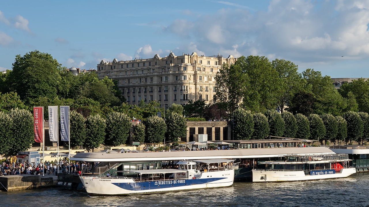
This also was a year with two trips to France. A passport bungle meant that I could not use a booked ferry trip, so I rearranged it for later. The stay in Paris still went ahead in May. Rennes and Versailles were the object of side trips during a getaway that featured mixed weather and extensive urban walking. The summer solstice was when I used the ferry booking between Portsmouth and Saint-Malo, where there was the only episode of mixed weather. Otherwise, there was no shortage of sunshine in Paris or Versailles, even if restrictions were becoming more intrusive ahead of the Olympic and Paralympic Games. Grenoble became my main base, allowing plenty of hiking to happen. The routes took me to Mont Rachais, the Desert de Jean-Jacques Rousseau, Charvet, Sassenage, Mont-Saint-Martin and along the River Isère. While tongue-tied by my grasp of French at times, much was to be enjoyed, too. All was accomplished by surface travel, which was even better in these days of climate crisis. That may set up some excursions in times to come.
A Southern Irish Summer: Traversing Hilltops, Coastlines and Peninsulas
Somewhat like 2010, 2024 feels like a year of two halves after I acquired a new Irish base in Cork city. Thus, July and August saw a lot of Irish traipsing in between attending to other matters that have been in the offing for a while. Killarney saw two back to back day trips, the second saw me reach the summit of Mangerton after being stymied by going around by Knockreer and Ross Castle on the first day. A full day was spent traversing the Ballyhoura Mountains from Ballyhea to Seefin and back. The three Atlantic peninsulas of West Cork, Mizen, Beara and Sheep's Head, all got visits. The first involved hiking from Schull to Ballydehob and the last allowed me to go from Kilcrohane to Ahakista via the top of Seefin (the name pops up in a few places on this evidence). Glengarriff's Nature Trails were a lure to the Beara Peninsula early in August, only to be followed with possibly the soggiest and wettest hike in my life along the Beara Way from Adrigole to Glengarriff. Other summertime forays took me to Cashel and Cahir, as well as the Knockmealdown Mountain foothills on a saunter from Cappoquin to Lismore.
A Subsequent Lull
The summer wanderings were followed by a lull in August. Fatigue and other distractions like testing out Generative AI curtailed things in the autumn before the weather fell into a rut uncongenial to hill wandering. There still was a loop around Great Island in Cork Harbour as well as more local forays to known spots until thing perked up more recently with visits to Blarney, Ballincollig and Kinsale.
Ideas for an Open Book
2025 remains an open book at this stage, though there are some ideas that are readily to hand. One is a sojourn in Inverness, while a transatlantic escapade cannot be ruled out either. Given recent political developments, Canada looks more likely than its southern neighbour. The need to use Virgin points may encourage me to go to Canada yet. Toronto could be a base for what surrounds it, and Galway could act in a similar fashion in Ireland. Business matters need added attention, so I do not have a free hand in all of this. Only time will tell what happens next.
Journeys Through Time and Terrain: A Clogheen and Knockmealdown Exploration
28th December 2024 During his later years, my father took an interest in the story of Fr. Nicholas Sheehy, a Roman Catholic priest who was martyred in Clonmel. Though he came from West Limerick, he ministered in south Tipperary and became parish priest at Clogheen. It was in the nearby Shanrahan graveyard where his remains were laid to rest following his execution.
That may explain in part how my second day from Cork took me to Clogheen. Another reason is that the Knockmealdown Mountains are similarly near at hand, thus making both motivations work in tandem. Thus, I made for the local church on my arrival in Clogheen where I surveyed a monument that was constructed in front of it.

That was not all, for I set off for the graveyard where the remains were interred. For part of the way, I was following segments of the Blackwater Way and the Clogheen Loop, only to leave them for my quest. A footway continued all the way by the side of a quiet regional road and no further than the graveyard itself; there is little doubt regarding the reason for such an urban feature in the midst of a portion of Irish countryside.
Once there, I lingered a while and made some photos when the sunshine was blocked by any clouds. As well as the historical aspect, there is a scenic side to the location too, reminding me of the other lure that drew me this way. My historical respects made, I followed a quiet byroad to the trail that I left behind me earlier. Some ascent lay ahead of me.


As I gained height, the views expanded all around me. To the north lay the expanse of the Galtee Mountains, whose shapely whalebacks captured my attention. These hulks may lie on the northern side of the valley, beset by heat haze, yet that took nothing from the way they looked, even if that haze challenged photography. The added height, compared to where I was located, could not be discounted, as I trod by more anonymous looking hummocks.
A boreen carried me a long way into the Knockmealdown range, with only a solitary tractor passing that way. All was deserted, not that I was complaining as I left the tarmac for a track leading towards Knockclugga, my only summit of the day. Though Knockshanahulion was not so far away, I decided against going that way in favour of following the trail downhill. Consciousness of time and the heat of the day might have something to do with this, yet it leaves open the prospect of a return sometime.


What lay before me also might have something to do with my decision-making. Knockmealdown, the highest hill in the range, lay before me and looked more shapely than the eminence that I had been traipsing. Views opened up in front of me and around me as I continued my trek, some of them leading south towards County Waterford. The trail shadowed forestry as it continued east, with a few ups and downs to exercise the limbs. In time, the growing heat of the day would catch me a little.


In time, I would reach the side of the R668, the road from Clogheen to Lismore that passes a noted viewpoint called The Vee. Though this was a spot favoured by my parents, I decided against following the road around that way in favour of the more peaceful trail in the direction of Bay Lough. As I did so, I marvelled at the direct trail up the steep western slope of Sugarloaf Hill. The audacity and heedlessness of the thing only gets stopped down when you realise that there is an inflection offering respite part of the way up. Otherwise, the sanity of the routing would need questioning.
After Bay Lough, the trail entered mercifully wooded shade at the expense of any views. Later on, I did see if I could glimpse The Vee by a moderate deviation, only to conclude that this was fruitless. The forestry cover put paid to that, and I wanted to catch the last bus of the day back to Cork. As ever, one needed to avoid getting marooned.

Trails were abundant and should have a use if a return came to pass. Names like the Avondhu Way and the Blackwater Way suggested proximity to the county of Cork, while the East Munster Way is more inclusive in its title; some of my rambling that day took me into the county of Waterford. My way back to Clogheen returned me to the R668 and brought me across the River Duag. Handily, I had a wait for the bus to come, and it may have been delayed.
When I boarded, I was told to use the lower saloon of a double-deck vehicle, a disappointment given the scenery through which it was going. Later on, a dishevelled character came downstairs with signs of having hit his head off something. That may have been the reason for the instruction. The same person was to find that he had embarked on a return trip from Cork instead of reaching his intended destination, which caused a difficulty for the driver. This was not a discussion in which I was involving myself, and I slipped away quietly; there was someone else to back up that driver.
None of this intruded greatly on what had been a superb day out. A later conversation with fellow residents at my hotel expressed surprise at what I did in the heat, especially when the location is quite a way inland. The increase in heat was nothing like the record-breaking temperatures that beset many in the UK only weeks earlier, yet the warming trend continued for the rest of that week.
An Impromptu Venture: Going through the Gap of Dunloe and around by the Black Valley
20th December 2024 After the energetic tramping of the preceding days, my mind was fixed on an easier day. Though the morning began with cloudy skies, I was determined to make something of the day. My choice became the Gap of Dunloe, somewhere that I only glimpsed from a passing car thirty years before. One particular vista from the narrow valley was immortalised by John Hinde in a jigsaw puzzle that I completed when I was younger. The colours may have been embellished by hand, yet the scene centred on a bridge surrounded by steep slopes, and perhaps with a jaunting car in there as well, comes to my mind's eye as I write these words.
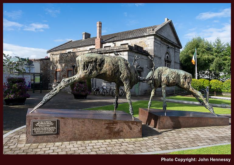
While much of my traipsing around Killarney in 2022 linked me to family outings from thirty years before, the day around the Gap of Dunloe and beyond was where this meme particularly took hold. It echoed a similar meme that took me back twenty years in Scotland. In the main, the latter linked solitary experiences, while the former supplanted communal ones with solitary counterparts. There are times when it is easier to imbibe your surroundings with no one else to distract you. At least, that is how it appears to work for me, anyway.
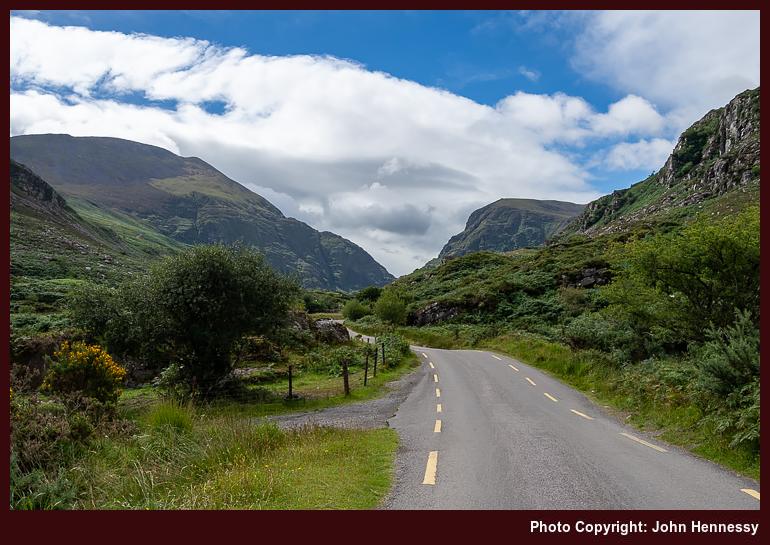
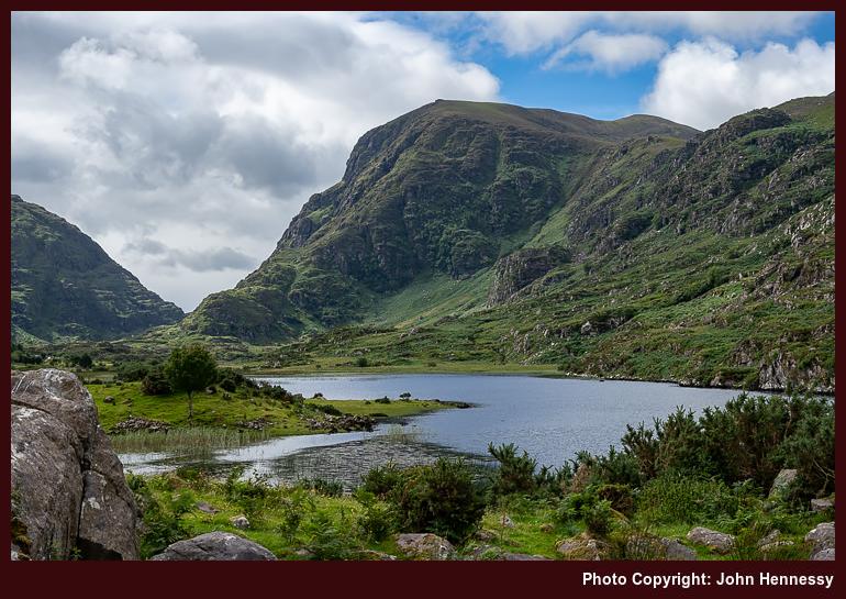
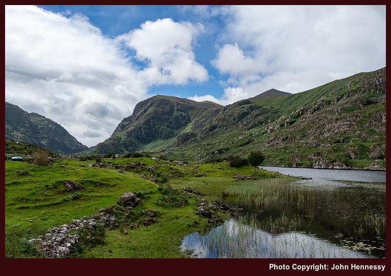
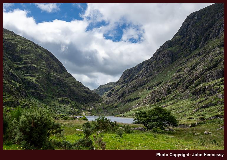
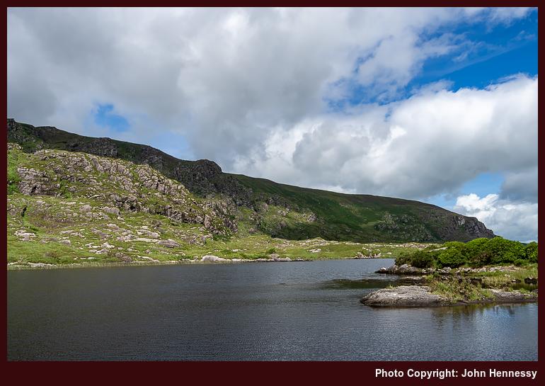
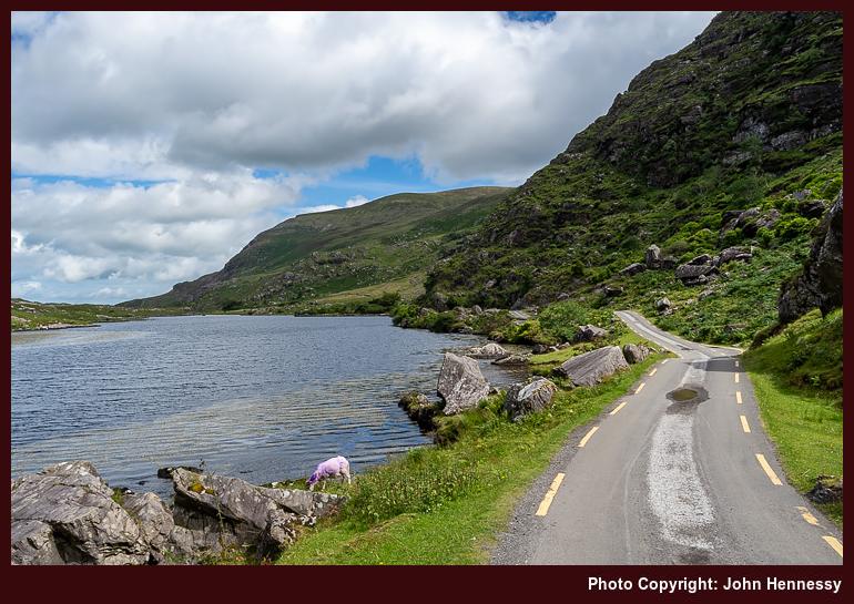
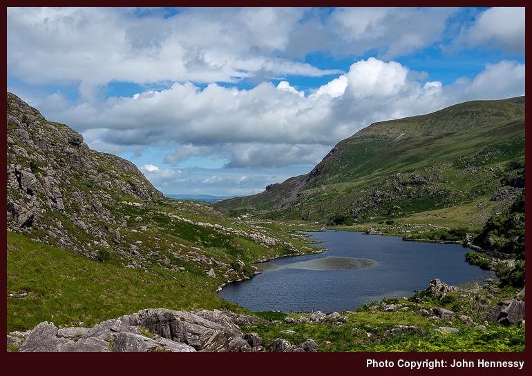
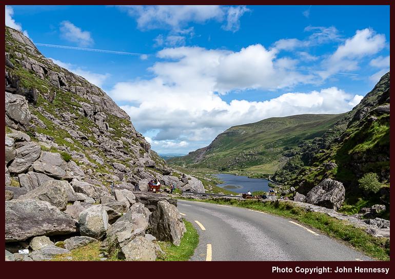
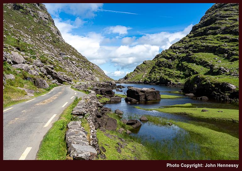
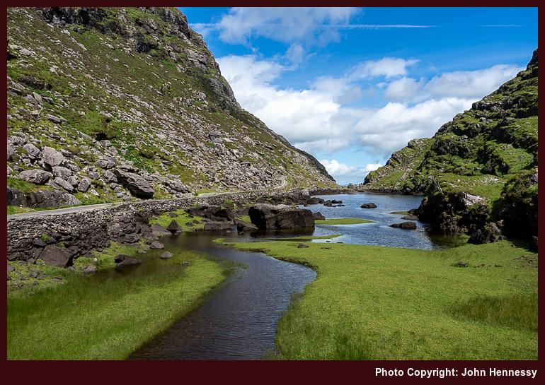
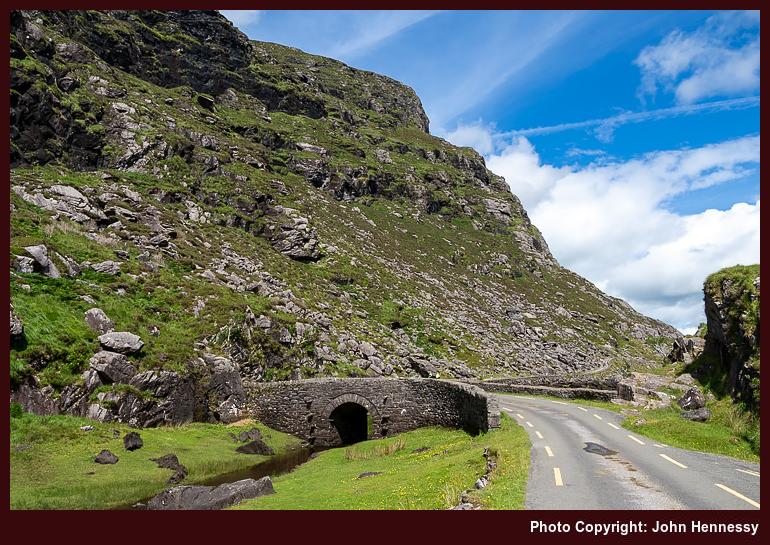
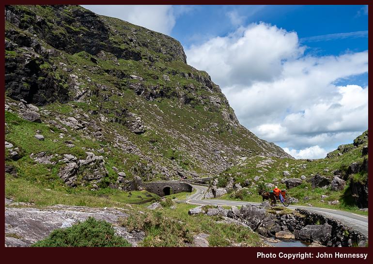
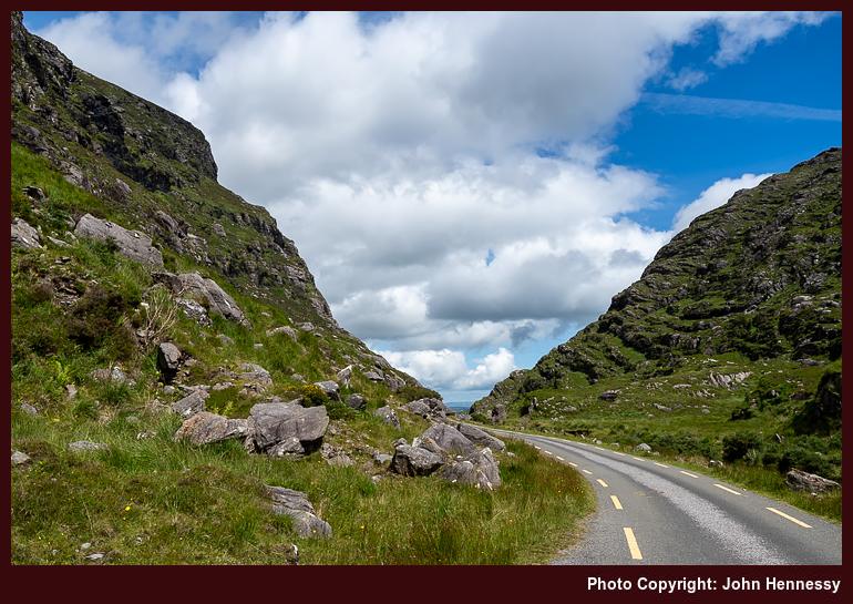
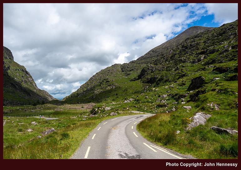
Again, being a year too early for improved bus services again comes to mind. The last bus of the day between Beaufort Bridge and Killarney did not leave so much of the day for being around the Gap of Dunloe given the time of my outbound journey. Services between Killorglin and Killarney cover more of the day these times, especially since route 279 complements Expressway route 40 by going via Killorglin between Tralee and Killarney. The limitation of a bus timetable played on my mind at the head of the gap, even if I could have made the return leg of my walk in the available time.
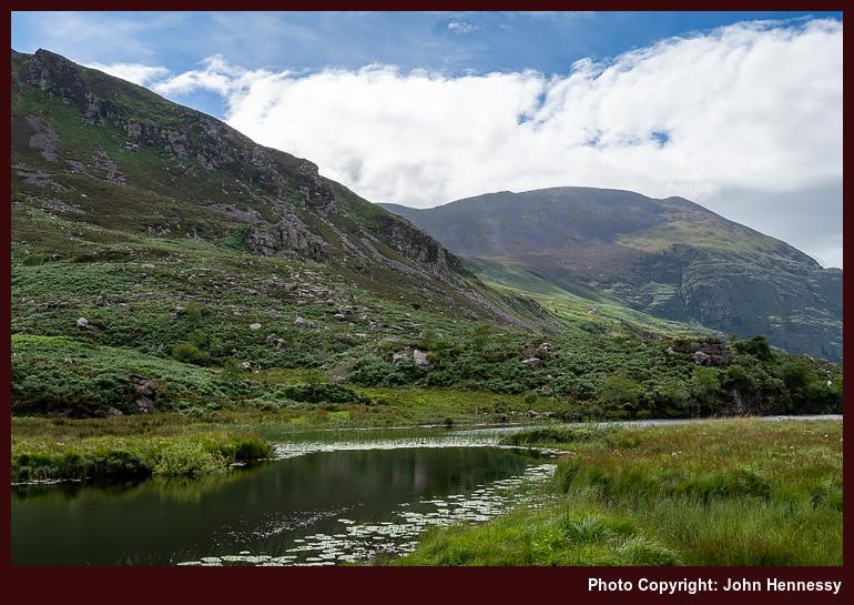
Between all that, I gained much from clouds breaking in the sky over my head. Quiet lanes led me from the bus stop past Beaufort and some ogham stones to reach Kate Kearney's Cottage, where horse and carriage tour providers had a terminus. My rambling involved sharing with others using various forms of transport: walking, cycling, motoring and equine. Even so, the unpeopled scenes that you see above were as they came out of the camera, something worth saying in an era when distraction removal has been made so much easier by the advent of Generative AI.
Such is the list of lakes passed on my way that the words "Pater Noster" come to mind in their geographical sense; the string of lakes are akin to beads on the string of a set of rosary beads, thus gaining the Latin words for Our Father, a pivotal prayer in Christianity. Going south, the list builds like this: Coosaun Lough, Cushnavally Lake, Augur Lake and Black Lough, each a "bead" on the "string" of the River Loe. All added interest as I went on my way, as much as the steep slopes rising around me.
Some were walls of rock, offering a sound mirror for passing tourists and their guides. While the delight of hearing echoes may marvel some, the pursuit runs counter to my desire for quietude. Thankfully, I only witnessed this happening lower down the valley and relinquished that experience to encounter the actual delights that sated me.
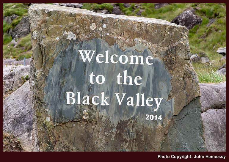
Inasmuch as it appeared that the sunshine would carry on for the rest of the day, that was not to be. It was as I neared the head of the gap that a passing rain shower caught me; it was as if it were trying to steer me into sticking with my original plan. However, the sight of a sign welcoming visitors to the Black Valley sunk my adhesion to that idea. Though Killarney was around twenty kilometres away on foot and I had only trail shoes rather than hiking boots, the prospect was one that I was not to surrender. Travelling under one's own power adds a certain amount of security anyway; all is under your control as far as your physical condition allows.
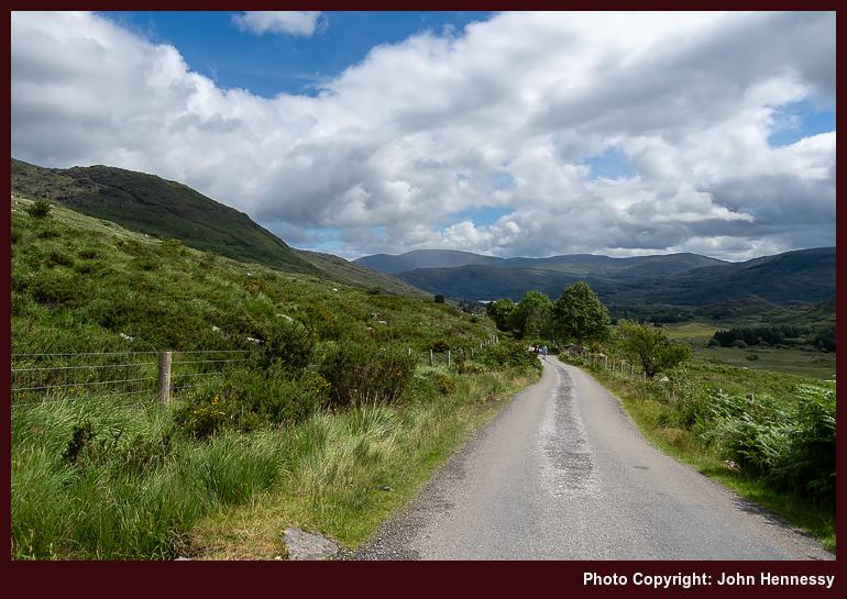
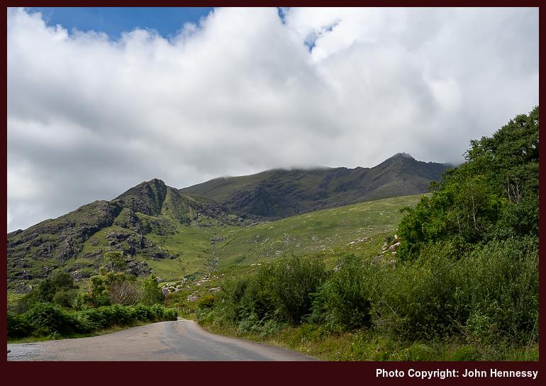
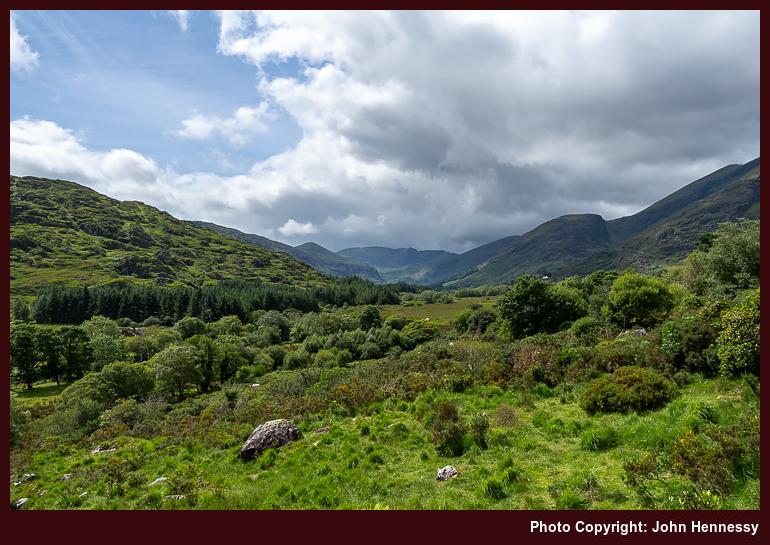
As the shower faded, I descended into a valley where I had not passed for around thirty years. This time, I was on foot and could soak in my surroundings, scenery, ambience and all else while following another section of the Kerry Way. It is challenging to do that so completely while travelling in a motor vehicle, as I was on the previous occasion in the area. The locality's church got a visit when I stopped a while on the way to Lord Brandon's Cottage. Cars were about as well horse and carriage tours, and I marvelled at where the former came from, especially when surprised by one that was behind me. It was not as if I expected a small convoy to pass me.
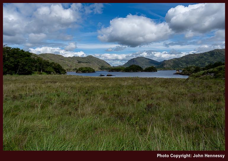
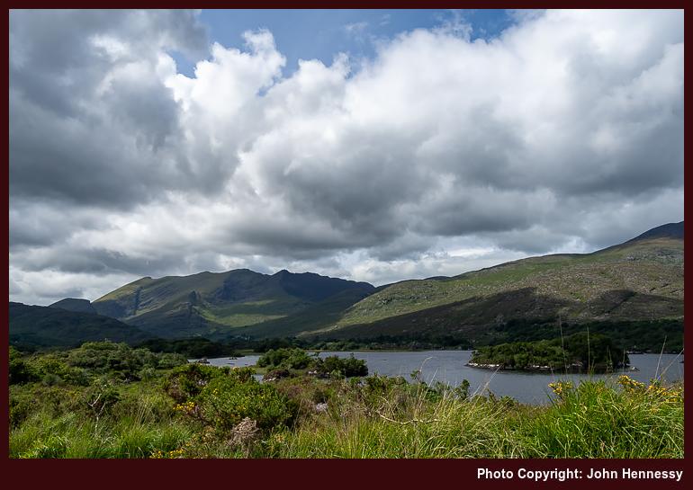
Though the boreen was not without its attendant delights, I was happy to leave all encounters with other traffic after me, at least for a while. Sadly, the sun ducked behind clouds around Lord Brandon's Cottage to foil attempts at photographic capture of the bridge across the Gearhameen River. In time, amends were made as I approached and passed Upper Lake on the way to Derrycunihy and Galway's Bridge. Though others were about, much was quiet too, and all was relished.
Crossing the N72 got me onto a track leading towards where I had been the previous day. Going straight ahead instead of turning left for Esknamucky Glen would have landed me back in Kenmare again. Since Killarney was where I was headed, turning left and retracing eastbound steps was my lot. If I had wondered about my trail shoes dealing with a rough path, I need not have worried. Merrell build their wares well, as I had plenty of cause to discover during 2022.
That small cascade where I could not linger the previous day became a lunching stop for me. Humanity and civilisation felt very far away in the blissful spot. Though overcast skies lay over me, that did nothing to take from the respite offered by this uncelebrated and unpeopled spot. Once I got going again, I was not minded to once more climb Torc Mountain after what the previous evening brought me while I was up there. Sticking to the trail sufficed, and I descended by a busy Torc Waterfall. If I was hoping for the place to be quiet and unfrequented at the time of day that I was passing, it was not to be.
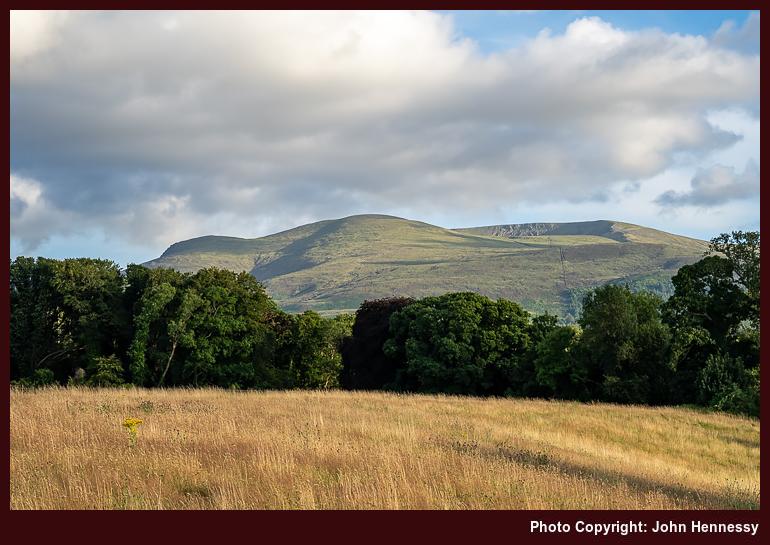
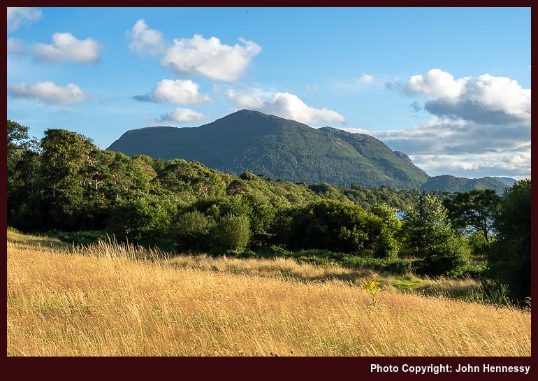
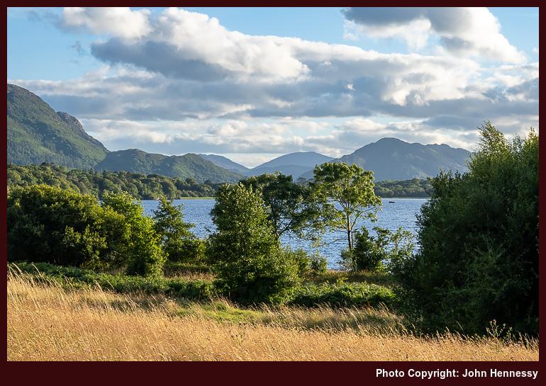
Another crossing of the N72 ensued, this time for a passage by Muckross House and Muckross Friary that had me being more present with the exercise. It offered a chance to make amends for any self-perceived slight at how I passed through the place the previous evening. There was a chance to pause at the ruined friary too, so there was no rushing. Savouring the delights of a summer evening was what it was all about, particularly when the clouds again parted to release more invigorating sunshine.
That approach pervaded the rest of the way, too. Going via Maurice O'Donoghue Park adjusted my course, so I ventured through Knockreer for what I though might be the last time. As I was moving with less fatigue than 24 hours previously, I wondered if impromptu long distance walking with lighter footwear was paying its dividends. An impulsive decision had granted me more than I would have dared to seek; the length of the route seemed overly ambitious during a spell of planning. This was a day that was memorable in so many good ways.
Kerry Way and Torc Mountain: A Highland Trek from Kenmare to Killarney
19th December 2024 In one respect, my longer stay in Killarney was a year too early. 2023 brought an enhanced bus service between Killarney and Kenmare. That would have made for an earlier start along the main hike of my second full day in Kerry: the section of the Kerry Way between Kenmare and Killarney. The later start may have meant that I had longer around Killarney before setting off, yet the long Irish summer evenings meant that there was no major impact in the end.
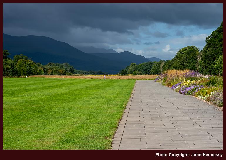
If I was too early for making use of better bus services, I was optimally timed for avoiding overtourism. A stroll through Knockreer this past July brought that home to me. While it might have been a later arrival from Cork that put me in the time slot for hotel guests being conveyed on horse and carriage tours by jarveys, I was left with the impression that jarveys owed nothing to passing walkers and cyclists. Convoys of them were going my way, and it did not feel very comfortable at all. The 2022 forays avoided all that in a world only slowly emerging from the pandemic tourism nadir.
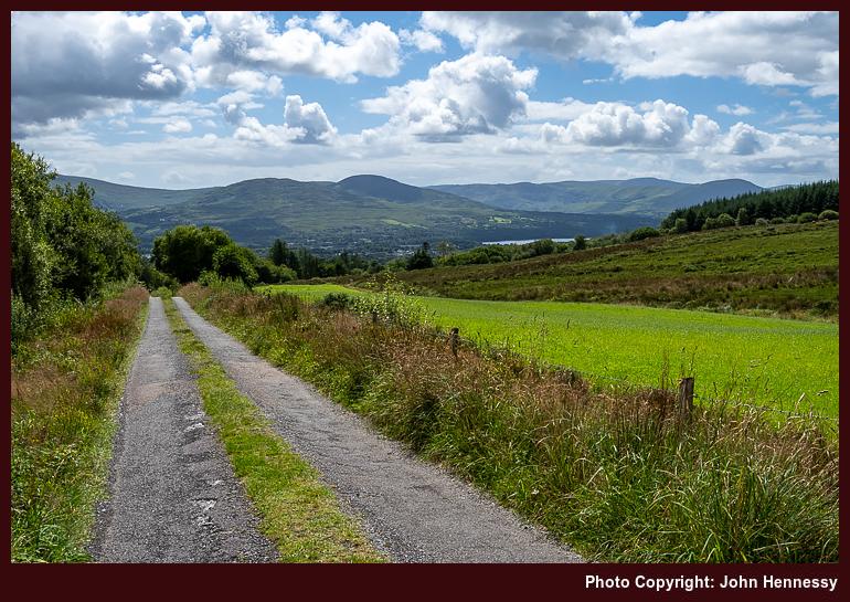
Unless I have some business to do, I tend not to loiter around Irish towns if I can avoid doing so. That was how it went for me in Kenmare, so I set to finding the route of the Kerry Way and ascending a back road leading unyieldingly uphill from the town. As it did so, I was treated to ever expanding views of Kenmare River and nearby Beara Peninsula on any rest breaks that were needed. The quietude of my surroundings was a marked counterpoint to extensive commercial business ongoing in the town that I left behind me.
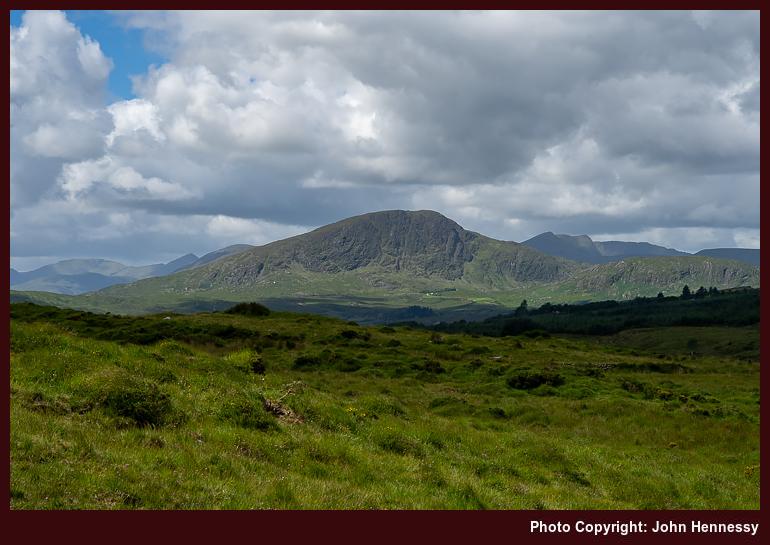
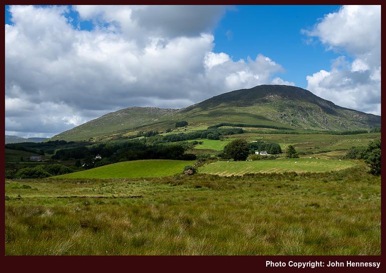
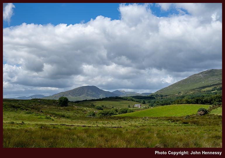
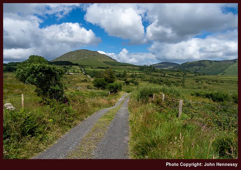
Not many others passed me in the opposite direction as I ventured further into the hills. As I did so, it was what surrounded me took up my attention in place of what lay behind me. Gradients also eased to make for less demanding progress along the boreen. It was as if I were passing through such an emerald idyll past which it was rude to rush. Many photography stops ensued as I closed in on Peakeen Mountain and Knockanaguish.
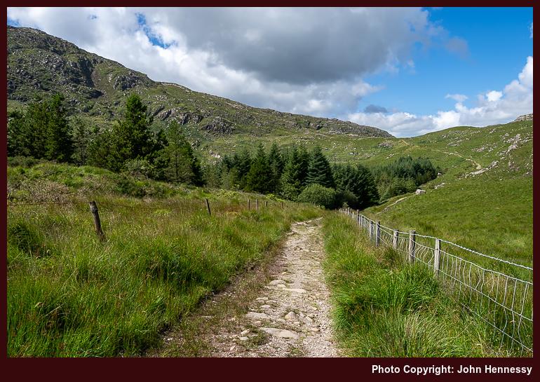
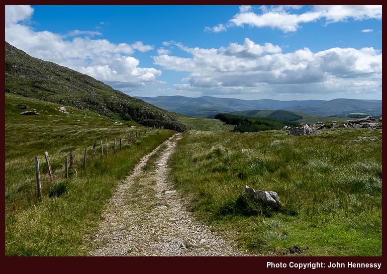
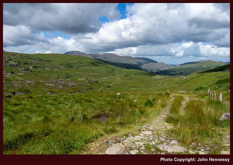
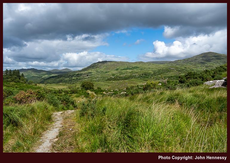
Leaving tarmacked boreens behind me, I took to the gravelled track leading me between Peakeen Mountain and Knockanaguish. It was hereabouts that the skies clouded to limit photography, and a rain shower overtook me to provide the only wetting of the day. Nevertheless, it soon passed to let me imbibe the delights of the bucolic surroundings. It really was special to have such a place deserted and to allot me one of the best lunching stops that I have ever enjoyed. That Windy Gap was not living up to its name made the experience even better.
After that elevated lunching spot, a descent was in order on a track leading to Galway's Bridge and Derrycunihy. However, that was not the direction to be following for Killarney, so I turned right to ascend to Esknamucky Glen; the name of the glen means place of the pigs in Irish (Eisc na Muicí). Before getting, someone going the other way asked for directions to Lady's View, an inquiry that surprised me. A consultation of the map revealed that they were not so misplaced, though a walk along the N72 did not strike me as anyone's idea of pleasure.
If I was expecting a gravel track all the way through Esknamucky Glen, disappointment would have been my lot. Since the surface of the trail is at times uneven along the lower slopes of Cromaglan Mountain, I was glad to be wearing boots. The aforementioned hill might make for a pleasing outing, especially after I opted not to reach its summit, and it is far from being the highest in the area by a long shot.
Only for someone else already being there, I might have dawdled near a small lake and an attendant waterfall on an off-trail break. It would have been well-placed after all the care with foot placement that preceded it. Instead, I made for the track that brought the idea of following the Old Kenmare Road section of the Kerry Way to my notice in the first place.
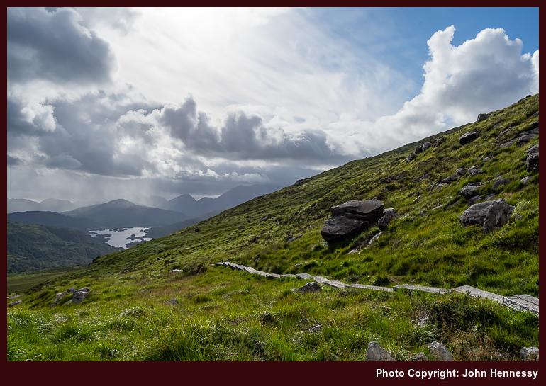
That was on a claggy day trip to Killarney from Tralee the previous June. Then, I made my getaway from a human throng that centred on Muckross Road to reach the top of Torc Mountain, despite the lack of any views because of the low cloud base. My passing the same hill in better conditions meant that I could not decide against making another ascent, even after the ups and downs of coming all that way from Kenmare.
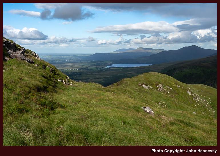
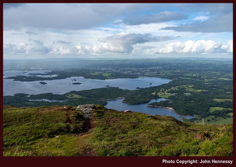
The added exertions were amply rewarded. Some Americans making their descent shared their astonishment at what they saw; the word "awesome" got used. As overused as that term might be, the panoramic views that I had missed on the earlier encounter were all there to be savoured. All of Killarney's lakes lay below, from Upper Lake to Muckross Lake to Lough Leane, along with Lough Guitane near Glenflesk and nestled beneath Mangerton and its neighbouring hills. This was a spot on which to linger, yet there was a good distance to walk to get to Killarney, and I needed to get going. That would have put paid to any designs on reaching the lower west top of the hill, should they ever had existed.
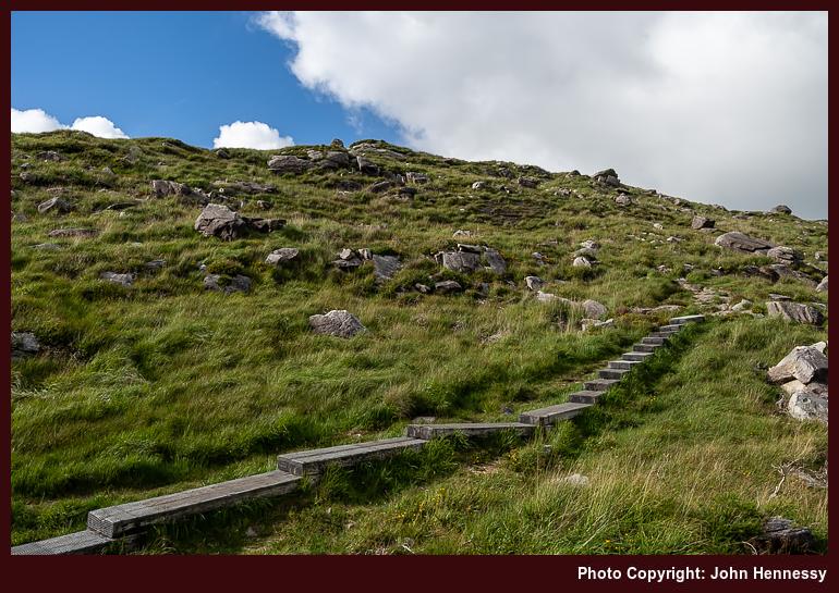
Conscious of time, I made my descent over boardwalk and pitched path, hardly a great combination for scurrying downhill when one's fear of tumbling takes control. Once on the track below, I rejected the prospect of a descent by Torc Waterfall for a gentler gravelled, and later tarmacked, one following the course of the Old Kenmare Road before crossing the N72 into Muckross.
By this stage, my recollection is that things had degenerated to a sort of zombie trot. Fatigue was to blame at the time, though I now wonder if time also was of the essence. Whatever was the combination of causes, it felt rude to be scurrying past Muckross Friary in the state of mind that I had entered by then. After travelling several more kilometres, I was back at my accommodation, ready for a good night's rest after an often stunning day.


