Category: Trip Reports
Traipsing through two countries and three counties
The start of a new year is often a time for reflection on what has gone before, as much as pondering the prospects of a year to come. In this, 2018 was no different, and I was in the middle of a career break as well, so the thinking turned to my next career moves and the choices that I arrived at in January 2018 continue to pervade more than two years later.
In fact, they affected the start of this year with another work break that allowed the taking of stock in light of then seemingly pervasive threats. Throughout this, I also got to wonder about future transatlantic excursions as a form of distraction. Many do love planning, but you need to be without an intrusive global event to make it happen. So all those dreams from January and February of this year are placed on hold.
Thankfully, it was only my own speed of inquiry and assessment that forestalled any overseas travel dreams in 2018. Other plans could be made to happen in a piecemeal if imperfect manner. What I needed to do is get over the residual stresses caused by what needed doing during 2016. At least, I did not have a global pandemic back, and I count myself very fortunate for that.
Returning to 2018 though, it was not as if all the required introspection ruled out day trips, quite like the activities or the weather of the first two months of this year. In fact, a few of those took me to Wales and the principality had not seen my making trips there for quite a while if I recall correctly. The sequence of Welsh outings actually began before Christmas 2017 when I embarked on a trip through the western end of the Brecon Beacons National Park. That took me through Abergavenny and Brecon as far as Neath before I continued my way home. In time, the possibility of exploring another quiet part of Wales may come to something.
My first Welsh excursion of 2018 actually took me to Cardiff, a city that I have long neglected, and the outing was repeated in part on the Spring Bank Holiday of 2019. Then, there may have been a Spice Girls reunion concert, yet what intruded on my ambling more were groups of cyclists going along multi-use trails. Sunshine pervaded on both visits, but thoughts of basing myself in Cardiff for a few days to explore the countryside within its vicinity retain their appeal. While I might do some cycling of my own too, I do intend to leave better space for walkers, especially around the delightful Bute Park and along the banks of the River Taff.
So far, what I am talking about is a spot of reconnaissance that may lead to future trips and there is one other excursion in January 2018 that deserves a mention before the main trip report, and it leads easily into it. That took me from Macclesfield to Aberystwyth via Shrewsbury and Llangurig. Not only did that take me past Pumlumon Fawr by bus, but the stopover at Llangurig also allowed some muddy walking along part of the Wye Valley Walk. What I really was exploring though were the logistics of getting near Pumlumon Fawr for an ascent of one of the highest hills in mid-Wales. That left me with the framework for a scheme that either would use Aberystwyth as a base or involve a bivvy on the side of the hill, depending on how brave I feel.
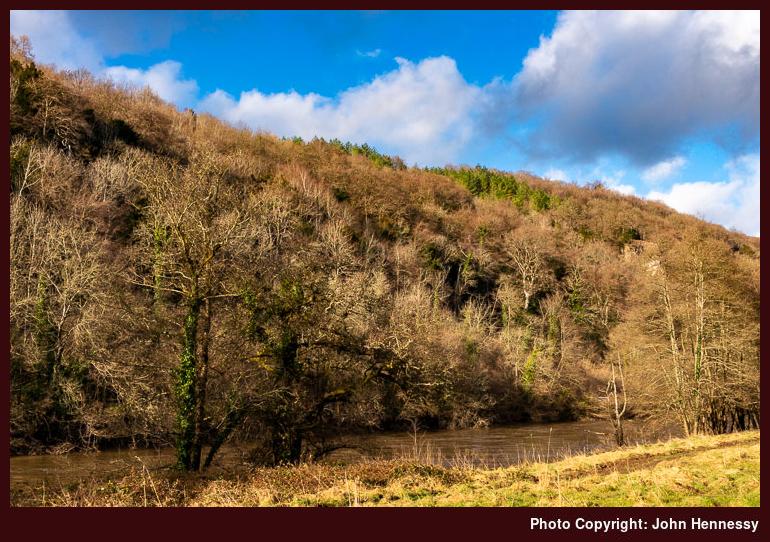
The Wye and Severn rivers both rise on Pumlumon Fawr, yet that was not where my Welsh wandering took me next. It may have featured the same River Wye, but this was a circular ramble, with Monmouth at its starting and ending points. In truth, I also fancy a visit to Tintern Abbey, but remains outstanding too, and the idea for the Monmouth excursion lay in my mind for quite a while before it happened.
Calling the route a circular one does much to hide its actual complexity, with some of that arising from serendipity. At my arrival in Monmouth, all that was yet unknown as I passed through it heart, with older buildings like those of its church and its independent school adding interest along the way. The school's students were going hither and thither in their boisterous ways and, fancying an air of greater peace, I left them to those to reach the River Wye.
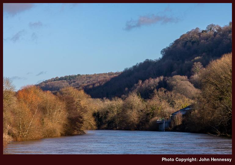
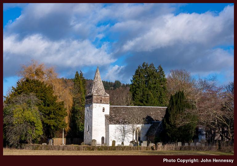
There, I met up with the Wye Valley Walk that was to convey me along the Welsh side of the river; Offa's Dyke Path also passed hereabouts, but that was not part of my designs since I was bound for Symonds Yat. With the hubbub of the A40 in the background, I relished the sunny morning as much as I could. Apart perhaps from the likes of St. Peter's Church near Dixton, those early stages were not to be peppered with so much in the way of human construction.
Forested hills lay to my right and in front of me as I went, and it was around these that I was to spend much of my time. Some were to be more easily named than others, but that did not detain my thinking as I reached the point where the river parted from the busy motorised thoroughfare. Beyond Wyastone Leys, my surrounding were to become much quieter and much now forested.
The forested route may have limited opportunities for photography, but I was soon enough at The Biblins where I would cross the Wye and encounter a greater human presence. Some were walking and others cycling, but there was enough room for all of us, and I still recall having the place to myself at times.
It was afternoon by the time that I reached the eastern part of Symonds Yat. Not only had the trail led me onto tarmac, but I had crossed into England and was in Herefordshire. The road and any traffic that was passing along it was left behind to round Huntsham Hill and return through Elliot's Wood. What became clear was how late in the afternoon it was getting, so I was anxious to keep going and photographic efforts stopped.
After reaching a road again, I then left it to go through Mailscot Wood and into both Gloucestershire and part of the Forest of Dean. With the road to Christchurch never far away, I was lured along a trail nearly as far as Hillersland before I turned in the direction of the River Wye again. That felt longer than was ideal given how late it was in the shortness of a January day.
Soon enough, though, I was back on the route of the Wye Valley Walk and heading towards Monmouth again. However, I decided against crossing the river until I reached the Wye Bridge in Monmouth, so following Route 423 of the National Cycle Network. By now I was back in Wales and soon enough reached a section of the railway that once connected Monmouth and Symonds Yat. That made navigation less of a concern as the hours of daylight faded.
Eventually, the gloaming would turn into full darkness and torch-lit walking along tarmac returned me to Monmouth, where I had plenty of time to find the bus terminus that I had not used on my arrival. Tintern was passed in darkness on the way home, but that fact did nothing to spoil the satisfying day out. In fact, it remains a useful excuse for returning to a delightful part of Wales.
Travel Arrangements
Train journey from Macclesfield to Hereford with a change at Stockport, followed by bus travel from Hereford to Monmouth using service 36. Bus journey from Monmouth to Chepstow using service 69 followed by train travel from there back to Macclesfield with a change in Birmingham New Street.
Spending a day going from Bamford to Hathersage via Stanage Edge
Not only does this trip report the last of a trilogy describing three different visits to the Peak District during the autumn of 2017, but it also is the last one from that year that still needed writing. 2018 is next and 2019 follows, though my hill wandering appears to have stopped mid-year for a number of reasons that I can recall readily at this moment. Still, these were different times compared to what we are going through at the moment, so it is good to be transported. Hopefully, we can enjoy more like them again sooner rather than later. Old memories are most useful, but the collection always needs augmenting.
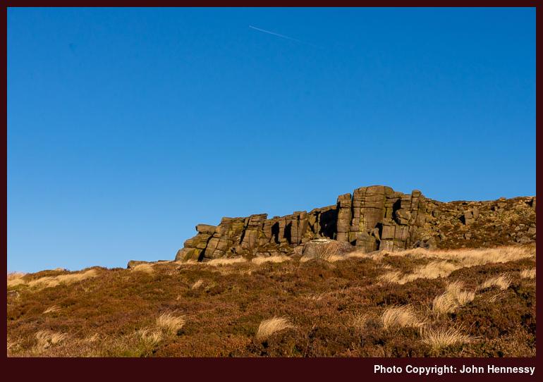
After days spent around the Great Ridge and Ladybower Reservoir, another idea prompted me to devote one to the countryside around Stanage Edge, and that is what this trip report describes. It was a return after a break extending back to the early years of the century, there were several day trips to this part of the world, and they brought home to me how hard it can be to find a marked right of way on pathless ground. There are times when general direction of travel is all you need, so map and compass work without so much regard for legality is then the way to proceed.
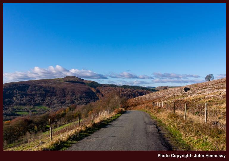
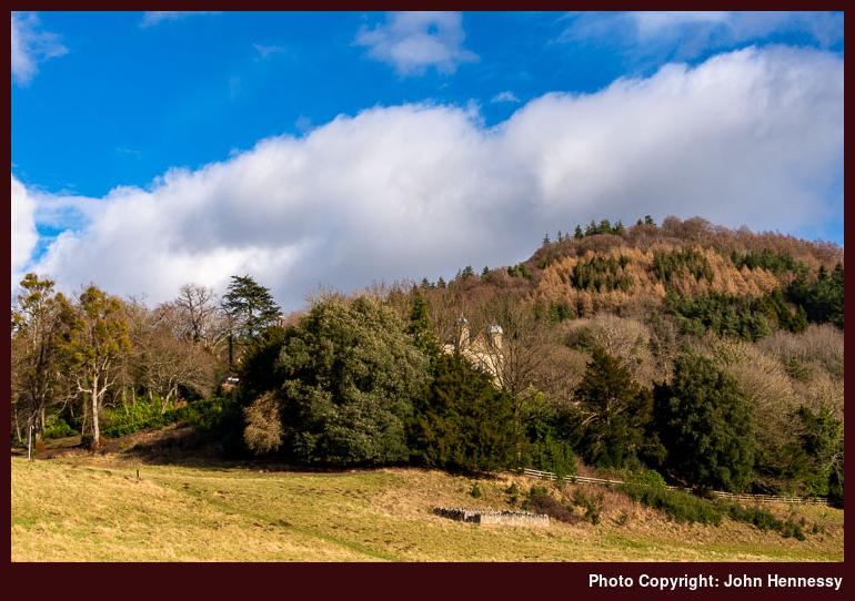
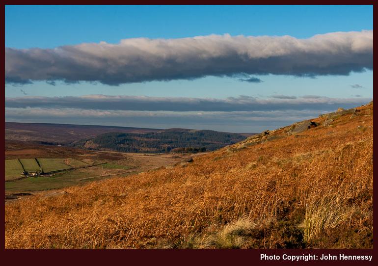
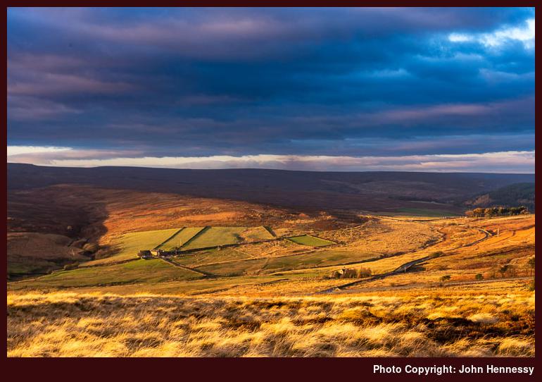
That meant there was an experiment ahead of me on arriving in Bamford, though I picked my way along lanes at the start. Designs on going up a bridleway through Bamford Clough were dashed by signs indicating excavations as part of maintenance works on the electricity supply network. Others were more courageous (or foolhardy, depending on what lay ahead of them) while I stuck with tarmac tramping for a little longer before I found an alternative footpath leading me from Ashopton Road to New Road, thus achieving a not dissimilar outcome. Doing so might have granted me less restricted views of my surroundings, though, and one of those appears above.
Eventually, I found the desired path that would lead me away from New Road and into the wilder emptier countryside that I planned to revisit after such a long absence, especially since it was to grant me ample amounts of the solitude that I so needed at the time. It also was bringing some challenging route finding that I wanted to use for testing GPS navigation on a fine crisp clear sunny day, albeit one with a stiff chilling wind to give the endeavour more of a wintry feel.
Going through abandoned quarry works that nature was reclaiming proved a little too intricate for dependence on a GPS receiver, but added map consultation and backtracking to salve any qualms at lack of route adherence were sufficient to achieve the required combination of peace of mind and onward progress.
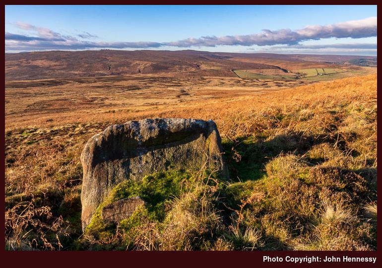
Eventually, it was time to cross pathless moorland, with some useful features like walls being so broken down that their visibility and usefulness get diminished. That though sends my mind back to a laden with memories of unguided cross-country tramping in failing light that eventually landed me in Bamford after scaring me more than a little. That day, banks of heather started to look like walls, so that is why their appearance on an OS map may not give you the handrails that you need. This was no saunter for those who depend on human landmarks for way finding guidance.
Such mirages were not to present themselves as I used the GPS to find the right line on the ground as I continued towards Stanage Edge over ground that at times had the consistency of a soggy bog. Neither waist-high rushes together, or dead bracken were to drive me from my course as I made my way from Bamford Moor to Moscar Moor and then onto Stanage End. The chill of the way was inescapable, so headgear and gloves were pressed into service, along with the warm fleece that I was wearing.
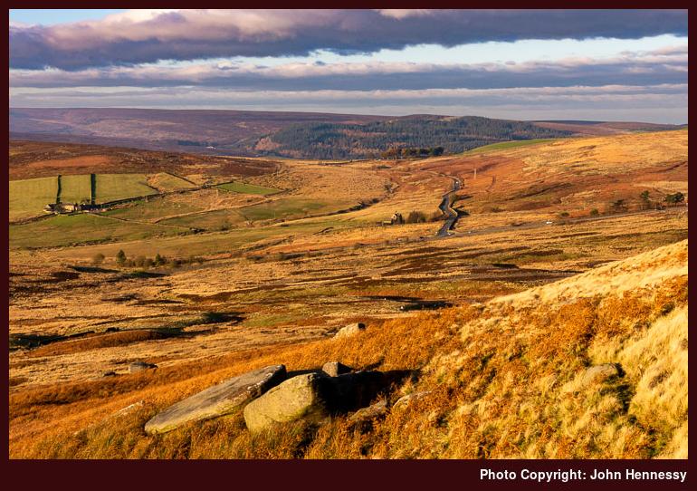
Though offering plenty of solitary hiking, the endeavour brought a time penalty since it was clear that it was nearer the end of the hours of daylight than was ideal. While the supposed proximity of the urban outskirts of Sheffield offered a possible alternative, I stuck with a return to Hathersage that took me past High Neb and along Stanage Edge itself. Light was declining all the while as I traipsed the trail, with some parts being boggier than others. None did anything to take away from the satisfaction of the stroll.
As the day approached the onset of its gloaming, I left Stanage Edge and the route of the Sheffield County Walk, to drop onto a byway that would lead me towards Dennis Knoll. As I did so, climbers were coming away from crags where they had spent time on what was a sunny day, one that lured out many an outdoors enthusiast. It was as if I were in the midst of other outdoor lovers at either end of my walk.
After Dennis Knoll, I resolved to stay on the lane descending all the way into Hathersage as some insurance against the looming loss of daylight with its attendant need for use of a head torch to light one's way. There are times when things need to be kept simple, though it was only on the outskirts of Hathersage itself that I recall losing all daylight. Finding my way through the village after recovering from a minor route deviation, I was at its train station in plenty of time before the next train to Manchester, so I was repeating what had happened in Bamford the previous Sunday when I missed a train by mere minutes. A two-hour wait was avoided (a new timetable halved service frequency) so I could begin my journey home after a satisfying day laden with good memories.
Travel Arrangements
Outbound train journey from Macclesfield to Bamford followed by a return journey from Hathersage to Macclesfield with both having changes of train at Manchester.
A November day spent around Ladybower Reservoir
If it not for other intrusions, there could have been many an account from previous years making their appearances on here in an effort to clear a backlog. Some even might have thought it to be a retrospective like what Cairngorm Wanderer is doing, but that would be the wrong impression. Other missives might have share sunny moments from those previously limited opportunities for outdoor exercise like what Tarmachan Mountaineering has been doing. Alas, the worries of the moment overwhelmed me so it only is now that I am getting to flesh out this post for your perusal.
Thankfully, things are looking up a little now and the Spring Bank Holiday weekend saw me finding emptier corners for solitary relaxation. As you would expect, they turned up in some lesser frequented spots like around Pott Shrigley, Rainow, Higher Sutton, Bosley and North Rode. Each did me the world of good and there was no need to deal with human encounters given the added alertness required of the time in which we find ourselves.
Back in November 2017, none of this could be foreseen, and my task then was to recuperate and recharge after a stressful few years that life had sent me. When opportunities arose, I got out then and found quieter spots, but encounters with humanity had none of the edge that they do nowadays. The stroll described here had an immediate forebear and shared with it echoes of my early efforts at hill wandering. That came from my first-ever encounter with Ladybower Reservoir being on Holy Saturday in 2002 and this hike allowed plenty of time to admire that attractively placed body of water.
Returning to Easter 2002, the whole weekend had me spending a lot of time in the Peak District. It started on Holy Thursday when I tried out the Doctor's Gate Footpath and a little part of the Pennine Way before returning to Glossop. Good Friday then was spent around Glossop and nearby Hadfield with a first visit to Longdendale, a place which appealed to me in spite of the electricity pylons. Though the collection of reservoirs hardly were so intrusive, I was left wondering how it might have appeared before they were built, and any appearances have done nothing to forestall return visits.

Though it similarly is a piece of human landscape engineering, that thought about wildness in Longdendale never really enters my mind when it comes to Ladybower Reservoir. The more natural appearance of the setting might have something to do with it and the absence of electricity pylons has to help as much as sights of steep-sided valleys with fingers of water reaching into them. At least, that is how it always seems to me whenever I think of this area and the photos accompanying this piece of writing may confirm that.
In many ways, the hike from November 2017 that is described here also reprised parts of a journey taken on a damp autumn day in another of the early years of this century. Then, the day improved as I continued all the way to Edale, but the 2017 counterpart had no such need as it remained sunny all the way until sunset.


Both walks, though separated by more than a decade, took a similar course: on arriving at Hope train station, I started to make my way towards Win Hill. It may have been a place that I have visited on numerous but every time has been different. Such is the spread of seasons and variability of weather that it is difficult if not impossible to see it and its surroundings in the same kind of light more than once.
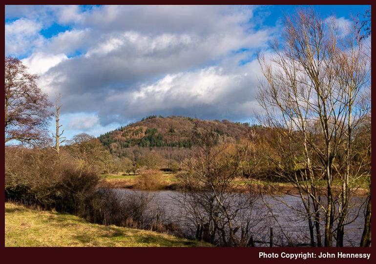
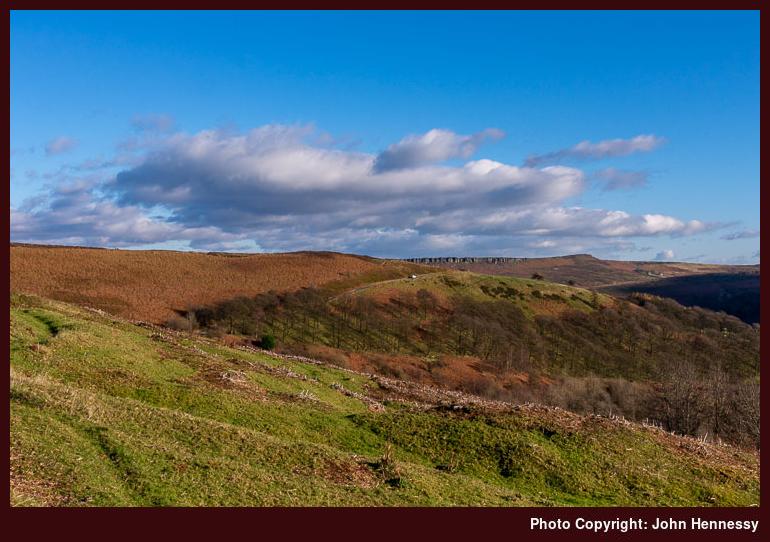
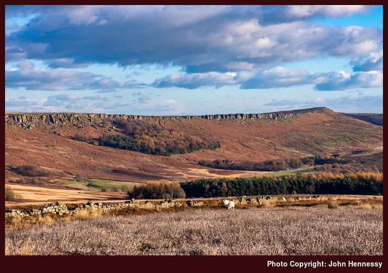
This time, my chosen route took me past Ryecroft and Thornhill Carrs on a variety of footpaths chosen to reach the top of Win Hill from the east. As I went over the top, the views all around and below me looked resplendent in the autumn sunshine. That I was not stopped in my track by the sights would be a surprise except that I had a circuit in mind before nightfall so that kept me moving, but the scenery was much enjoyed too, and the portfolio included views over Bamford and Yorkshire Bridge towards Stanage Edge as well as what you see above.


Once over the summit, I dropped down to Hope Cross, after which I started my descent to reach the River Ashop in the Woodlands Valley. From there, I continued to Ladybower Dam while enjoying the fading light of day and with my legs feeling less energetic than might have been desired. There was nothing for the task but keep going up and down as the track shadowed the shoreline. Along the way, a farmer was out to see his livestock while my journey continued.
At the dam, curiosity overcame any physical fatigue to see where the northern end of the Derwent Valley Heritage Way was to be found before retracing my steps and following it as far as the A6187. All the while, daylight faded to darkness and my head torch was used not only for navigating the gloaming but also in the dark of night, with a field being negotiated without rancour or error.
That added challenge may have cost me time on the way to Bamford train station though and I missed a train departure by a mere minute. The next day came sunny too, as if niggles come in pairs. However, the fact that I had enjoyed a superb day out was more than enough recompense for any forgettable irritations.
Travel Commentary
A day when the railways faced major disruptions hardly was one to travel from Macclesfield to Hope for a walk in the Dark Peak but no one was to know ahead of time and it did not delay my arrival in any event. As it happened, the journey home was slightly blighted by my missing a train at Bamford by less than a minute. That forced a wait of an hour for me, and getting back to Macclesfield from Manchester also was complicated by disruption elsewhere in the rail network. Even so, rail travel travails on that day have done nothing to deter me from trying again; these things ebb and flow.
Confinement
Looking back on last year now, it strikes me just how I never went walking the countryside as much as I might have done. However, there were preoccupations weighing on my mind. Ongoing political events were among them but a then forthcoming upheaval in my working life was a more pronounced concern. The latter continued into this year but was sorted in March though it had limited excursions in January as much as the weather did likewise in February.
Whatever tricky challenges I had imagined for 2020, they became nothing compared to a new viral disease that had sent us all into lockdown. In my case, it also brought added tension that got the better of me in April. Chats with clinicians have helped and I am moving beyond the episode now thanks to clarification of thinking as much as daily relaxation exercises.
Throughout all of this, I ventured out of doors every day for physical exercise in the locality. Some days, I have contented myself with local parks (Riverside, Victoria, South and West) but my horizons have expanded on other ones. As well as walking, I have returned to cycling too in an effort to make the current time feel less confining. While fairer weather and the time of year add encouragement, it also is amazing how a level of restriction causes you to make more use of what you have and that applies to me too.
All the while, I have been seeking our quieter places for an added sense of relaxation. Generally, I would have sought solitude anyway but social distancing is another motivation. Living in Macclesfield, I am fortunate to have nearby hill country into which I can escape. Of course, others can have similar ideas and that is why I limit travel along both the Macclesfield Canal and the Middlewood Way.
Tegg's Nose and Croker Hill have seen encounters along with a variety of local places like Henbury, Gawsworth, Bollington, Prestbury, Rainow, Siddington, Marton, Alderley Edge, Chelford, North Rode and Bosley. The latter list sounds fairly extensive in its disorderly arrangement but it is good to have such surrounding countryside when so many are staying close to home.
Some places like Henbury can be busier that might be expected so it is taking some time to learn how to ensure social distancing is ever improving. Cutting down on touching of surfaces and bringing hand sanitiser on an outing is part of the way of things at the moment though there have been little moral boosters as well.
It might any some but the pervasive of sunny days is a blessing too and I have been making photos as I go. It is amazing what new sights you can find on a local patch. For instance, Macclesfield's South Park offers views of Shutlingsloe and Croker Hill that add to a sunny evening stroll. There are new rights of way to find and travel as well as amenities like Bosley Reservoir. It all helps to lift a mood and can grant you a quiet relaxing cycling or stroll if you get things right with timing. Going out when others are not inspired to do the same remains a possibility as much as finding where they have not been inspired to go.
An autumnal return to Derbyshire’s Great Ridge
Late last year, I got to read Tim Flannery's Europe: The First 100 Million Years. While this mainly is a palaeontological tale, it also features geological facets too, and it fascinates me that Europe is in essence built from an island archipelago. Putting all that together probably gave us the hills and mountains that we enjoy today, and I am left wondering if there are echoes of those former islands in the diversity of nations that exist throughout history and into our own time. The latter story leads to the politics of preceding and current ages, of which I was reminded while reading Simon Jenkins' A Short History of Europe: From Pericles to Putin. That was another of my recent reads, though I do limit my exposure to news of current developments since they tend to hurt just a bit.
It is not the latter that causes me to recount my recent reading, but the book that I mentioned at the beginning. After all, I am recalling a hike from October 2017 that took in an area with limestone formations laid down by undersea creatures when it was in the tropics, such is the rearranging work of plate tectonics. Yorkshire may be better known for such things, but Derbyshire has its share too.
The autumn of 2017 was for me a time for recuperation and recovery, and there were sunnier slots that lured me out and about. In contrast, its counterpart in 2019 was filled with near-continual wet weather, uncertainty and some big career decisions. 2020 has seen much of the same kind of weather already, but the work conundrum is on its way to getting resolved, so I can look ahead a little more.
All of that lay in the future on the sunny Sunday in 2017 when I travelled to Hope after having whetted my appetite for hill wandering around Calderdale. Naturally, the weather lured others out and about too, with some being less prepared with knowledge than was ideal. Hearing the questions of some, it was if they were destined for a self-contained spot like Lyme Park rather than the more open country around the Hope Valley. Still, they made their own way after some guidance from others, and our paths crossed later in the day.
My destination was somewhere that I reckon I had not trodden since a wet weather outing in December 2009: Derbyshire's Great Ridge. This time, I walked it in the opposite direction from the two other occasions that I recall walking it; in addition to the 2009 encounter, there was a sunnier Sunday traverse earlier that decade (perhaps in 2002) and that took me over Win Hill too if I remember correctly.

In some ways, it was that first-ever trip that lured me back again. Then, film photography was my means of recording any sights that I witnessed along the way, and I fancied seeing what I could do with digital image capture. That was more than enough encouragement for the initial ascent of Lose Hill. Getting there from Hope train station took me around by Aston, Farfield Farm, Kirkhill Bridge and Losehill Farm. Sunny skies were my lot all the while, though greater cloudiness was to intrude later in the hike.

Once up on Lose Hill, I could see a lot more of what surrounded me, with Hope village and Win Hill being among these. The Great Ridge is a popular place to hike too, so I needed to share the way with others as far as Win Hill when I took a quieter route on the way to Castleton. There still were plenty of moments of solitude, though, so the trail did feel too crowded.


An easy-to-follow trail carried me along the undulating ridge, and the pleasing sights in the autumn sunshine continued despite all the clouds in the sky. Views were there to take my eyes back along where I had come, as well as peering where I had not been. Hope Valley and Edale were there to be surveyed as much as the hills that surrounded them. While there was much that was familiar, there also were a multitude of new sights to savour just as well.

Mam Tor was a busy place as it so often is, and it was not solely foot travellers who had found their way there, but paragliders also were about in numbers. As is often the case with honeypots, it takes going a little distance away to regain added solitude. Unusually, this act took me downhill instead of gaining some height, as is so often the case.

By now, I was en route towards Castleton as the sun declined ever more in the sky. The day was nearing its end, but the scenery was not to be plunged into darkness so quickly. My route was to take me over Windy Knoll and past Rowter Farm as I traipsed towards a rendezvous with the Limestone Trail for the last stretch of my outdoor strolling for the day.
It was to address a missing section of a hike from Buxton to Castleton on a summer's day that lost the route of the Limestone Trail somewhere near Peak Forest. Getting the rest of the way took a spot of muddled navigation, with general positioning being evident, but greater precision was lost to me at the time. Still, I got to where I wanted to be, albeit with a sense of dissatisfaction at its execution.
Even with declining light, there was none of that imprecision this time around, and I dropped into Cave Dale as intended. What slowed things was the need for careful progress along a track over limestone paving. That took its toll on my already fatigued limbs, but I got to Castleton without any sense of mishap. From there, a mix of bus and rail travel was to get me home again after a more than decent day out.
Travel Arrangements
Return train journey between Macclesfield and Hope, with a change in Manchester Piccadilly. Bus journey from Castleton to Hope.