A year with much city hopping around Ireland, Switzerland and elsewhere
 3rd November 2025
 While you can plan as much as you like, a year never turns out quite as you hope. For me, that has been the story of 2025. A hoped for trip to Canada could not happen, necessitating a booking cancellation. The need to get more freelance work in a tough market simply weighed on everything else. Having addressed that need, it is only now that I can begin to look ahead again, even though a busy work life takes from that a bit.
This also got in the way of wilderness wandering, which meant my getaways involved cities most of the time, even if adjacent countryside also saw my footfall there. Also, booking a place to stay forces you to get going more than dangling the prospect of a day trip before you in circumstances like what I have experienced this year. That more likely made my excursions urban than they otherwise might have been.
Cork Residencies
January began in Cork, Ireland’s second city because of my spending Christmas there in somewhere that I have as an Irish base. My search for freelance work had begun without my realising the arduous road ahead of me. Otherwise, it was time to haul myself outside around such places as Blarney and Kinsale when a certain torpor could prevail otherwise. Before I left for the UK in the middle of January, a property matter was set in place that would close later in the year.
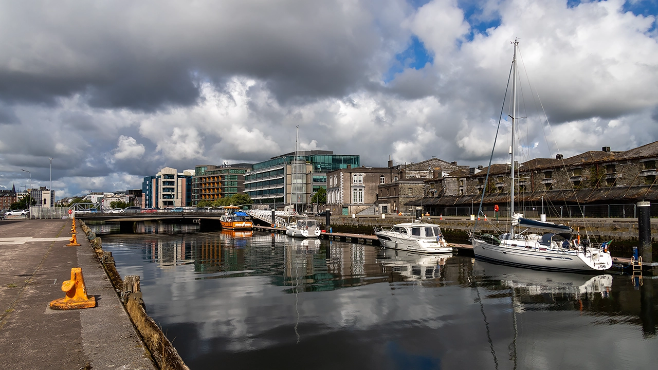
April would see me return, first for a weekend visit, searching for items that I needed to send to someone else and recovering after another discussion about new work came to nothing. The recovery was helpful, while the search remained fruitless in the interval before I returned for an Easter residency that allowed me to visit Cobh and Kinsale again, among other things. Then, my time was spent away from other city landmarks like its English Market, the north side’s Shandon area, University College Cork, Mardyke or Fitzgerald’s Park. Other things were on my mind.
A funeral was the cause of my returning at the end of July. Apart from saying goodbye to an elderly relative, things were otherwise upbeat thanks to my commencing a new contract and getting out in the sunshine for some pleasant walks around by Blackrock Castle and Cobh on consecutive evenings; this is an area that is much influenced by its harbour and estuary. However, it felt too short a rendezvous, ensuring that a return is in mind as soon as a space comes up for such a venture.
Swiss Getaways
May brought a near miss with getting work organised and that left me feeling morose. Having felt on the fringes for too long, a conference trip to Geneva came not before time, even if it may have scuppered that earlier opportunity. These just in time searches are very fragile things, as I was to discover in June, albeit without any real consequences that time aide from feeling saddened at having to choose something else.
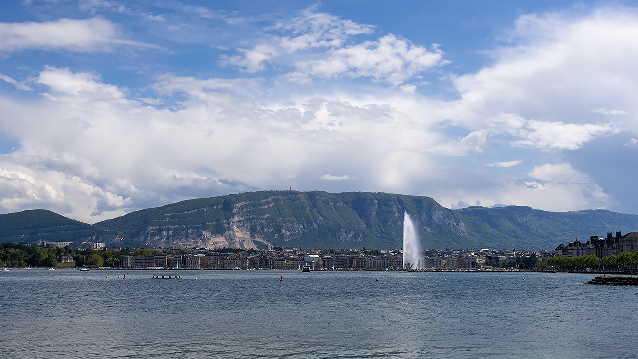
Sunlit evenings in Geneva ensured that I became sated with what the city offered, along with some complementary weekend sampling along Via Jacobi from Coppet back to Geneva. Landmarks familiar from a stay in September 2015 like Jet d’Eau, the banks of the Rhône and Lake Geneva were again frequented, while the cobbled streets of the old town climb to the Cathédrale St-Pierre offered new perspectives. Later that week, a certain amount of repetition aroused a need for novelty that propelled me to Bern for a glorious evening of strolling that did me a lot of good as I traipsed its loop of the River Aare, another first since September 2015.
Other prospects like Zurich and Lucerne appealed during my time in Geneva, until I saw the travel times were longer than I fancied. They offered a platform for a bank holiday getaway before which things began to look up for me a little. Lucerne was where I spent the better day of the trip, leaving Zurich to be explored in mixed weather. That limited photographic activity, yet it did not stop me embarking on a return sailing on Zurichsee that got me as far as Rapperswil, where I spent a good deal of time strolling around there and Pfäffikon under seemingly improving skies.
Since Zurich left an itch to scratch, a return ensued as May ended and June began. Hot sunshine was the enduring weather challenge this time around, even if it did little to stop me strolling along the shores of Zurichsee after following the banks of the Limmat or even along the banks of the River Rhine in Basel with that striking proximity to France and Germany.
Additional evening ambling around Zurich after returning from the latter led me into that city's nearby woods. There, I found an abundance of quietude that was healing, a refuge from the pervading uncertainty in my life. It was much needed and would have reached deeper into my psyche if my work life had been going better. It was quite a counterpoint to all activity around each city's Münster.
Passage through Paris was an element in all this journeying too, albeit far more briefly than during my travels in 2024. The first time was as part of a train journey conveying me all the way from Geneva to Macclesfield, while the second would have been the Zurich equivalent except for its expense. Then, it was Paris Charles de Gaul airport that was my exit point from continental Europe, a much quicker journey, albeit not one that was without its occasions for relaxation either.
British Trials, Solace and Celebration
While the Irish and Swiss segments of this piece have a certain chronology to them, even with Irish trips bookending the Swiss ones, the British portion does a spot of time hopping around each of them. First, there was the January return to the UK, after which I attended to numerous other matters that lay outstanding, possibly affecting my search for new freelancing work.
When meetings with a potential client came to nothing, I decided to break things up with weekend trips to Edinburgh and London. These mixed up revisiting old haunts with seeing new places while I rebooted my search for work. It was going to be out in the sunshine rather than being downbeat at home. My work strategy was getting a shake up too, which set the scene for coming months. Success would take time to come, meaning that there would be another trip to London early in June to attend a conference before everything came together.
Yet Another Scottish Incursion
When it did, there was cause to celebrate, albeit quietly. Before commencing a new contract, I headed north to Inverness, ticking off one last item from my excursion list for my time between contracts. It was in my head for the autumn of 2024 and might have happened if I could lure myself away from Ireland for longer during that September.
The ideas were rural in the main: Fionn Bheinn near Achnacarry, the Great Glen Way between Drumnadrochit and Inverness and the South Loch Ness Trail from Foyers or Dores back to Inverness. In the end, I opted for the first two, partly because of having better public transport options.
Even so, there was an evening spent in the highland city itself, pottering around the Ness Islands and passing Inverness Castle. On the trail back from Drumnadrochit, I briefly encountered the Caledonian Canal, though I did not spend as much time along its towpaths as on a previous visit as 2023 transitioned into 2024.
Eastern Quests
Norfolk, Suffolk and Cambridgeshire drew me away from home in July at a time when going east meant gaining cooler weather. This again was a mix of urban and rural, with much traipsing by the orienting River Wensum as well as a visit to Whitlingham Country Park. The medieval sights were surveyed too, especially around its cathedral close and its quiet green space within the city. There was time to traipse between Brandon and Thetford, shadowing the Little Ouse and passing through The Brecks under ever clouding skies. Those dented my brief visit to Ely and denied me photographic satisfaction there, ensuring a reprise two months later.
Though Ely was my target, I stayed in Cambridge because of its better accommodation options. A short train journey was all it took for me to see Ely's cathedral on a sunnier day, its unusual lantern tower drew a share of my attention before I pottered out of the city while skies broke over my head. Some rural ambling shadowing the Great Ouse showed me just how much of a landmark those cathedral towers make when viewed from the level, drained ground around the city. A return to its heart sated my photographic desires before another stroll by the river took me back to the train station under again clouding skies. Time had been called on my visit without causing any umbrage in my mind.
There was time to revisit Cambridge, too, to see and photograph different sights before I left for home. Advancing cloud cover again spurred me on to the train station after a sunny morning of ambling around the Backs, among other places. Different places were open compared with a previous encounter from years before. The River Cam was busy with punts and I left them to their way. Pembroke College saw me tarrying a while before I continued on a journey that was ending a sequence of summer jaunts, mainly urban but at times rural too.
A Southwestern Incursion
There was some time hopping above too: the two eastern excursions encapsulated a first trip to Devon and Cornwall. Again, cities pervaded with time spent around Exeter and Plymouth. Penzance became the Cornwall terminus for my rambling, allowing me to see the county's scenery from a passing train. While Exeter's cathedral and its surroundings clearly were a draw, they did not keep me away from the Riverside Valley Park, bounded both by the River Exe and the Exeter Canal. Exmouth was another location that lure, causing me to wander the coast a little too much for my own comfort given the advancing end of the hours of daylight. Nevertheless, this dalliance with the South West Coast Path did not result in ruin either, and Penzance became another, though my previous adventuring had tamed designs on an out and back trot to St. Michael's Mount. Thus, I made it home without any misstep.
Looking Ahead and Looking Back
There are upcoming business trips to Germany ahead of me, so the city hopping is not over for this year. Mainz is to be the location for a client meeting, with Frankfurt's airport proving essential for convenient travel. Because of the nature of the trip and the time of year, exploring will be at a premium, though. This also would be my first-ever overnight stay in Germany, only for the second likely to soon follow it: a conference trip to Hamburg. There, my time will be more my own, so more may come of it, though uncertainty pervades those possibilities.
A return to Cork for a longer spell is in my mind too, even if one cannot hope for too much when the hours of darkness are longer; an Easter stay would be better on that score. Beyond that, another conference could draw me to Italy for the first time. The venue is Milan in a time when hours of daylight are more amenable to personal city explorations. Since this is quite a time away yet, plans are not at all firm at this stage.
On reflection, there was a lot of temporal toing and froing in the above, unlike any rivers that flowed in only one direction. That was the sacrifice caused by focussing on locations to provide a thread holding together the whole account. Returning to the hydrological theme, it may have made the account tidal in places.
Another theme was what eventually became a successful search for freelance work, one whose busyness perhaps keeps me away from gallivanting as much the technological novelties that are coming my way. Reading is happening in parallel and something may stick there too, even if it feels far too premature to be considering summer holidaying plans. Last year's hubris does sit so well now.
Three experiences of conservation across Britain and Ireland
1st November 2025 Two recent encounters prompted the preparation of this piece. The first was an email from the BMC that surprised me with a mention of Wales' efforts to set up a new National Park, apparently a manifesto commitment. It also mentions efforts to set up a South Pennines Regional Park, an initiative that has faltered. Lastly, an article in Wanderlust magazine reminded me of the setting up of Kerry Marine National Park early in 2024. Together, these stories show how policy, geography and local sentiment combine to shape what gets protected, how it is managed and why it matters. Some of it is good news that we really need more often in these precarious times. All the locations are known to me from varied explorations over the years, ensuring interest in what has happened and what is to happen yet.
Kerry: A Marine Success
Ireland's decision points in a fresh direction, adding a marine focus to its national park system. Páirc Náisiúnta na Mara, Ciarraí was established in 2024 off the County Kerry coast as the country's first marine national park. Its boundary is dispersed across islands, offshore reefs and mainland coastal sites, linking sea and shore in a single conservation framework. It includes Skellig Michael, west of the Iveragh Peninsula, where an early Christian monastery clings to a jagged island that is a UNESCO World Heritage Site. It also embraces parts of the mainland such as the Inch Peninsula, where one of Ireland's most significant dune systems supports rare plants and animals including the Natterjack toad, and upland and coastal locations that underline how land and sea processes interlock along the Atlantic edge.
The park's ecological interest is varied. Habitats include limestone reefs, sand dunes and blanket bog, together with cliffs and islands that host substantial seabird colonies. Puffins arrive in season to breed, whilst storm-petrels and Manx shearwaters use offshore stacks and islands that are difficult for predators to reach. The marine environment supports seals, dolphins and other wildlife that benefit from the protection of feeding and breeding areas. Cultural heritage sits alongside nature. Beyond Skellig Michael there are underwater archaeological features including shipwrecks, and on Valentia Island the famous Tetrapod Trackway preserves the footprints of some of the earliest creatures to walk on land.
Visiting takes a different shape to that in a single-block terrestrial park. Because sites are dispersed, planning is needed to decide which places to see and how to reach them. Weather and sea conditions influence access, especially for boat trips to offshore islands. The park is open year-round at no charge, but it is framed primarily by conservation, so visitor experiences are expected to be respectful of sensitive habitats and species. Nature-based tourism has room to grow under careful management, whether through coastal walking routes, wildlife watching or guided visits that interpret the geology and archaeology of the region. The wider area already draws people to routes like the Kerry Way and to small harbours and beaches where the Atlantic setting is felt at close quarters, and the new designation helps shape how those activities unfold in the long term.
Wales: Work in Progress
The Welsh Government has committed to designating a new national park in north-east Wales, fulfilling a 2021 manifesto pledge. The suggested title honours Owain Glyndŵr and would bring the total number of Welsh national parks to four, alongside Eryri, Bannau Brycheiniog and the Pembrokeshire Coast. The proposal centres on the existing Clwydian Range and Dee Valley National Landscape, formerly an Area of Outstanding Natural Beauty, whilst extending beyond it. The most recent outline suggests an area of about 927 square kilometres and includes a sweep from parts of the north-east coast with notable dune systems, over the Clwydian hills and the Berwyn range, and into sections of north Powys. Exact boundaries are being refined through a statutory consultation process, recognising that lines on a map carry real consequences for planning, funding and land management.
The rationale for designation is framed by Wales's response to the nature emergency and the desire to embed conservation, nature recovery and climate action more deeply into public land management. National parks in Wales are expected to uphold landscape protection and enable responsible access, whilst supporting local economies through sustainable tourism and investment. Supporters argue that the proposed park could strengthen protections for habitats, give fresh impetus to biodiversity restoration and bring a profile that draws visitors and funding to an area that already attracts walkers and heritage enthusiasts. For many in north-west England, it would be reachable on a day trip, adding another option for outdoor recreation within manageable travel time.
Turning a proposal into a park involves a sequence of legal and administrative steps. Designation would trigger processes set out in Welsh legislation, culminating in the establishment of a dedicated national park authority or equivalent governance body. That authority would be expected to balance conservation with visitor management, draw up and implement a management plan, and work with local authorities and communities on planning policy, access and infrastructure. Funding is central to this, and the Welsh Government has indicated that it does not intend for existing national parks or local authorities to be financially disadvantaged by the creation of a new park. The details of the funding model are still being developed, with attention on how to resource staff, projects and visitor services without eroding other services.
Public engagement has been brisk. An initial seven-week engagement period took place in 2023, followed by a more detailed statutory consultation in 2025 on the proposed designation order and boundary. The aim is to reach a decision and, if confirmed, formally designate the park before the next Senedd election in 2026. After designation, a park authority would be formed and management plans prepared in consultation with those who live and work in the area. Clarifying the precise planning powers of the new authority relative to existing local planning functions remains a live issue and will influence how development, housing and infrastructure are handled.
Views are mixed. Conservation organisations such as the Campaign for National Parks have set out a supportive case, highlighting the chance to embed nature recovery, climate action and sustainable tourism within a high-profile framework. Some stakeholders see an opportunity to raise the region's profile and diversify the rural economy through visitor spending and investment in nature-based projects. Others are wary. Concerns voiced by some local authorities and communities, notably in parts of Powys and Flintshire, include cost, bureaucracy, potential planning restrictions, the prospect of losing local control, house-price inflation and increased visitor pressure. One survey cited in the debate reported that about 51 per cent of respondents supported designation whilst 42 per cent opposed it, capturing the sense that opinion is far from uniform.
The practical worries extend into how costs would be shared and how land use might change. Councils have raised the possibility of being asked to fund a portion of the park budget. Land managers want clarity on whether growth controls or altered guidance would apply to agriculture and forestry. People living in small settlements wonder what increased visitor numbers might mean for parking, transport and tranquillity. The Guardian has carried coverage that illustrates the tenor of some local discussions, with phrases such as "play area for townies" reflecting anxiety about being swamped by outsiders or pushed aside by a new governance structure. Balancing conservation gains with the realities of rural livelihoods is an ongoing challenge in protected landscapes and will be central to how any new authority sets its tone.
Boundary definition is another knotty part of the work. Earlier candidate areas have been refined or excluded as maps have been tested against on-the-ground considerations, from ecological coherence to administrative practicality. Getting the line right matters because it determines which communities fall inside or outside, which habitats are covered and which authorities will have to align their planning with a park-level policy. It also determines how visitor flows might be managed, which is important for fragile upland paths and sensitive dune systems that can be eroded by heavy use.
South Pennines: A Failed Experiment
Northern England saw a different approach in the South Pennines. The area between the Peak District and the Yorkshire Dales is one of England's largest upland landscapes without a National Park or Area of Outstanding Natural Beauty designation. It has sweeping moorlands, gritstone edges, reservoirs and wooded slopes, and an industrial legacy of mills, packhorse routes and valley towns that sit close to high moors. Its wildlife interest is significant, with blanket bog that stores carbon and supports species such as merlin, short-eared owl and twite. Its proximity to cities offers a rare sense of remoteness, a short distance from dense settlement.
Rather than wait for national designation, local authorities and partners launched a "self-declared" regional park in 2021. The intention was to coordinate conservation, recreation and investment across a landscape that had long straddled administrative boundaries. Because it had no statutory basis, the concept relied on voluntary collaboration, project funding and goodwill. That model proved hard to sustain, and the organisation behind the initiative announced in late 2023 that it would close. In effect, the name and idea live on in public consciousness, but the machinery that might have given it day-to-day coherence has been wound down.
Visiting the area remains rewarding, though it differs from a statutory national park. Protections are uneven, management structures vary, and the visitor infrastructure is not as mature. Many routes cross high moorland where the weather shifts quickly, winds can be strong and visibility can drop unexpectedly. A degree of planning helps, whether for remote moorland traverses or gentler valley circuits that blend natural and industrial heritage. As a lived-in landscape, the mix of reservoirs, old works and open moor means not every route feels like a classic hill walk, which is part of its character.
If the idea of a formal designation ever returns, the legal and administrative route would be lengthy. Under the National Parks and Access to the Countryside Act 1949, as amended, only Natural England can recommend new National Parks or Areas of Outstanding Natural Beauty. It would first have to identify a candidate area through national assessments, then test it against criteria for natural beauty and recreational opportunities, which for a National Park must be present on a significant scale. The South Pennines would likely meet the test across the uplands, though the presence of large settlements and infrastructure in the valleys complicates any judgement on tranquillity and visual cohesion.
Should an area pass initial screening, Natural England would prepare a technical boundary and examine management feasibility. Boundaries must be defensible on physical or administrative grounds, which is not straightforward when a candidate spans many councils. Agreement across several local authorities would be necessary, and in the South Pennines that could involve at least eight, each with distinct planning policies and priorities. Extensive consultation with councils, landowners and communities would follow. If substantial objections were raised, a public inquiry could be required, as happened with the South Downs, which took years to complete before designation.
Only after that would a recommendation go to the Secretary of State at the Department for Environment, Food and Rural Affairs for a decision. If approved, a statutory order would designate the park, a management body would be established and a management plan adopted. The whole process typically takes five to ten years, costs several million pounds and depends on sustained local and political support. Recent priorities for Natural England have been to maintain existing sites and pursue boundary changes to other AONB's, whilst government policy more broadly has emphasised local nature recovery strategies and partnerships.
The South Pennines have existing protections in the form of Sites of Special Scientific Interest and Special Protection Areas, which cover key moorland habitats and birdlife, and these may have been considered sufficient for ecological protection absent a landscape-level designation. Governance is another factor, as Natural England often prefers designations where a single or small number of authorities can manage coherently. A lack of unified local backing also weighs against progression. Taken together, these factors explain why a statutory effort never gathered pace and why the self-declared model, however admired, faltered when resources tightened.
Broader Implications
Set side by side, these three examples underline how different policy instruments are being applied in neighbouring jurisdictions. Ireland has successfully delivered a marine park under a banner that carries both ecological and cultural weight, from seabird cliffs to monastic heritage and palaeontological traces. Wales is following a familiar statutory path to create a new national park with clear governance and duties, though the exact balance of planning powers must still be settled and funding structures detailed. The story of England's South Pennines shows both the appeal and the limits of a voluntary approach in a complex, highly inhabited landscape where strong protections already exist for certain habitats but a landscape-scale designation remains unreachable.
For residents and visitors, these developments matter beyond the lines on a map. They shape priorities for landscape restoration, public access planning and visitor management, whilst influencing how local services evolve and how farmers, fishers and land managers are supported to adapt. Expectations shift for countryside behaviour (whether sticking to dune boardwalks to protect rare species, giving seabird colonies space during breeding season, or planning moorland walks more carefully where infrastructure is limited). Underlying all these are political choices about resource investment and the balance between human needs and nature recovery.
The coming months will show whether Wales confirms the Glyndŵr designation and how its boundary and governance are finalised. The South Pennines will continue to be an important upland despite the winding down of the formal regional park effort, and discussions about its long-term status may well return. In Kerry, the task is to turn a headline announcement into lasting protection on the water and the shore, with community involvement and science guiding decisions. Each path has its own hurdles, but the broader direction is clear. The protected landscape idea is not static, and the mix of upland ranges, post-industrial valleys, dune systems, islands and marine reefs now under consideration suggests a more varied future for how these places are recognised and looked after.
From canal paths to high ridges: Pondering possibilities for Lochaber returns
21st October 2025 The Lochaber and West Highland Way albums in the online photo gallery recently got updates (an overhaul in the case of the former) from trips to the former during April 2009, July 2013 and June 2024. However, this activity itself spurred some notions of returning to Lochaber because I fancy making digital replacements for what I pruned from the gallery. Naturally, it would have been better to have those newer images in place before culling their predecessors.
It was a previous round of curation that led me to traipse me along sections of the West Highland Way last year, one between Fort William and Kinlochleven followed by another from Glen Coe to Bridge of Orchy. Those journeys replaced images of lesser quality than what I prefer these days, efforts that were rewarded, which is just as well given the wearying heat experienced on the former and the wintry showers encountered on the latter. None of this took from the success of the endeavour, an aspect that dulled any wishes to return to the area for a time afterwards.
Returning to those unused excuses for returning, I am collating a few here for further perusal. These go beyond an ascent of the Pap of Glencoe from the village that gives it part of its name or even any continuation as far as Sgor nan Fiannaidh though that looks like a craggy proposition on OS maps even if Harvey Maps show a path up there. Proceeding any closer to the Aonach Eagach is of no interest to me, given its intensity of exposure and the scrambling involved; this also might be going in the wrong direction too.
Otherwise, Glenfinnan may have its monument commemorating the Jacobite Rising at the head of Loch Shiel as well as its cinematic associations because of a famous viaduct, and short paths that lead to classic viewpoints of both landmarks, while longer circuits climb into the surrounding hills and a track up the glen reaches the Corryhully bothy. Bringing us more on topic, Kinlochleven turns up a lot here because of what lies on its doorstep, which is far more than the well visited Grey Mare's Tail waterfall or even the well trodden West Highland Way, which threads past some of what is described below.
Matters of Unfinished Business
Glen Nevis
An encounter with Glen Nevis was among my earliest incursions into the Scottish Highlands. That was a serendipitous affair that included a trot along a very short section of the mountain track leading to the top of none other than Ben Nevis. It granted me ample views of what lay about me after some forest track trampling in advance of an intrusion that met no reproach from others who were better equipped for their hiking. Apart from the possibility of reaching Scotland's country top, other traipsing through the glen on the West Highland Way has left me sated for now.
However, that still leaves other parts much further into the glen. After all, my second visit took me all the way to the car park at the end of the tarmac road on a stroll with my brother. While a dull day might have limited photography, that was not the point at the time. It was only a few years later that I went past the sign asking about visitor preparedness to reach wilder parts on a day laced with heavy rain. Before that, I had loitered around Achriabhach on a wonderful August evening on a circuit that followed forestry tracks from Fort William before sticking with tarmac for the way back. Then, gaining height on the path shadowing Allt Coire a' Mhusgain granted me a vantage point from which to savour my surroundings at a time when directional sunlight cast many shadows.
Surprisingly, there has been no follow up on those incursions for a good while since they were made. It is not before time that this should be something that is set to rights, though the vicissitudes of Lochaber's weather and the numbers drawn by the delights that await them mean that the errand is challenging. Overcoming those will bring rewards, though.
Great Glen Way
Around midsummer this year, I pottered along the Great Glen Way between Drumnadrochit and Inverness. The start was under cloudy skies without much hope of seeing sunshine, yet there were breaks in the cloud cover later and a fine end to the day. For a long time, my dalliance with the trail was at the other end: between Clunes of the western bank of Loch Lochy, Gairlochy, Banavie and Fort William.
The sprawling rambles started from Spean Bridge and passed the impressively situated Commando Memorial. Their reach included the shores of Loch Arkaig as much as Loch Lochy, with Achnacarry and the Mìle Dorcha as landmarks on my traipsing. Along the way, I surveyed sightings of the Grey Corries as much as the more dramatic side of Ben Nevis and its neighbouring hills. Since all got captured on film, I would fancy returning to make digital images of these alluring panoramas too.
An added sense of adventure could send one's mind to ponder the heights of Meall na Teanga and Sron a' Choire Ghairbh, often suggested as a joint ascent in guidebooks. My first reaction to such an idea was that the realities of carless hiking make this implausible, until I got around to looking at timetables. An early start could make this happen with a spot of care, and Laggan sounds a better starting point than significantly more distant Fort William. However, routing by Mìle Dorcha could increase transport options with a diversion to Spean Bridge.
The stretching of logistical realities sent another flight of fancy into my mind: walking from Laggan to Fort William using the Great Glen Way. This is no quick stroll at 36 kilometres (22.5 miles), though it can be managed in a single day given adequate hours of daylight. The aforementioned section between Drumnadrochit and Inverness was around 32 km (20 miles), after all. If required, a 5 km (3 mile) diversion to Spean Bridge would shorten the distance with access to bus and rail services. However, the section beyond Gairlochy would add digital photos for me when the weather is offering, so the full distance still appeals and seeing those aforementioned hillwalking summits would do no harm either.
Loch Treig, Lairig Leacach & Glen Spean
It was May 2006 when I walked from Corrour station to Spean Bridge after overnight travel got me to Fort William, an escapade that inspired one of the first trip reports on here at a time when brevity was more my style. The sunlit landscapes, still brown after the winter and awaiting greening for the summer, caught my eye as much as Loch Treig itself and any remaining snow on the surrounding hilltops. Though the start may have been later than was ideal, I was still in ample time for a train back to Fort William, and I seem to remember that there were later bus services available in those friendlier times too.
While I might have had a digital camera with me then, film photography was my mainstay at the time and later fumbling meant that I lost the photos anyway. Thus, going that way again is something that appeals to me should such an opportunity arise. Lairig Leacach and the Grey Corries would again have my ephemeral company, though there are other route options in the area that may appeal just as well.
The descent to Spean Bridge had me skirting Leanachan Forest, which offers possibilities such as the 9.8 kilometres Leanachan and River Lundy circular, offering a sheltered outing when weather conditions make higher routes inadvisable. However, the mixture of walkers and mountain bikers does mean that you need to pay more attention at junctions, without being distracted by views of Ben Nevis through the trees.
Adjoining that is Torlundy and the Nevis Range gondola that lifts walkers to opportunities that would otherwise require long approaches. From the Top Station, well-made paths lead to the nearby Sgùrr Finnisg-aig and Meall Beag viewpoints, as well as a more challenging 9.5 kilometre route to Aonach Beag and Aonach Mòr for those possessing the required stamina and navigational skills. In contrast, the Snowgoose Trail turns the approach on its head, climbing for 6 kilometres from the car park to the mid-station restaurant, with the gondola available either up or down to ease the effort.
Staring from Kinlochleven offers another possibilities, with some of these passing Loch Eilde Mor, another location visited a good while ago and with remaining digital photos too, some of which now being in the Lochaber album to which I alluded earlier. One is a circuit that also takes in the 13 kilometres long Blackwater Reservoir and its one kilometre wide dam, an intriguing prospect that frequents quiet countryside with views towards the Pap of Glencoe.
Another trail links with the track between Corrour station and Loch Treig from where there can be a reprise of the hike to Spean Bridge made in 2006, while continuing past Loch Eilde Beag to meet the Abhainn Rath could be another option. Heading north from there towards Lairig Leacach means a potentially tricky river crossing, even if it could make use of the pair of Crocs that I acquired after a similar necessity in Gleann Eanaich during May of last year. While the map may show a ford, the width of the river remains concerning, espcially when weather conditions mean a spate is in full flow.
Otherwise, a more committing possibility might be to continue west to Glen Nevis, an idea with which I have toyed in the past, albeit with a start at Corrour station after arriving there on a northbound Caledonian Sleeper train. The economics of that mode of arrival are not so favourable these days, and securing a booking is challenging enough, possibly because of overtourism. With a sufficiently early start, the Kinlochleven start might be a more feasible option.
A Spectrum of Underused Prospects
Ardgour
It was December 2009 when I made my only crossing of the Corran Narrows to savour what lies on the other side of Loch Linnhe. Leaden clouds packed the sky to ensure a dark and sunless encounter. Nevertheless, seeing these parts on a brighter day remains an unused prospect. Once you get there, the council-commissioned Corran Ferry gets you to the other side in minutes to reach perhaps deserted hills and more remote walking to boot.
The Druim na Sgriodain loop is one of the more convenient possibilities in an area more amenable to backpacking than day hikes, especially given the sparse bus timetable that is prioritised for locals more than visitors. Returning to the route, it is one that includes 12.2 kilometres of walking with 795 metres of ascent, an undertaking that would engage you for much of a day with its challenging terrain. After that, there is Garbh Bheinn, at 885 metres, often compared to a Munro and demanding of the kind of respect, making it one for dry, settled weather when visibility remains good.
This is an area for those seeking solitude and remoteness, especially when you venture into neighbouring Morvern and Sunart. As with much of the Scottish Highlands, it helps to have calm conditions along with a sense of self-sufficiency. While my incursions may be limited, I retain hopes of witnessing panoramas that sprawl over water and hill, gifts of clear sunlit days.
Ben Nevis
For someone with a fascination with a fascination with hill country and a long history of frequenting Fort William, it may come as a surprise to you to hear that I never visited the 1,345-metre high top of Ben Nevis. All that I have is a little taste of the Mountain Track from my first-ever foray into Glen Nevis. Advancing awareness of how ill-equipped I was for the full venture throttled any uprisings of ambition, assuming there ever were any, which exceeds any sense of reality.
My brother was wondering about reaching the summit when we went this way on our round trip of Scotland. The answer that seven or eight hours (allowing oneself nine might be no bad idea) were needed was sufficient for dulling any ambitions. Parking up a car at the youth hostel would have gained us a starting point for a 14.2 kilometre out and back hike if we were so equipped. If we had known, a partial climb might have been in order: after all, following the Mountain Trail to Halfway Lochan offers a 7.7 kilometre return route to a fine viewpoint at around 610 metres, one that offers views over Lochan Meall an t-Suidhe.
While the Mountain track might be my choice if I get to make an ascent, there are other possibilities for more experienced walkers, and the Càrn Mòr Dearg Arête is a celebrated adventurous option. This 17.9 kilometre ridge route from the North Face car park is exposed and steep, involving scrambling and pathless sections that require assured footing and good judgement, particularly if cloud presses low over the massif. Thus, this is no place for novices.
Returning to the subject of partial ascents, the North Face approach to the CIC Hut is another fine outing in its own right. This 11.1 kilometre return route climbs steadily beside the Allt a' Mhuilinn to reach the memorial hut beneath Ben Nevis's towering cliffs. Nevertheless, you can continue to the summit from here, stretching your hiking distance to around 25.6 kilometres on a challenge that can take 11 or 12 hours with some backtracking as you round the mountain to reach the upper section of the Mountain Track.
Continuing the theme of combining the Mountain Track and the North Face Path, I spied another option on the map that gains views along its length, if not the top of Scotland's highest hill. This opens up going from Torlundy to Fort William via the CIC Hut, a 17.5-kilometre route that opens with a sustained climb. As a means of getting to know the terrain, this has its appeal and opens up possibilities for reconnaissance before committing to any sort of summit attempt, as grandiose as that makes things sound.
The Mamores
Continuing on the mountaineering thread brings me to things that are flights of fancy to someone who normally summits on a single hill (maybe two at times) in one day, rather than doing a round of them. There are some of those with renown to be found among the Mamores. This is the kind of hill country where safety needs added care. For example, the north-eastern ridge of Sgùrr a' Mhàim should never be used for descent, as it has been associated with fatalities. After all, you are covering the kind of ground that needs added experience, a head for heights, proper equipment and the ability to navigate in poor visibility.
One is the 15.9 kilometre Ring of Steall, linking four summits in a committing loop, and the 13.4 kilometre Stob Bàn and Mullach nan Coirean round. Both are technical and strenuous with ridge walking, scrambling, traversal of narrow arêtes and steep descents. Both are dwarfed by the 39.8 kilometre Mamores Tour that takes in the summits of Mullach nan Coirean, Sgùrr a' Mhàim, Am Bodach, An Gearanach, Na Gruagaichean, Binnein Mòr and others, and the descent from Binnein Beag that requires great care.
Glen Nevis acts as an access point for much of this, as does Kinlochleven, from which stalker's paths will convey you to the likes of Sgurr Eilde Mor, Binnein Mor, Sgor nam Fiannaidh and Am Bodach. While reaching those heights on more modest incursions appears tempting, the potential of these making for challenging mountain days provides pause for thought.
From coast to highland: A selection of hiking routes across six continents
6th October 2025 Recently, I finished reading through DK's Hike: Walk the World. This follows their Outdoor Europe, regarding which I compiled another piece on here. In the same vein, here is one inspired by the more recently read title. The included routes range from rail beds reimagined as greenways to high passes braided between glaciers, allowing for a variety that is wide enough to cover moods, seasons and levels of ambition. Since the volume is a global collation, it offers is a tour through options on several continents, moving from cold coasts to jungled interiors and back to highlands again, with each region contributing trails that say something different about the land and the people who have used it.
North America: Pacific and Mountain West
On the Pacific edge and across North American mountains, routes range from the historic Chilkoot Trail, which once carried prospectors between tidewater and interior valleys, to the contemporary ʔapsčiik t̓ašii that shares the beaches and forests of Vancouver Island's wild outer coast. Volcanic plateaux and rainforest carve their own paths on the Hoh River Trail, while sea cliffs appear again on the Ka'ena Point Trail at the far end of O'ahu. Inland, granite basins and reservoirs frame the Wapama and Rancheria Falls Trail, and high ranges shape long days on the Pacific Crest Trail. Red rock country invites detours such as the East Mesa Trail to Observation Point and the Fairyland Loop Trail, both giving grandstand views over canyons. Further north and east, the Tonquin Valley Trail and the Plain of Six Glaciers Trail bring ice-carved scenery into reach, while the Teton Crest Trail and the classic Rim-to-Rim crossing push deep into mountain and desert environments. In Colorado, the West Maroon Pass Trail strings together alpine meadows, and the Black Elk Peak Trail crowns the Black Hills with a granite outlook.
North America: Northeast and Great Lakes
In the northeast and along the Great Lakes, shoreline and escarpment are the guiding lines. The Bruce Trail traces the Niagara Escarpment for hundreds of kilometres, while the Fundy Footpath and the Skyline Trail make the most of the tides and highland plateaus in Atlantic Canada. Nearer the ocean again, the East Coast Trail strings together headlands and kittiwake colonies along Newfoundland's ragged shore, and the Charlevoix Traverse adds a wilderness link across Quebec's shield country. South of the border, the Superior Hiking Trail follows the scalloped edge of Lake Superior, the Northville–Placid Trail cuts a quieter course through the Adirondacks, and the Lake Chicot Loop creates a gentle circuit around an oxbow in the American South. In the desert south-west, the Pueblo Alto Loop Trail explores masonry and viewpoints above a great house complex, and the idiosyncratic Spite Highway offers a different kind of straight-line progress through a chain of islands.
North America: Long-Distance and Island Trails
North America also remains the home of through-routes that many recognise by name. The Appalachian Trail links ridgelines from Georgia to Maine and continues to inspire section walks that fit around everyday life. The Bermuda Railway Trail, once the province of rolling stock, now invites an unhurried crossing of the islands by foot, while the Blue Mountain Peak Trail climbs to Jamaica's high point for cool dawn views. Island walking continues on the Waitukubuli National Trail across Dominica, where rainforest, ridges and fishing villages pass by in a slow procession. Much further north, the Arctic Circle Trail in Greenland introduces a different register again, with silence and long horizons guiding the stride through a treeless interior.
Central and South America
Southwards from the Caribbean and Gulf shores, the choice widens into jungle, canyon and altiplano. El Mirador remains a draw for those interested in long days among the remnants of a forested civilisation. Wildlife-rich slopes and cloud forest link together on the Quetzal Trail, while Corcovado National Park keeps the Pacific meeting wildland on its own demanding tracks. The Valle de Cocora and Quilotoa Loop combine wax palms with crater rims in an Andean double act, and Choquequirao adds its terraced amphitheatres to the list of remote objectives. Elsewhere in the highlands, the Colca Canyon / Isla del Sol duo places terraced valleys beside a lake of myth, each with paths that rise and fall through successive pockets of history and everyday life.
Further east and south, Atlantic rainforest and island circuits form their own collection. The Trilho do Ouro keeps company with river, bridge and old stonework, and the Ilha Grande Circuit circles beaches and coves under forested hills. Patagonia brings precise outlines and clearer air, with Laguna de los Tres offering a close encounter with Fitz Roy's buttresses, while the Dientes de Navarino Circuit adds a subpolar alternative just beyond the Beagle Channel. Out in the Pacific, the Birdman Trail tells another story in rock and sea as it loops over a volcanic isle where legends once carried real weight.
North Atlantic Islands
Across the North Atlantic, volcanic corridors and fjord-side paths set the tone before gentler farmland returns. In Iceland, Laugavegur Trail & The Postman's Path stitch together rhyolite ridges, geothermal flats and sea-cliff ledges in two very different moods of the same island. The Besseggen Ridge presents a confident arc above turquoise and slate-blue lakes, while Skåneleden drifts past skerries, beech woods and old walls along the south of Sweden. A lighter project again, Camønoen turns a Danish island into a multi-day stroll that never strays far from sea breezes and village harbours.
Britain and Ireland
Britain and Ireland add coastal circuits, ridge paths and heritage themes to any itinerary. The National Famine Way follows a poignant migration route that threads together river, canal and market town. Out on the peninsula and headland country of England's south-west, the South West Coast Path breaks the shoreline into digestible edges, while the Peddars Way and Norfolk Coast Path marry a Roman marching line with dune-backed beaches. Inland, Cat Bells remains a short yet airy Lake District ascent, and Cwm Idwal distils mountain geology into a half-day circuit that feels larger than it is. Long-distance connectors include the Great Glen Way, making use of glens and lochs to pass from west to east in Scotland, and the Fife Coastal Path that gives a more intimate, village-to-village alternative. A more experimental flavour appears on the Twin Valley Ley Line Trail, which borrows from folklore while traversing moorland and field.
Continental Europe: North and Alps
Continental options move from lowland long-distance footpaths to dramatic limestone and gneiss. The Dutch Pieterpad shows how a flat country can reveal its variation when taken step by step, and the Escapardenne Eislek Trail does something similar among the ridges and valleys that link Luxembourg and Belgium. The Moselsteig threads vineyards and meanders; the Malerweg turns the Elbe Sandstone Mountains into a gallery of pinnacles; and the Heidschnuckenweg explores heath, woodland and quiet villages with seasonal colour. The Alps provide classic waymarking with the Inn Valley High Trail giving balcony views above Tyrolean towns, the Adlerweg joining key passes, and day routes such as Tre Cime di Lavaredo and the Faulhornweg taking in limestone towers and grassy spines. Multi-country circuits like the Tour du Mont Blanc remain perennially popular, while the GR20 on Corsica keeps testing legs on a granitic spine that asks for sure-footedness as well as patience.
Southern Europe and Mediterranean
Southern Europe and its islands broaden the palette. The Loire Valley softens the stride with river bends and cultural landmarks, whereas the Cares Gorge turns the Picos de Europa into a limestone slot with airy walkways. The Sámara Circuit offers a volcanic take on circular walking, and the Camino de Santiago provides a network of routes whose destination is as important as the journey. Atlantic islands contribute their own wet rock and levadas, with Levada das 25 Fontes tracing channels through laurel forest, while the Seven Hanging Valleys Trail in the Algarve brings clifftop arches and ochre layers within easy reach. Further east, the Viru Bog Trail makes sense of peatland with boardwalks that lift the walker above mirror-like pools, and the Wooden Architecture Route presents timber churches and wayside details across rolling lowlands. Newer additions include the Via Transilvanica, which strings together villages and forest edges through a long Romanian corridor, and Planinica, a shorter name for an ascent that opens onto wide views above limestone and lake. Beyond the Adriatic, the Samaria Gorge carries stream and footpath between walls that almost meet, the Carian Trail repurposes old mule paths along a rocky Aegean coast, and Upper Svaneti blends stone towers with Caucasian valleys where glaciers remain part of the skyline.
Middle East and North Africa
To the south and east of the Mediterranean, walking meets canyon, desert and high plateau. Wadi Ghuweir Trail takes advantage of sandstone corridors where palms and water persist in sheltered places. In Oman, The Balcony Walk follows a ledge high above a canyon floor, providing lofty views with minimal exposure to the midday sun, and in North Africa the Toubkal Circuit brings the highest Atlas summits into a planning horizon that can be adjusted to the season.
Sub-Saharan Africa
Sub-Saharan Africa offers rainforest, highlands and coastlines that reward careful timing. In West Africa, the route from Gola Rainforest to Tiwai Island brings primate calls and river islands into the day's rhythm. The Simien Mountains National Park contains escarpments and grasslands with long-ranging views that change with the light, while the Congo-Nile Trail in the Great Lakes region mixes lake shore with cultivated hillsides. East Africa contributes emerald glades and blue pools in the Ngare Ndare Forest, and the Mulanje Grand Traverse in the south turns a granite massif into a multi-day expedition. Island walking appears again among the Grands Circuits, a term that covers extended tours with a feel for volcanic amphitheatres, and desert becomes a companion on the Tok Tokkie Trails, which make good use of dawn and dusk. Finally, the Otter Trail threads coastal forest, river mouth and rock platform into a five-day sequence that rewards steady attention to tide and weather.
Asia: High Ranges and Subcontinent
Asia carries some of the world's highest ranges and a great many quieter corners as well. The Ak-Suu Transverse traverses alpine meadows and passes with a steady progression that makes sense on a map as well as underfoot, while the K2 Base Camp Trek adds moraine and glacier travel to the repertoire for those with the time and stamina. India and its neighbours provide further contrasts, from the Chhattisgarh Jungle Trek with its village-to-village intimacy to the Valley of Flowers where monsoon-fed meadows frame a short season of blossoms. South across the Palk Strait, World's End and Baker's Falls combine cliff-edge viewpoints with shaded sections that keep temperatures tolerable. The Langtang Valley shows how a single valley can be enough for a week of walking, and the Druk Path steps between lakes and ridges to link two Bhutanese towns across high ground.
Asia: East and Southeast
Further east and south-east, tropical limestone and island summits sit beside urban long-distance routes. Thailand's Tab Kak Hang Nak Nature Trail earns its viewpoint with a warm climb through forest; Kulen Mountain in Cambodia mixes jungle paths with relics and riverbeds; and the Viet Hai Trail on Cát Bà Island introduces karst scenery from a human scale. In the Philippines, the Batad Rice Terrace Trail uses centuries-old engineering to shape a route, while the MacLehose Trail in Hong Kong and the Teapot Trail in Taiwan show how metropolitan areas can leave room for multi-day walking. Mainland China maintains massive walls that double as routes in their own right, and the Tiger Leaping Gorge Trail remains a classic high balcony above one of Asia's great rivers. To the north, the Great Baikal Trail links villages and bays with Siberian water and taiga as constant companions, the Seoul City Wall Trail traces history along a ridge of fortifications, and Japan provides both the primeval forests around Mount Miyanoura and the sweeping shoreline of the Michinoku Coastal Trail as study in contrast.
Australia
Australia's choice spans Indian Ocean capes, sandstone escarpments and long South Australian ridgelines. The Cape to Cape makes a point of coastal geology and surf along the Margaret River region, while the Barrk Sandstone Walk turns a loop over ancient rock country where galleries and lookouts appear in turn. The Heysen Trail ranges for many weeks through wine country, ranges and mallee, and the Grampians Peak Trail gathers the highlights of a serrated mountain chain into a well-defined traverse. Cooler air and button grass arrive with Dove Lake-Cradle Mountain, a circuit that frames a well-known crag, and the K'gari (Fraser Island) Great Walk makes use of island lakes, dunes and forest tracks to craft inland and coastal days. New South Wales contributes the Solitary Islands Coastal Walk, which links headlands, beaches and lagoons with regular public transport options for shorter sections.
New Zealand
Across the Tasman Sea, New Zealand takes the idea of single-day highlights and longer undertakings and offers a choice of both. The Rakiura Track sets a gentle rhythm on Stewart Island with bays and bush, while the Hooker Valley Track presents a straightforward approach towards ice and moraine under Aoraki's shadow. Multi-day classics such as the Milford Track and the Queen Charlotte Track combine boat landings with high passes or ridgeline strolling, and the Tongariro Alpine Crossing guides walkers through an active volcanic zone of craters, lakes and pumice. The Lake Waikaremoana Track completes the picture with a journey along a forested shore and over a bluff-backed ridge that looks out across a broad inland sea.
Conclusion
One issue with a compilation such as this one is that you almost know you cannot walk every trail that it includes. In short, you have to pick and choose, since it is all too easy for a mind to range around a planet compared to the realities of getting a body about it. Speaking of realities, there were places featured that are not as accessible as they once were; these have been removed. While some magazines feature such places (I encountered examples in issues of Wanderlust and Wired for Adventure), albeit with caveats, that is not what I do on here. Also, there are more hiking and walking trails in the world than are featured above, meaning that going deeper forsakes any sense of depth, and that is more than acceptable too.
Second chances and clearer skies: Revisiting Ely and Cambridge with a camera in hand
12th September 2025 Last weekend, I forced a return to England's eastern reaches despite ongoing workload, political upheavals, hotel room assignment errors by distracted staff and personal blundering with technology (a new phone was presenting me with a learning curve). This time, it was the turn of Cambridgeshire, with a base in Cambridge itself following a Friday night arrival.
My real target was Ely, after my previous incursion into these parts left me seeing the place under skies laden with heavy cloud and dampness in the air. That was to occupy me on Saturday, though the state of the skies did not fill me with confidence regarding photographic prospects. Patience was to answer that, with breaks in the cloud cover to allow for pleasing photos to be made of the city's cathedral and its environs.
There also were chances to venture into some adjoining countryside courtesy of following short sections of the Hereward Way and the Fen Rivers Way. While I stuck with train travel, the latter would have taken me all the way back to Cambridge if I so desired; timing likely was restricted for that anyway. The small taste of fenland wandering was enough to sate me in any case, especially when I had photographic satisfaction in other ways.
On returning to Cambridge, I attended to a matter after sorting out hotel room confusion caused by my being booked into one room and given a key card for another. A quiet evening ensued beyond all this before I set to sauntering around Cambridge again the next morning. Next to ten years had passed since my last dalliance with the place, mainly on a Sunday after a Saturday arrival.
This time, I remained more central than I may have done on my previous visit, which may have taking in Midsummer Common before I serendipitously arrived into the grounds of St. John's College, where I spent a deal of my time back then. This time around, they were off limits without paying a £15 entrance fee. Not wanting to devote the time needed to get value from such an investment, I spent my time elsewhere, and the same applied to the Botanic Gardens later on my rambles. After all, there were ample other places for strolling, some of which were beside the River Cam and other watercourses.
Pembroke College became one of these places to tarry awhile, as much as the grounds of Trinity College in the Backs. It was while I was in the grounds of the former that clouds grew more obstructive of sunshine, giving me a hint that my time of departure might be near. Given that other parts of England were having it wetter than where I was, I could not feel shortchanged to any extent. After all, there had been much pleasing photography to savour, even if the whole venture had happened against the run of play in some respects.
Travel Arrangements
On Friday evening, after work, I travelled by train from Macclesfield to Cambridge, making connections at both Stoke-on-Trent and Nuneaton along the way. Next day, I took a return journey to Ely and back. For the homeward journey on Sunday, I caught the train from Cambridge back to Macclesfield, this time changing at Birmingham New Street rather than retracing my original route.


