Additions, revisions and other diversions
With things weighing on my mind, this has not been a summer full of getaways like the one two years ago, though local walks and outings have been known to happen. Last summer was one full of cycling, and this one has not gone like that for a number of reasons.
That is not to imply that there have been no thoughts about trips away, and I am wondering about a mid-winter getaway while pondering what 2017 might hold. Things might remain uncertain for me, but looking through magazines to collect website links has been setting me to thinking. Some of these have been outdoors magazines while others have been travel ones, so quite a selection has built up for clearance, and I am glad to have filed things away for most of the backlog by now.
Most of these pertain to visitor information that I am filing away for reference as well as adding to the travel section of the website, and some trails have been added to the More Outdoor Activities Inspiration page. There are some that don't fit as easily and ones like Get Ireland Walking, Britain on Foot, and Walking for Health fitting into the activity encouragement category, something that I probably need at the moment. Then, there are conservation organisations like Buglife, RSPB, BirdLife International, Scottish Wildcats, Vincent Wildlife, Vincent Wildlife Ireland, Scottish Beavers and Hedgelink UK that I also found in Ramblers' Walk magazine. These are a reminder that we cannot forget about the natural world about us, no matter what comes our way in life.
Another diversion has been a BBC documentary series on New Zealand, a country that I would not mind seeing, even if the distance there means that it is not an essential destination for me. Still, it is good to see what is there if it appears to be a greener counterpart of Iceland in many ways. My mind is getting used to roving around the world now, but I still should rove about Britain and Ireland when the opportunities arise. They may have a use in soothing my spirit over the coming months.
Walks around Barmouth in different decades
Currently, I find myself in uncertain times. The cause is the recent vote on Britain's membership of the European Union when a small yet significant majority supported leaving it. As someone who hails from the Republic of Ireland, that adds doubt to the prospect of my remaining where I have lived for more than twenty years. My being a non-British national making use of my rights to freedom of movement is but a part of this. Such has been the nature of public discourse during the referendum campaign that this no longer feels like home and I feel less a part of a place where I have felt acceptance before now.
All this is enough to cause me to stop and review my life situation, especially with the need to complete outstanding family business in Ireland after the change of last year. A career break would be welcome and it might allow me to ponder next steps. Obtaining British citizenship is one option that I am exploring seriously and moving to another EU country like Germany could be another. After all, it could make a good base for exploring the Alps, as would Switzerland (though it is not in the EU) if opportunities arise there. Either would be a big change since my explorations of Britain would be much reduced and the focus of this blog and the whole website would change dramatically as a result.
Considerations like these were non-existent a decade ago when I considered myself an integral part of British society. That sense of settlement was enough to allow me to spend much time to be exploring the delights of hill country in Scotland, Wales and England. Many of those inspired entries on here and there are more to relate. One from November 2014 reminded me of another from the middle of the last decade, a simpler time that even pre-dated the existence of this blog. With all the current tumult, it is good to think back to then because recollections of happier times help us to get through the tougher ones that come our way from time to time.
A Spring Bank Holiday Weekend
Memories are faded now but I reckon that the occasion was in 2005 when I paid a visit to Dolgellau on that year's Spring Bank Holiday weekend. It was to be a weekend visit and Cadair Idris was the lure. However, it had escaped my notice that this was the weekend of Ras y gader, a fell race up and down the very mountain that had drawn me in the first place. If I had an accommodation booking, this would have been of no consequence and I was in the habit of turning up at the local tourist office on the day to organise such matters back then. There was no luck in Dolgellau and the nearest vacancy was in Llwyngwril. This threw out whatever plans I might have had and I asked about Machynlleth instead.
With accommodation booked in Machynlleth, I pottered about Dolgellau a little before catching the next bus there. It was an overcast and rainy afternoon, but things were cheerier when I reached Machynlleth. Strolling about the town, I sorted out something to eat and passed one of the marker stones of the Glyndŵr's Way as I explored the place. Later on, I re-planned my weekend.
Looking at travel possibilities and pondering other considerations, I settled on a trot about Barmouth. Next morning, I caught the bus that followed the coast as it went between Machynlleth and Dolgellau serving such places as Aberdovey, Tywyn, Llwyngwril and Fairbourne. It was at the road end for Ynysgyffylog and Morfa Mawddach train station where I left the bus and where I caught it again in the evening for the return journey to Machynlleth. In between, there was to be a lot of stravaiging.
Firstly, I made for the Mawddach Trail and then crossed the tolled pedestrian bridge to get across the Mawddach river (the return trip was 50p then) to Barmouth where I had business to do before setting off into the countryside. With that out of the way, I set to ascending a steep path that took me by the first-ever piece of land acquired by the now ubiquitous National Trust. Even now, I have recollections of seeing sea thrift as I did so in the bright sunshine.
After the sweaty climb, things levelled and I bumbled along a variety of paths. What tempted me was the prospect of an out and back walk to Diffwys, one of the Rhinogydd so that was the general direction that I took. The course was not direct though as I navigated the footpath network but I believe that I must have passed Cell-fechan and Gellfawr before heading north with views of the pastoral coastline ahead of me. Eventually, I would have turned east on a path that took me towards Bwlch y Rhiwgyr where the time of day caused me to set aside any thoughts of reaching the top of Diffwys. That was to wait until February 2010 when an out and back walk from Dyffryn Ardudwy got me there.

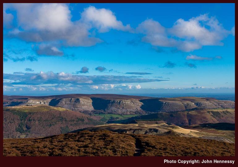
The descent of good sense was no disappointment for the change, of course, was to gift me views of Cadair Idris like the one you see above. The lovely sunny day and the seasonal height of the sun in the sky was enough to ensure that. In wintertime, the north face of Cadair Idris is often shrouded in shadow, so that makes it a difficult photographic prospect. The unexpected collection of three standing stones aroused my curiosity and, while there are not as dramatic a site as others of their kind, there are prominent enough to get highlighted on OS maps. What I had found was Cerrig Arthur.
From there I returned to Barmouth by a more direct route that still followed public footpaths to cut down on road walking. The evening was delightful with a mix of bright sunshine and perfect views whose impressions have not been erased that much by the passage of time. Though I might have liked to hang around longer, there was a bus to catch, so my time in Barmouth was fleeting and I returned across the toll bridge to make sure that I was in time for my bus to Machynlleth. The next day, I stopped off for a short time in Dolgellau on my way home for one last hurrah on a weekend that had not been unkind to me.
A Pleasant November Afternoon
It was to take me until November 2014 before I would go walking about Barmouth again. There were accommodation foibles this time around too but it was not finding a place to stay that was the issue for I have learned my lesson and nowadays book ahead before I travel. Another problem was to arise.
Because I went for a walk around Llangollen the day before, I stayed in the town that night and at a hotel that I had used a few times previously. After the day of walking, I was hoping for a quiet, relaxing night. What I had not expected was that the night's entertainment was to set off the fire alarm so many times that the band had to finish early. If the band was called The Blunders as I remember it, then it was particularly apt.
The result was two unhappy sets of customers. First, there were the hotel's overnight guests who did not get the quiet night that they might have expected until all the fuss had subsided; some cancelled their payments in disgust. Then, there were those after a good night out and had travelled a distance to see the band in question. Neither were satisfied and it was one of those nights that are best not repeated. As it happens, I have not been there since then, but that has more to do with my not visiting the area rather than any fury at what happened.
Still, a night's rest was had once everything had calmed down again and the next morning saw me catch a bus to Barmouth. A midday arrival with short daylight hours along with heaviness in my legs after the previous day's exertions meant that I was going to keep things simple.
The fine winter sunshine and the location meant that nothing more than that was needed so I pottered about a quiet Barmouth for a little while before picking out the path that was to take me by Dinas Oleu and Gorllwyn. There was height to be gained but I took my time and recall no overextension as I dealt with the intricacies of passing through a network of small walled fields.


Eventually, I found my way onto the single track road between Barmouth and Sylfaen and that was left so I could sample the glorious views from the viewpoint at the Panorama Walk. Even though it was November, others were about too and what was a mild afternoon for the time of year. Views along the Mawddach estuary were in plentiful supply and there was Cadair Idris on the other side, shrouded in its habitual wintertime shadows.


Because it led downhill and away from my objective of Cerrig Arthur, I eschewed the track leading towards Cutiau and returned to the road. Well lit views towards the Rhinogydd and their foothills lay ahead of me as I shortened the distance to Sylfaen. Diffwys and Craig y Grut lay among their number and I delighted on seeing both from this side again.

After Sylfaen, the road became a gravel track and the time of day concentrated my mind when it came to seeking out the antiquity on which I had happened in 2005. Hazy memories made for an indirect course and there was no one around to get upset about that. Once I relocated the three standing stones, I set to making some photos in the late afternoon light. Lengthening shadows made this tricky but I managed what I came to do and returned again to a quiet Barmouth well ahead of the time to start my homeward journey. Those few hours reminded me of the delights of the area, and why I should focus my mind and set a few days aside to explore around there sometime soon.
Travel arrangements:
Bus service X94 from Llangollen to Barmouth and the way back to Wrexham. Train journey from Wrexham to Macclesfield.
A new GPS receiver
Most if not all articles written about outdoors gear usually do not contain any mention of life circumstances, yet they pervade this one. To me, January 2015 brought a life-changing event whose alterations still are ongoing. My father's passing away last year and that of my mother years nearly two years before then now make for a very changed set of circumstances. Not having to deal with my father's fear of flying has meant that I can countenance overseas excursions like those that took me to Iceland and Switzerland last year, together with Austria a few weeks ago.
Motivation & Opportunity
If it were not for last year's trip to Iceland, I may never have acquired a GPS receiver. Apart from an abortive attempt to buy a Magellan eXplorist 100, it stubbornly remained on the nice-to-have section of any gear wish list since I never got to spend the outlay. It was exposure to the shortcomings of maps with a 1:100000 (1 cm per 1 km) scale on a walk around Landmannalaugar that finally convinced me to try again. Even with a subsequent trip to Switzerland and perhaps because of what I spent on accommodation, travel and other things, the acquisition that had to wait.
The deed itself was done in circumstances that one might have expected to produce a different set of priorities, for it was in the time around last Christmas. My plan was to spend Christmas itself in Britain before heading to Ireland for a few days and returning before New Year's Day. That didn't happen, as emotions just were too raw, and I rearranged the trip for sometime in January. One thing that added to my melancholy was how things went during Christmas 2014 when a neighbour of my parents went about planning Christmas 2015 when all I wanted to do was get into 2015 and leave 2014 after me. Now Christmas has lost all its child-like allure for me, I tend to want to get past it rather than bringing the next one closer.
Not travelling to Ireland at the end of 2015 meant that I could get past last Christmas and leave it after me to grow smaller in the rearview mirror of life. Doing otherwise would mean lugging too much emotional baggage through 2016 and that was why that 2014 invitation hurt me as much as it did; that Christmas was one that I needed to leave after me. The extra time at home was put to good use too, for I embarked on a tidying spree that resulted in so many bin bags of items for disposal and recycling that it took a few weeks to clear them. Aside from the last Tuesday of the year or the afternoon of Christmas Eve, the weather had not been so enticing anyway, and it felt like a pathetic fallacy that so much rain fell and the winter generally was a rain-drenched season anyway.
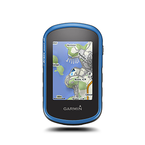
Having bailed out of the planned Irish trip on St. Stephen's Day, or Boxing Day as it is known in the U.K., I decided to book the purchase of the long-windedly titled Garmin eTrex Touch 25 from Go Outdoors' Manchester branch. Perusal of a newspaper on the way there revealed just how miserable some people's Christmas had been, for they were physically flooded while I was emotionally so; the Calder valley had been very badly hit by the weather, and they were not alone.
Early Testing
Time elapsed before I got to testing out the new gadget, and there is more I have yet to get it to do even now. That Christmastime Tuesday trot around Macclesfield that took in Tegg's Nose and part of the Gritstone Trail depended on my local knowledge and a paper map instead. Testing the new acquisition in earnest was to take until the second week of 2016 and various opportunities since then have seen it left at home, so I am far from developing a dependence on the device. These have included a recent walk from Tideswell to Hathersage via Litton, Foolow and Eyam as well as a subsequent one from Leek to Macclesfield that took in the Roaches as well as Tittesworth Reservoir, Gradbach, Wildboarclough and Higher Sutton.
Still, it has been taken outside a good few times. These mainly have been on trots about Macclesfield that include some soggy ones earlier in the year and drier ones more recently. It also has made it to West Limerick in Ireland, Stirling in Scotland as well as Innsbruck and Zillertal in Austria.
As the word "Touch" in the name suggests, this is a touch-screen device and my attempts to keep the screen reasonably clean mean that I use a stylus with it like I do with a phone or tablet. Starting it up brings you to a screen for one of its numerous modes. So far, I have stuck with the hiking one and there is another customised version of this that I created but there others for various forms of cycling as well as hunting, fishing, climbing and geocaching. It is only the hiking modes that I have tried so far but one of the cycling ones (bike, tour bike and mountain bike) could be a possibility yet.
In my experience, this is not a device for spot reading of where you are but one that tracks where you are going. Given that it shows a map underneath, that does help when you are unsure of things though battery usage then becomes a concern as does remembering to enjoy what surrounds you, which is what gets us out and about in the first place anyway. Going about the place staring at a small screen rather defeats the point of exploring the countryside and could cause an accident. As for battery life, my unit is on probation with disposable batteries until I can be sure that rechargeable ones are not getting discharged too quickly.
Available Maps
By default, the Garmin comes with its own maps for eastern and western Europe. For places without alternative coverage like Iceland, these are a good substitute for the walking maps that are available. In fact, having the gadget with me around Landmannalaugar last year would have been a big help for it shows that trail at higher magnification than the 1:100000 scale map that I was using at the time.
However, there are other maps available with the BirdsEye Select series offering 1:25000 Ordnance Survey data for Great Britain as well as its equivalents for France, Germany, Switzerland and Austria (including part of Italy). Holiday destinations like Madeira, the Balearic and Canary Islands together with the Azores see inclusion in this series too. Along with the OS, you get data from Kompass, France's IGN and Germany's BKG. The advantage of these offerings is that you choose the area for which you are buying maps and not the selection decided for you by a provider. Garmin offers other series, and there is a one called BirdsEye that appears to do the same for the U.S.A. and Canada.
To get coverage beyond the aforementioned countries, you need to look at Garmin's other offerings. These differ from the above in that these are preselected areas rather than self-selected ones from the BirdsEye series, and cost more for higher definition maps because of the amount of coverage that is included. For Great Britain, there is the Discoverer series and both TOPO US 24K and TOPO US 100K series just cover the U.S.A. Country coverage for the other mapping series (there is one in the BirdsEye range for satellite imagery, but I am less interested in that) is below.
TOPO PRO:
France, Germany, Switzerland, Austria, Czech, Finland, Spain, Belgium, Luxembourg, the Netherlands, Slovenia, Croatia, Bosnia and Herzegovina, Serbia, Kosovo, Montenegro, Macedonia, Albania, Norway, Sweden, Angola, Botswana, Lesotho, Madagascar, Malawi, Mauritius, Mayotte, Mozambique, Namibia, Reunion, South Africa, Swaziland, Zambia, Zimbabwe and Denmark.
TOPO:
U.S.A., Canada, Australia, New Zealand, Spain, Slovakia, Bulgaria, Tunisia, Hungary, Mexico, Chile, Norway, Argentina, Bolivia, Morocco, Greenland, Austria, Belgium, Croatia, Czech, Denmark, Estonia, Finland, France, Germany, Great Britain, Greece, Ireland, Italy, Latvia, Lithuania, Luxembourg, Malta, Netherlands, Poland, Portugal, Romania, Slovenia, Sweden, Switzerland, Algeria, Angola, Benin, Botswana, Burkina Faso, Burundi, Cameroon, Cape Verde, Central African Republic, Ceuta, Chad, Comoros, Côte d’Ivoire, Democratic Republic of Congo, Djibouti, Egypt, Equatorial Guinea, Eritrea, Ethiopia, Gabon, Gambia, Ghana, Guinea, Guinea-Bissau, Kenya, Lesotho, Liberia, Libya, Madagascar, Malawi, Mali, Mauritania, Mauritius, Mayotte, Melilla, Mozambique, Namibia, Niger, Nigeria, Republic of Congo, Réunion, Rwanda, São Tomé and Príncipe, Senegal, Seychelles, Sierra Leone, Somalia, South Africa, South Sudan, Swaziland, Tanzania, Togo, Uganda, Western Sahara, Zambia, Zimbabwe, Bahrain, Ceuta, Gaza, Iraq, Israel, Jordan, Kuwait, Lebanon, Melilla, Oman, Qatar, Saudi Arabia, United Arab Emirates, West bank, Western Sahara and Yemen.
TOPO Light:
U.K., Ireland, Australia, New Zealand, Finland, Belarus, Israel, Poland, Portugal, Turkey, Romania, Burundi, Djibouti, Eritrea, Ethiopia, Kenya, Rwanda, Somalia, Sudan South, Tanzania, Uganda, Turkey, Romania.
Aside from the BirdsEye range, where the Basecamp PC or Mac software is needed, maps can be purchased and downloaded to your device from the website. However, the browser plug-in does not work in the current versions of Firefox or Google Chrome at the time of writing because it has not been digitally signed by Garmin. On Windows PC's, that leaves Internet Explorer as the only option, and I needed to try it more than once to ensure that Basecamp registered the new map. Finding out what happens with Safari is not something that I have got to doing yet, but it is a possibility.
Storage
With all the downloadable data, it is just as well that the eTrex Touch 25 takes a microSD card; the default maps and software leave just over 2 GB free out of the 8 GB of internal storage. The slot is in the battery compartment underneath the batteries and I have added a 16 GB one. If my needs extend beyond that, a bigger one can be added in its place. It is possible to buy data on SD or microSD from Garmin, so there could be the temptation to use one of these in the same slot. A limited number of packages come on DVD and I wonder how they get transferred, even if this is a legacy format nowadays.
Software
Sessions exploring the available computer software followed suit, and Garmin's BaseCamp is what's required for managing any data. Exports to GPX files meant that routes could be seen in Mapyx Quo and Anquet's OMN too.
Not really places for exercising dogs
My last post on here got my mind running down memory lane's more recent reaches and this has turned out to be another of those. During the twists and turns of life in recent years, going out for walks close to home has become a fixture. There have been spurts of cycling too, with 2015 seeing me rekindle my love of that exploit once road confidence was allowed a chance to re-grow.
Encounters
This piece though is inspired by something that I increasingly encounter while frequenting local parks during lunchtime and evening strolls: the exercising of dogs. It might have been life's other distractions, but this is something that I only really started to notice over the past year. In fact, it would appear to be a growing trend, yet that is a perception rather than statistical reality, so this is best treated with care.
Nevertheless, dog excrement appears to be a problem that at least refuses to go away with Macclesfield's Riverside Park and Tegg's Nose Country Park. Like with other things in life, it seems that some owners are more diligent about cleaning up after their dogs than others. While the task admittedly is an unpleasant one, spreading diseases that cross species boundaries is not neighbourly either and some of these afflict humanity. It is for that reason that I have seen signs on a playing pitch in Prestbury that advertise a ban on letting dogs on there.
Speaking of the nuisance that dogs can cause, I saw one person allow their two dogs chase a heron about the aforementioned Riverside Park with their not being able to catch being offered as an excuse when I stared at what was happening. It cannot have been good for the bird and it moved away soon afterwards. Would you blame it?
Disconnection
Maybe the latter incident displays a certain detachment from the task of exercising dogs and even the fact that all of our urban centres are surrounded by rural areas. The first of these manifests itself in the use of smartphones while in charge of an animal, giving a very clear hint that the activity possibly is seen as an unattractive chore, hardly a good thing if you want to retain control. You even might wonder how folk who walk half a dozen dogs at a time manage, yet dog walking services frequent the same parks that the rest of us use and seemingly without incident, though I do wonder if one should have some space of your own for such a commercial enterprise.
The second kind of detachment is a more worrying one for it affects wildlife and livestock. The latter especially affects those of us who enjoy trotting through the countryside for attacks on farm animals by dogs hardly enamour us urban types to farmers. It is not for nothing that dogs are not allowed to run loose in many places. Early 2015 saw a spate of these attacks with signs appearing all over the place. A number are reproduced with some being so graphic that I thought it to be best to keep the lot in monochrome.
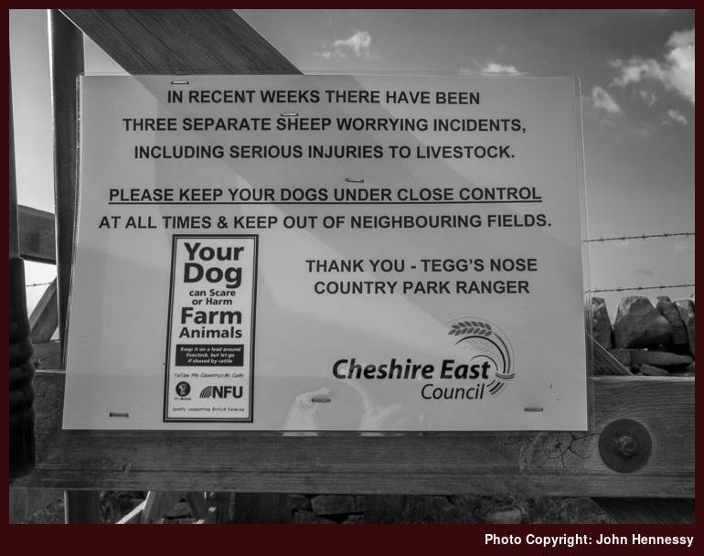
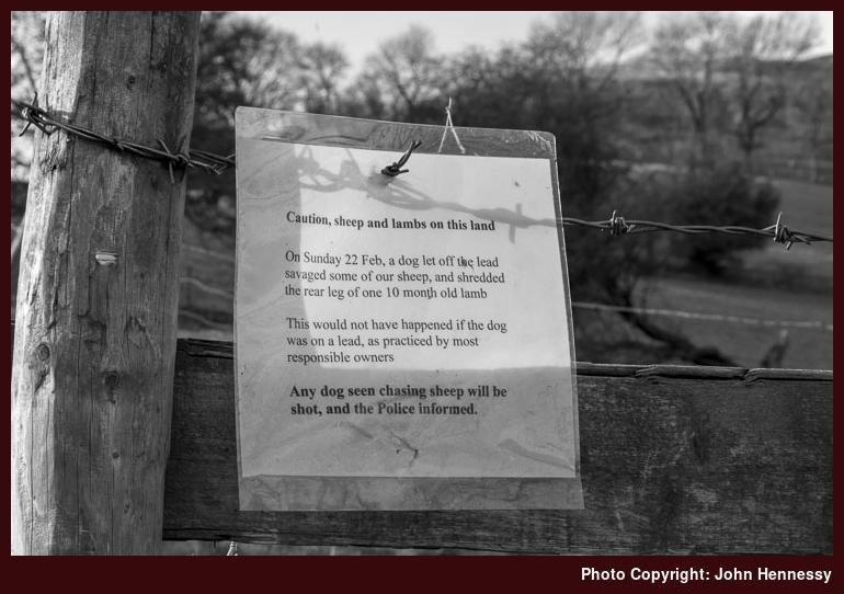
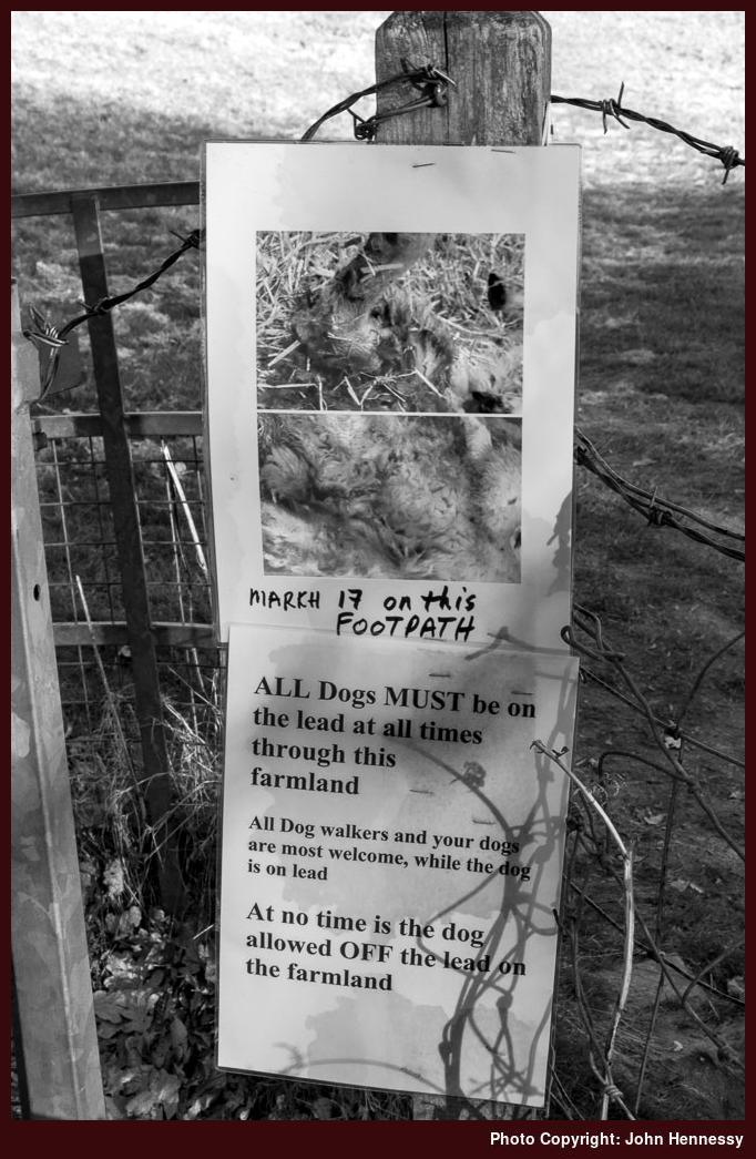
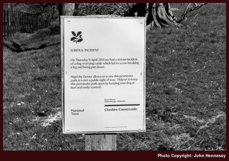
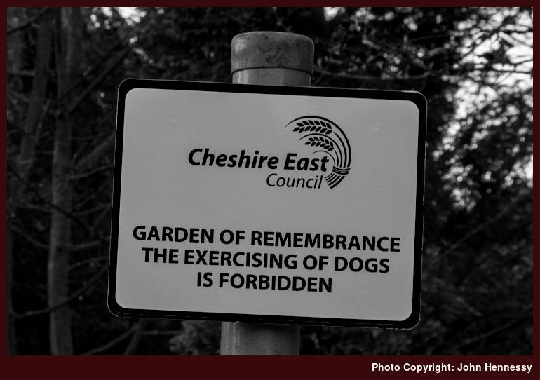
The first sign was seen on a visit to Tegg's Nose on Easter Sunday 2015 and remains there as I found on a more recent visit on a recent warm sunny Monday evening. Easter Monday 2015 saw me walk from Walker Barn back home via Macclesfield Forest, Shutlingsloe and Langley, which is where the second and third signs were encountered. The attack must have been so appalling that a shocking colour image was added to a poster; to protect the tinder of disposition, all of them are in black and white here. The fourth sign was met on a walk that took in Alderley Edge and Hare Hill, which proves that cattle are not immune from canine harassment. Subsequently, the permissive path was closed for the winter season and it is not hard to see why such a restriction came to pass. There has been criticism but it shows what a careless dog owner can cause us to lose in terms of goodwill. Even now, its opening is restricted to the hours from 10:00 to 17:00 between March 1st and October 30th and that highlights the need to always keep others in mind whatever we are doing, hardly a popular message in these individualistic times. Lastly, you would like that cemeteries and gardens of remembrance would be immune, but the above sign sadly is needed. Are we also losing awareness of our own mortality too?
Farm Dogs
It is all too easy to show disapproval of what others but we do have to look at ourselves too. While I never would own a dog myself now, I grew up on a farm where dogs were allowed to run loose. My first memories are of two Border Collies, an apparently placid mother and her son. However, there were some rumblings about his having had a go at someone walking on the road, so all may not have been as well as anyone would hope. Usually though, things were uneventful and they lived until an advanced age (for dogs anyway).
On a less friendly note, a lad working with my father on the farm had an enthusiasm for Alsatians and an intrusive one was kept in the farmyard for the sake of security. The creature did not last long though, since it was believed to have found either a poisoned rat or some rat poison. Up to that point, it had been a bit of a nuisance so it was not missed like the Border Collies that I think outlived it anyway.
After a few months without any dog in the place, there was something of a female puppy buying binge with three arriving one after the other. The first was another Alsatian, but this was nothing like its predecessor and showed the type of temperament for which many of the breed are known, albeit with perhaps less in the way of intelligence.
An Old English Sheepdog came afterwards and was anything but what my mother expected. She had wanted another placid Border Collie but instead got a lively hairy affectionate creature that was as daft as a brush and often wished to jump upon us, a right nuisance if we were dressed in better clothes.
Then, there was a cross-bred that was part Labrador Retriever and part Pyrenean Mountain Dog. Even though that one was the most sober of the lot, it still did not save my mother's washing from being pulled off the line from time to time. The tormenting cannot have made the lady enthusiastic about having any more young dogs about the place.
Sadly, both the Alsatian and the Old English Sheepdog met untimely ends. The latter was knocked over by a car on the road and rat poison or poisoned vermin was the suspected cause of death for the former. That left the Labrador cross-bred, so things were quieter, though my father, a light sleeper, got enough of all night barking sessions and puppies appeared from time to time too. It will make a dog lover wince to learn that all of these were destroyed and not always in the nicest manner either. After all this, the cross-bred eventually met her end and I seem to recall canine cancer being mentioned as a cause of death in the animal's older age.
After that, there was no replacement and I reckon that I am inclined to reckon that both of my parents were weary of having dogs by this point. Farm cats became substitutes though their begging at mealtimes grated enough to ensure a porch was added to the back of the house for the sake of extra peace. There also was a comical episode when my mother chucked a dustpan brush at cats to disperse them and my brother came the same way with a mate of his.
Reappraisal
Now that I look back on it, I am amazed by how freely those dogs were allowed to roam and how they largely were left to their own devices. Maybe it was when the three young dogs were about the place that it was realised quite what was involved in having them and the nuisance that could be caused. There might have been Barbara Woodhouse programs on the television along with One Man and his Dog, but the world outside the house was far less disciplined.
That is not to say that there were no rules for there was hardly any question of dogs being allowed into the house, though the pups were allowed in on their first night. That was the sum total of any such invasion. Even an attempted incursion during a thunderstorm was met with a rebuttal.
Since those times, my views have changed to agree with those of our local "DogFather", who writes in the Macclesfield Express and AlderleyEdge.com. Dogs need training and it was the lack of that that caused my parents so much intrusion. They also need continued discipline or they could be roaming the countryside causing havoc. It was not for nothing that there were ads on Irish television promoting the locking up of dogs by night to cut down on livestock worrying.
Another factor has been my being nipped in the ankles by dogs myself. The first was done by a Border Collie when I was returning home on my bike from a visit to my aunt and the light failing. More recently, a Jack Russell terrier did much the same while I was on a walk around Alderley Edge. After both incidents, I got my tetanus status checked and updated for very obvious reasons. They also colour my current view of dogs such that I give them a wider berth than during my days growing up in Ireland. That is not to say that I do not appreciate the need for dogs to be exercised and I also feel that those in charge of the creatures need to realise their responsibilities too. Not realising those will bring you the sort of nuisance that blighted my parent's lives and could affect wildlife, livestock and other people too. It is not for nothing that there is the slogan about a dog being for life and not just for Christmas.
Two visits to Llangollen
It feels like a different world now that I look back on it but 2014 had its share of hill country excursions and these have yet to be recalled on here. All this came before my father's passing away near the start of 2015 and thoughts turned elsewhere afterwards. Naturally, there was grieving as I moved into an era with work to be done with my late father's estate. In fact, some of that remains outstanding yet and that still weighs on my mind a little as does the fact that neither of my parents are there any more.
More cheerful distractions have occupied my mind too, for I can begin to consider overseas explorations like those to Iceland and Switzerland last year. Associated mental meanderings still entertain me with recent explorations of the prospects of North American wilderness wandering still bringing their own learning episodes. While I am realistic about the chances of making those possibilities real, learning more about other parts of the world is good too.
One of the risks of doing this is that far-flung shores bedazzle me when similar delights are nearer to hand. In other words, they could have curtailed the motivation that once got me out and about the hill country of Britain and Ireland. Certainly, 2015 saw me doing less of such things and my main holiday breaks were spent overseas too. Still, you cannot journey among overseas mountains without doing so among home hills and I hope to rekindle those again.
A stormy winter has not helped that and the other topsy turviness of the past twelve months meant that I took to local cycling trips in a big way. That restored my cycling confidence after a break of around two years so I am not complaining. If it helps my going on cycling trips away from my home turf, it would be even better.
All remained ahead of me in 2014 and dared not to go foreseeing the future. There was enough on my plate with my keeping an eye on how my elderly father was doing back then. It was plain that he was not going to be there forever, so the focus was on what then was the present. It was a time when breaks were much needed so that got me out among hills on foot.
One might have thought that Christmas 2013 would have been tough going after the passing away of my mother earlier in the year but I was to find the one a year later much harder for a variety of reasons. My father must have got to thinking that Christmas 2014 was his last and it sure enough was. It may have meant that he had a dream for it that could not be made real, so that did not help. That a neighbour began to discuss plans for Christmas 2015 was no help either and became another obstacle to overcome, as if grief itself was not enough.
Maybe it is now that those are behind me that I can begin to write these words because every Christmas is becoming something to surmount with a breather afterwards. Forgetting the next one until it comes now is my way and it could have been that way for a while since I relished the peace of January and February even when my parents still were there.
After the ups and downs of early 2013, 2014 got a steady start and things were settling into a rhythm with my father though his fragile health meant that nursing home care was his lot even if never was one that he wanted. This semi-steadiness where a new set of circumstances had become familiar meant that my mind could to hill wandering and the middle of January 2014 saw a weekend visit to Llangollen.
2014-01-19
To make sure that I actually did make it to North Wales, I booked an overnight stay in Llangollen. It helped that it would not mean an early start on a Saturday to get there and I also broke any rut into which I had fallen by spending a night away from home. This was an uneventful stay too and the quiet of the dining room the next morning was a reminder of how early in the year it was.
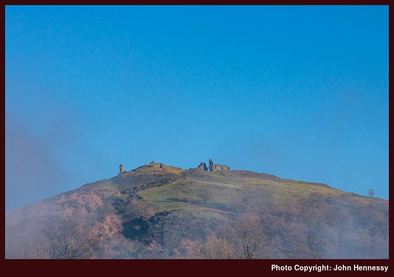
It was a frosty morning too as I dawdled around Llangollen. Though I had a day of walking ahead of me, it would have been rude to leave the place in haste with the sun out like it was. There was some clag about too and it circled the ruins of Castell Dinas Brân, but that was to burn off.
Soon enough, I found my way to the canal whose banks I was to follow out into the countryside. It also was the start of my shadowing the River Dee, a trend that was to follow for much of the day. That way out from Llangollen is familiar to me from many walks around there so it was a case of following the towpath, enjoying what lay about me and keep an eye on progress. Helping with the last of these were landmarks like the Royal International Pavilion and the train sheds of the Llangollen Railway.
The canal ends near the Horseshoe Falls, an attraction for many a stroller. Beyond this, I had a little bit of navigating to do, but a clear path was on hand to get me onto the road near Llantysilio's church, where I stayed a while to see if the sun would return from behind a cloud again to light it for a photo. It was not that willing so I got going again.
Road walking was my lot for a short while until I found the path that was to take me around by Llandynan. This was to take me through forestry where I was not so sure of where the path was. After some deliberation, I made my way out the other side to reach the collection of houses that I was seeking and where I was surprised by the course from there to Rhewl.
Rhewl too is a small place and I dallied there to make sure of where I was headed next. Once I was decided, the course was plain: follow a tarmacked byway uphill. This took me along part of the Clwydian Way and I found it steeper than anything I had met before that day, so stops were needed on the way. The scenery on view beyond the trees provided ample excuses, especially given that the sun was out again. One of those was where the road ended so I could take stock of what lay ahead of me. Though I thought them to be a series of rocky outcrops at the time, I also got to gaze at quarry spoil heaps that I was to pass later on.
On the other side of the gate, a gravel track awaited, and initial progress was across gentler gradients. Around the next corner, the way that the track was cut into the hillside became clear to me and it took an enticing line. Some height was lost so that had to be regained again on the way up to the pass between Moel y Gaer and Moel y Gamelin. With what surrounded me, it was a minor chore.
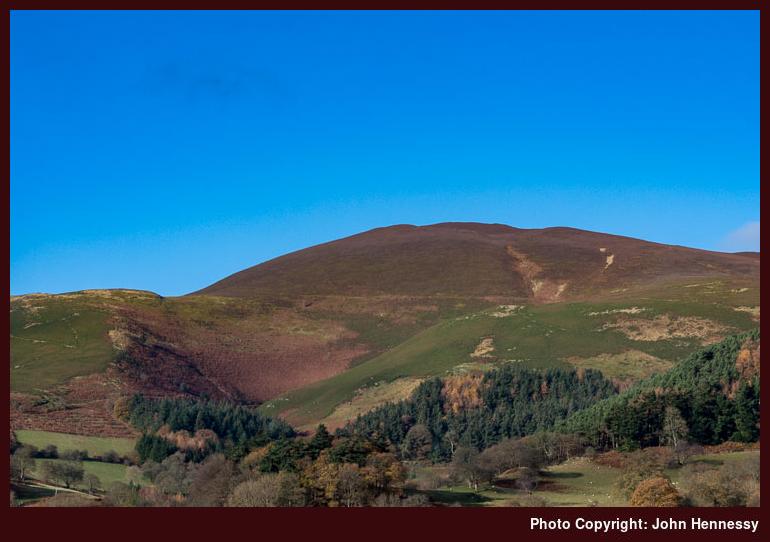
Once at the pass, I had a decision to make. Did I want to take in Moel Morfydd and Moel y Gaer before visiting Moel y Gamelin? Looking at the time, I made straight for the latter and it was to be the November visit when I trotted over the other two, not that I foresaw that at the time.
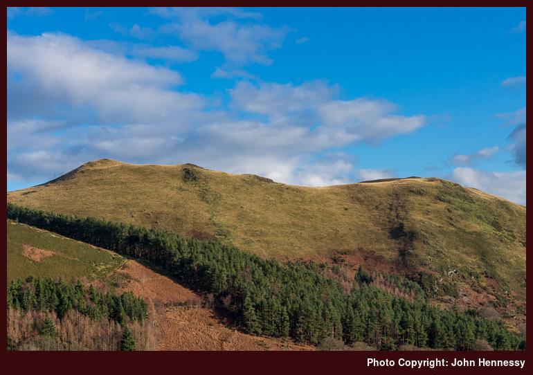
There is no right of way over Moel y Gamelin so it is just as well that this was access land and more folk were around there than elsewhere. Quite where they started was not clear to me, but the day's weather had drawn them just like me. There still was no crowding though and occasional friendly greetings accompanied the much-needed episodes of soothing solitude.
All the heat generated by the height gain resulted in the shedding of layers such that one might have thought that I'd thought it to be a spring day. There had been one last heave needed to get to the top of Moel y Gamelin and open up views over the Horseshoe Pass in all directions, including the distinctive Eglwyseg Mountain to the east. Though it was well into the afternoon, I was drawn as far as the top of neighbouring Moel y Faen before retracing my steps to pick up a public footpath that was to be the first leg of my return to Llangollen.
That hugged the steep hillside much like the Offa's Dyke Path crosses the aforementioned Eglwyseg Mountain. Along with the Horseshoe Pass below me, Berwyn Quarry came into view and acted as a reminded that I was in a working landscape. Later, I was to pass behind some of its spoil heaps before moving onto less industrial surroundings. There, paths looked less clear and I went around by Pen-y-Bryn because that was clearest and it usefully dropped me onto the Dee Valley Way near Llandynan so I could retrace my steps to Llangollen along the outbound route, a useful thing in declining light.
Travel arrangements:
Return train journey from Macclesfield to Wrexham. Bus service 5 from Wrexham to Llangollen and bus service 5A for the way back.
2014-11-22
Given the vagaries of the weekend weather forecast, I must have been in need of the getaway that took me to Llangollen on that Saturday before continuing to Barmouth the next day. The tale of the second part of the weekend has been moved to another post but it revisited places that I had not seen since 2005.
For the Llangollen portion of the escapade, I saw to unfinished business earlier in the year when Moel y Gamelin took my fancy. My hilltop objectives then became Moel y Gaer and Moel Morfydd and an early morning departure landed me in Llangollen. The initial stages of the walk even retraced much of the January route apart from sticking with the road as far as Rhewl because the wood near Llandynan did not inspire me when I was last there. The part of the Clwydian Way from there to the gap between Moel y Gamelin and Moel y Gaer was followed more faithfully. There seemed to be more pheasants than people for poor field-craft on my part was causing them to take flight in their usual noisy manner. The theme of unpeopled hills pervaded as good as the entire walk for whatever reason; it might have been the weather but that only can be a guess at best.
While I had started under sunny skies, clouds had staged a coup to show me why the weather predictions had been so variable. As I gained height to reach the top of Moel y Gaer, rain began to move in to dispel any hopes of much in the way of photos. Though it came and went, the wet theme continued until I was losing height again on the other side of Moel Morfydd when things dried up for me.
Then, the question came to the fore as to when to turn off the track I was following. This was not a right of way so it helped that I was on access land. Though the track would have taken me to a road that could have made for easier route finding, I decided that it would have gone the long way around and went so far along it for views before turning back to find a public footpath that would get me down part of the way. On open moorland, finding such things without signs takes a certain amount of deduction, so a navigational puzzle had been set. The further down I went, the more tricky it got until I finally got myself on the route of the Dee Valley Way as planned. From then on, route finding was more straightforward and became even more so after Rhewl when I merely retraced my steps, albeit in declining light. A night's rest was to follow before the rest of the weekend took shape.
Though I have yet to go back to see more of Llangollen's nearby hills, there are excuses for returning. Walking over Moel y Gaer and Moel Morfydd in better weather would be one and following the whole Dee Valley Way is another option. The latter would be a long day walk starting from Corwen and then continuing east as far as Llangollen. Then, there are those ups and downs of which I suspect it has many. It only goes to show that you never can say that an area is done, since there always is something new to see.
Travel arrangements:
Return train journey from Macclesfield to Wrexham. Bus service 5 from Wrexham to Llangollen and bus service X94 from there to Barmouth.