Category: Outdoor Activities
Uphill strolling from Grindelwald to Kleine Scheidegg
Flushed with satisfaction after a spellbinding day spent around Zermatt, another Swiss walking excursion became inevitable, and the weather held up for this one too. My destination became Grindelwald and the lure was a possible sighting of the Eiger. Quite how I selected this is lost to recollection now but I suspect that a BBC television documentary about the first successful ascent of the mountain's north face might have had something to do with it.
On the way there, I took the chance to see Bern again and my time there this time around proved short but it was good to potter about the city in sunshine rather than the greyness of the preceding Saturday. Just as on the way to Zermatt, the sunlit surroundings enlivened the train journey all the way to Grindelwald and not just my flying visit to the Swiss capital.
When I finally arrived at my destination, a bit of bumbling around the place ensued. It was an unplanned affair probably caused by my own inattention or an unwillingness to lose height at the start of my walk but it handily got me oriented. With my bearings obtained, I then set off downhill towards Grund and it was all uphill walking after that.

There was no doubt about the way ahead once the course of gaining height had begun. Swiss efficiency regarding signposting and continued attention to the map saw to that. The mix of road and off-road walking was heavily swayed towards the latter. There never was any recourse to threading on bare pasture like what you would find in Britain or Ireland. The investment in path maintenance bested what is found in those other places and the views over Grindelwald opened out more and more as I continued higher and higher. Even so, steady progress ensured that I was going strong until at least Alpiglen.
Though it was the Eiger that may have drawn me, it was the rocky pinnacles of the Wetterhorn and the Mättenburg that held much of my attention as long as I had sight of them in pleasant sunshine. Wisps of cloud graced the mountainsides as if to foretell the way that the skies would fill with them in the afternoon before breaking up again at evening time. Seeing such craggy fastnesses as I did among landscape that is much tamed was no contradiction. All appeared to fit together surprisingly well.


As I continued higher, other views began to attract my notice. The north side of the valley leading to Grindelwald was green in appearance in spite of its steep slopes and cragginess. On the other side of this lay Brienzersee and its environs, though all of that lay out of sight. My hike never was to take me above the altitude of the intervening summits and I was surprised to spot a mountain hut (more like a hotel really) perched on a mountain top around 2500 metres above sea level in a photo months after my Swiss escapade.
The railway line never was far away on this stroll and often provided chances for stopping early if the need arose. There are those who probably use it to gain height before walking downhill again, the reverse of what I was doing. Steep inclines mean that it is a cog railway but they did not scare me at all when I eventually used the train to return to Grindelwald, quite unlike what cable cars can do.
Cloud started to take over as I plied the woodlands between Brandegg and Alpiglen, so my cloudless views of the Eiger were not to be. All I got were glimpses through wisps of cloud before then and that was to be my lot. Beyond Alpiglen, my memories are of overcast skies and barer countryside with views of Kleine Scheidegg ahead of me. Its buildings looked so near that the thought of their being my final destination felt unreal.
Having set aside the idea of finishing my walk at Alpiglen, I was now to go along the track as far as I had intended to travel. With the sunshine absent, there was a certain chill in the air and my course was to take me past idle cable car stations. The out of season feel lent an added sense of desolation to this part of my saunter.
Height was being gained all the while and I noticed a certain shortness of breath descending on me. Unlike the previous day around Grindelwald, the altitude was making its presence felt. Progress just had to slow to what my lungs would allow. That my legs still were more than willing did not help matters. A pair of walkers coming down from Kleine Scheidegg shared words of encouragement and I was well in time for the next train down to Grindelwald.
The views that I hoped to enjoy were denied me and the lack of metalled streets surprised me. The chill in the air was enough to stall any thoughts of dallying and places felt closed down when I might have liked to stop somewhere for a while if I were to hang about the place. In the end, catching the next train was my priority and I got on the next one once I had a ticket for the journey.
Once in Grindelwald, I stayed a while instead of taking the next train to Interlaken Ost. Aside from the fact that the cloud cover was breaking to all some evening sunshine, I also needed time to collect myself after being over 2000 metres above sea level and ascending over 1000 metres to get there. Though I was flying back to Manchester the next morning, what I did not need was any rushing about and it had been a great introduction to where I was. It is true that I learned a little life lesson about what altitude can do to you, but there was much satisfaction too, so that is how I will remember my day in Berner Oberland.
Unfinished Business and Other Possibilities
There is much to savour around Grindelwald and Kleine Scheidegg and I still fancy seeing the sight of the Eiger uninterrupted by cloud cover. Other lofty eminences like Mönch and Jungfrau are nearby and there is the prospect of a railway excursion as far as Jungfraujoch, a costly escapade with views to match the outlay. Less outlandishly, other hiking possibilities are there to be savoured and it helps that nearby Lauterbrunnen also is well served by trains. Enjoying a longer walk would less in the way of height gain or more altitude acclimatisation sounds more than a good thing to me.
Travel Arrangements
Return train journey between Geneva and Grindelwald with changes at Bern and Interlaken Ost. Train from Kleine Scheidegg to Grindelwald.
Seeing much more than I expected around Zermatt
In early September 2015, I got to make good an intention to savour some alpine scenery. When I pondered the option in July of the same year, the predicted heat looked off-putting, so I chose Iceland instead. In any case, summer temperatures among the Alps can be such that shoulder seasons are preferable, so long as winter conditions neither linger late nor arrive early.
Exploring Cities
In my case, waiting until the end of the summer holiday season paid dividends. What I was hoping to do was to keep the cost of my Swiss escapade under some sort of control, and the weather did not disappoint either. Within a single week, temperatures had declined to more comfortable levels, so it was with some pleasure that I wandered around Geneva on my first day in the country. The city's famous fountain on the edge of Lac Léman was in operation as I strolled along the lake's shoreline as far as the city's botanic gardens, where I stayed a while before retracing my steps to my hotel near the train station. As I did so, I passed the buildings occupied by the United Nations under now clouded skies.
The clouds broke again to leave a ravishing evening to be enjoyed by all who were out and about. Though I could not pick out Mont Blanc either through lack of visibility or lack of knowledge, there were other French slopes to see as I crossed the River Rhône to the other side of the lake where views of their Swiss counterparts were to be gained. All this ensured a late finish despite any shortening in the hours of daylight, and I still diverted around by the city's main cathedral church as light failed. Later, again, I returned to the shoreline to try my hand at some nighttime photography.
While this kind of thing scuppered arrangements in Iceland, there was little such impact in Switzerland. For one thing, the next day came dull and cloudy and the country enjoys an efficient if expensive public transport system. In any case, I was bound for Bern, where I spent some time sauntering along the banks of the River Aare that partially encircles the heart of the Swiss capital. There was more exploration than that and I got to see the improbably larger clock on one side of the Zytglogge too, though overhead wires for powering both trams and trolley buses do not help photographic compositions. Nevertheless, it was good to explore another Swiss city and sample more of its famed rail network than that between Geneva and its airport. Returning to the former at a reasonable hour allowed for planning of the next day's outing, among other necessities.
Seeing the Matterhorn
Macclesfield's proximity to Shutlingsloe means that I have stood on top of it more than a few times. The distinctively wedge shaped hill also manages to earn the soubriquet of being Cheshire's "Matterhorn". It is a comparison that flatters other hills, with Yorkshire's Roseberry Topping and Wales' Cnicht falling into the same category. As ever, the real Swiss mountain is a very different prospect, though its profile is known to many. The obvious difference is a summit height that more or less guarantees the presence of snow and ice, together with the need for hiring a mountain guide.
My own encounter was not to need such things, since I stayed low and looked up from there. Though the summit lay over 2000 metres above me, its 4478-metre altitude meant that I too was up higher than I ever had gone before. Even so, I did not notice the altitude as I strolled up and down Zmuttal in the bright sunshine. My own route's highest point was at around 2179 metres above sea level, a height gain of over 500 metres above that of Zermatt itself. This became a pleasant day trip would bring many rewards.
Once I had paid for a train ticket using cash withdrawn from an ATM, I was set to commence a sunlit journey to Zermatt. Weekend computer system maintenance had put paid to my acquiring a Swiss travel pass, as much as buying a train ticket using a credit or debit card. All that was left after me with wonderful views across Lac Léman to occupy much of the travel time. After rounding the lake and seeing views sampled the day before in better weather, we left the waterside at Montreux in a French-speaking part of Switzerland to head east to Brig in a German-speaking one. From Brig, a cog railway conveyed us through often narrow valleys to its terminus at Zermatt.
Zermatt is a car-free town, with car travellers needing to park up at nearby Täsch before using the railway to get the rest of the journey. There were additional shuttle services, so Brig-Zermatt trains are not doing the work alone. Coming out of the station, I noticed some horse-drawn carriages for conveying visitors to their hotels and electric vehicles shuttled about too.
Even with some vehicles going about their business, the place felt largely pedestrianised, so I could walk freely. The sunny day had caused others to visit the place too, but that was no intrusion. The strength of the sun was enough encouragement for me to address an oversight, so a set of sunglasses was acquired and much used.

It took me some time to get clear of Zermatt, and the track towards the village of Zmutt was what I sought. The unmistakeable beacon that is the Matterhorn lured me in the right direction, and I sated my appetite for capturing it in some photos of my own. There were other sights to savour too, for the light remained so glorious that many photos were made. For the whole day, I was going to be in my element, taking in what lay around me.
In the midday heat, I was appreciative that my route took me through some tree cover. There are times when trees obstruct wider views of a landscape, but this belt of woodland was not to outstay its welcome. Any shade while breaking the back of an ascent had its uses, and others were going the same way. This was no intrusion, and any concentration of humanity petered out the further along the valley that I went. My pace was to be mine alone.

Looking back on it now, I reckon that Zmutt was the chosen destination for any fellow travellers because continuing beyond the place had me meeting with scarcely anyone at all. Eateries were open in the aforementioned village, and I was tempted to stop awhile but decided to keep walking. My desired loop was larger than the one that I nearly made through error. Others could enjoy the smaller circuit, while I carried towards and beyond the closed hut at Chalbermatten.

The longer that I continued along the trail, the wilder things felt. Having an open mountainside brought ample views of mountains all around me. However, what I had not realised then was how much I could see; that only became apparent while I was creating a new online photo album afterwards. When naming photos, I just had to counter my usual scepticism to admit that lofty heights like Gornergrat and Monte Rosa had come within my sights. Such was the collection of mountain tops that I passed that a very long list would appear if I were to mention them all here.

Much of my time on this hike, my eyes were led back down the valley along which I had come. It was not just the developing sights, but the fact that the sun was in the way for photos in other directions. That included the Zmuttgletscher at the valley head as much as the Matterhorn itself. While the other side of the valley was clothed in tree cover, the steeper aspect of that where I was walking made both for barer surroundings and for loftier sights less accessible to my camera. The latter was to be resolved among the trees where I was to turn to start on my return to Zermatt.
Leaving the path that would have taken me to Schönbielhütte, I made for a crossing of the Zmuttbach without much in the way of any sign of the pools shown on my map. Any views towards the Zmuttgletscher and its neighbour glaciers were to be left behind me too as I made for the track that was to carry me through woodland for much of the way back to Zermatt. After all that I had enjoyed, any restriction in views was no irritation as I passed Stafel and Biel. Others linger in those spots, and I was left the trail to enjoy because not so many were using it. It seemed that visitors to this valley dissipated in the late afternoon, much in the same way as their counterparts would in Britain and Ireland.

Loss of height was not a thing that the track did rapidly, so I was granted views overlooking the village of Zmutt and other parts of the valley below. Enjoying these may have involved peer between trees, but that felt like a mere triviality. Eventually, I was to leave tree cover after me and regain views on the way to the Furi cable car station that looked resplendent in the evening sunshine. Cows were grazing in what would be an improbably high pasture if it were to be found in Britain or Ireland. The shelter of high mountains has raised this as much as the tree line.
Dropping some 100 metres of height, I passed Zum See on the way towards the path that I had used on the outbound leg of my walk earlier in the day. My mind was by now focussed on reaching Zermatt's train station to start the return journey to Geneva. Everywhere lay quieter compared to earlier in the day, and I made steady rather than hurried progress. The day had been pleasant and memorable for all sorts of good reasons, and I still marvel at the number of photos that I made and how well they look. All the effort proved more than worthwhile.
Further Possibilities
It may be that this could become a start of a series of visits because there remains much more to see. For one thing, there is a higher level walk around Zmuttal, at least on the valley's northern side, that could reward any added exertions. More leisurely pursuits like taking the train up to the Gornergrat remain tempting prospects, as could making use of cable cars, despite my sense of exposure every time that I have used one. After all, they could give me a leg up for exploring other lofty spots such as Stellisee. Zermatt is surrounded by wonders and there are enough hiking trails to keep anyone going for a good while.
Travel Arrangements
Return air travel between Manchester and Geneva with EasyJet, with rail connections to and from Geneva. Return train journey between Geneva and Zermatt, with changes of train at Brig.
Revisiting Lathkill Dale
Currently, I have been catching up with quite a bit of reading. Between books bought with good intentions that were left unattended and magazines that have lain in wait for attention, there has been a backlog awaiting clearance. Among all this is a collection of writings by the renowned Scottish outdoorsman John Muir, a profound inspiration for the National Parks system that you find in the U.S.A. today. There have been others like Henry David Thoreau's Walden and Fiona Reynolds' Fight for Beauty. Some have proven easier to read than others, with John Muir's Picturesque California being of intermediate difficulty. Such is the lucidity of his writing that it seems a shame to rush through it, so taking it slowly is undoubtedly what I am doing. The evocative descriptions need to be relished and allowed to soak into memory, especially in tumultuous times like what we have today.
Though I have yet to visit them myself, Muir's detailed descriptions of the glaciated landscapes of the High Sierra strike a chord with me. In one sense, they remind me of the glens cut into the Cairngorms plateau in Scotland, but there is another landscape that also comes to mind for similar reasons. It, too, feels like a sort of plateau with valleys cut into it, though the outline is far less lofty and dramatic.
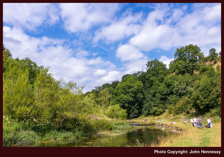
To give you a hint as to where these are to be found, the valleys themselves are called dales, but this is not Yorkshire but Derbyshire. Recent years have seen me explore them more, since they are not so far away from where I now call home. Some can be very narrow and their names include Dove, Wolfescote, Biggin, Monsal and Chee. All of those named have seen me explore them at some point or other, with some reflecting the names of the rivers that flow though them, while others don't.
One of their number that I have not mentioned so far apart from its appearance in the title of this piece is Lathkill Dale. My first encounter was on a hike I did in December 2013 just before a Christmas visit to Ireland. Though limestone outcrops abounded on slopes around me, there was no winter sun to make them more photogenic. While sunshine did appear later in the walk, I always fancied the idea of a reprise on a brighter day.
That second visit followed a trip to Iceland, whose account on here took a fair bit of time to write. It was not so much having to withdraw everything from an unwilling memory as has bedevilled other recent trip reports, but the fact that there was so much to be recalled. The account here requires more effort, but the previous Icelandic outing has its uses.
A hike around Landmannalaugar thrust me into countryside wilder than I had encountered before then, so the chance of sampling something more familiar had its place. The contrast between dusty mountainsides and leafy valleys could not be more striking. It is the latter to which I am accustomed, so I was happy to be among them again.

My walk began in Monyash and, following arrival there, I spent some time around its parish church before continuing onto Lathkill Dale. The way that I went is hazy to me now, for it is a faint recollection that I followed part of the Limestone Way before going down through Fern Dale, but that could be imaginary. It maybe that I followed the road towards Bakewell before picking up a public footpath that did the same, much as I did on that December Sunday in 2013.


As I went down the dale, milky skies bubbled up with clouds that obstructed the sun at times. While That limited chances for photos, it did nothing to take away from the wonder of seeing the limestone outcrops that line the sides of the dale. When they were fully lit by the sun, any wait was more than well rewarded. Given that it was sights like these that delighted me on walks around Dove Dale, Wolfescote Dale and Biggin Dale, I was little surprised that they did the same for me here
.
Woodland strolling was my lot for the next section of my stroll. Back in December 2013, the River Lathkill was swollen and barely kept within its banks. The dryer time of year meant that it was not as readily seen as on that previous visit, and I was glad of the tree cover. Though I have something of a love/hate relationship with woodland, what it takes in views is given in shade from strong sunshine. Thus, I was resigned to my lot, and I soon enough came to break where others were gathered by the riverside. Though the promising weather had drawn others out and about, there remained interludes of solitude interspersed with episodes of sharing the pace with others.

After Conksbury Bridge, I went to the other side of the river and frequented quieter parts. The approach to Alport was where I enjoyed some winter sunshine the last time around, but there was more time under cloud cover on this occasion. After Alport, I chose to follow Dark Lane and started to feel the summer heat as I rose above the surrounding dales. Beyond some farm buildings, a public bridleway conveyed me across Haddon-Fields and down to the banks of the River Wye. Views over Haddon Hall opened out before, as did a curious sight of a field of what appeared like wheat, barley or oats being harvested like grass silage. It might have been a mistaken impression, so I continued to enjoy other, more familiar sights.

To get to the banks of the River Wye, I needed to get across the A6 near the gates of Haddon Hall. Once past that difficulty, I strode along the footway beside the estate wall until a public footpath directed me to quieter surroundings again. Like the River Lathkill, the Wye was swollen on my winter visit, but was quieter on this late summer outing. After a stretch of woodland, there were more fields to be crossed on the final approach to Bakewell. It was mid-afternoon, so I was glad to be reaching my destination given the heat. After spending a little time pottering around there, I started on my way home and that offered a fleeting trot around Buxton too. There had been familiarity, and that suited just fine after the unfamiliar sights of the preceding weeks. There were more to come in the following ones, but these were not to feel so alien.
Travel Arrangements
Any general haziness prevailing throughout this account also applies to my recollection of how I got to and from my walk. From photos, it appears that a return journey on service 58 between Macclesfield and Buxton was involved. Because this was a Saturday, getting to Monyash would have involved travel on service 177 (since withdrawn) while travel between Bakewell and Buxton most likely made use of the TransPeak service.
Unfamiliar sights, unfamiliar surroundings
For now, any thoughts that I may have about exploring other countries have been put on hold. Instead, I am rekindling my enthusiasm for British hill country wandering by catching up with unread issues of TGO magazine. My overseas attentions have caused a few of these to pile up.
The results are plain so far with a few walks around Cheshire, Derbyshire, Shropshire and Yorkshire having happened. Completion of the Sandstone Trail was among these, as was revisiting Calderdale and the Peak District. This is a habit that I should like to continue.
None of this means that I am about to cease heading overseas and one of those excursions is the subject of this piece. It became a possibility following a life change at the start of 2015 and began a series of Scandinavian explorations that have continued since then.
New Possibilities
A major life event in January 2015 was to be a life changer for me and outstanding work resulting from this still continues as I write these words. The new circumstances bring additional responsibilities that are set to persist for a few years yet. It also opened up other avenues for I now could consider overseas hiking trips and they were not realisable before then.
Strangely, the event in question also elicited a sense of release now that the sense of added burden over two years had ceased. It was this that allowed my thoughts to turn to overseas ventures during February 2015. The possibility that came to mind was an extensive one: the Alps. After some months, my research resulted in an article elsewhere on this website.
The aforementioned compilation took quite a while and brought home to me how I had forgotten how unnoticed the build up of my knowledge of British hill country had been. It was the effort expended in doing this all at once for other parts that drew it to my attention. The same could be said for my subsequent collations of car-free explorations of American wilderness as well as the delights of the wilder parts of New York state.
Even before the prospect of self-powered explorations of other countries was realisable I still compiled some articles on here that were intended to be useful for planning visits to Scandinavia. It was a business trip to Sweden that got these going and the resulting collection also features Norway, the Faroe Islands and Iceland. Magazine inserts and other inspirations caused me to build up what is there.
All of these give me something from which to draw inspiration for various outdoor escapades. For the first of the lot, Switzerland was in contention until I saw predicted temperatures of 30° C for places like Geneva, so that thought was postponed until September. Somehow, Iceland then came to mind and fitted in with a habit of going north for a summer break that has sent me to Scotland so many times.
Heading for Alien Shores
Not being someone who is guided by fashions of the day, my eventual choice of destination is an interesting one. After all, Iceland is one of those fashionable if expensive countries to visit at the moment. The feel of the place also is so very different from that with which I am familiar in Britain and Ireland. First, volcanism is ever present and ensures bare countryside in some parts. Then, there is the latitude so you find ice fields and glaciers too. The mix is as exotic as it is alien and that is before the winter appearances of the aurora borealis even comes to mind. Lastly, you also get long hours of daylight during the summer and these kept me out of doors well into the evening while I was there.
One thing is more familiar though: the vagaries of maritime weather. This is where I came up better than I might have expected; going north does not guarantee fine weather all that often, as my Scottish incursions have taught me over the years. A tentative drizzle around Landmannalaugar was as wet as it got during my stay and sunshine abounded much of the rest of the time of my stay.
Things looked cloudy enough when I looked down from my flight as it reached the end of its journey from Manchester to Keflavik. Those initial glimpses of Iceland revealed just how rugged, barren and empty the landscape of its south-western corner actually is. Seeing signs of human habitation and endeavour in this very different setting was a contrast that will not leave me easily. Trees were going to be a rarer sight here than the comparatively more lush corners of Britain and Ireland.
Getting Bearings and Other Necessities
It had been a while since I arrived somewhere where I had such scant knowledge of its layout, so one of my first tasks was to find my way around Reykjavík after arriving from Keflavik by coach. This was mixed with other needs like getting something to eat, buying maps and checking into my hotel. All took place as the sun played hide and seek among the clouds over my head. The weather had brightened since my morning arrival in the country.
Somehow, I had come to Iceland without a full set of maps. While I had seen maps stocked in the U.K., the scale typically was 1:100000 and I wanted to see if I could do better. In the event, what I found in various shops (including tourist information centres) was the same and even applied to IÐNU's own shop too. There were some exceptions, such as the 1:75000 IÐNU Sérkort map of Suðvesterland but I was to find that a GPS receiver would have been more useful for hill walking in Iceland than elsewhere and that thought would have applied even with default Garmin maps.
While my quest for maps was not as successful as I might have liked, my traipse around Reykjavík itself unearthed far more treasures. Along the city's coastline, I found an art installation called the Sun Voyager, Harpa concert hall and Höfði House (where there was a major summit between then Ronald Reagan and Mikhail Gorbachev in the 1980's that formed part of a process paving the way for the end of the Cold War).
Across the sea, there was Esja and the hills that lay about it acting as a lure that never caught their quarry. Looking at the aforementioned 1:75000 IÐNU Sérkort map of Suðvesterland reveals a variety of paths and tracks criss-crossing the area so that makes it a good place to visit on another visit. Sometimes, you collect possibilities as well as seeing sights and gathering experiences.
Traipsing hither and thither took me to such varying sights as Reykajavikurtjörn, Hallgrímskirkja and Hljómskálagarður. All inspired photos as and when the sun allowed. Even with spells of sunshine, I still got to other needs like checking in at my hotel to offload my luggage and enjoying an evening meal in between map hunting. My arrival there might have been early, but my room was ready so I could be accommodated at that stage. After a little organisation, I was on my way again and my base was to see little of me over the course of my stay aside from sleeping and breakfast.
A First Incursion into the Icelandic Countryside
What suffered from staying out of doors so much and until 23:00 was planning, and the late bedtime caused a little oversleeping too. Neither of these were helped by dopey confusion regarding the time caused by the Fitbit on my wrist not being set up to synchronise the time zone with my phone. It was a setting that I had yet to find before it could be fixed.
While the morning disarray ultimately meant that I had to choose between Þórsmörk and Landmannalaugar for the hill walking outing of my trip, the alternative of a tour that took in sights like Þingvellir National Park, Geysir and Gullfoss was more than enough compensation. It also helped that this happened on the sunniest day of my stay in Iceland.

The outing that I was to enjoy began from Reykjavík's BSÍ coach station, the one where I arrived the day before. Though it was part of the Iceland on your Own (IOYO) bus network, the journey was accompanied by a recorded commentary. Even so, we were to have lengthy stops too and the first of these was at Þingvellir where those who dared could cross the rift between the European and North American tectonic plates to meet again with the coach on the other side. Though even this sounded a tad risky, I still fancied a spot of further exploration so I took up the option and was rewarded with ample views. This was not a solitary stroll though for this is something of a honeypot. Even so, there remained quieter corners where you could photograph pleasing parts of the landscape without intrusion.
In the end, I found myself awaiting the coach and not the other way around and that is the better way to have things. A day spent around Þingvellir would not have been so bad, but there were other sights that I would not have seen. Our next calling point was Haukadalur where there were geysers to be seen. On the way there, we travelled along an unmetalled stretch of road that was the first of my trip to Iceland. There would be more to come the next day.
The one that gave its name to all these gushers is less active these days, so everyone awaits the action of Strokkur, much newer than the celebrated Geysir that only gets activated by earthquakes nowadays. Apparently, the underground tubes conveying the superheated water under pressure get clogged over time. The water temperatures are such that getting too close earns more than a scalding so it is best to keep a safe distance and it is surreal to see streams of steaming water running along the ground.
Another result of the spectacle, apart from a slight sulphurous stench is that life cannot get a foothold, so bare ground is what you get. Seeking aspects that looked more green, I continued up the slopes of Laugarfjall and that provided the required visual relief. There were wider views of the surroundings too as I pottered about before descending again. We only had so much time and I got to feel that I had my fill anyway.

Gullfoss was our next port of call and was where the coach turned to retrace its journey back to Reykjavík. It is here where there were connections with coaches going north to Akureyri, an all-day excursion through the Icelandic highlands that could be done faster with an internal flight. Going slower along the ground might reveal more, though.
It may not be Iceland's biggest but the sight of Gullfoss amazed me and it is little that it draws so many. Such is the amount of water cascading down precipices that it wets both visitors and their cameras. My own camera should have been wiped more often than I did, but the photos remain memorable even if some post-production was needed on some of them. Dettifoss in the north of the island is supposed to be even more impressive than this and it is difficult to see that could be.
When the coach began its return journey, there was a different ambience to that on the outbound journey. It was more chilled and it was no waste to pass previously experienced sights again. Spending some more time around Þingvellir granted differing sights because the sun had moved during the course of the day. That made photos of Þingvallavatn, a very large lake, all the more successful and it was a quieter time to visit too.
After a pleasing outing, there was a chance for more strolling around Reykjavík in the evening sunshine. It was a good way to finish a day of seeing a variety of landscapes that many see as part of a Golden Circle tour. My exposure to the Icelandic countryside had been boosted but a walk around nearby Esja and its neighbours would have compensated if I missed the opportunity that gave me so much. A further hill country incursion remained outstanding and I was not about to muddle that.
A First Immersion in the Icelandic Highlands
It was difficult to pick between Landmannalaugar and Þórsmörk but I somehow plumped for the former and there was an early morning start because the outbound coach departure that I needed was at 08:00. The day ahead was going to be duller than the one preceding it, but my course was set, probably by a guidebook that I consulted.
The journey ahead was a long one as it stopped at Selfoss and Hella before leaving metalled roads for the gravelled F-numbered roads for which it would need both its four-wheel drive and ground clearance, especially at river crossings. It was this section stage of the journey that both took most of the time and took us through the most isolated countryside with next to no human habitation to be found. There were some good reasons for this because we were passing near Hekla, one of the island's volcanoes. The cloudy skies made the empty landscape about us appear even more desolate.
When it came, Landmannalaugar's wildness was striking. The presence of a mountain hut, ablution facilities and a campsite is about all there is to the place. It really felt like a seasonal settlement solely there to serve outdoors lovers and the sense of isolation was unmistakeable. In some ways, the place reminded me of photos of Everest Base Camp in the Himalaya, even if they are very different locations in many ways.
There were patches of grass and a natural geothermal pool, but this was no domesticated holiday camp and the weather added its own share of rawness under overcast skies. Having limited time, I started on my walk with one of the 1:100000 scaled maps that I had with me. A 1:25000 scaled one might have been available from the mountain hut but I had some experimenting to do.
My walk took me back along the only road into Landmannalaugar towards Nåmshraun but I found a track leading uphill onto my first summit of the day before that point. That top was both unnamed and unpeopled while I was there but it got me up to 710 metres above sea level, so views of the surrounding hill country opened out before me. What was missing was sunshine so I must admit to feeling somewhat deprived, even after the delights of the preceding days. Other photos had spoiled me and raised expectations that little bit too high.
After some height loss, the walk to the top of Suðurnámur began in earnest. My surroundings grew ever wilder as I continued and finding progress on such the small-scale map that I had was difficult. A chat with a fellow walker who had the larger scale map show the wisdom in having that item but I still had to trust the path as far as a reassuring signpost. Hikes often are better off not being completed in short spaces of time and this was one of those. It did not help that the time for my planned return to Reykjavík loomed larger in my mind and that never speeds up the passage of time.
It was around Vondugiljaaurur that I decided on a later departure even if the only one in my head was at 20:30 and meant an after midnight arrival in Reykjavík when I was flying home from the city later that morning. The first thing not to be rushed was the descent to the valley floor because of its steepness and the seemingly fragile surface on which I was threading. Then, the sun broke through the cloud cover to light up what surrounded me on the valley floor and there was no way that I could rush away from that. Lastly, there was no sign of the human habitations from which I had started walking. They were not that far way but it felt as if I was in another world. It is amazing what a craggy upland pavement can do to obscure such things.

Even so, the distances were not as large as I had grown to accept. Arriving at Landmannalaugar's facilities just ten minutes earlier may have kept me running to my planned timetable but I was to see my coach leaving as I neared the end of my hike. With more time available, another walk may have been in order, but one felt enough for me that day. As things stood, I now had time to survey and photograph sights like Norðurnámur and the sun emerged again to do its magic as I pottered about. There were spells of dampness too and the chill in the air became apparent after I stopped being so active.
When I found that another company offered an earlier return journey, I was more than tempted to use that. After all, there is no café in Landmannalaugar where one might linger and depending on a later bus with a flight next day did not seem prudent. Leaving at 18:00, it was good to be on the way back to civilisation again. My first taste of Iceland's wild country certainly felt more of an adventure than I expected and there is much here that could draw me back again.
Unfinished Business
A first visit never gets you under the skin of a place and that is what I found in Iceland nearly as much as Austria and Norway. My time there was short too so I naturally needed to pick and choose between different options that were in my head. Other destinations have drawn me to them since then, yet a return to Iceland remains outstanding.
Seeing Landmannalaugar with more sunshine remains one possibility and it helps that I have a better for how wild it feels. My first encounter needed the longer day that I spent there and that lesson will not be overlooked if there is a repeat visit. Other spots like Esja near Reykjavík or Þórsmörk deserve exploration too and Akureyri in the north of the island looks promising. A cross-country coach trip is another idea, so a longer stay might do no harm on any future visit. Who knows what delights such a thing could bring? For now, I have photos from the last trip as a reminder of the rewards of such a venture.
Travel Arrangements
Return journey between Manchester and Keflavik with EasyJet. Scheduled coach journeys between Keflavik and Reykjavík. Coach tour with Reykjavík Excursions that included visits to Þingvellir National Park, Geysir and Gullfoss. Coach travel from Reykjavík to Landmannalaugar with Reykjavík Excursions and return journey with Trex.
Ambles within sight of The Cloud
There are many walks that could fall under this ambiguous title since so much of Cheshire lies within the sight of this hill. It is one of those landmarks such as Shutlingsloe, or Croker Hill (distinguished by its radio broadcasting station) that overlook so many of my strolls and cycles near where I now call home. These not only extend towards the Cheshire Plain, but the landmark can be identified from among the hills that lie between Macclesfield and Buxton, so those following the Gritstone Trail will see the hill long before or long after crossing its summit. There was a temptation to add Leek to the preceding list of towns, but that may be going too far.

Calling a hill a "cloud" looks incongruous to modern eyes until you realise that it is a usage dating from old English as much as calling a valley a "hope" much like what happens in north Derbyshire and South Yorkshire. The latter has been known to trap the unaware like a new vicar in Oxenhope as described by Simon Armitage in his book "Walking Home". Sometimes, place names can be a last redoubt for older meanings so it is best to keep that in mind as we saunter through countryside, even or especially when following the route of the Pennine Way.

Not at all far from The Cloud is another town that I have yet to mention: Congleton. It may not sound like a starting or an ending point for walks but it has been both for me over the years and some of these have been described on here already. One took me to Leek via Biddulph and Rudyard Lake and Congleton was my destination on a walk along part of the Gritstone Trail that started from Langley.

The Macclesfield Canal passes by Congleton too and very handily is next to the town's train station. Sometimes, life can way us down so much that we can fail to engage in activities that offer momentary relief. Anything that makes it easier to get out for a walk has to be helpful. Simpler often is better, so what can be easier than trotting along a canal towpath? Certainly, that helped to get me walking between Macclesfield and Congleton in the dying months of 2012 and the first one of 2013 while there was quite a lot on my mind. This was the start of emotion consuming events that have carried on over the last few years, even though there have been episodes of release too and it was during one of these that I walked along the canal in bright spring sunshine in April 2015.
The lure was the prospect of getting pleasing views of The Cloud, particularly on the section between Crossley Hall Farm and Bosley Locks. For a time, I was relieved of the cares of life as I passed numerous familiar sights. It is difficult to anything very new about those and there is one section of the canal that I have yet to walk that goes south from Congleton until I am led again onto previously trodden reaches on the way to Kidsgrove where it connects with the Trent & Mersey Canal. That opens the prospect of a cycle along its wide towpath that may lead me from one train station to another if I went far enough.
The main linchpin of this piece is another walk, one that I did at the start of November 2015. However, it was not what I had in mind for that day. Only for a late train, my preference was for a walk commencing from Disley. What is somewhat lost to memory is the route that I wanted to follow. In March of this year, I did follow the Gritstone Trail as far as Kerridge before following our paths on the rest of the way home so it could have been that. There was another option that was just as likely: a circular stroll around Disley and Lyme Park.

Instead of sticking with the disruption of a delayed train journey, I caught a bus to Congleton. My next port of call was Astbury Mere and I followed part of Route 573 of the National Cycle Network to get to it. It might have been the spontaneity of my choice of destination that caused me to overlook a section of the Dane Valley Way in favour of a discovery from an evening cycle during the summer of 2015. Encounters late on those days probably inspired me to consider a midday visit when light would be more plentiful for photography.
Astbury Mere Country Park is surrounded by residential areas despite its name, so folk were to be found pottering about on that mild November day. Everyone still had plenty of space to themselves though and I enjoyed my walk around the mere before leaving it to get to Astbury.

Once I made my way along some streets, a public footpath called Stony Lane then took me most of the way to Astbury. The village has been a calling point on numerous cycles, but this was the first time that I arrived there on foot. With a curious church and lines of cottages leading to it from the A34, it is a photogenic spot so I lingered a while before retracing some of my steps while walking to the Macclesfield Canal.

Following the canal towpath, I crossed through Congleton before dropping into Dane-in-Shaw Pasture where I found a public footpath leading to Brookhouse Lane. Then, I took to following the Gritstone Trail for the rest of the way to the top of The Cloud. Though unseasonably warm, it was getting late in the day by this point and the sense of the whole exercise might be questioned by some if they knew what I was doing. Nevertheless, I stuck with my plan and climbed through woodland as I did so. It did not take long to come out of the tree cover to take in amble views over the Cheshire Plain and whatever else I could see in the late afternoon light.
It was sensible not to delay either so I started on my descent of Cloud Side to reach a lane that would start me on my return to Congleton. That meant going around the hill again, but the views made it worth doing and I was to stick to lanes anyway given the now fading light. Further lanes that I was to use included Tunstall Road, Pedley Lane and Middle Lane as I passed Key Green to come under the street lights of Congleton before too long. Freed from any chance of getting benighted, my main concern was getting to where I needed to be to catch my bus back to Macclesfield after a very satisfying day.