Category: Reflections
From home to Shining Tor and back
During June 2020, restrictions were being slackened. One thing that peeved was the sluggishness in allowing greater usage of public transport. Not being able to drive a car meant I felt discrimination against me, while car users got more freedom than I had. Later in June, that did get sorted, and I later learned that one person ignored the restrictions and used public transport anyway. That was much further than I was willing to go, though my compliance with the restrictions was not perfect either.
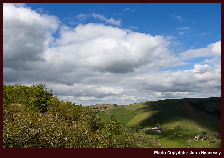
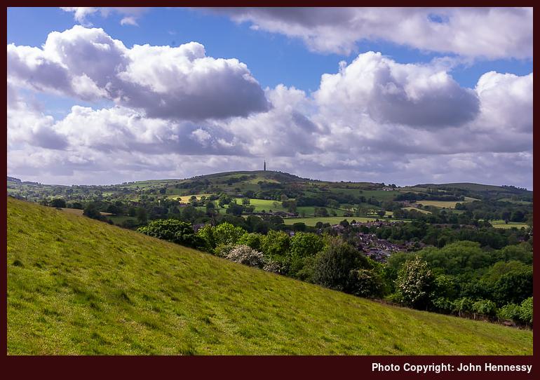
Whatever what my actual plan for the day was, that is lost to me now. My hike had me making a beeline to Lamaload Reservoir, sticking to road walking until I had passed Rainow. Then, I left that for a public footpath before getting as far as Ginclough. Nevertheless, I still was in the Cheshire portion of the Peak District National Park.
My recollection of this is that much of the way from my house was people free, giving me a necessary opportunity for relaxation. Once off-road, that was not to halt. My direction may have been taking me towards Common Barn, yet I was to change from that to descend towards the waterworks at the base of Lamaload Reservoir.
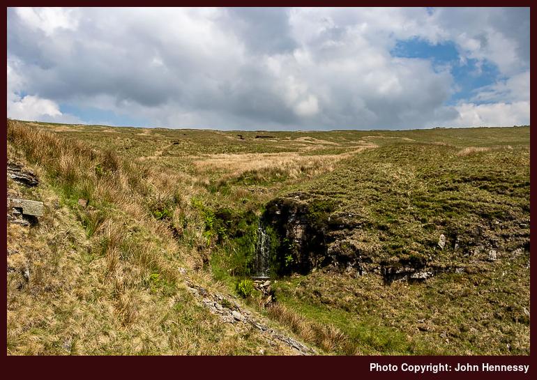
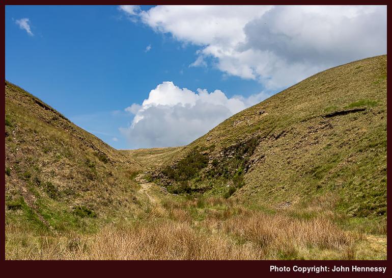
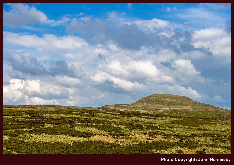
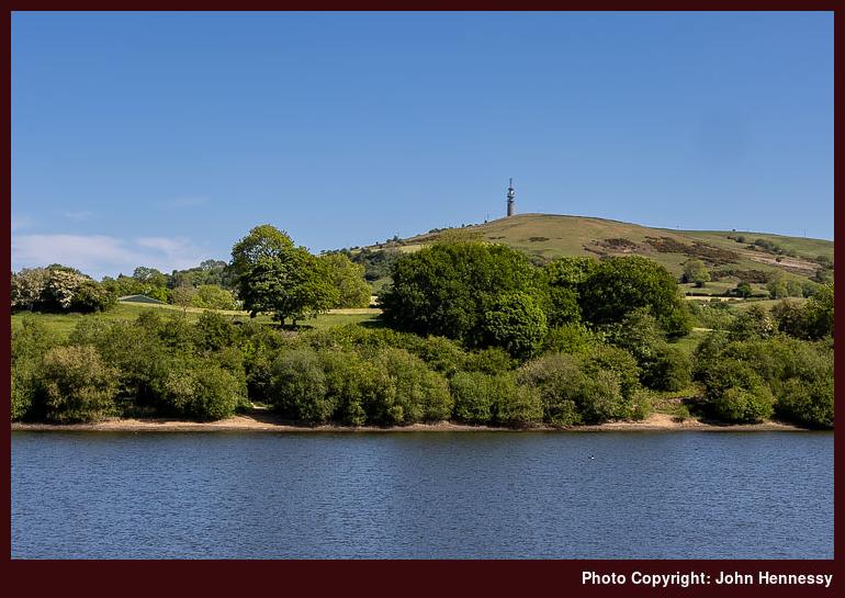
From those, I needed to regain the height that I was after losing to pass the reservoir on its northern side. That got me to Hooleyhey Lane. If I intended to circumnavigate the reservoir, the draw of Shining Tor was too strong, and I began the steep ascent from the lane to get there.
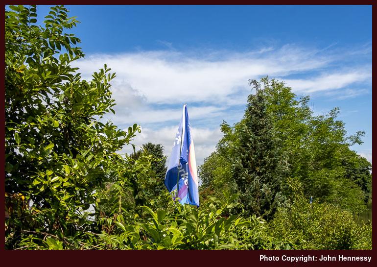
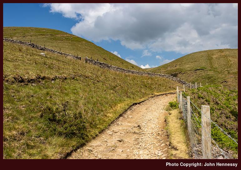
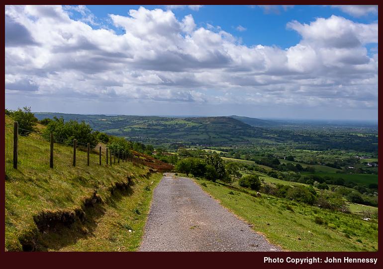
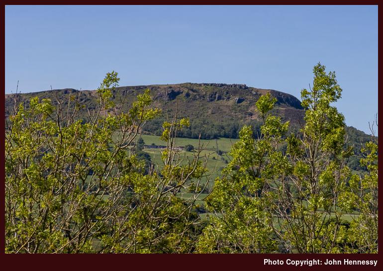
After the initial slog, the gradients slackened for a while to allow admiration of the surrounding views. Cats Tor and Windgather Rocks were to draw my eyes to the north as much as the valleys to the east of these. The gradients stiffened again for the final ascent of Cheshire's county top. After a largely unpeopled journey, I was to encounter more here.
The cause was something that I noticed throughout that summer, the presence of a car park. It was if many thought that driving out of town made for a better approach. Since this quietened the stroll between the attraction and urban surroundings, I could not complain too much.
The descent to the Cat and Fiddle Inn was not at full speed, since social distancing remained a necessity while vaccines were being tested and finalised. Like many pubs, the inn was trading as a shop at the time, and I was tempted to buy refreshments. However, there was a significant queue because of restricted numbers allowed into the premises and customer demand. Thus, I continued on my way.
A walk featuring Lamaload Reservoir was extended as I got lured as far as Shining Tor before descending to the Cat and Fiddle Inn and then continuing home, passing Wildboarclough, Shutlingsloe and Higher Sutton on the way. Predictably, more folk were encountered around Shining Tor and the Cat and Fiddle Inn (trading as a shop at the time) but there was plenty of space to wear off any grumbles about lack of social distancing. An ascent of Shutlingsloe will need to wait because it is a small honeypot in these times and might have been too much for tiring legs in any case.
From the Cat and Fiddle Inn, I set off on a bridleway leading to Danebower Hollow. Reaching the A54 did little to serve my purposes, so I instead descended through Danethorn Hollow to reach the track shadowing Cumberland Brook and taking me towards Clough House. This downhill stretch was a stern test for limbs wearied by the preceding ups and downs, particularly when a rough track was involved.
In hindsight, the car park at Clough House probably would have been best avoided for better social distancing, yet I did not delay my moving on from there. Instead, I made for a public footpath that took me by Banktop. This would have been a route possibility for Shutlingsloe, but for at least two considerations. One was the amount of space on the summit and how many people would be there. Another was my wearying state at the time and the heat of the afternoon at the time. That was to be sated on a weekday later in the summer.
It might have been better if I could a descent to Nabs Road only to go uphill again on another public footpath. Passing through large fields on the way to Lower Nabs Farm took a little concentration and reminded me of an evening going along there with the prospect of declining light being all too real. The placing of colourful bucket lids made direction finding a lot easier then, and remained in place to offer the same help during this later summer.
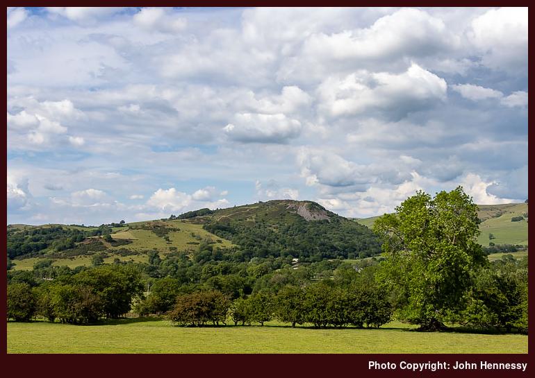
Once as far as Greenway Bridge, I made a different decision to that earlier encounter when I continued along the road. With ample light, I used the public footpath to and past Oakenclough instead. There was more height to be gained, which gave me more views of Shutlingsloe from a different angle before I reached the last higher point on my walk. Gradients levelled a while before I began a gentle descent towards the Hanging Gate Inn.
There may have been a short public footpath cutting off a little road walking, but it passed through the pub grounds and I thought it to be better to remain on the road instead. Tarmac tramping was no insult to my sensibilities at this stage because there were good views to enjoy. After passing Higher Sutton, Sutton was next with Gurnett afterwards. By this point, there were so many route choices for getting home that recounting which of these got used hardly matters now.
After all, this was an excursion made that good of a day with its warm sunny moments as well as cloudier wind-chilled ones. The mix caused no perturbation because there was nothing but dry weather on offer. As an out-and-back excursion from my house, it felt a little ambitious, but the only cost was fatigued limbs that a little rest allowed me to recover. The reaching of a county from one's home only using one's own power still strikes me as intriguing, too.
In search of real respite amid a lockdown
Before the pandemic hit us, my way of getting a breather involved travel and nature. Hiking was as much part of that as reading about travel and nature. Photography and computing were other forms of refuge. Since then, I have found some others that might help during a similar episode if it were to happen today. Living means learning; it is the only way.
Impact
The restrictions that came in March 2020 disrupted my previous and customary coping mechanisms. Catching up with unread photography magazines further drove the point home. It just hurt too much to read about nice places where I could not go. That meant that do the same with travel magazines was out of the question, and they faced an existential crisis too. Outdoor magazines did not escape either. Most survived in time, with Lonely Planet Traveller being the only title that I know to have been discontinued.
It all added up to a sense of sensory deprivation, and broadcasting service were similarly thinned out. It was if there was little escape from morbidity and mortality. The latter really played on my mind, making some clinical encounters unavoidable at exactly the time when they needed to be curtailed.
Mercifully or perversely, depending on your point of view, we got a lot of sunny weather throughout the episode. If it did nothing but rain, I am not sure how we would have coped. That single episode of exercise per day was not just about physical health and well-being. It was nearly more important for keeping one's mental health on an even keel through a period when there was so much around that was downbeat.
To add to it, I also cut out caffeine from my diet and my use of sugar has more or less gone the same way since then. Even if that added weariness, I continued to get outside. The confinement meant that social distancing was more difficult than might have been expected. My yearning for added solitude went largely unsated, too.
Coping
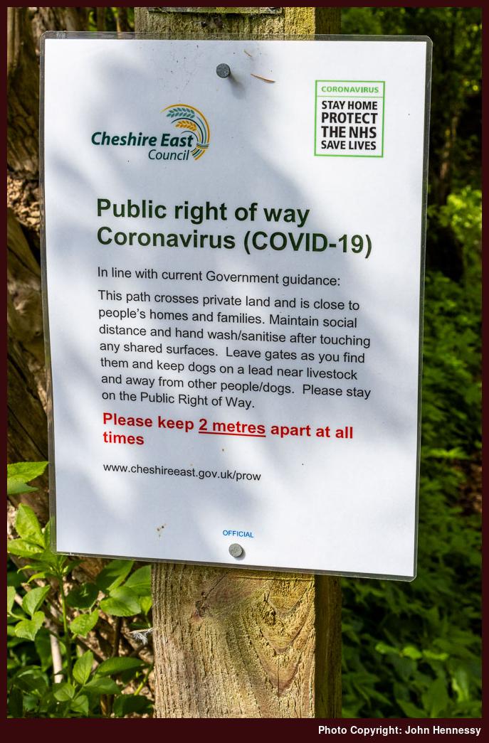
While Ireland placed limits on how far you could travel, I cannot remember that being the case in England, and it proved to be something of a lifesaver. Since public rights of way remained open, we were not confined to roads either, even if traffic plummeted so much that you could walk them in the name of social distancing.
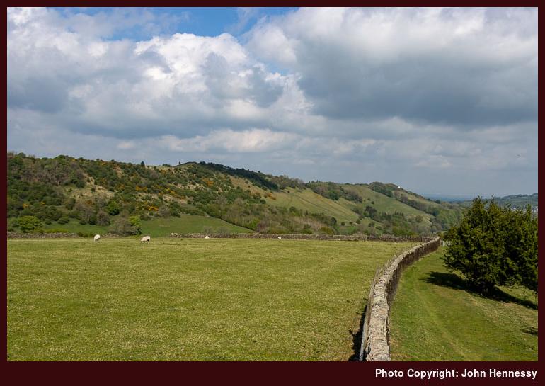
We were not confined to urban parks like West Park, Victoria Park or South Park, all in Macclesfield. Others like Riverside Park or Tegg's Nose Country Park remained available. The latter offered an escape from urban surroundings that got used one sunny Saturday in April as part of an emergence from a personal nadir.
Cycling was another useful release. The quieter roads allowed for added courage once I began with routes that took in Henbury or Gawsworth. The Victory in Europe Bank Holiday at the start of May saw me get as far as Siddington and Marton, where there were few people to encounter. The same could be said for an outing the following day that took me around by Nether Alderley and Jodrell Bank, though the final approach to Macclesfield was more peopled and hence less comfortable for me. Around the same time, there were walks that included Riverside Park and Tegg's Nose. Thus, it was not all about cycling.
Making Space
Breaks from work were much needed and really beneficial. At least, I could keep working through the whole thing, unlike so many others. Even so, extra non-working days at the start of May had their uses, even if I muddled my bank holiday timings. Boris Johnson's apparent preference for Bank Holiday Fridays was so new to me that I needed to make my client aware of changes in plan.
Still, the first of May saw an afternoon stroll that took in the Danes Moss Nature Reserve under grey skies and with some light rain at times. A late afternoon visit to Tegg's Nose Country Park on Saturday found the place largely deserted, offering a great deal of respite from any tension that had built up in the preceding weeks. On Sunday, I went on a circuit that included Prestbury, again with the same escape from an artificial concentration of humanity.
When I noticed that Royal Mail were working on that Monday, I was surprised, but the change of date for the Early May Bank Holiday never twigged until I spoke with my brother the next day. Nonetheless, I strolled around by Rainow and followed the Gritstone Trail towards Tegg's Nose and returned home via Langley. Tuesday allowed time for a circuit of Kerridge Hill and the adjoining Saddle of Kerridge that skirted Bollington and Rainow along its lower flanks. Looking back on things now, it was an extended weekend that became very full.
As we continued through May, there was a slight sense that pressures were easing. Experience with the new infection was increasing, and the grim toll was not as high as it might have been. Restrictions still remained, though; it would take until June before any real slackening could be felt. There still was an infection curve to be flattened.
Release
Thankfully, the Spring Bank Holiday was in the part of the week when I expected it to be. After what happened earlier in the month, this had been checked. The associated weekend was stretched with some extra days to allow further recuperation from the ongoing travails. In some ways, these were to be liminal.
On that Friday, I again went for a longer stroll. This followed the Middlewood Way until I was past Bollington. Many others were out along that trail, so it was not the most relaxing of walks. That was one reason why I sought other routes with fewer people around. Not having to worry about social distancing meant that more reinvigoration could come my way. On this hike, that came about by continuing to Pott Shrigley. Fancying a spot of photography, I spent a while in the churchyard, which granted me the people-free space that I so needed. Thus sated, I skirted Bollington on the way to Rainow. That meant meeting with more people again, though not as many as on the Middlewood Way. Even so, I still needed the quieter route to Tegg's Nose that I constructed. On reaching there, I began the final stretch of my journey home.
If I needed it, the next day's hiking supplied more than enough occasions where I could ramble with simple abandon. The mixed weather with some spots of rain in the afternoon did nothing to take from this. My route had me skirting Tegg's Nose on the way to Langley before crossing fields and gaining height on the way to Ridge Hill. It was while I was going along this lane towards Higher Sutton that a final sense of complete release hit me. All was well at that moment and there was nothing to fear. The feeling is one that I recall readily today as I write these words.
Eventually, the name changed to Meg Lane and I opted not to continue to meet with the Gritstone Trail. Instead, I chose a public footpath that would drop me to Lowerhouse where I did just that. From there, I ascended Fox Bank to go further than another ill-fated attempted ascent of Croker Hill had stalled due to my feeling unwell in the summer heat. This time, I had to contend with a blustery day that easily dispelled any disquiet regarding infectious disease. Others may have been around, but they were few in number, and we were well spaced as well.
The descent into more sheltered spots was to take me along a quiet public footpath to the A54. Route finding took a little concentration, and it felt as if I was proceeding along a holloway (or sunken lane) at times. The variety provides yet more of an escape for the psyche. Crossing the A54 to pick up a path by Bosley Reservoir did nothing to take from this. It helped that it was not busy around there, either. This struck me as a pleasant place to be, and that was to draw me back later.
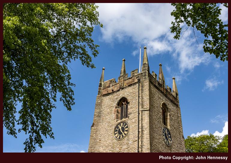
Before all that, I needed to continue home. Thus, I followed a right of way to the A523. Going north took me to Bosley. This was partly to see its church, not that it is the most prepossessing of buildings with its red brick construction. Another public footpath conveyed from the church to Tunstall Road, where I met with the Dane Valley Way.
It was by now well into the afternoon and I had some quiet space, the like of which I did not have since the arrival of the pandemic. Still, I left it for the towpath of the Macclesfield Canal because I did not fancy passing through what was marked on the map as a stud farm. In fact, this is more like a business park and going through there might have saved me some road walking along another part of the A54, never a nice road to walk.
My next destination was North Rode. Another part of the Dane Valley Way got me off the A54 to reach a public footpath taking me the rest of the way. Again, quietude was my lot and there was some time spent next to its pretty church before continuing from there to Gawsworth.
This was to be where things got a bit busier again. First, getting to Rodegreen took me off-road once more. Going right along Pexall Road not only took me to Shellow Lane, but also towards the public footpath leading to Gawsworth and its church. This was to be a more confined affair in spatial terms, a trickier situation when you need to pass people with pandemic wariness around. Later, I would pass fish-ponds attended by numerous people fishing. It looked a little too busy to me, so I passed on as best as I could.
This was a time when local public footpaths were never busier; you could find lines trodden in fields where you never would have had them before. They have faded since then, too. Thus, the path conveying me from between Gawsworth Old Hall and Gawsworth New Hall did little to deter others from using it. Having got so much from the day, that did little to perturb me; you have to share anyway.
Once on Woodhouse Lane, I continued in the direction of the Danes Moss Nature Reserve. Without photos because of the greyness of the skies, I am left with a quandary in this account: how did I get home from there? One thing is sure, it did nothing to take from the restorative nature of the stroll. For that reason, I wonder if I continued on paths to Congleton Road before following that into Macclesfield. Making for the Macclesfield Canal instead would mean going a busier way and one with people confined to narrow boats there too; it is not the best for them to have too many around during a pandemic either. Thus, I am siding with the first option.
That night, I felt very different. The relaxation in places with few if any people had done the trick. All the tension was gone, and I felt more normal than I had done for a while. The fact that I really could relax in such places again was a real help for my subsequent state of mind.
After the previous day, the Sunday that followed needed to be an easier day. It came hotter, too, which added impetus for just that. Some outdoor reading in South Park and Victoria Park became the main highlight, a good development for adding more normality. The Bank Holiday Monday came sunny and allowed a cycle that took in Bosley village and Bosley Reservoir before rounding The Cloud, a prominent local hill. That meant a descent along Peover Lane and nervous travel along the A54 before leaving that to reach North Rode, where a much-needed break was taken near its church in the sunshine. From there, I continued to Gawsworth, where I again stopped a while ahead of the last stretch to Macclesfield and home.
Looking through my photos from that Monday, I am surprised that none were made while I was on Tunstall Lane, given the views that were available. However, I set that to rights the following Saturday. The previous weekend must have worked up quite a bit of magic because I boldly ventured into Staffordshire, a first since the pandemic had arrived. Having crossed Hug Bridge nearby, I easily could see myself visiting Rushton Spencer before heading along the lane by Rushton Bank and Woodhouse Green. The steep ascent forced me to walk the bike in places but granted me the views over Bosley Reservoir to Croker Hill that I desired. Careful progress was made along Cloud Side because I am not so good with hills while cycling; descents particularly challenge me, possibly because of cycling bike with bad brakes while much younger. Once as far as Peover Lane, it was largely a reprise of Monday's route back home. Courage and fortitude had been found, something that would propel me through the following June.
An insurance price hike
My BMC multi-trip insurance policy is set to expire in the next few weeks. Though I have an annual policy with another provider, this is a more standard affair that may not cover the sort of outdoor activities that I enjoy overseas. Thus, I went with the BMC policy to increase the coverage, particularly with a multi-week trip to the San Francisco Bay Area in the offing.
Other transatlantic prospects are in my mind for this year, in advance of any political drama on the other side of the Atlantic. However, the price of a renewal for this year has jumped by several hundred pounds. That has been enough for a rethink, even if the BMC's finances are in a parlous state, and they could do with added income.
Thus, I am not going to renew for this year. For any overseas escapades, I am going to go with single trip cover instead. Other providers like True Traveller or Battleface may be a better fit for what I need, since it is hiking that I do rather than climbing or anything more adventurous than that. The latter of these quoted me a price close to that of the BMC, though, while the former is cheaper. This can be revisited closer to any trip away.
Getaways closer to home in the last few weeks, like those to the Trossachs or Badenoch and Strathspey, were far less risky anyway. Others may follow if the weather allows. The insurance side of things can wait.
Clearance
This year, the Easter period for me has been filled with decluttering of my house and reorganisation of what is inside of it. In part may have been encouraged by the mixed weather that we have been getting for much of the last twelve months, let alone the last few weeks. There appears to be no real break coming on that front, so it was just as well that I took a chance on a mid-Wales trip at the start of March.
That did have some sunshine at times, which is what tempted me to base myself in Aberystwyth for a few days. The first full day allowed for coastal ambling, firstly around Aberystwyth itself (taking in Penparcau) and then south along the coast as I walked back from Borth.
The next day saw me head inland for a hike that took in Pumlumon Fawr and Bwlch Nant-yr-Aran. The wind was not only cold but also brutal in strength, so I did not dally on the tops. It was only dogged determination or perhaps foolish stubbornness that propelled me to the top of Pumlumon Fawr in the conditions.
The air had been clearer with some sunshine to brighten my surroundings, somewhat justifying the exertion of willpower. On the way back from Ponterwyd, the bus driver was wondering what I was doing out and about on such a cold day, only to laugh when I told him that the real problem was the strength of the wind. The skies were greyer as I started my return home, yet I was not disappointed with what I had got.
Since then, there has been a broadband upgrade in advance of all the domestic alterations that I have been making. Charity shops have been beneficiaries of all this clearance, and the restrictions on bin capacity meant that getting rid of any waste proved challenging without access to a car. The added clearance makes all the effort worthwhile, though. Some new pieces of furniture have replaced old ones too, and a spot of painting brightened some walls in its own way. While progress has been good, there is more to do.
That may wait, though, since my mind is turning to excursions should weather windows offer. A walk on Ben Ledi near Callander is a tempting idea, as is a brief visit to Paris that uses rail travel to get there and back. Other French destinations may be later possibilities, like North American escapades to Portland in Oregon or Seattle in Washington State.
It helps to have good maps…
While writing trip reports for Tenerife, I was reminded of the travails that I encountered with using the maps that I had in my possession. At the time, I found myself cross-referencing data between different providers for working out where I was going. That was not ideal, but I managed to make it work.
Something similar happened in Canada. When the maps from Natural Resources Canada did not have all the detail that I expected, I resorted to using the base map provided by ViewRanger because it showed trails on there. For my various traipsings, that did suffice, even if there are possible risks like those highlighted in an article on the TGO website.
In the UK or Ireland, it may be that the tracks shown cannot be used by the public, so you need to check how things look on the ground. Then, there are possible errors because many trails are crowdsourced. That is another reason for checking on what surrounds you and applies when using user routes found on various apps and websites. The likes of AllTrails and Outdooractive come to mind here.
In my case, I ran into no problems in Canada because I was following low-level trails and established tracks much of the time. For off-trail use, mapping from National Resources Canada would have proved as necessary as the use of a compass and awareness of wildlife. Hiking in North America takes one into wilder places after all. Finding paper maps takes a bit more work, as I found, but the added effort pays dividends as long as you watch coverage of where you are planning to go.
In a more recent excursion to California, the Gaia GPS app became invaluable as long as I had downloaded the map data before setting off on hiking trips. Topo Maps+ from Glacier Peak Studios may be another option for users of Apple devices, but I stuck with what I had courtesy of a subscription to Outside+. In any case, Gaia GPS did whatever I needed, and I hardly needed to check any paper maps that I had.
That was just as well, since map scales vary widely for U.S. hiking areas anyway. USGS quads may be standardised, but the same cannot be said for other publishers, with National Geographic being a prominent example. Still, any device has a limited battery lifetime so being proficient with a map and compass remains a necessity, especially in remote areas where mobile signal may be too limited.