Category: Reflections
Sunlit journeying under a cloud of condescension
"I could wait here all day", he said condescendingly. That is not a response that you need from a bus driver when buying a bus ticket using a debit card. Every other ticket machine that I encountered did not need the card to be placed on the machine like this one did. Not being a regular, I did not think of that. That driver came across as a jobsworth and was not at all helpful. It felt like I met someone who was killing time until retirement, and the experience was such that I got off the bus in Leek when someone else did. It felt better not to share space with that driver.
The payment was made on the day when it was required, so I did my part. The operator dropped the service later in the year; it is difficult to keep going if you have staff that are not customer-friendly, but there may be other reasons. Later on, another driver with the same company, albeit working a different route, came across as more anxious yet was helpful at the same time; he reminded me what to do with a debit card as you would hope. That cannot be faulted. The previous summer, I overheard a conversation involving yet another driver from the same company. The topic was how uncomfortable passengers felt about a different driver. It makes one wonder when you hear things like that.
The real disappointment is that this was a more mainstream company and now the dominant operator in Cheshire East. Their having facilities beyond those of a smaller operator made me fancy walking around Leek more often. The truth is that I have not been there since that day in June 2021, and that a previous operator regained the route under council contract after a messy transition.
Since I now have another place to put them, I normally do not share musings on public transport on here any longer. There was a time when I did so, but that has passed. Such was how I took the response at the time that it cast a shadow over the rest of the day. Hence, it needs mentioning. Thankfully, I had decided on walking all the way home, avoiding a repeat encounter; my nature is conflict averse at the best of times.
Once off the bus, I could begin to put the whole thing behind me; the day was sunny, so distractions could come my way. There was overlap with previous traipsing between Leek and Buxton the previous year, yet the public transport experience and the effort involved in collating route variations for various hikes from Hayfield was enough to put me off including this account in that narrative.

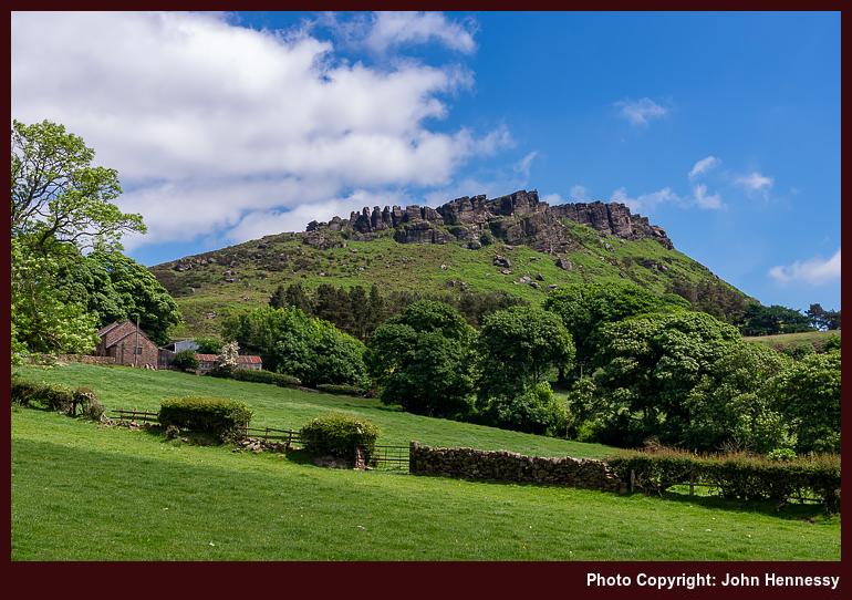

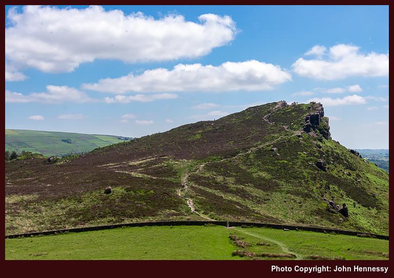
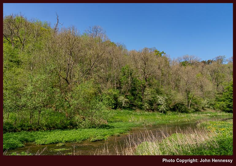
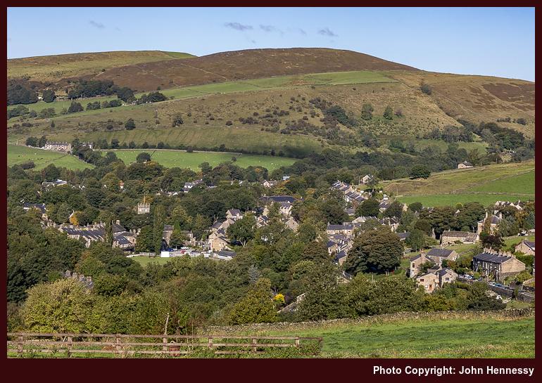
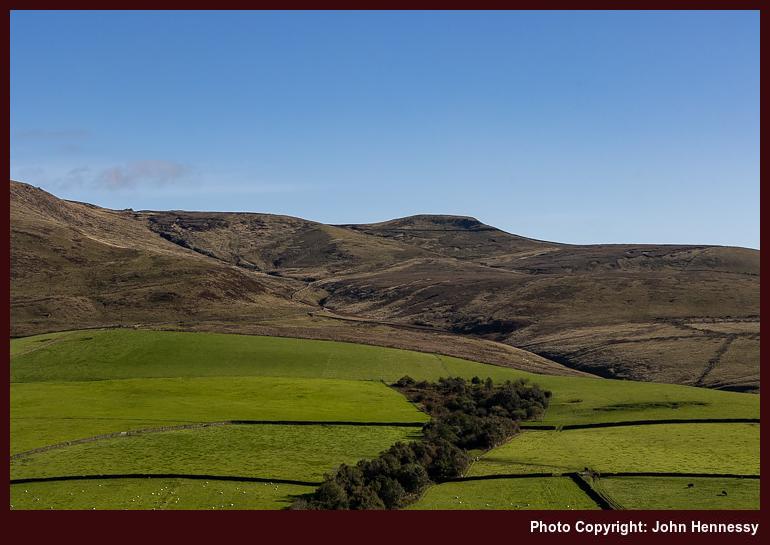
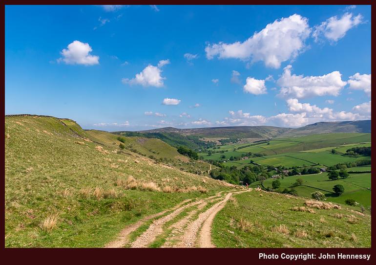
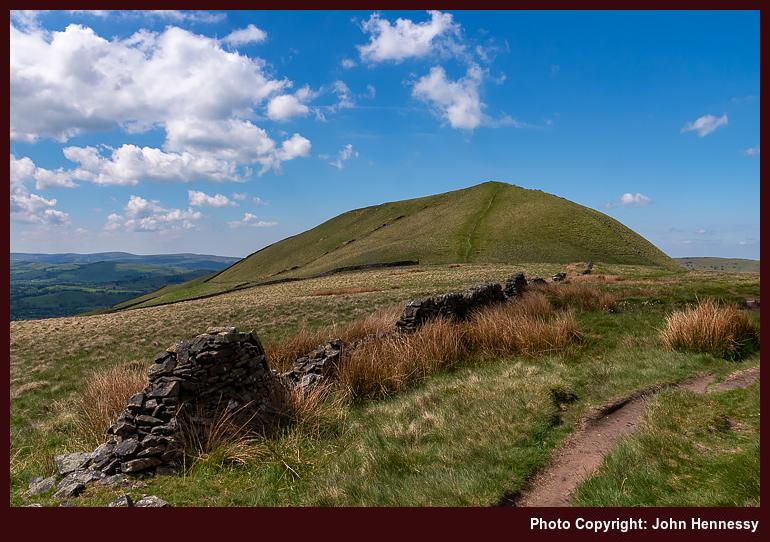
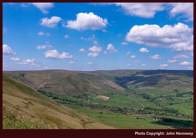
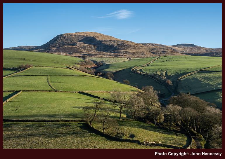
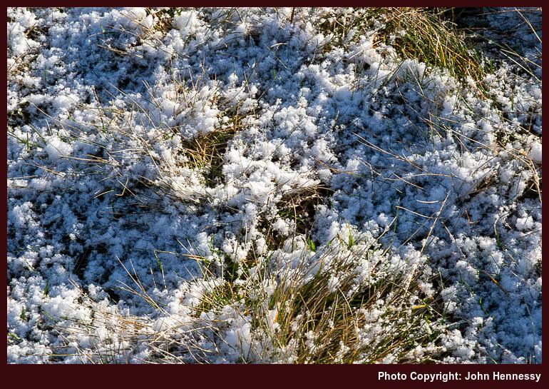
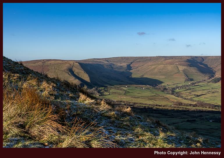
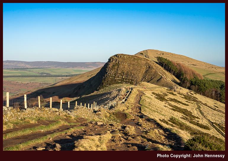
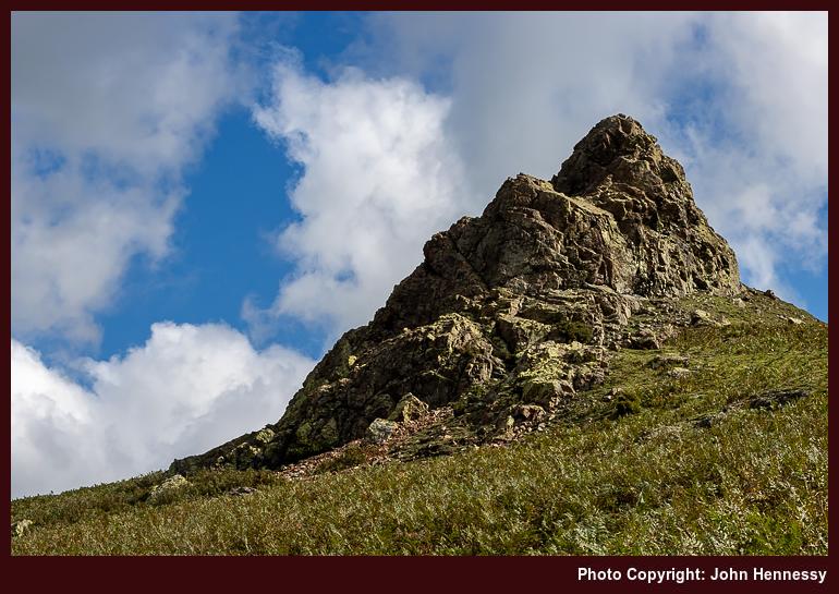
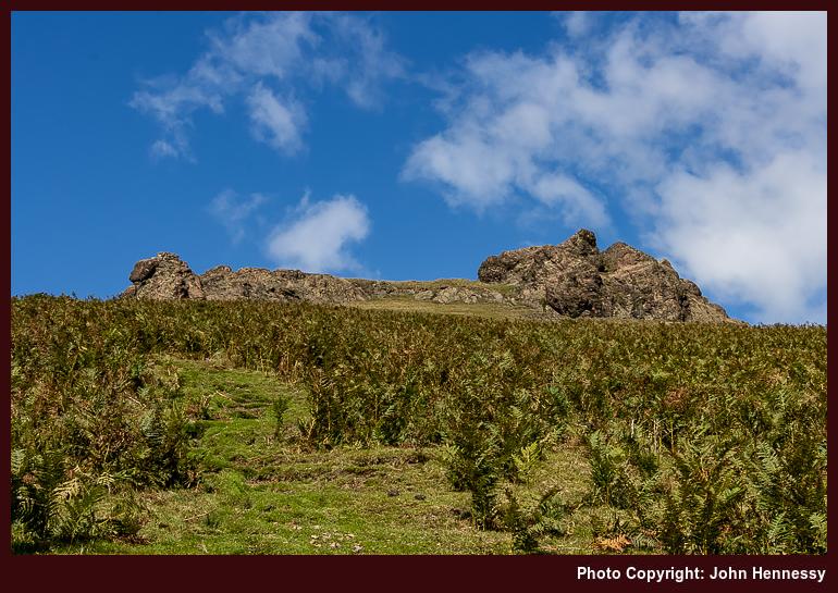
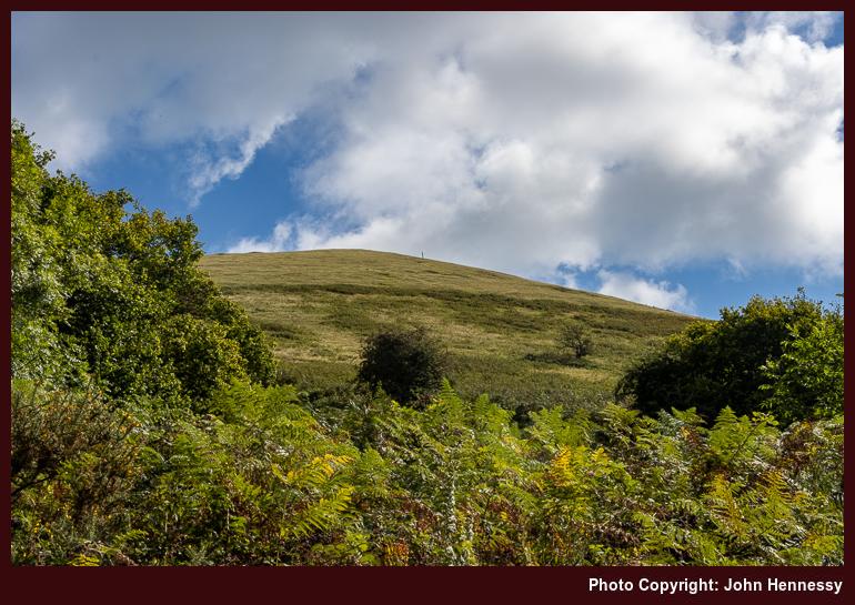
The way from Leek to the Roaches probably was a quiet affair, as it so often is, yet details of the route taken are lost to me now. Even photos are not much help, since pastoral countryside can look similar in all sorts of places. However, I did make for the Roaches without visiting Hen Cloud. There were quite a few up there, which might have deflected me as much as have being there before. Being between vaccination doses continued to keep me cautious.
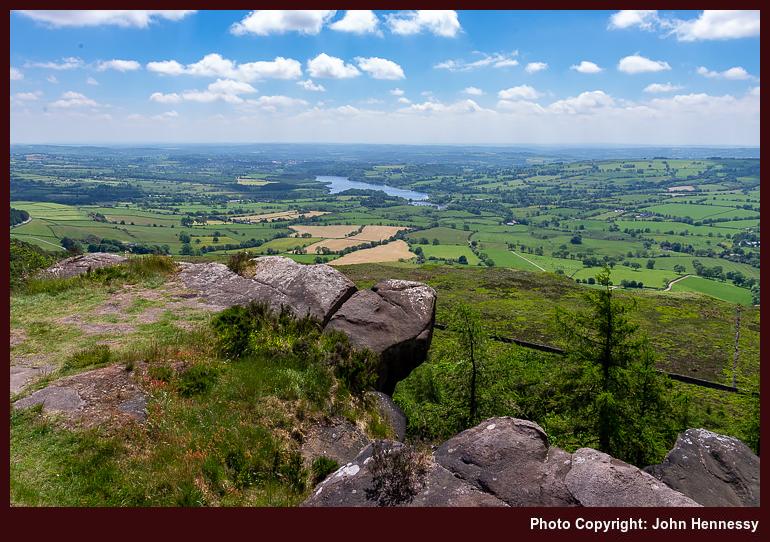
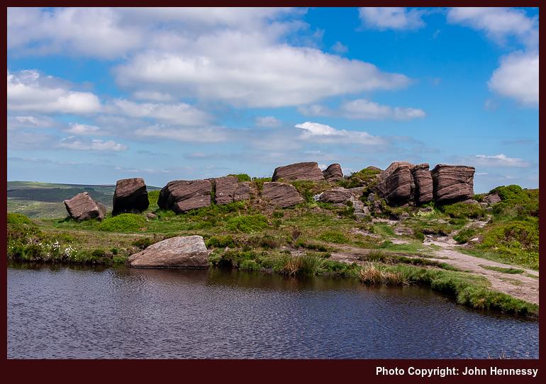
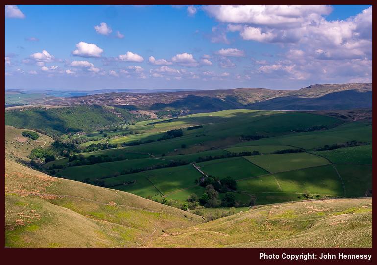
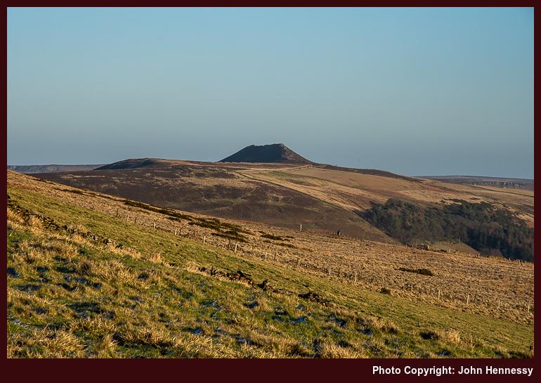
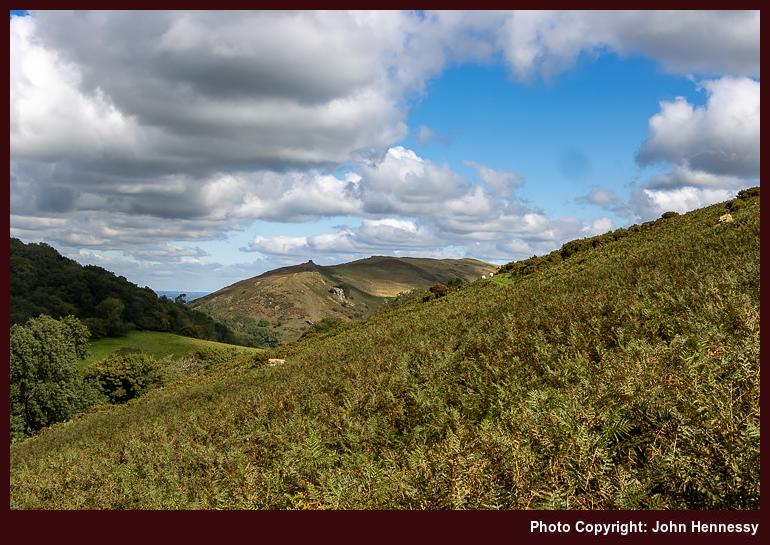
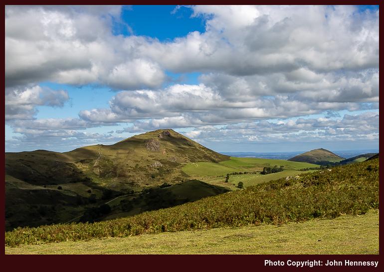
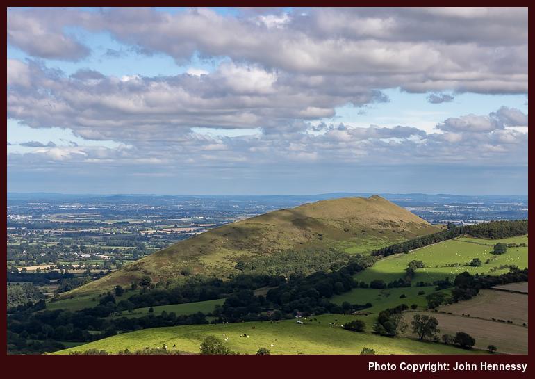
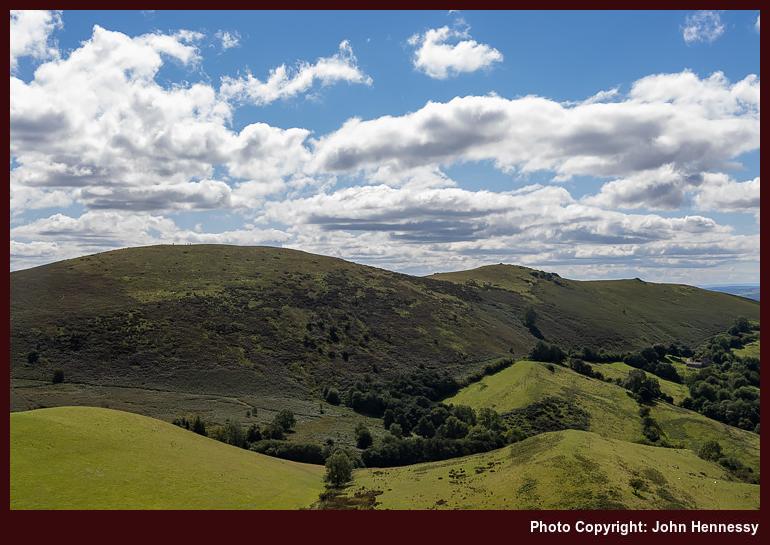
As I continued north, much was as familiar to me as it was good to see it again, especially with sunshine. Tittesworth Reservoir lay below, Ramshaw Rocks were there to the east and in the west there was Croker Hill and Shutlingsloe. While making tracks in one county, it was possible to glimpse towards two more. The day was feeling much better.
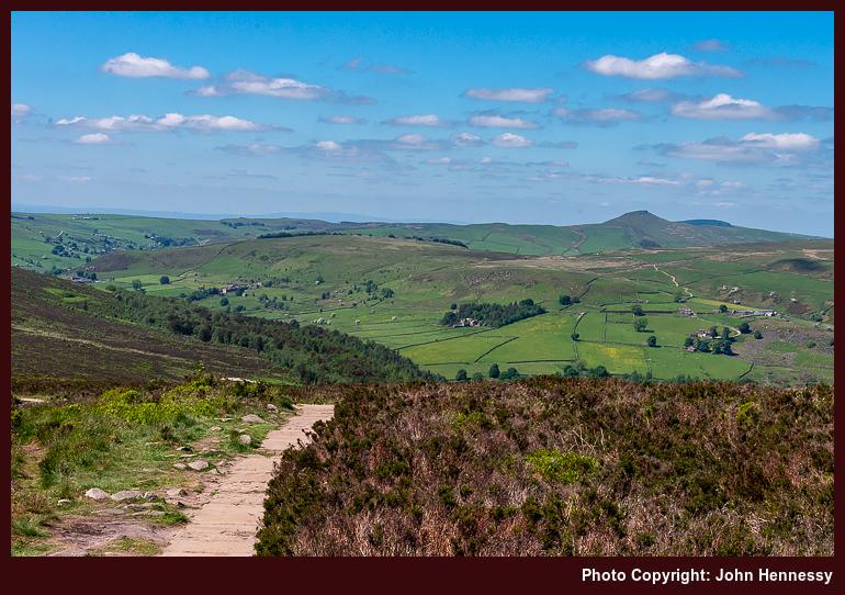
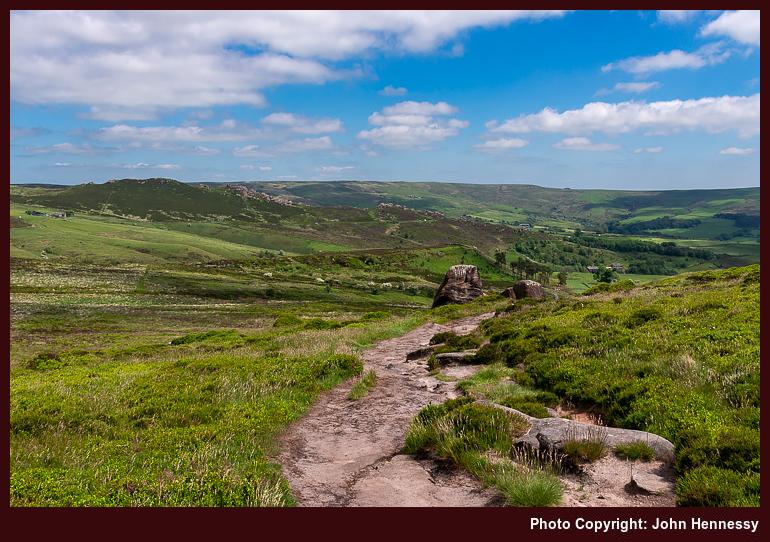
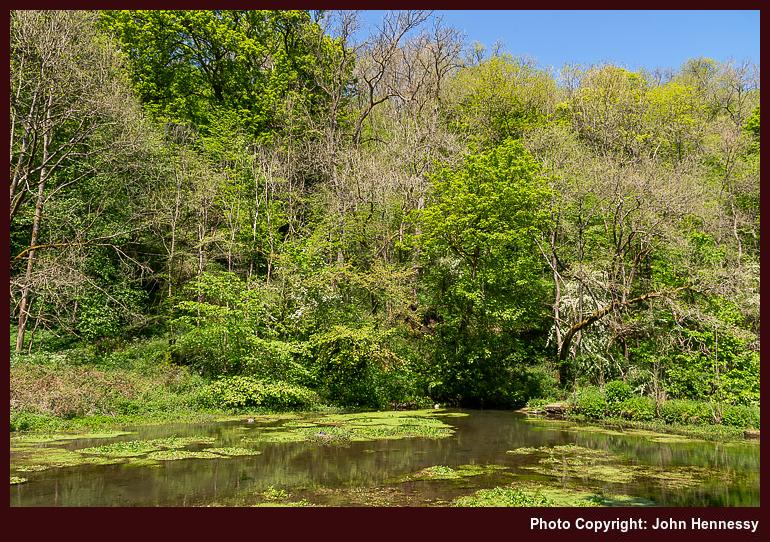
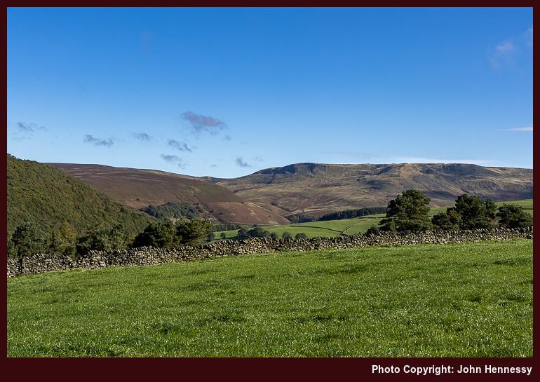
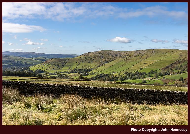
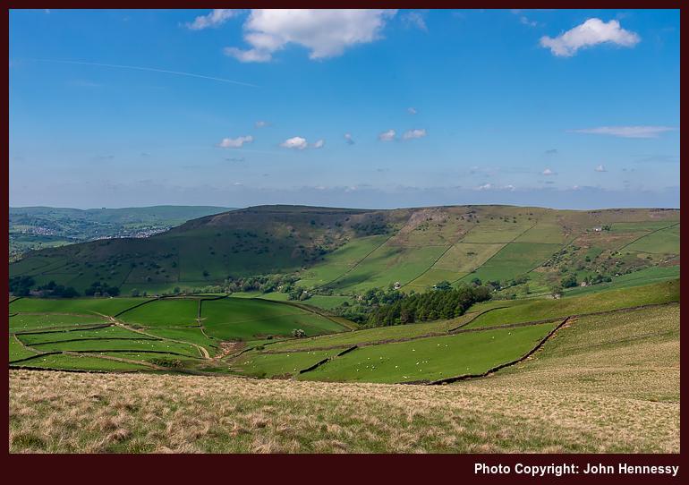
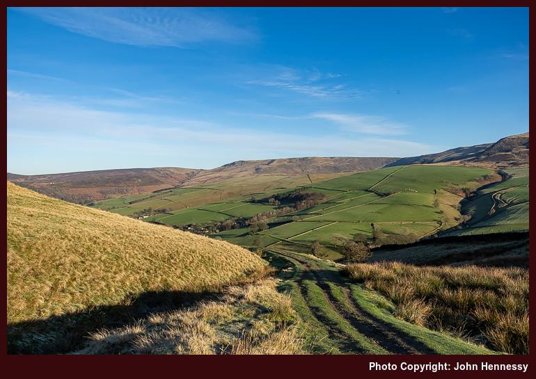
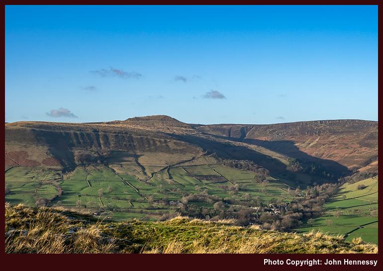
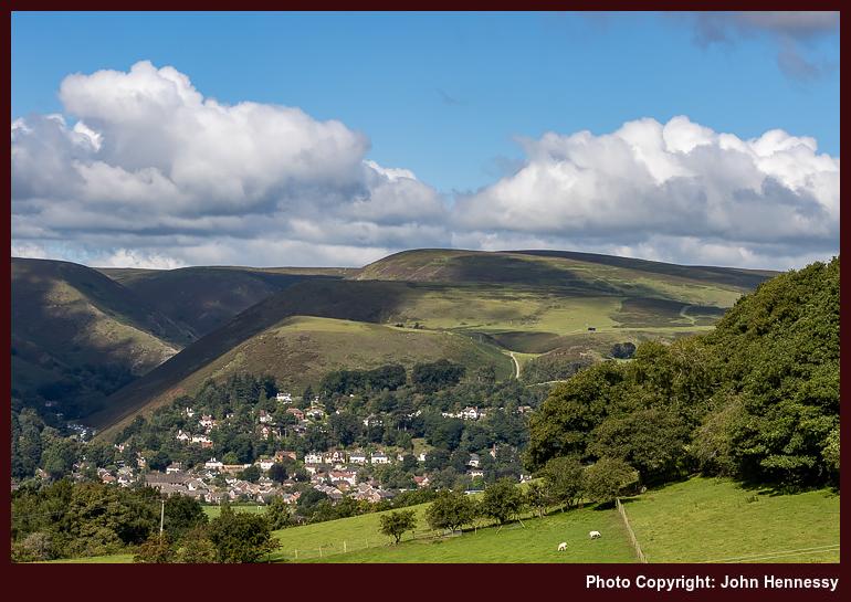
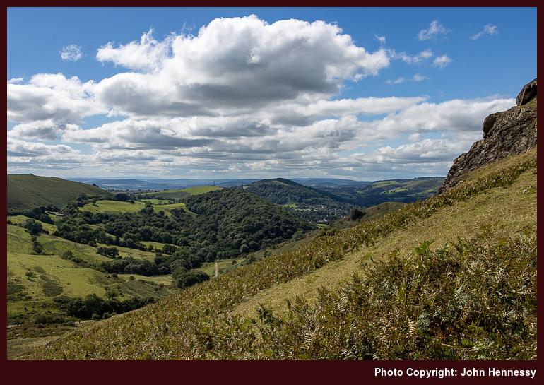
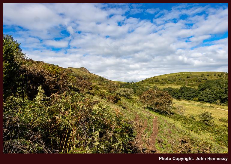
However, it was having its busier moments as well. Seeing a large group going around was a reminder that many were getting more relaxed. Restrictions were easier and the ongoing vaccination programme had gifted political benefits, ones that were not to last. After the Roaches, my wandering took me over Back Forest and near Lud's Church, which is where that large group intruded on my day somewhat; my sense is that they were staying in group accommodation (possibly the former YHA in Gradbach, now an outdoor adventure centre?) and this was part of a circular route that they were following. Nevertheless, there were ample views over Gradbach and the nascent Dane Valley that compensated as much as those towards Shutlingsloe and what was near there.
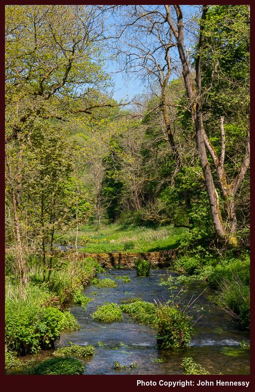
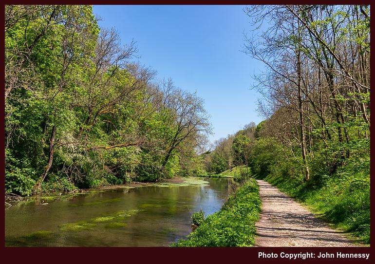
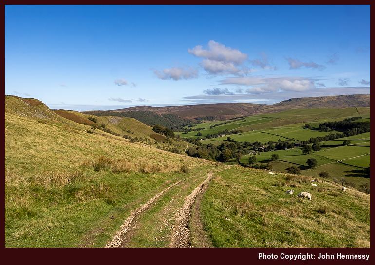
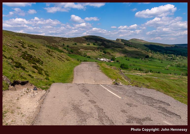
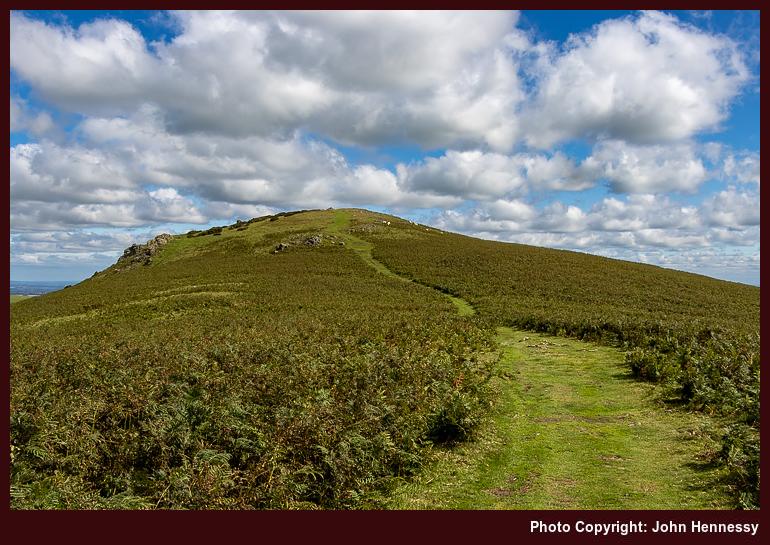
Things grew quieter around Hangingstone Farm, which was to my taste. By this stage, I was near where I had first gone on the Sunday of a Spring Bank Holiday weekend in 2009. Danebridge was the next landmark on my route and where I would cross the River Dane to re-enter Cheshire. It would have been tempting to think that I was most of the way home, yet that would have been wishful thinking.
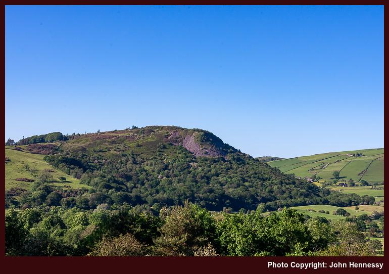
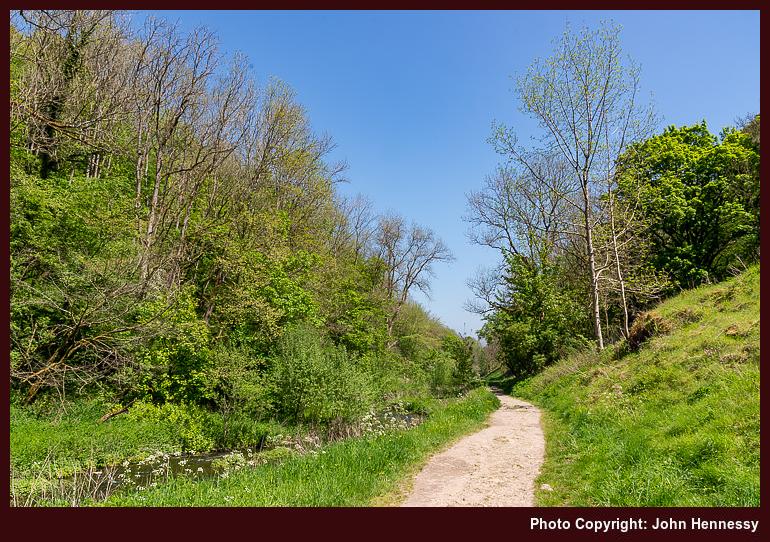
Initial impressions that the route from Danebridge had slipped from recollection now look pessimistic, for there remain some reminders. Hammerton Farm and Longgutter are made probable by my remembering that the latter was peopled with a family or families enjoying a country stay. It might have been that I needed to ask the way through there as well. Bonhomie was the general air thereabouts, a contrast to the start of the day. Eventually, I would have alighted on the lane leading me to Higher Sutton, Ridge Hill and beyond to Macclesfield. This is supported by the appearance of Tegg's Nose in my photographic records, and Shutlingsloe looms large here too.
The spirit may have been wounded, yet the day was not spoilt. That is how things feel to me now, having shared my thoughts on how it all began. Maybe that is the point of writing these accounts; the act helps to deal with any wounds and other things that may have gone awry. As I worked through this one, I was reminded of when my elderly Meindl Burma boots failed the preceding Easter. Their successors set the scene for a tale of a trot from Miller's Dale to Castleton over two months later.
Travel Arrangements
Outbound journey on bus service 109 from Macclesfield to Leek.
Seeking quiet, being cautious around others
There has been a trip report hiatus on here. The cause was my assembling a visitor guide to Canada. Even with automation and GenAI, that took quite a bit of time; in contrast, this trip report is handwritten, not machine-spewed. There were quite a few websites to process, and Canada is a very big country. It could have been that I bit off more than I should be chewing. While breaking the assemblage apart now seems sensible, I will leave that for later. The whole effort may tempt me to return to the place yet.
Thinking about the delights of Canada turns out to be vastly more exciting than thinking back to 2021, a year when the big story was the roll-out of vaccinations for everyone. Some jumped at the chance to put the pandemic behind them, while others took a more cautious approach; I was one of the latter.
Even with a single dose of the vaccine, I still took things slowly. It helped that I had other things to do, and had acclimated to the situation anyway. There was no venturing beyond the counties of Cheshire, Derbyshire and Staffordshire for me. That applied to the Spring Bank Holiday weekend at the end of May that year.
Saturday was typical of what happened in the run-up to the weekend. There may have been a good deal of sunshine that spring, yet I stayed local all the while. The most memorable thing about Easter of that year was that all Easter Eggs had been sold; there were none left in the shops when I went looking. Otherwise, things were slowly opening after the winter lockdown. That was the backdrop to an evening cycle that took me around by Gawsworth.
The next day, Sunday, was hardly any more dramatic. The sunny weather allowed for a walk from Disley back to Macclesfield that avoided Lyme Park while taking passing Lamaload Reservoir. These parts were becoming very familiar to me through passing through them so often. The real bliss was in how few were going the same way; perhaps others were going further afield, leaving me with the reassurance of solitude. After all the restrictions, it might have been the others were getting bored, and I remember moans about the behaviour of visitors to the Lake District earlier that year. My own search for added novelty got going in 2022 when I could get as far as Ireland.
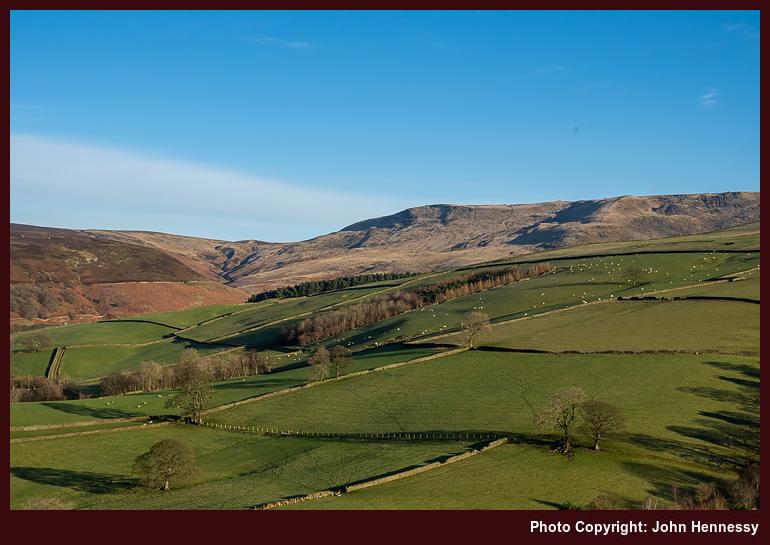
Stitching together frayed memories, I now realise that a Bank Holiday amble from Monyash to Bakewell was not quite the reprise of earlier ones going between the two places. The hint was my following the Limestone Way out of Monyash. Instead of venturing into and through Lathkill Dale as I had been thinking, I avoided it. Instead, I passed One Ash Farm and descended into Cales Dale only to climb out of it again, a steep down and up for my legs.
It all shows that there is an aspect of plateau about these parts, with dales being cut into that over the passage of geological time. Staying out of those gouges for at least a while had me going around by Low Wood, a Peak District National Park property. Thus far, I got the sense that I was facing a busier day than the one before. While there were quiet moments, more were drawn out by the sunshine, like I was.
My target was the River Bradford, and it was here where I would encounter quite a few groups going the way, adding discomfiture to this single vaccinated wanderer. Nevertheless, there were ample opportunities to admire the bucolic surroundings. Even so, my designs on following the river all the day to Bradford were stymied by gatherings on its banks. To look at these, one would think that the pandemic never happened.
Instead, I left the river to go through the village of Youlgreave before continuing to Bakewell on a hazy afternoon when the warmth of the sun could be felt. Maybe the sense of summer was the cause of there being so many sunseekers along the banks of the River Bradford. Piecing together the way from Youlgreave to Bakewell is a puzzle created by the passage of time. There are hints, like the spending of time in a cemetery away from the town centre. Any hint of a crossing over the River Lathkill by means of Conksbury Bridge appears plausible yet cannot be confirmed. The recollections are as hazy as the afternoon was. One thing is clear, the mix of road and path was not one that I followed before.
The thing that is better etched into my mind was how busy Bakewell was when I got to the heart of the place. There was a wait for the bus home, and it did not feel very comfortable about the lack of any form of social distancing. It felt like the pandemic had ended for many, and they were getting back to what they did before it. This was going to grow as the year continued; this was something that I needed to learn to handle. After all, there were signs of slippage with mask wearing on the way home, even if I bore no lasting consequences.
Travel Arrangements
Getting to Disley on Sunday was by train with a change in Stockport. On Monday, there was a return journey on bus service 58, getting off in Monyash on the outbound journey and embarking from Bakewell on the way back to Macclesfield.
Heading south and east from Hayfield in three seasons
Assembling an account with more than one hike can get tricky; the amount of variation is what catches you. For one thing, the routes can alter, even in the middle of a hike. A chill in the air, a feeling of lethargy and a desire for quieter surroundings all contribute to decision-making. If they were all alike, what would be the point of writing about them and then reading these afterwards?
Here, there are three seasons: autumn, summer and winter. The order may seem wrong, yet in fits the calendar order from 2020 through 2021 to 2022. Photos were made with three cameras: one acquired in 2019, another from 2013 and one more from 2021. Only for the hiking year order, these again would look out of sequence. Not everything gets lined up as one might expect.
All the traipsing around Derbyshire reflects one more thing: the progression of a global pandemic. The revisiting of old haunts and the finding of their previously unexplored corners was a consequence of this. This was not a time for globe-trotting. Otherwise, it was a matter of inspiration and opportunity working within weather windows and other constraints. It all makes for a more organic approach to hill wandering.
Any Illusion of Endless Summer Gets Shattered
The decision to divert an ostensible Hayfield to Hope hike to end in Chapel-en-le-Frith was done up front. The idea of continuing further est never occurred to me. To my mind, the extent felt long enough. However, I was to find that it was shorter than I sensed it would be. Only later did I note Rushup Edge on the map and the possibility it opened.
An unseasonably warm September was coming to a chilly end. Nevertheless, I was lured to Hayfield anyway. This became the finale to a year which turned out better for hill going than the onset of a global pandemic would suggest. There was a lot of good weather and a desire to get out of the house, which helps with these things.
The arrival into and departure from Hayfield was under brighter skies than the previous encounter in July. Even with the portents of clouded skies offered in the forecast, they felt far away at that stage. The first portion of my amble was along the Pennine Bridleway, before I deviated around by Stubbs Farm for added quietness in advance of rejoining the Pennine Bridleway again. A portion of relative solitude had been won.
Once I began to gain height, the views began to open up around me. Clouds were on their way from the north, yet there was plenty of splendour to savour before everything changed. This was a vantage point from which to peer at what lay around Kinder Scout, vistas of which I never tire. They offered rest breaks while gradients tested the legs.
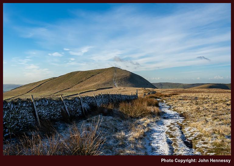
Around Higher Heys Farm, the slopes eased a bit before they stiffened around Mount Famine. An illusion about how far it was to Chapel-en-le-Frith may have kept me off that top. Cloud cover was coming fast at this stage anyway, so views may have been impaired in any case. That certainly was how things became by the time that I neared South Head. Again, I stayed on the Pennine Bridleway instead of reaching its summit.
It was when I was bypassing South Head that I really felt the chill to the point that I concluded that I was underdressed for it. Going more lightweight meant that my layering was less proficient than I needed. Since this was no time to dawdle, I continued on my way. Later, my decision to go this way had me reproaching it until a later walk set it to rights.
A decision point lay ahead and put this question to me: do I stay on the Pennine Bridleway or go around by Brown Knoll? The proximity of Chapel-en-le-Frith had dawned on me at this stage. The hours of daylight may have declining at that time of year, yet arriving there within an hour or two felt too soon to me.
Thus, I left the track to go across the moor on what I was expecting to be a muddy path. That was how it appeared at the start, too. However, it eventually became a flagged affair, which surprised me because this is not a right of way. The ability to travel is supported by this being access land, and I reckon that the Peak District National Park must take a more active part in its maintenance too.
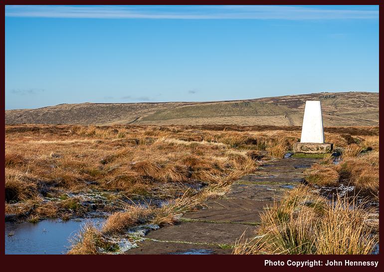
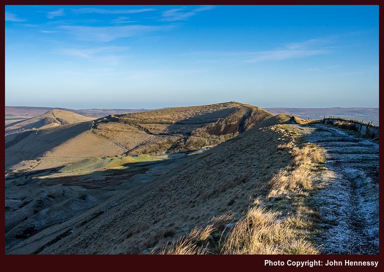
The more appealing surface lured me along. If I had continued straight, the path would have conveyed me to Edale Cross. However, I turned right to pass the trig point at Brown Knoll. Others were out too, so this is not an unknown corner of the High Peak. Even with leaving room for others, good progress was made to reach the Chapel Gate track.
After more decent and noting the way to Rushup Edge, I was on Sheffield Road, not far from where the Pennine Bridleway would have brought me. That might have been rejoined to continue south or even return to Hayfield. Instead, I sought out a public footpath that bring me onto a lane near Sparrowpit that would take me past Blackbrook.
My recollection of this time is of heavy grey skies, yet photos show some blueness breaking through. The surroundings also were far quieter than what I had travelled in the moors. While that was relished, there was also a growing sense of anticlimax. It increased on the approach to Chapel-en-le-Frith on lanes and other roads until I fortuitously met with a bus stop moments before the next bus to Buxton. The greyness would not help to dispel that overriding emotion.
The rest of 2020 would see no more outings as substantial as this one, so there was an element of finality about it. Computing and exercise walks would sustain me through a restricted winter. Something that had waylaid me in spring had come to accommodation in autumn. Others may not have felt likewise at this stage, weathering one dreary spell was one thing, but doing the same for another may have felt like too much. Thankfully, that is not how it was for me.
Doing Some Tops While Bypassing the Great Ridge
A lot had happened between September 2020 and the following June. Vaccines were available, and the inoculation program was in full flow. For me, that meant that one of two jabs were received by the end of April. The initial wait for the second one was until early July before that was cut to the end of June, a weekend when others were invited to come forward, adding to a certain discomfiture at the time.
It was between these vaccination appointments that a return to Hayfield happened. After the number of outings during 2020, 2021 became a pale reflection. Novelty had dissipated, and it did not help that computing and weightier reading material had sapped some of the energy available for it. The way that everything kept changing also was no help, and an exceptional July heatwave added icing to the proverbial cake.
Even so, there were some bright spots that could inspire other trip reports. A hike from Monsal to Bakewell at the end of May is one possibility. In the middle of June, there was another from Leek to Macclesfield that may be worth recounting. At the end of August, two things happened. One was a trot from Miller's Dale to Castleton; the other was a spate of them going across Comb's Moss. Night walking took hold later in the year, not that so much can be written about that. Autumn and winter walks from Buxton and Macclesfield may be worth recounting too.
None of these got into my compilation of trip resumes, a waiting area for extended trip reports. A mixture of distractions, lethargy and loss of interest all possibly had something to do with it. Talking about an ongoing pandemic becomes increasingly tedious as time goes on, which did not help either. Looking back on it now, even with faded memories, possibly works better. It adds more flesh to the writing.
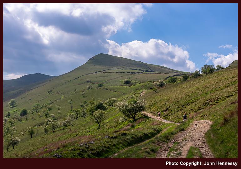
One prompt for getting out in early June 2021 was the prospect of sunny weather. There may have been a wait for a second course of vaccination, but life could not be put on hold. Thus, I could fit in some summits on a hike from Hayfield to Hope. This time, there was no deviation via Stubbs Farm, so it was a case of following the Pennine Bridleway all the way to the flank of Mount Famine, a top apparently named for the Irish Great Famine. The world can feel small at times.
The surrounding views were of cloud-shadowed hillsides, adding a dappled appearance to things. If caught under one, there was a wait before sunlit photography could resume. That was a small grumble given the other goodness on offer. Others were drawn out too, and my wariness about proximity to others had grown over the winter; keeping oneself ready for the completion of vaccination was another contributing factor. Thus, I was glad to leave the Pennine Bridleway to make ample use of the freedom of access land; the routing could be relaxed, and I possibly had the place to myself too.
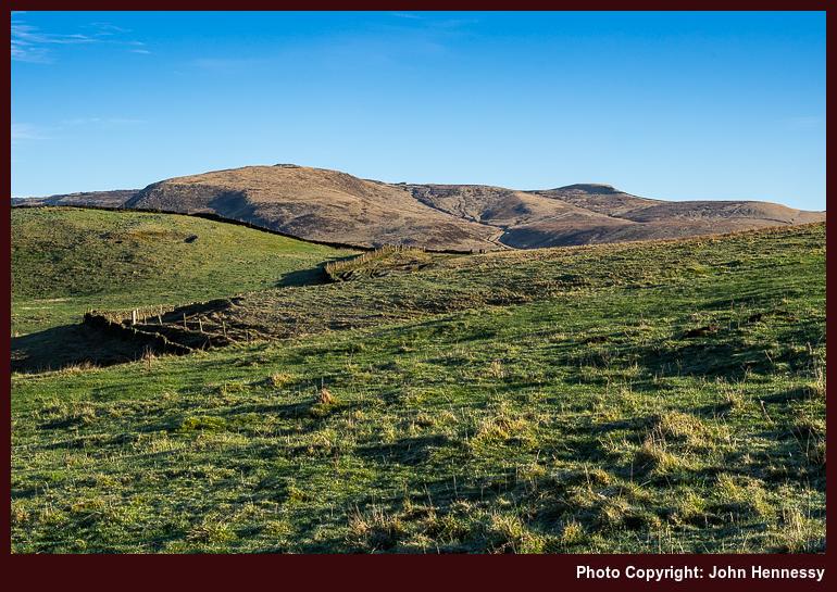
On returning to the Pennine Bridleway, I was set to leave it again very soon after. A crossing of South Head was not refused this time around. While the slopes may have been steep, the resulting views were worth the added effort. It also helped that an annoyance from the preceding September had been remediated. Once I was down on the track again, the path to Brown Knoll was at hand.
Cloudy skies had beset the previous encounter with Brown Knoll, so it felt good to be in its vicinity under sun-filled skies. Bog cotton dappled the moors as I trampled the mix of boggy and flagged paths around there. On reaching the Chapel Gate track, I turned for Rushup Edge instead of the way leading towards Chapel-en-le-Frith. This was rough underfoot, but the forbearance was rewarded.
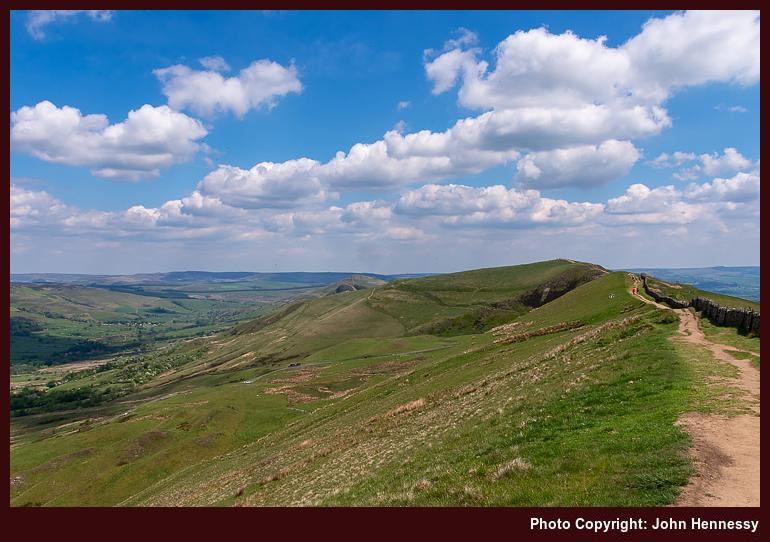

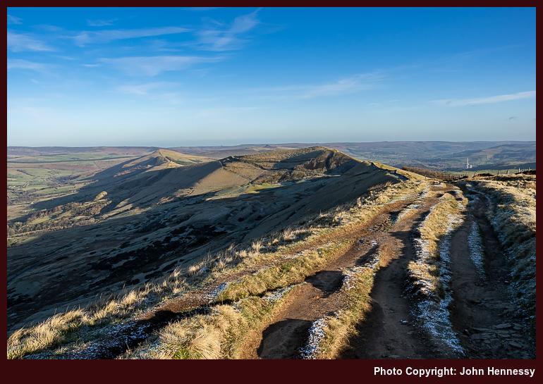
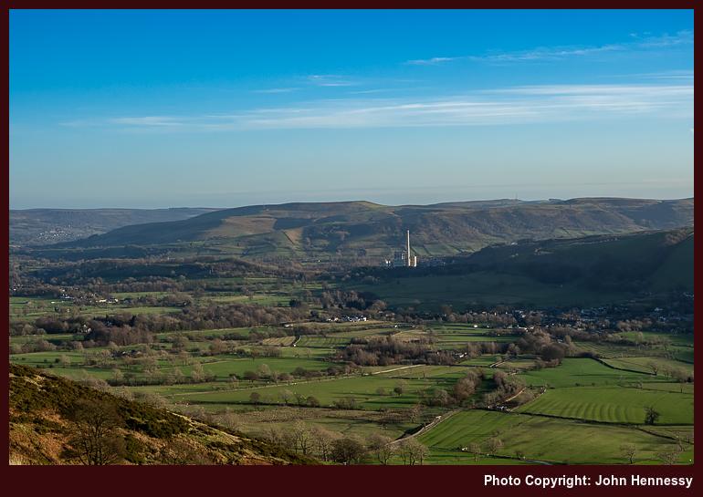
Since the views turned out to be extensive, there was no way that I was going to have the place to myself. To my left, they led the eye into Edale and onto Kinder Scout, and what lay around that. To my right, I was gazing towards Hope and Castleton. Looking straight ahead drew the eye towards Mam Tor and the Great Ridge. If Rushup Edge was attracting attention, then the Great Ridge had to be busy. Restrictions on space and previous visits made me partly bypass it for another way.
First, I had to get down to the road going past Mam Tor on a way up from Edale. The steepness and the amount of erosion made that inelegant, yet it worked out for me. Another right of way popped me onto tarmac that was offering a more direct way towards Blue John Cavern. While such a honeypot may not have been so apt in the circumstances, it offered a useful opportunity for getting refreshments in the heat of the day.
Seeing the remains of the abandoned A625 and the damage inflicted by underlying unstable geology was another attraction of going around there. The apparent freshness of road markings etched itself into my memory, a surprise given the passage of time. Following this direction of travel led me to Mam Farm and quieter surroundings. While others may have been plodding above me, I felt less troubled as I passed Woodseats and Only Grange Farm.
Beyond the latter, I needed to rejoin the Great Ridge around Back Tor to enter Brockett Booth Plantation. That was accomplished in a less than auspicious manner; the slopes were steep and occasionally boggy, too. Lose Hill got bypassed on the way to Hope village, thus cutting the encounter with the busy ridge to a minimum. Some were asking the way to Castleton as I did so, and I pointed the way as best as I could before continuing on my descent route. Once in Hope, I topped up with more refreshments before heading for the train station to start on my way home.
Including the Great Ridge, While Omitting Previously Trampled Summits
If anyone had thought that two courses of vaccination were enough in the middle of 2021, there was a more infectious variant at the end of the year that meant another inoculation for many, myself included. Restrictions reappeared, which added confidence in my case. These were less onerous, thankfully. Thus, a hike from Buxton to Macclesfield preceded Christmas that year, along with other excursions.
2022 began with a few, too. The first was an urban outing to Sheffield that preceded the trek from Hayfield to Hope that is described here. That became followed by one from Congleton to Macclesfield that reprised another from the previous July. Soon after that, it was back to work again in advance of coming novelties. Ireland became where I found international travel mojo again, while Marsden became the hub of a springtime Pennine Way project. Otherwise, Wales, Cumbria and Scotland all saw my footfall again. Novelty was returning on a phased basis.
Now that I think of it, it must have been the sunlit journeying between Macclesfield and Sheffield that returned the Great Ridge to my mind after largely avoiding it the previous June. Another yomp from Hayfield to Hope was in the offing. This one avoided the tops of Mount Famine and South Head. Otherwise, there was a frosty start along the Pennine Bridleway.
As following the Pennine Bridleway increased how high I was, the views opened around me. Since the sun was lower in the sky, shadows also were longer and there were more of them. None took from the delight at being out among these sunlit hillsides again. One should not tire of these surroundings, especially when they alter through the seasons.

There were no diversions to the tops of Mount Famine or South Head this time round, and no regrets at not doing so either. The curtailed hours of daylight might have been enough cause to keep such forays under control, yet the real decider was my being sated while there in June. In any case, I fancied seeing what I could capture photographically along the northern slopes of South Head. Shadows cast by the low sun would foil this to a point; it was just as well that I made something of the same sights during my June hike.
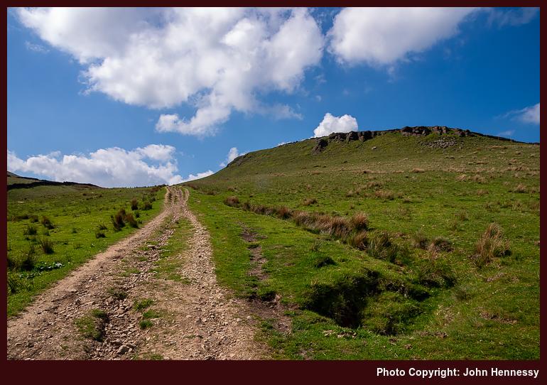
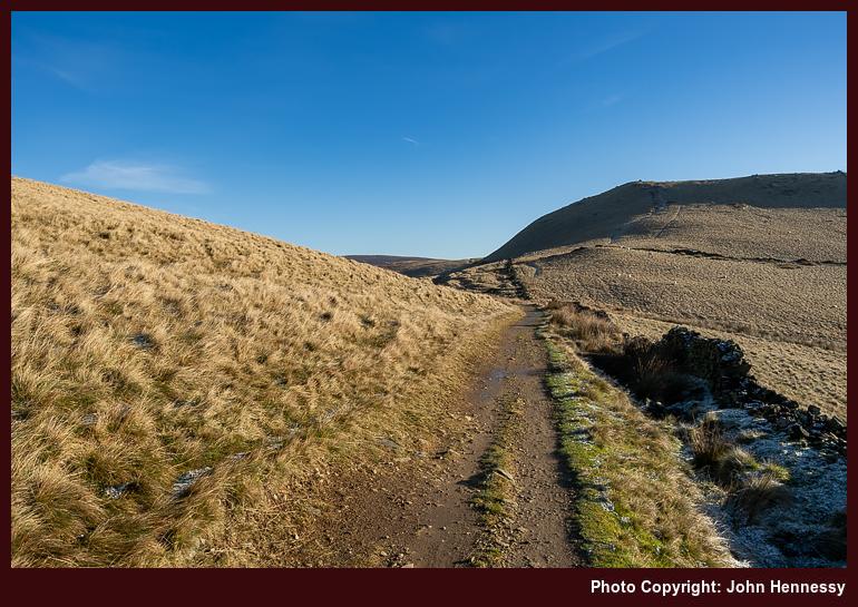
Again, I was bound for Brown Knoll. Thus, I left the Pennine Bridleway like the two walks described earlier. While frozen ground often can be less wetting, I am not sure if that was completely the case around there. Frost was lingering in places after the night before, a feature of crisp January days like the one that I was enjoying.
After Brown Knoll, I was again bound overhead the railway tunnel that carries trains between Manchester and Sheffield, one through which I often travel. It has a name too: the Cowburn Tunnel. In keeping with named objects, I bound for a named track, Chapel Gate. From that, I was headed for Rushup Edge.
Again, that offered panoramic views all around me. Less were out along it than on my previous trot along it, too. Many shadows were being cast, not that they took from any photos I made. In many ways, they added a little something. This might have been winter, yet there was a lot of green on view, the winter sun lit that wonderfully.
If I had thought that enough were back at work to ensure that the Great Ridge was deserted, I was wrong on that point. Going along the path that runs over Mam Tor, Hollins Cross, Back Tor and Lose Hill was a matter of getting over that state of affairs, not that it intruded that greatly at the time. This still was better than during the previous summer, and there were pleasing sights to savour too.
That was while daylight held because the day was nearer the arrival of nightfall. That much is evident from any photos made on the top of Lose Hill. Thankfully, I could capture a scene with Win Hill in it before then. Making for Hope's train station before daylight finally failed became a priority. Even so, care still was needed over steep slopes; one never knows what frozen could facilitate a slip. If it is not frost, then slippery mud can do it on you. Nevertheless, there is no recollection of a mishap, so all must have gone well. That has to include getting home by train.
Reflections
These three hikes extend over a dramatic period. The first felt like an anticlimax with an air of unfinished business. After that, the second was during a time of transition and completed the unfinished work of the first. Lastly, the third acted as part of a bookend marking the end of a period held in stasis and in advance of an increase in novelty that began in March. It looked both ways, as January often does. All provided their own essence of satisfaction, while the final instalment added an element of closure.
Travel Arrangements
All used bus service 60 to get from Macclesfield to Hayfield. The first outing returned from Chapel-en-le-Frith by bus with a change in Buxton. The second and third outings involved getting home from Hope. The former appears to have gone around Sheffield on the evidence of a photo seemingly made in its main train station. After that, a fast train would have got me to Stockport, where another train could be caught to get me the rest of the way. Another plausible and more sensible return option would use the slow train to go as far as Manchester Piccadilly to meet an onward connection to Macclesfield. That may have been used the last time around, but memory fails me here. The way home cannot have been that memorable, a sign that things were moving somewhat towards normality.
A sunny amble through the Goyt Valley: Going from Whaley Bridge to Macclesfield
Once grey July Saturday during the early noughties, I set off from Buxton on a hike that may use of the Midshires Way. There was a lengthy walk along the A5004 before I left it for an old Roman Road. That skirted Combs Moss before continuing east from White Hall Outdoor Pursuits Centre. Eventually, I would cross the A5004 on the way to the dam at the end of Errwood Reservoir in the Goyt Valley.
My next steps would take me away from the long-distance trail to follow the shore of Fernilee Reservoir more closely. By then, the skies were beginning to break overhead as part of a change to periods of sunshine and showers, the latter being annoying when it came to photography. When the sun was out, it was raining and then the sun went way when the rain stopped. While that might be an oversimplification, there were times like that which remain etched in my memory.
That pestering really got going after I rejoined the Midshires Way after being under cover of trees while near the reservoir. The twists and turns of the trail needed close attention to a map, not the best when it was made of paper and that gets wet. It is little wonder that I acquired a waterproof version that I retain to this day. Regardless of all the irritations, I made it to Whaley Bridge in sunshine and made my way to a rendezvous point for onward travel by public transport, bus or train.
My reason for going down that memory lane is that it partly inspired the routing for a hike that would take me from Whaley Bridge to Macclesfield via the Goyt Valley during September 2020. This was another of those hikes that conveyed me home after an outbound bus journey. The initial stretches, those between Whaley Bridge and Taxal, were shared with hikes between the two places that went via Windgather Rocks. This time around, they were trampled under grey skies in hope of later sunshine.
Thus, the way to the Goyt Valley would be a reverse of the direction taken all those years before. The weaving of the trail around Overton Hall Farm, Madscar Farm and others like Normanwood was etched somewhere in my mind anyway. Images of the farms were absent, yet the essence of the trail was not.

At Oldfield, I decided not to descend to the lower path that I followed those years ago and several times since then. This time, I stayed on the Midshires Way and on higher ground. Forestry surrounded me as the cloud cover disintegrated over my head. Tree harvesting added holes through which I could look out on what lay across the valley, a fortuitous development even if it meant timber stacks, warning signs and a rougher track. It all made for a more interesting stroll along the slopes of Hoo Moor.


The trail would return me to tarmac for the descent to the dam of Errwood Reservoir, where a photo stop was inevitable with all the sun on offer. After leaving the reservoir dam, Bunsal Cob was where I took my leave of the trail that I had been following. This time around, I was not bound for Buxton; it was not to be a complete reprise of the way followed those years before. The section of the Midshires Way leading north from Buxton would play its part in introducing me to Combs Moss nearly a year later.


Paths and tracks taking me down the eastern side of Errwood Reservoir became my lot after Bunsal Cob. Some of these recalled a hike from October 2012 in advance of a year when everything changed. 2020 was another for many people, so the wonderful weather and an illusion that all was well allowed a momentary escape from all that was happening.


Going beyond Errwood Reservoir was leading me into familiar moors where there was ample space for us all. Wild Moor always catches my eye, and the sogginess of Goyt's Moss dirties many a rambler. Since it is all access land, it hardly matters whether you are on a right of way or not, so long as you are heading in the right direction. This makes for good map and compass countryside and was a test for the mobile app that I was using; rights of way can be challenging to locate in a bog.


Goyt's Clough became where I again alighted on tarmac. My next step was to find the right of way that would convey me across Deep Clough and Stake Clough on the way towards Stake Farm and the A537. This meant a steep ascent with many breaks to take in what surrounded me; this was also ground that I travelled on that October 2012 hike. Having been to it several times already in 2020, I skipped Shining Top, an act that cut the endurance being demanded of my legs. Variation adds a bit of novelty to life, anyway.


The haul up to Forest Chapel lay ahead of me as I began to follow a concessionary path leading towards Torgate. Since this had been traipsed earlier in 2020, I knew that I needed to go down to Chest Hollow and pass near Cuckoo Rocks. That descent accentuated the ascent to be made after the distance already covered on the way from Whaley Bridge. Taking things slowly was the answer.

Getting as far as Torgate Farm was the first part of this. From there, a right of way conveyed me to the curiously named Bottom-of-the-Oven, with a right turn that took me across Torgate Hill. The byway going up to Forest Chapel was a real test. Overcoming that was not the end, for another ascent followed it, the one along the byway taking me into Macclesfield Forest, where a surprising route decision would be made.
But for the proximity of Tegg's Nose Country Park playing on my mind, logic would have dictated that going down to Clough House and then proceeding via Langley might have made more sense. Instead, more uphill travel, some of it steep, became my lot on the way to Walker Barn. That took me past Hacked Way Lane and Warrilowhead Farm, yet I got through it without much drama. This was quieter ground, which might have been another reason for going this way.
Good sense again took hold from Walker Barn to Macclesfield. On the way, Tegg's Nose Country Park was skirted (the sun might have made the place and its paths and trails more busy than I fancied), primarily using a byway leading onto Back Eddisbury Road, before that allowed me to reach Buxton Road.
Home was near at hand by then, so steady and patience progress got me the rest of the way. Given that it had been a day with nearly as much variety as there was sunshine, it would have been rude to complain. The September illusion of endless summer had pounced yet again; it was best to sate oneself through participation in the charade.
Travel Arrangements
Bus service 60 from Macclesfield to Whaley Bridge
A return to the Shropshire Hills: Daisy-chaining tops near Church Stretton
It had been nearly three years since my previous visit to Shropshire, and even an ongoing pandemic failed to keep me away from these rolling hills. All it took was the prospect of a gloriously sunny Saturday for me to return to the area, planning to explore places that I had last walked in November 2010. That previous afternoon amble, curtailed by a later arrival and the waning daylight, had left the perfect excuse for another visit: unfinished business.
On arrival, the village of Church Stretton was quiet in itself. The B4371 that I followed in the direction of Much Wenlock was no busier, though a collection of parked cars accompanied a trail head. Still, the way up to Gaer Head, my first ascent of the day, hardly was crowded. Vistas of sunlit countryside, dappled with cloud shadows, opened out around me as I gained height. While the ascent route took me off the public right of way, this was access land, so it mattered less where you trod.
The whole area around Hope Bowdler Hill was gloriously unpeopled, a not insignificant mercy during a pandemic when there was a wait to get vaccines developed. Views of other tops were there to be savoured as I pottered about the place, for my route was non-linear. That is what visiting various summits does to such a thing. When they are at hand, it seems rude not to do just that, particularly on a morning of glorious sunshine.
Willstone Hill was another of those calling points before height had to be lost on the way towards Caer Caradoc Hill. Such a development always disappoints me when going uphill takes so much effort. That there is another ascent afterwards makes the loss more memorable. Shropshire's hills may be low in stature, yet there are plenty of steep ascents and descents to be found. Still, the regaining of height allowed to look back on where I had been, providing some consolation for the ups and downs.
It still felt as if the world was elsewhere while I was trampling Caer Caradoc Hill and its satellite summit, Little Caradoc. This was a repeat visitation after nearly ten years. Then, I had not got to Hope Bowdler Hill and its neighbours, let alone The Lawley, which lay ahead of me. Getting that far would need a steep descent to Comley followed by yet another steep ascent along a narrow ridge.
After having the previous hills more or less to myself, albeit with occasional encounters with others, the busyness of The Lawley surprised me. It was attracting groups of hikers, a challenging prospect during a pandemic, and especially so when there is not so much space for everyone. Quite why so many were traipsing around there was something of a mystery to me. Was it that it was far away from a built-up area? Was it the time of day because some stragglers may have started late? These are unanswered questions, so it was fortunate that I got some respite from the passage of others as I walked the whole ridge before turning southwest along its western flank.
Again, The Lawley is access land, like so much around there. The ridge walk had been along a less formal trail, so the initial ascent concentrated the mind, while the descent was not so taxing. The way back was on a right of way that led towards Comley again. After there, I more or less lost most of the others who had been around those parts.
By then, I was well on the return to Church Stretton and started to follow another trail that I had followed years before. The skies again broke overhead to allow the sun to work its usual magic on the surrounding landscape. Any regret at its hiding while I was around The Lawley needed to be put behind me. Some others were going the way too, and someone's not hearing my reply to them caused them to take umbrage at me for it. Thankfully, that soon passed, and I continued on my way as before.
If I had thought that I had chosen an easier way back to Church Stretton, there was one more surprise awaiting me. It should not have been the case because I had crossed the steep, eroded ground before; the passage of time had done the same kine work to my memory. Before that, I was being surprised at how far I needed to go, often over overgrown ground. The path was not so clear either, which needed some added attention regarding navigation.
Then, there was that descent over what felt like rotting ground. With weary legs, that took a combination of patience and care. Once the challenge was overcome, it then was a matter of crossing a footbridge. Friendlier gradients were my lot thereafter; even the foot of Helmeth Hill did not intrude too much. A watercourse was shadowed and fields crossed to reach a lane from there. Church Stretton was now at hand, so patient progress on those well-used legs was the order of the moment. Fortuitously, there was an opportunity for a refreshment stop before starting on my train journey back home.
Though the hike happened more than four years ago, this account has been one of the easier ones to write. Whether it was about somewhere less frequented, or there was another reason, it proved to be more memorable in a good way. The area may be compact, yet there is a lot here. When you get the sunshine that I was gifted, all one can do is marvel at what is around them, no matter what else is happening in the world.
Travel Arrangements
Return train journey between Macclesfield and Church Stretton. On the way back, there was a change at Stockport. It may have been the same on the outbound journey, but that is not as memorable as how busy the train became south of Crewe. Thankfully, things were quieter on the return leg, which made for a far more relaxing journey.