Category: Pennine Way
Pennine Way adventures in the Yorkshire Dales: Part 3
The weekend forecast got me returning to Yorkshire for the continuation of my Pennine Way quest, this time for a day trip on Saturday. The fact that I had no driving lesson to do allowed me to head off. It was an over and back trip with no overnight stays involved. My target was to head from Malham Tarn to Horton-in-Ribblesdale, crossing Fountains Fell and Pen-y-Ghent along the way. To get there, I caught the first train from Macclesfield to Manchester at 07:10 and onward connections via Leeds got me to Settle in time for the 11:30 minibus to Malham.

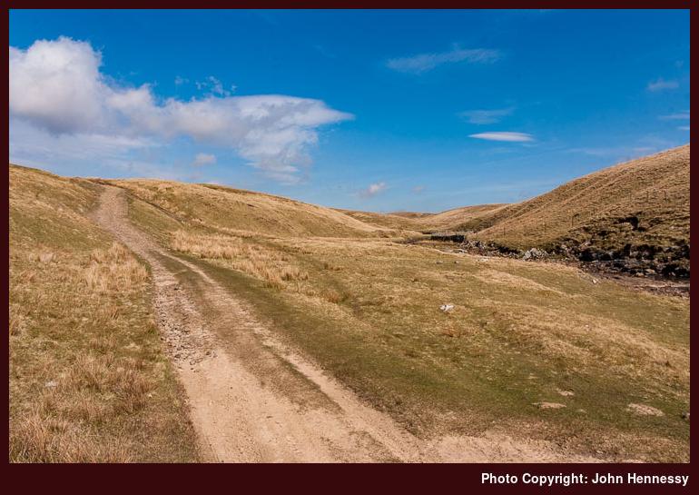
That got me to Malham Tarn around 10:45 and the prospect was much, much better than it was on Easter Monday. The spring sunshine, however hazy, lit up the scene more fully than I had ever seen it before; my 2002 visit was a cloud-bound affair. I retraced my steps around the tarn and made my way to Tennant Gill, from where the ascent of Fountains Fell began. That ascent is a long-drawn-out affair, but with the prevailing conditions, it was a delight, though the day was beginning to heat up. With my now well-worn OS OL2 map duly changed over to the correct side (the breeze and the bone dry conditions underfoot meant that it was placed on the ground to do this), I trooped over the fell, only to lose a lot of the height that I had gained.
The bulk of Pen-y-Ghent was temptingly close, though some miles were to be trodden before I was to reach it; the Pennine Way never goes at anything directly... After a spot of road walking to Dale Head, the ascent began again. Strangely, it didn't seem to take a lot out of me until I encountered that testing step near the top of Pen-y-ghent. Maybe, it was my taking it nice and easy, so that explains it. Nevertheless, I always find it strange that the Pennine Way goes up and over Pen-y-ghent when it could easily go around it. That would avoid the piece of clambering over limestone slabs that nearly caused me to bottle it. Nevertheless, I did conquer myself and go to the top of Pen-y-ghent for the second time. On the event, I did feel a little queasy after the clambering, and I don't know whether it was vertigo or something else that caused it.
My first trip up Pen-y-ghent followed the Pennine Way from Horton, but an inspection of the map convinced me, rightly in my view, not to come down the southern slopes of the hill; that was where I ascended on my second visit. Instead, I walked over Plover Hill and came off that way. The way down was still steep, yet I managed it, and I then followed a bridleway from Foxup Moor until I rejoined the Pennine Way to return to Horton. That was in April 2004 when the wall on the top of Pen-y-ghent was a standard affair with two stiles over it. Then, I got myself told off for descending from one of those in the wrong fashion as I was heading for the hill's trig point; I had been facing away from the wall rather towards it. Later that year, a spot of refurbishment was carried out, and this added wind shelters and more manageable stiles than the traditional wooden ones that did the job previously. Apparently, it was done to celebrate 50 years of the Yorkshire Dales National Park.

Returning to the second Pen-y-ghent encounter, the seats in the wind shelters allowed me to rest a while in an attempt to settle myself down before the descent to Horton. That descent is known territory to me from my previous outing, and I took it easy and enjoyed the way down as much as possible; without walking poles this is a knee-jarring stretch, so my full attention was required. It is also a stretch where you should not be rushing to catch a train, so I discarded any thoughts of using the 17:44 departure, which proved to be just as well; I would have been more than 15 minutes late. The evening was glorious, and I rediscovered views that I first encountered three years previously. Awaiting the 19:29 train allowed me to fully settle down after the day's exertions. Though that train was late, I still got home as I had planned, and the day out had been as good as I had hoped.
Pennine Way adventures in the Yorkshire Dales: Part 2
I spent my Easter Monday journeying between Malham Tarn and Gargrave. Apart from the absence of platform information on the departure screens in Leeds train station, travelling to Settle was an uneventful affair; a quick word with station staff set the world to rights as to what platform to use. Once in Settle, I awaited the minibus service to Malham Tarn.
In Settle, the weather was cloudy, but Malham Tarn was shrouded in dense fog. Even so, I took a stroll around the tarn before breaking from the Pennine Way to take the road down towards Malham. As I followed the road, the fog turned to rain and my Rab Latok jacket got its first true wet weather test and it performed well. Eventually, I was to leave the road on a public footpath that reunited me with the Pennine Way, and I continued until the top of Malham Cove. By that time, I had got the sense that wet limestone was too slippery for my liking. Also, given that a walk from Hebden to Malham in July 2002 had proceeded along the Pennine Way between Malham Tarn and Malham, I decided that a diversion would not be a shameful act and had allowed me more pragmatism during the prior bout of road walking. Therefore, I picked up the footpath to another road that dropped me into Malham, where I indulged myself with an ice cream and a bottle of Lucozade Sport from the shop at the bridge.
By then, the rain had cleared, though dampness still pervaded the air. So, it was with resting waterproofs that I again picked up the Pennine Way on my southbound itinerary. The mist still pervaded the heights and dark skies prevailed, yet my walk was enjoyable nonetheless. Even with that atmosphere, Malham was still the honey trap that it always is, but I was soon to escape the throng, if that's the right expression. Flat riverbank walking was to be my lot following a spot of up and down at Hanlith; for the next few miles, bell ringing from the church at Kirkby Malham was to enliven the air. As I got beyond Airton, I begin to see signs of what proved to be an improvement in the weather, and this improvement began to make itself known as I crossed the Aire to begin an ascent of Eshton Moor.
That ascent was to precede a bout of rather disgraceful field navigation, but I found my feet. Navigating my way across fields has never been a strong point of mine, and having multi-cornered examples did little to help me. Nevertheless, some calm thought and map reading proved up to the task of reorienting myself and enjoy what had by now become a very pleasant view in the sunshine; it made the whole day and my camera(s) were set to work. Though lacking in height, Flasby Fell proved a wonderful muse. I eventually made my way onto the road into Gargrave, which had lost the sun by the time of my arrival. Again crossing the Aire, I continued to the train station where an approaching train took me to Skipton, from where I continued my onward journey.

Pennine Way adventures in the Yorkshire Dales: Part 1
Easter Sunday saw me tackle the section of the Pennine Way between Horton-in-Ribblesdale and Hawes. It is mostly on good tracks through open country with big skies. That the day itself was sun-drenched added to the enjoyment.
Transport to Horton didn't work to plan and could have derailed the proceedings. Rail engineering works between Leeds and Shipley meant that trains were replaced by coaches and we ended up with a coach driver who didn't know where he was going. That he turned up late as well didn't help matters either. The result was that those on the coach wanting to proceed to stations on the Settle-Carlisle railway missed our connection. As you can imagine, there was a spot of confusion before we ended up on a train to Skipton from where taxis got us to our destinations; information screens didn't aid our cause either.
The Sunday morning laggardness with transport made my start from Horton an hour later than planned, but that wasn't to make much of a difference to my enjoyment of the day at all. From the YDNP car park, I made my way onto the track that was to carry me on towards Birkwith Moor and there were ample views of glorious Three Peaks country. In its vicinity, the Pennine Way leaves the track to pick up another near Old Ing. Between tracks, a very nice reconstructed path performs the honours with suitable deterrents for those wanting to take wheeled transport over it.
From Old Ing, another track drops you into Ling Gill nature reserve (I took a spot of lunch between these points with a view of the Ribblehead Viaduct in the distance and the rest was welcome too) before you are hauled out again to join the rutted High Cam Road at Cam End. I very soon encountered the reason for the ruts: green lane enthusiasts with their off-road vehicles.
While I was unsure as to the legality of their enterprise, I left them be rather than starting a futile one-man protest against it. Seeing people driving vehicles at little more than walking speed does make me wonder at what they get out of their pursuit when walking would be more carefree.
Eventually, my wandering took me on to a tarmac road before I left that for yet another track, one without ruts this time. However, while I should have been enjoying the delights of the sights below, a strong wind began to harry me. With the shelter of a stone wall, things weren't too bad but it didn't last. Care was required so that I didn't get blown over and this was at 500–600 metres above sea level. I'd hate to think what things would have been like higher up. It was with some relief that I left that track to continue on the Pennine Way as it descended to the Hawes on the floor of Wensleydale; the breeze was then at my back until the hills started to offer some shelter. Eventually, I encountered Gayle and wound my way on to Hawes.
I reached Hawes at around 17:30 after a ca. 11:00 departure from Horton, so good progress was made. If things had gone to plan with the trip to Horton, I might even have caught a bus taking me all the way back to Leeds. Instead, I had an hour to kill in a pleasant Yorkshire town until a bus took me to Northallerton for an onward train journey; sadly too short for a meal in a pub or even for a fish supper at the chippy. The slow service of the latter and its vibrant trade ensured that I didn't succumb to any temptations. It was a matter of finding a quiet corner and relaxing in the sunshine after a wonderful day; finding the right bus stop in the town's marketplace was also a priority, but that wasn't to prove too painful. The next phase of my Pennine Way adventures from here might allow me to sample more of Hawes' delights, yet that's for the future.
A less than perfect Pennine day
I was out and about yesterday completing the section of the Pennine Way between Marsden and Littleborough. However, as if to scold me for leaving it for later, the hills shrouded themselves in clag that wasn't to budge until I had reached the crossing over the M62. It's an eerie experience following a path while only having visibility for several metres around you: thoughts of the results of a misnavigation were hardly enjoyable. Thankfully, the Pennine Way offers a good clear track to follow, and any navigational questions were quickly resolved with inspection of a map; if it hadn't been like that, turning back would have been the best option. Needless to say, views of the surrounding countryside weren't on offer, so another day in the area is a must if I want to savour what I missed. Yesterday also brought firmly home to me how tricky road crossings become in heavy fog; I rated every safe road crossing as an achievement until the air cleared: the crossing of the A62 at Standedge required particular care due to the lack of visibility and a foggy A672 more so.
Things actually started out looking well. Marsden was enjoying bright sunshine, so there was some hope that the clag lying on the hills might go away. The sun stayed out as I picked up the Kirklees Way that was to take me on to the Pennine Way. The latter has been rerouted so you no longer cross the dam of the Wessenden reservoir; having gone and had a look at why, it seems that the risk of land slippage is at the heart of this change and it does add a descent/ascent that would otherwise have been avoided. Nevertheless, the diversion does seem to an overly cautious move; crossing the slopes of the Craigmichen Scar on the Southern Upland looks much more hazardous in comparison. Another observation is that the route change has yet to make it into the Trailblazer and Cicerone guides to the Pennine Way.
It was after this point that the clag was encountered and it remained like so until I crossed the M62. However, it also seems that the veil of fog was plaguing other places as well; Cheshire was also blighted by it until after lunchtime as Alan Sloman's Big Walk blog records. As it happened, it was about this time that I reached the M62 crossing, and things then started to cheer up considerably and there was a wonderful end to the day. Views of Rishworth Moor and Blackstone Edge were in ample supply. After crossing the latter, the gritstone boulder fields caused a mad navigational moment that I would not relish happening in heavy clag. The result was a pleasant diversion round by Blackstone Edge Reservoir that would have been even better if pylons weren't stalking their way across the countryside. Nevertheless, I quickly knew where I was and took a pleasant path down to Littleborough from the White House pub (I'm keeping that landmark in mind for telling the driver of the Halifax bus where to stop on any future visit).
From Littleborough, the journey home was straightforward: train to Manchester Victoria, crossing to Manchester Piccadilly by Metrolink tram and on foot (the Bury-Altrincham one that I caught didn't call at Piccadilly; something to bear in mind for the future...), train to Macclesfield. The outbound journey was similarly uneventful, the main difference from the return journey being the train from Manchester Victoria to Marsden (it had a non-functioning toilet but we won't dwell on that...).
After my day out, I now have some ideas for future visits. One of these is a circular walk taking in Blackstone Edge and Green Withens Reservoir; it looks a good one for a sunny day. Then there's the matter of savouring the countryside swallowed up in all that clag. One option is a point-to-point walk from Littleborough to Marsden on a route labelled the Station to Station Walk, perhaps taking a diversion along the Pennine Way and the Kirklees Way for the final approach to Marsden. Both are appealing options and could turn what was at times a frustrating day, before its blossoming into a superb evening, into further good ones.

One or more cruxes of the Pennine Way
Upon pondering my progress along the Pennine Way, I started to look at how things might pan out from a logistical point of view, the further north that I continued. Once the section between Littleborough and Marsden is out of the way (hopefully soon), things extend beyond the realm of the day trip and overnight stays, weekend trips even, become a necessity. The land also gets wilder as you continue north, a joy for the hill walker but a challenge for users of public transport like me. And unfamiliarity with an area adds to that. Because I have been that way more than a few times, the Yorkshire Dales sections shouldn't prove to be too much trouble until I get beyond Ribblesdale. Hawes, Thwaite and Keld will be new to me but that's an attraction in itself, seeing new places and enjoying scenery afresh. It will also mean exploring the transport options and they seem to extend from the east. The same applies to Teesdale though Dufton is accessible from the Settle-Carlisle railway, at least on foot. Between Alston and Bellingham, the Newcastle-Carlisle railway and assorted bus connections help access to Alston, Hadrian's Wall and around. Beyond Bellingham, things require even more care with Byrness having limited transport options though they do suffice with good planning.
However, all that still leaves a 27 mile section before Kirk Yetholm is reached. There are mountain refuges along the way so purchasing a lightweight sleeping bag such as PHD's Minimus or Piqolo has come to mind. I also got to wondering if there were any ways to split the marathon journey into more manageable chunks, especially as I am not trying to do the entire Pennine Way in one go. That this is not straightforward becomes obvious when one peruses a map; as one goes north along what becomes the Scotland-England border, the sparsely populated Scottish side is evident to the left and it is a good distance to habitation on the English one. For example, crossing the Cheviot from Wooler and continuing from there is next to a twenty mile day. Ingram and the hamlets of Upper Coquetdale (accommodation is provided in Alwinton and Harbottle but it does not come cheap) may help but long walk-ins are involved from these too. This is wild country all right and I believe it to be the crux of the Pennine Way so that overnight stay in a refuge seems to be the best way to overcome it. Anything has to be better than a one day (up to 14 hours walking at my speed) marathon.