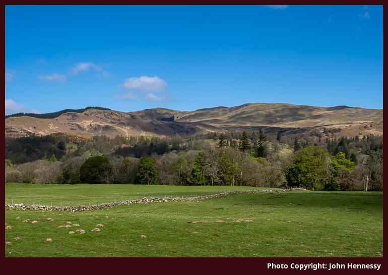
Looking North from Boschastle, Callander, Stirling District, Scotland
The photo you now see here replaces an earlier image made in August 2002 that I made when I exclusively pursued film photography. The day on which I captured that scene started off very cloudy and cloud continued to frustrate photographic efforts until late in the day but the combination of good light and dramatic skies more than made up for the earlier lack of good fortune. The changeover to digital photography cam years later and had to await the advance of technology together with my overcoming a certain amount of inertia.
When I shared that older image, I tried to identify the hills that it showed. Looking at the map, I now realise that it is easier to say where it was made. That follows for the current image, made in April 2024. This is what you to the north the former railway alignment that now carries both the Rob Roy Way and the Callander and Strathyre Cycle Route, the latter being part of the National Cycle Network. The photo captures part of a hike that featured the summit of Ben Ledi as its highest point, the third time that I visited that hill top.
See more photos from this album (Southern Highlands)